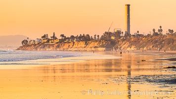
Carlsbad Coast Highway Sunset, from Terramar and North Ponto to Oceanside and Camp Pendleton. The smoke stack that marked the old Encina Power Plant was removed in 2021. Oceanside Pier is seen beautifully lit in the distance. Rising in the distance is San Onofre Mountain (1722') topped by a tall signal tower, one of the southern peaks in the Santa Ana Mountains.
Location: Carlsbad, California
Image ID: 37479
Location: Carlsbad, California
Image ID: 37479

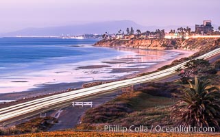
Carlsbad Coast at Sunset, Terramar and the Oceanside Pier, with Camp Pendleton and the San Onofre power plant in the distance on this incredibly clean and crisp evening view. Rising in the distance is San Onofre Mountain (1722') topped by a tall signal tower, one of the southern peaks in the Santa Ana Mountains.
Location: Carlsbad, California
Image ID: 37482
Panorama dimensions: 1106 x 3500
Location: Carlsbad, California
Image ID: 37482
Panorama dimensions: 1106 x 3500
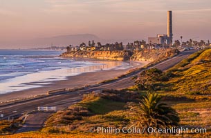
Carlsbad Coast Highway Sunset, Terramar and North Ponto to Oceanside with Camp Pendleton in the distance. Rising in the distance is San Onofre Mountain (1722') topped by a tall signal tower, one of the southern peaks in the Santa Ana Mountains.
Location: Carlsbad, California
Image ID: 35902
Location: Carlsbad, California
Image ID: 35902
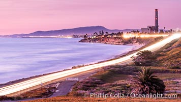
Sunset on Terra Mar and the Carlsbad coastline, looking north to Oceanside, Camp Pendleton and San Onofre. The Oceanside Pier, lit up at night, is seen further up the coast. Rising in the distance is San Onofre Mountain (1722') topped by a tall signal tower, one of the southern peaks in the Santa Ana Mountains.
Image ID: 36117
Image ID: 36117
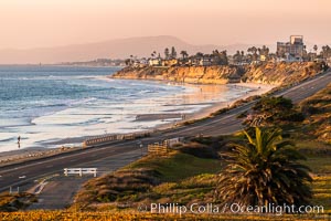
Carlsbad Coast Highway Sunset, Terramar and North Ponto to Oceanside with Camp Pendleton in the distance. Rising in the distance is San Onofre Mountain (1722') topped by a tall signal tower, one of the southern peaks in the Santa Ana Mountains.
Location: Carlsbad, California
Image ID: 37478
Location: Carlsbad, California
Image ID: 37478
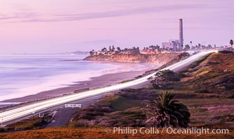
Carlsbad Coast Highway Sunset, Terramar and North Ponto to Oceanside with Camp Pendleton in the distance. San Onofre Mountain (1722'), one of the southern peaks in the Santa Ana Mountains, can just barely be seen in the distance.
Location: Carlsbad, California
Image ID: 35904
Location: Carlsbad, California
Image ID: 35904
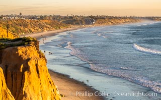
Carlsbad Coastline at Sunset, looking south from Terramar toward South Carlsbad State Beach, Ponto, Leucadia and Encinitas.
Location: Carlsbad, California
Image ID: 37707
Location: Carlsbad, California
Image ID: 37707
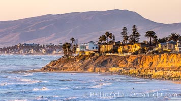
Terramar Sunset, viewed from North Ponto with Oceanside and Camp Pendleton in the distance. Rising in the distance is San Onofre Mountain (1722') topped by a tall signal tower, one of the southern peaks in the Santa Ana Mountains.
Location: Carlsbad, California
Image ID: 36743
Location: Carlsbad, California
Image ID: 36743
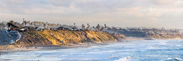
South Carlsbad State Beach and campground at sunset, sea cliffs and bluffs. Coast Highway to the left, Ponto Beach and Encinitas/Leucadia to the right.
Location: Carlsbad, California
Image ID: 37710
Panorama dimensions: 5467 x 16208
Location: Carlsbad, California
Image ID: 37710
Panorama dimensions: 5467 x 16208
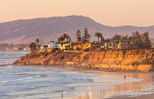
Terramar Sunset, viewed from North Ponto with Oceanside and Camp Pendleton in the distance. Rising in the distance is San Onofre Mountain (1722') topped by a tall signal tower, one of the southern peaks in the Santa Ana Mountains.
Location: Carlsbad, California
Image ID: 35903
Location: Carlsbad, California
Image ID: 35903

South Carlsbad State Beach sunset, beautiful clouds and soft colors.
Location: Carlsbad, California
Image ID: 27406
Location: Carlsbad, California
Image ID: 27406
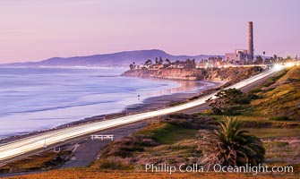
Carlsbad Coast Highway Sunset, North Ponto to Oceanside with Camp Pendleton in the distance. Rising in the distance is San Onofre Mountain (1722') topped by a tall signal tower, one of the southern peaks in the Santa Ana Mountains.
Location: Carlsbad, California
Image ID: 35905
Location: Carlsbad, California
Image ID: 35905
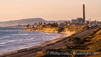
Sunset on Terra Mar and the Carlsbad coastline, looking north to Oceanside, Camp Pendleton and San Onofre. Rising in the distance is San Onofre Mountain (1722') topped by a tall signal tower, one of the southern peaks in the Santa Ana Mountains.
Image ID: 36116
Image ID: 36116

Breaking wave, South Carlsbad State Beach, Ponto, morning, winter.
Location: Ponto, Carlsbad, California
Image ID: 14794
Location: Ponto, Carlsbad, California
Image ID: 14794
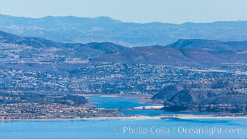
Batiquitos Lagoon, Carlsbad and La Costa, Ponto Beach, aerial photo.
Location: Carlsbad, California
Image ID: 29079
Location: Carlsbad, California
Image ID: 29079
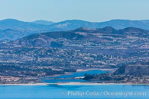
Batiquitos Lagoon, Carlsbad and La Costa, Ponto Beach, aerial photo.
Location: Carlsbad, California
Image ID: 29080
Location: Carlsbad, California
Image ID: 29080

South Carlsbad State Beach sunset, beautiful clouds and soft colors.
Location: Carlsbad, California
Image ID: 27407
Location: Carlsbad, California
Image ID: 27407

Cobblestones, South Carlsbad State Beach, Carlsbad.
Location: Ponto, Carlsbad, California
Image ID: 17984
Location: Ponto, Carlsbad, California
Image ID: 17984

Breaking wave, South Carlsbad State Beach, Ponto, morning, winter.
Location: Ponto, Carlsbad, California
Image ID: 14789
Location: Ponto, Carlsbad, California
Image ID: 14789

Breaking wave, South Carlsbad State Beach, Ponto, morning, winter.
Location: Ponto, Carlsbad, California
Image ID: 14790
Location: Ponto, Carlsbad, California
Image ID: 14790

