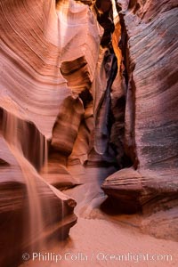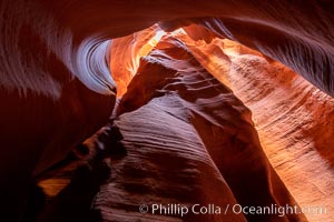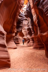
A hiker admiring the striated walls and dramatic light within Antelope Canyon, a deep narrow slot canyon formed by water and wind erosion.
Location: Navajo Tribal Lands, Page, Arizona
Image ID: 17993
Location: Navajo Tribal Lands, Page, Arizona
Image ID: 17993
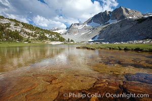
Townsley Lake (10396'), a beautiful alpine lake sitting below blue sky, clouds and Fletcher Peak (right), lies amid the Cathedral Range of glacier-sculpted granite peaks in Yosemite's high country, near Vogelsang High Sierra Camp.
Location: Yosemite National Park, California
Image ID: 23206
Location: Yosemite National Park, California
Image ID: 23206
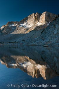
Cathedral Range peaks reflected in the still waters of Townsley Lake at sunrise.
Location: Yosemite National Park, California
Image ID: 25756
Location: Yosemite National Park, California
Image ID: 25756
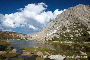
Fletcher Peak (11407') rises above Fletcher Lake (10174'), near Vogelsang High Sierra Camp in Yosemite's high country.
Location: Yosemite National Park, California
Image ID: 23208
Location: Yosemite National Park, California
Image ID: 23208
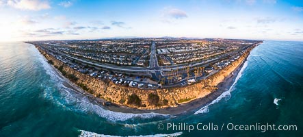
South Carlsbad State Beach and campground, aerial photo.
Location: Carlsbad, California
Image ID: 38228
Panorama dimensions: 4357 x 9642
Location: Carlsbad, California
Image ID: 38228
Panorama dimensions: 4357 x 9642
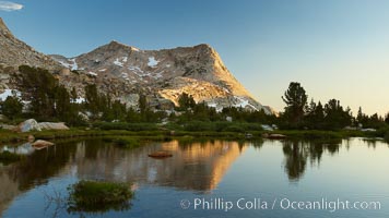
Vogelsang Peak (11516') at sunset, reflected in a small creek near Vogelsang High Sierra Camp in Yosemite's high country.
Location: Yosemite National Park, California
Image ID: 23202
Location: Yosemite National Park, California
Image ID: 23202
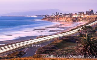
Carlsbad Coast Highway Sunset, from Terramar and North Ponto to Oceanside and Camp Pendleton. The smoke stack that marked the old Encina Power Plant was removed in 2021. Oceanside Pier is seen beautifully lit in the distance. Rising in the distance is San Onofre Mountain (1722') topped by a tall signal tower, one of the southern peaks in the Santa Ana Mountains.
Location: Carlsbad, California
Image ID: 37479
Location: Carlsbad, California
Image ID: 37479

Carlsbad Coast at Sunset, Terramar and the Oceanside Pier, with Camp Pendleton and the San Onofre power plant in the distance on this incredibly clean and crisp evening view. Rising in the distance is San Onofre Mountain (1722') topped by a tall signal tower, one of the southern peaks in the Santa Ana Mountains.
Location: Carlsbad, California
Image ID: 37482
Panorama dimensions: 1106 x 3500
Location: Carlsbad, California
Image ID: 37482
Panorama dimensions: 1106 x 3500
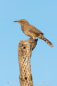
Cactus wren.
Species: Cactus wren, Campylorhynchus brunneicapillus
Location: Amado, Arizona
Image ID: 23003
Species: Cactus wren, Campylorhynchus brunneicapillus
Location: Amado, Arizona
Image ID: 23003
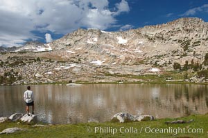
Hiker views Vogelsang Lake, and Vogelsang Peak (11516') at sunrise in Yosemite's High Sierra.
Location: Yosemite National Park, California
Image ID: 23201
Location: Yosemite National Park, California
Image ID: 23201
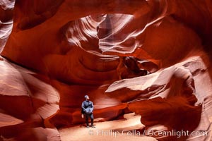
A hiker admiring the striated walls and dramatic light within Antelope Canyon, a deep narrow slot canyon formed by water and wind erosion.
Location: Navajo Tribal Lands, Page, Arizona
Image ID: 18009
Location: Navajo Tribal Lands, Page, Arizona
Image ID: 18009
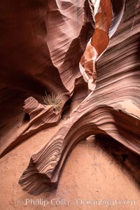
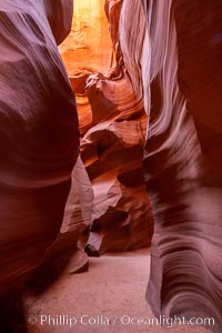
Rattlesnake Canyon, a beautiful slot canyon that is part of the larger Antelope Canyon system. Page, Arizona.
Location: Navajo Tribal Lands, Page, Arizona
Image ID: 36039
Location: Navajo Tribal Lands, Page, Arizona
Image ID: 36039
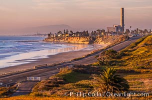
Carlsbad Coast Highway Sunset, Terramar and North Ponto to Oceanside with Camp Pendleton in the distance. Rising in the distance is San Onofre Mountain (1722') topped by a tall signal tower, one of the southern peaks in the Santa Ana Mountains.
Location: Carlsbad, California
Image ID: 35902
Location: Carlsbad, California
Image ID: 35902
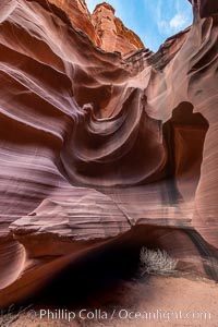
Owl Canyon, a beautiful slot canyon that is part of the larger Antelope Canyon system. Page, Arizona.
Location: Navajo Tribal Lands, Page, Arizona
Image ID: 36030
Location: Navajo Tribal Lands, Page, Arizona
Image ID: 36030
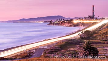
Sunset on Terra Mar and the Carlsbad coastline, looking north to Oceanside, Camp Pendleton and San Onofre. The Oceanside Pier, lit up at night, is seen further up the coast. Rising in the distance is San Onofre Mountain (1722') topped by a tall signal tower, one of the southern peaks in the Santa Ana Mountains.
Image ID: 36117
Image ID: 36117
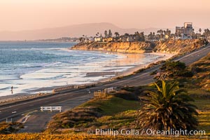
Carlsbad Coast Highway Sunset, Terramar and North Ponto to Oceanside with Camp Pendleton in the distance. Rising in the distance is San Onofre Mountain (1722') topped by a tall signal tower, one of the southern peaks in the Santa Ana Mountains.
Location: Carlsbad, California
Image ID: 37478
Location: Carlsbad, California
Image ID: 37478

Panoramic view from Vogelsang Pass (10685') in Yosemite's high country, looking south. A hiker appears twice in this curious panoramic photo, enjoying the spectacular view. Visible on the left are Parson's Peak (12147'), Gallison Lake and Bernice Lake, while Vogelsang Peak (11516') rises to the right.
Location: Yosemite National Park, California
Image ID: 23210
Panorama dimensions: 4512 x 17738
Location: Yosemite National Park, California
Image ID: 23210
Panorama dimensions: 4512 x 17738
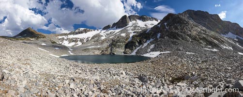
Panorama of Nameless Lake (10709'), surrounded by glacier-sculpted granite peaks of the Cathedral Range, near Vogelsang High Sierra Camp.
Location: Yosemite National Park, California
Image ID: 23211
Panorama dimensions: 3756 x 9102
Location: Yosemite National Park, California
Image ID: 23211
Panorama dimensions: 3756 x 9102
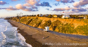
South Carlsbad State Beach and campground, aerial photo.
Location: Carlsbad, California
Image ID: 38006
Location: Carlsbad, California
Image ID: 38006

Panorama of Vogelsang basin, surrounding Vogelsang Lake in Yosemite's High Sierra, viewed from near Vogelsang Pass (10685'). Left is Vogelsang Peak (11516'), Choo-choo Ridge is in the distant middle, and the western flank of Fletcher Peak is to the right.
Location: Yosemite National Park, California
Image ID: 23217
Panorama dimensions: 2945 x 13845
Location: Yosemite National Park, California
Image ID: 23217
Panorama dimensions: 2945 x 13845
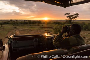
Safari guide spotting wildlife at sunrise, Olare Orok Conservancy, Kenya.
Location: Olare Orok Conservancy, Kenya
Image ID: 30047
Location: Olare Orok Conservancy, Kenya
Image ID: 30047
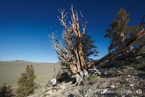
A hiker admires an ancient bristlecone pine tree, on the Methuselah Walk in the Schulman Grove in the White Mountains at an elevation of 9500 above sea level. The oldest bristlecone pines in the world are found in the Schulman Grove, some of them over 4700 years old. Ancient Bristlecone Pine Forest.
Species: Bristlecone pine, Pinus longaeva
Location: White Mountains, Inyo National Forest, California
Image ID: 23232
Species: Bristlecone pine, Pinus longaeva
Location: White Mountains, Inyo National Forest, California
Image ID: 23232
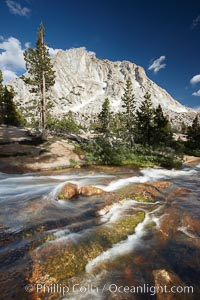
Fletcher Peak (10319') at sunset, viewed from Vogelsang High Sierra Camp in Yosemite's high country.
Location: Yosemite National Park, California
Image ID: 23248
Location: Yosemite National Park, California
Image ID: 23248
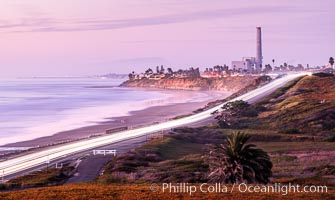
Carlsbad Coast Highway Sunset, Terramar and North Ponto to Oceanside with Camp Pendleton in the distance. San Onofre Mountain (1722'), one of the southern peaks in the Santa Ana Mountains, can just barely be seen in the distance.
Location: Carlsbad, California
Image ID: 35904
Location: Carlsbad, California
Image ID: 35904
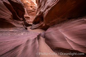
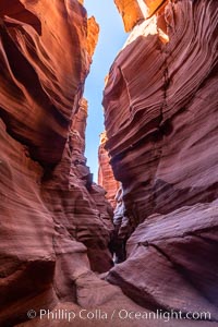
Owl Canyon, a beautiful slot canyon that is part of the larger Antelope Canyon system. Page, Arizona.
Location: Navajo Tribal Lands, Page, Arizona
Image ID: 36028
Location: Navajo Tribal Lands, Page, Arizona
Image ID: 36028
