
Carlsbad Coast Highway Sunset, from Terramar and North Ponto to Oceanside and Camp Pendleton. The smoke stack that marked the old Encina Power Plant was removed in 2021. Oceanside Pier is seen beautifully lit in the distance. Rising in the distance is San Onofre Mountain (1722') topped by a tall signal tower, one of the southern peaks in the Santa Ana Mountains.
Location: Carlsbad, California
Image ID: 37479
Location: Carlsbad, California
Image ID: 37479
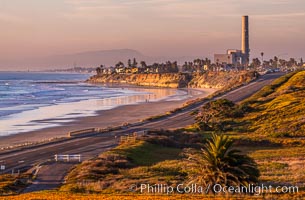
Carlsbad Coast Highway Sunset, Terramar and North Ponto to Oceanside with Camp Pendleton in the distance. Rising in the distance is San Onofre Mountain (1722') topped by a tall signal tower, one of the southern peaks in the Santa Ana Mountains.
Location: Carlsbad, California
Image ID: 35902
Location: Carlsbad, California
Image ID: 35902
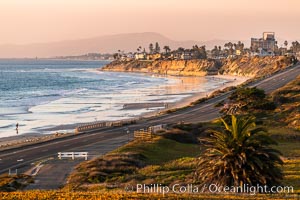
Carlsbad Coast Highway Sunset, Terramar and North Ponto to Oceanside with Camp Pendleton in the distance. Rising in the distance is San Onofre Mountain (1722') topped by a tall signal tower, one of the southern peaks in the Santa Ana Mountains.
Location: Carlsbad, California
Image ID: 37478
Location: Carlsbad, California
Image ID: 37478

Carlsbad Coast Highway Sunset, Terramar and North Ponto to Oceanside with Camp Pendleton in the distance. San Onofre Mountain (1722'), one of the southern peaks in the Santa Ana Mountains, can just barely be seen in the distance.
Location: Carlsbad, California
Image ID: 35904
Location: Carlsbad, California
Image ID: 35904
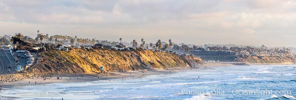
South Carlsbad State Beach and campground at sunset, sea cliffs and bluffs. Coast Highway to the left, Ponto Beach and Encinitas/Leucadia to the right.
Location: Carlsbad, California
Image ID: 37710
Panorama dimensions: 5467 x 16208
Location: Carlsbad, California
Image ID: 37710
Panorama dimensions: 5467 x 16208
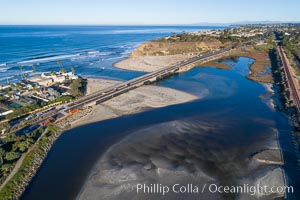
San Dieguito Lagoon and San Dieguito River empty into the Pacific Ocean at Dog Beach in Del Mar, aerial photo.
Location: Del Mar, California
Image ID: 38107
Location: Del Mar, California
Image ID: 38107

Carlsbad Coast Highway Sunset, North Ponto to Oceanside with Camp Pendleton in the distance. Rising in the distance is San Onofre Mountain (1722') topped by a tall signal tower, one of the southern peaks in the Santa Ana Mountains.
Location: Carlsbad, California
Image ID: 35905
Location: Carlsbad, California
Image ID: 35905
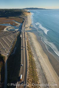
Coast Highway 101, looking south from Del Mar, with Los Penasquitos Marsh on the left and the cliffs of Torrey Pines State Reserve and La Jolla in the distance.
Location: San Diego, California
Image ID: 22310
Location: San Diego, California
Image ID: 22310
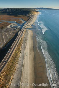
Coast Highway 101, looking south from Del Mar, with Los Penasquitos Marsh on the left and the cliffs of Torrey Pines State Reserve and La Jolla in the distance.
Location: San Diego, California
Image ID: 22434
Location: San Diego, California
Image ID: 22434

Remains of the old historic "Coast Highway 101", undermined as the bluff upon which it was built eroded away, now broken into pieces of concrete and asphalt blocks and fallen down the sea cliffs, lying on the beach.
Location: Carlsbad, California
Image ID: 22191
Location: Carlsbad, California
Image ID: 22191

Remains of the old historic "Coast Highway 101", undermined as the bluff upon which it was built eroded away, now broken into pieces of concrete and asphalt blocks and fallen down the sea cliffs, lying on the beach.
Location: Carlsbad, California
Image ID: 22192
Location: Carlsbad, California
Image ID: 22192

Remains of the old historic "Coast Highway 101", undermined as the bluff upon which it was built eroded away, now broken into pieces of concrete and asphalt blocks and fallen down the sea cliffs, lying on the beach.
Location: Carlsbad, California
Image ID: 22193
Location: Carlsbad, California
Image ID: 22193
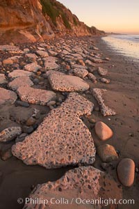
Remains of the old historic "Coast Highway 101", undermined as the bluff upon which it was built eroded away, now broken into pieces of concrete and asphalt blocks and fallen down the sea cliffs, lying on the beach.
Location: Carlsbad, California
Image ID: 22194
Location: Carlsbad, California
Image ID: 22194
