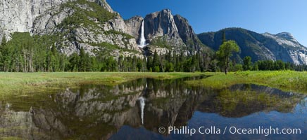
Yosemite Falls reflected in flooded meadow. The Merced River floods its banks in spring, forming beautiful reflections of Yosemite Falls.
Location: Yosemite National Park, California
Image ID: 26887
Panorama dimensions: 5256 x 11469
Location: Yosemite National Park, California
Image ID: 26887
Panorama dimensions: 5256 x 11469
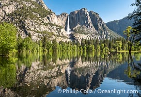
Yosemite Falls reflected in Flooded Sentinel Meadow, when the Merced River floods Yosemite Valley following a winter of historic snowfall in the Sierra Nevada, Yosemite National Park.
Location: Yosemite National Park, California
Image ID: 39378
Location: Yosemite National Park, California
Image ID: 39378
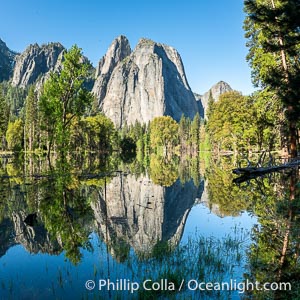
Cathedral Rocks reflected in a meadow flooded by the Merced River, historical snowmelt following record snowfall floods Yosemite Valley in May 2023.
Location: Yosemite National Park, California
Image ID: 39375
Location: Yosemite National Park, California
Image ID: 39375
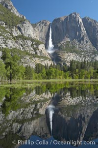
Yosemite Falls is reflected in a springtime pool in flooded Cooks Meadow, Yosemite Valley.
Location: Yosemite Falls, Yosemite National Park, California
Image ID: 16135
Location: Yosemite Falls, Yosemite National Park, California
Image ID: 16135
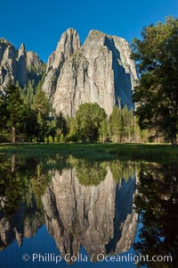
Cathedral Rocks at sunrise, reflected in a spring meadow flooded by the Merced River.
Location: Yosemite National Park, California
Image ID: 26856
Location: Yosemite National Park, California
Image ID: 26856
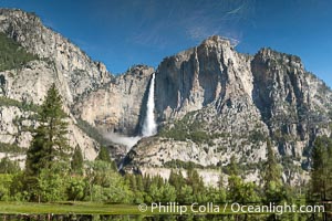
Reflection of Yosemite Falls in Flooded Cooks Meadow. The Merced River overflows its banks following the historical storms of 2023, flooding Yosemite Valley and producing pools that reflect a roaring Upper Yosemite Falls. This is a reflection, flipped upside down.
Location: Yosemite National Park, California
Image ID: 39381
Location: Yosemite National Park, California
Image ID: 39381
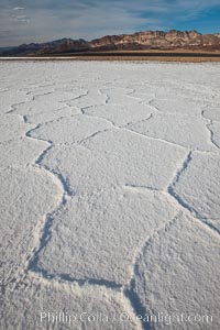
Salt polygons. After winter flooding, the salt on the Badwater Basin playa dries into geometric polygonal shapes.
Location: Badwater, Death Valley National Park, California
Image ID: 25242
Location: Badwater, Death Valley National Park, California
Image ID: 25242
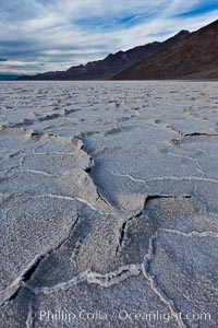
Salt polygons. After winter flooding, the salt on the Badwater Basin playa dries into geometric polygonal shapes.
Location: Badwater, Death Valley National Park, California
Image ID: 27631
Location: Badwater, Death Valley National Park, California
Image ID: 27631
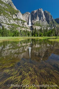
Yosemite Falls reflected in flooded meadow. The Merced River floods its banks in spring, forming beautiful reflections of Yosemite Falls.
Location: Yosemite National Park, California
Image ID: 26888
Location: Yosemite National Park, California
Image ID: 26888
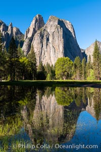
Cathedral Rocks at sunrise, reflected in a spring meadow flooded by the Merced River.
Location: Cathedral Rocks, Yosemite National Park, California
Image ID: 34546
Location: Cathedral Rocks, Yosemite National Park, California
Image ID: 34546
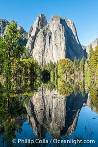
Cathedral Rocks reflected in a meadow flooded by the Merced River, historical snowmelt following record snowfall floods Yosemite Valley in May 2023.
Location: Yosemite National Park, California
Image ID: 39374
Location: Yosemite National Park, California
Image ID: 39374
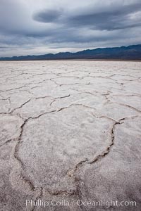
Salt polygons. After winter flooding, the salt on the Badwater Basin playa dries into geometric polygonal shapes.
Location: Badwater, Death Valley National Park, California
Image ID: 25254
Location: Badwater, Death Valley National Park, California
Image ID: 25254
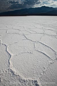
Salt polygons. After winter flooding, the salt on the Badwater Basin playa dries into geometric polygonal shapes.
Location: Badwater, Death Valley National Park, California
Image ID: 25262
Location: Badwater, Death Valley National Park, California
Image ID: 25262

Panorama of Exit Creek, early morning, summer, as it washes over the flood plain below Exit Glacier.
Location: Exit Glacier, Kenai Fjords National Park, Alaska
Image ID: 19109
Panorama dimensions: 4068 x 14964
Location: Exit Glacier, Kenai Fjords National Park, Alaska
Image ID: 19109
Panorama dimensions: 4068 x 14964
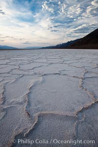
Salt polygons. After winter flooding, the salt on the Badwater Basin playa dries into geometric polygonal shapes.
Location: Badwater, Death Valley National Park, California
Image ID: 25259
Location: Badwater, Death Valley National Park, California
Image ID: 25259
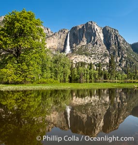
Yosemite Falls reflected in Flooded Sentinel Meadow, when the Merced River floods Yosemite Valley following a winter of historic snowfall in the Sierra Nevada, Yosemite National Park, May 2023.
Location: Yosemite National Park, California
Image ID: 39380
Location: Yosemite National Park, California
Image ID: 39380
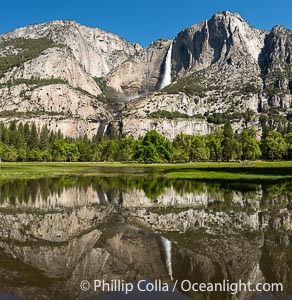
Yosemite Falls reflected in Flooded Cooks Meadow, when the Merced River floods Yosemite Valley following a winter of historic snowfall in the Sierra Nevada, Yosemite National Park.
Location: Yosemite National Park, California
Image ID: 39382
Location: Yosemite National Park, California
Image ID: 39382
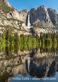
Yosemite Falls reflected in Flooded Sentinel Meadow, when the Merced River floods Yosemite Valley following a winter of historic snowfall in the Sierra Nevada, Yosemite National Park.
Location: Yosemite National Park, California
Image ID: 39377
Location: Yosemite National Park, California
Image ID: 39377
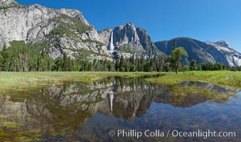
Yosemite Falls reflected in flooded meadow. The Merced River floods its banks in spring, forming beautiful reflections of Yosemite Falls.
Location: Yosemite National Park, California
Image ID: 26854
Panorama dimensions: 5219 x 8858
Location: Yosemite National Park, California
Image ID: 26854
Panorama dimensions: 5219 x 8858
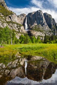
Yosemite Falls is reflected in a springtime pool in flooded Cooks Meadow, Yosemite Valley.
Location: Yosemite Falls, Yosemite National Park, California
Image ID: 34548
Panorama dimensions: 7891 x 5261
Location: Yosemite Falls, Yosemite National Park, California
Image ID: 34548
Panorama dimensions: 7891 x 5261
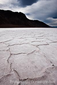
Salt polygons. After winter flooding, the salt on the Badwater Basin playa dries into geometric polygonal shapes.
Location: Badwater, Death Valley National Park, California
Image ID: 25293
Location: Badwater, Death Valley National Park, California
Image ID: 25293
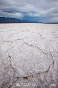
Salt polygons. After winter flooding, the salt on the Badwater Basin playa dries into geometric polygonal shapes.
Location: Badwater, Death Valley National Park, California
Image ID: 25294
Location: Badwater, Death Valley National Park, California
Image ID: 25294
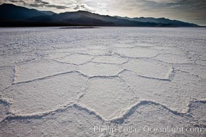
Salt polygons. After winter flooding, the salt on the Badwater Basin playa dries into geometric polygonal shapes.
Location: Badwater, Death Valley National Park, California
Image ID: 25303
Location: Badwater, Death Valley National Park, California
Image ID: 25303
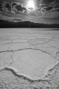
Salt polygons. After winter flooding, the salt on the Badwater Basin playa dries into geometric polygonal shapes.
Location: Badwater, Death Valley National Park, California
Image ID: 25304
Location: Badwater, Death Valley National Park, California
Image ID: 25304
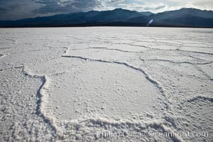
Salt polygons. After winter flooding, the salt on the Badwater Basin playa dries into geometric polygonal shapes.
Location: Badwater, Death Valley National Park, California
Image ID: 25305
Location: Badwater, Death Valley National Park, California
Image ID: 25305
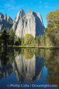
Cathedral Rocks is reflected in flooded El Capitan Meadow, springtime morning. Yosemite Valley.
Location: El Capitan, Yosemite National Park, California
Image ID: 16099
Location: El Capitan, Yosemite National Park, California
Image ID: 16099
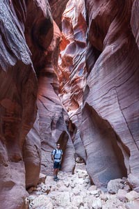
Hiker in Buckskin Gulch. A hiker considers the towering walls and narrow passageway of Buckskin Gulch, a dramatic slot canyon forged by centuries of erosion through sandstone. Buckskin Gulch is the worlds longest accessible slot canyon, running from the Paria River toward the Colorado River. Flash flooding is a serious danger in the narrows where there is no escape.
Location: Buckskin Gulch, Paria Canyon-Vermilion Cliffs Wilderness, Arizona
Image ID: 20716
Location: Buckskin Gulch, Paria Canyon-Vermilion Cliffs Wilderness, Arizona
Image ID: 20716
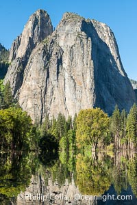
Cathedral Rocks reflected in a meadow flooded by the Merced River, historical snowmelt following record snowfall floods Yosemite Valley in May 2023.
Location: Yosemite National Park, California
Image ID: 39376
Location: Yosemite National Park, California
Image ID: 39376
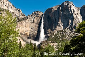
Upper Yosemite Falls Roaring in May as Historic Snowmelt Floods Yosemite Valley, May 2023.
Location: Yosemite National Park, California
Image ID: 39379
Location: Yosemite National Park, California
Image ID: 39379
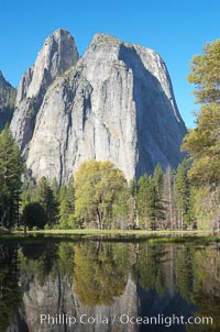
Cathedral Rocks is reflected in flooded El Capitan Meadow, springtime morning. Yosemite Valley.
Location: El Capitan, Yosemite National Park, California
Image ID: 16100
Location: El Capitan, Yosemite National Park, California
Image ID: 16100