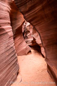
Rattlesnake Canyon, a beautiful slot canyon that is part of the larger Antelope Canyon system. Page, Arizona.
Location: Navajo Tribal Lands, Page, Arizona
Image ID: 36037
Location: Navajo Tribal Lands, Page, Arizona
Image ID: 36037
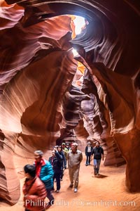
Chinese tourists in Upper Antelope Canyon, a spectacular but now-crowded slot canyon near Page, Arizona.
Location: Navajo Tribal Lands, Page, Arizona
Image ID: 36040
Location: Navajo Tribal Lands, Page, Arizona
Image ID: 36040
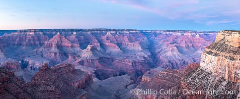
Grand Canyon at dusk, sunset, viewed from Grandeur Point on the south rim of Grand Canyon National Park.
Location: Grand Canyon National Park, Arizona
Image ID: 37754
Panorama dimensions: 5151 x 12441
Location: Grand Canyon National Park, Arizona
Image ID: 37754
Panorama dimensions: 5151 x 12441
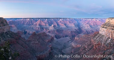
Grand Canyon at dusk, sunset, viewed from Grandeur Point on the south rim of Grand Canyon National Park.
Location: Grand Canyon National Park, Arizona
Image ID: 37755
Panorama dimensions: 4731 x 8961
Location: Grand Canyon National Park, Arizona
Image ID: 37755
Panorama dimensions: 4731 x 8961
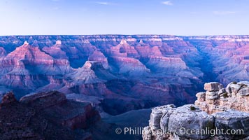
Grand Canyon at dusk, sunset, viewed from Grandeur Point on the south rim of Grand Canyon National Park.
Location: Grand Canyon National Park, Arizona
Image ID: 37756
Location: Grand Canyon National Park, Arizona
Image ID: 37756
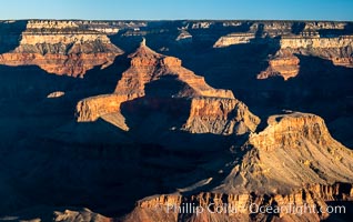
Grand Canyon at sunrise viewed from Yavapai Point on the south rim of Grand Canyon National Park.
Location: Grand Canyon National Park, Arizona
Image ID: 37758
Location: Grand Canyon National Park, Arizona
Image ID: 37758
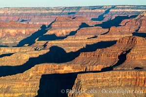
Grand Canyon at sunrise viewed from Yavapai Point on the south rim of Grand Canyon National Park.
Location: Grand Canyon National Park, Arizona
Image ID: 37759
Location: Grand Canyon National Park, Arizona
Image ID: 37759
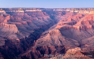
Grand Canyon at dusk, sunset, viewed from Mather Point on the south rim of Grand Canyon National Park.
Location: Grand Canyon National Park, Arizona
Image ID: 37763
Location: Grand Canyon National Park, Arizona
Image ID: 37763
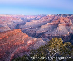
Belt of Venus over Grand Canyon at sunrise, viewed from Hopi Point on the south rim of Grand Canyon National Park. The Belt of Venus, or anti-twilight arch, is the shadow of the earth cast upon the atmosphere just above the horizon, and occurs a few minutes before sunrise or after sunset.
Location: Grand Canyon National Park, Arizona
Image ID: 37764
Location: Grand Canyon National Park, Arizona
Image ID: 37764
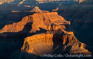
Grand Canyon at sunrise, viewed from Hopi Point on the south rim of Grand Canyon National Park.
Location: Grand Canyon National Park, Arizona
Image ID: 37766
Location: Grand Canyon National Park, Arizona
Image ID: 37766
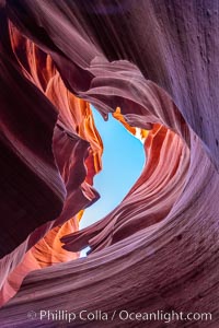
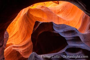
Lower Antelope Canyon, a deep, narrow and spectacular slot canyon lying on Navajo Tribal lands near Page, Arizona.
Location: Navajo Tribal Lands, Page, Arizona
Image ID: 37769
Location: Navajo Tribal Lands, Page, Arizona
Image ID: 37769
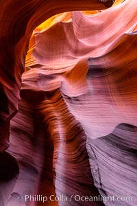
Lower Antelope Canyon, a deep, narrow and spectacular slot canyon lying on Navajo Tribal lands near Page, Arizona.
Location: Navajo Tribal Lands, Page, Arizona
Image ID: 37770
Location: Navajo Tribal Lands, Page, Arizona
Image ID: 37770
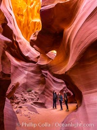
Lower Antelope Canyon, a deep, narrow and spectacular slot canyon lying on Navajo Tribal lands near Page, Arizona.
Location: Navajo Tribal Lands, Page, Arizona
Image ID: 37772
Location: Navajo Tribal Lands, Page, Arizona
Image ID: 37772
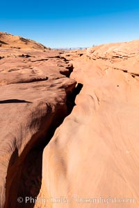
Lower Antelope Canyon, a deep, narrow and spectacular slot canyon lying on Navajo Tribal lands near Page, Arizona.
Location: Navajo Tribal Lands, Page, Arizona
Image ID: 37775
Location: Navajo Tribal Lands, Page, Arizona
Image ID: 37775
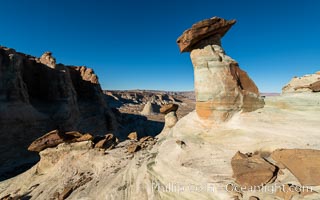
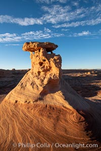
Pedestal rock, or hoodoo, at Stud Horse Point. These hoodoos form when erosion occurs around but not underneath a more resistant caprock that sits atop of the hoodoo spire. Stud Horse Point is a spectacular viewpoint on a mesa overlooking the Arizona / Utah border.
Location: Page, Arizona
Image ID: 37776
Location: Page, Arizona
Image ID: 37776
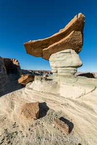
Pedestal rock, or hoodoo, at Stud Horse Point. These hoodoos form when erosion occurs around but not underneath a more resistant caprock that sits atop of the hoodoo spire. Stud Horse Point is a spectacular viewpoint on a mesa overlooking the Arizona / Utah border.
Location: Page, Arizona
Image ID: 37779
Location: Page, Arizona
Image ID: 37779

House finch, female.
Species: House finch, Carpodacus mexicanus
Location: Amado, Arizona
Image ID: 22899
Species: House finch, Carpodacus mexicanus
Location: Amado, Arizona
Image ID: 22899
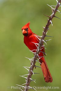
Northern cardinal, male.
Species: Northern cardinal, Cardinalis cardinalis
Location: Amado, Arizona
Image ID: 22923
Species: Northern cardinal, Cardinalis cardinalis
Location: Amado, Arizona
Image ID: 22923
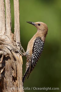
Gila woodpecker, female.
Species: Gila woodpecker, Melanerpes uropygialis
Location: Amado, Arizona
Image ID: 22928
Species: Gila woodpecker, Melanerpes uropygialis
Location: Amado, Arizona
Image ID: 22928
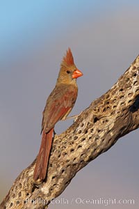
Northern cardinal, female.
Species: Northern cardinal, Cardinalis cardinalis
Location: Amado, Arizona
Image ID: 22929
Species: Northern cardinal, Cardinalis cardinalis
Location: Amado, Arizona
Image ID: 22929
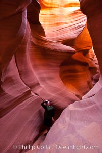
Lower Antelope Canyon, a deep, narrow and spectacular slot canyon lying on Navajo Tribal lands near Page, Arizona.
Location: Navajo Tribal Lands, Page, Arizona
Image ID: 26657
Location: Navajo Tribal Lands, Page, Arizona
Image ID: 26657

Panorama of the Wave. The Wave is a sweeping, dramatic display of eroded sandstone, forged by eons of water and wind erosion, laying bare striations formed from compacted sand dunes over millenia. This panoramic picture is formed from thirteen individual photographs.
Location: North Coyote Buttes, Paria Canyon-Vermilion Cliffs Wilderness, Arizona
Image ID: 20702
Panorama dimensions: 4617 x 17432
Location: North Coyote Buttes, Paria Canyon-Vermilion Cliffs Wilderness, Arizona
Image ID: 20702
Panorama dimensions: 4617 x 17432
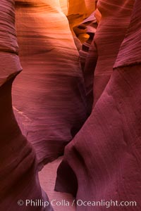
Lower Antelope Canyon, a deep, narrow and spectacular slot canyon lying on Navajo Tribal lands near Page, Arizona.
Location: Navajo Tribal Lands, Page, Arizona
Image ID: 28556
Location: Navajo Tribal Lands, Page, Arizona
Image ID: 28556
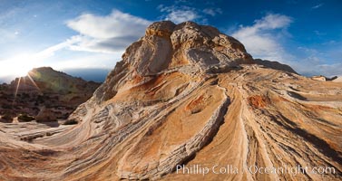
Sarah's Swirl, a particularly beautiful formation at White Pocket in the Vermillion Cliffs National Monument.
Location: White Pocket, Vermillion Cliffs National Monument, Arizona
Image ID: 26603
Location: White Pocket, Vermillion Cliffs National Monument, Arizona
Image ID: 26603
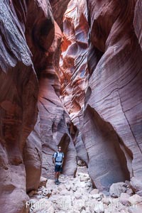
Hiker in Buckskin Gulch. A hiker considers the towering walls and narrow passageway of Buckskin Gulch, a dramatic slot canyon forged by centuries of erosion through sandstone. Buckskin Gulch is the worlds longest accessible slot canyon, running from the Paria River toward the Colorado River. Flash flooding is a serious danger in the narrows where there is no escape.
Location: Buckskin Gulch, Paria Canyon-Vermilion Cliffs Wilderness, Arizona
Image ID: 20716
Location: Buckskin Gulch, Paria Canyon-Vermilion Cliffs Wilderness, Arizona
Image ID: 20716
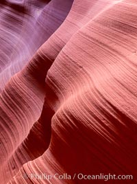
Lower Antelope Canyon, a deep, narrow and spectacular slot canyon lying on Navajo Tribal lands near Page, Arizona.
Location: Navajo Tribal Lands, Page, Arizona
Image ID: 26649
Location: Navajo Tribal Lands, Page, Arizona
Image ID: 26649
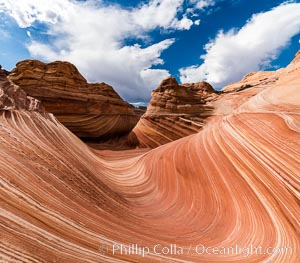
The Wave in the North Coyote Buttes, an area of fantastic eroded sandstone featuring beautiful swirls, wild colors, countless striations, and bizarre shapes set amidst the dramatic surrounding North Coyote Buttes of Arizona and Utah. The sandstone formations of the North Coyote Buttes, including the Wave, date from the Jurassic period. Managed by the Bureau of Land Management, the Wave is located in the Paria Canyon-Vermilion Cliffs Wilderness and is accessible on foot by permit only.
Location: North Coyote Buttes, Paria Canyon-Vermilion Cliffs Wilderness, Arizona
Image ID: 28600
Location: North Coyote Buttes, Paria Canyon-Vermilion Cliffs Wilderness, Arizona
Image ID: 28600
