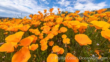
California Poppies, Rancho La Costa, Carlsbad.
Species: California poppy, Eschscholzia californica
Location: Rancho La Costa, Carlsbad, California
Image ID: 35184
Species: California poppy, Eschscholzia californica
Location: Rancho La Costa, Carlsbad, California
Image ID: 35184
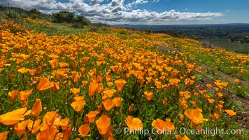
California Poppies, Rancho La Costa, Carlsbad.
Species: California poppy, Eschscholzia californica
Location: Rancho La Costa, Carlsbad, California
Image ID: 35209
Species: California poppy, Eschscholzia californica
Location: Rancho La Costa, Carlsbad, California
Image ID: 35209
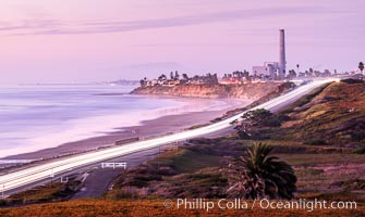
Carlsbad Coast Highway Sunset, Terramar and North Ponto to Oceanside with Camp Pendleton in the distance. San Onofre Mountain (1722'), one of the southern peaks in the Santa Ana Mountains, can just barely be seen in the distance.
Location: Carlsbad, California
Image ID: 35904
Location: Carlsbad, California
Image ID: 35904
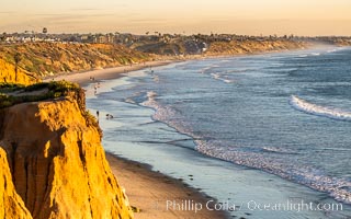
Carlsbad Coastline at Sunset, looking south from Terramar toward South Carlsbad State Beach, Ponto, Leucadia and Encinitas.
Location: Carlsbad, California
Image ID: 37707
Location: Carlsbad, California
Image ID: 37707

Wildflowers, Rancho La Costa, Carlsbad.
Location: Rancho La Costa, Carlsbad, California
Image ID: 33117
Location: Rancho La Costa, Carlsbad, California
Image ID: 33117

Wildflowers, Rancho La Costa, Carlsbad.
Location: Rancho La Costa, Carlsbad, California
Image ID: 33118
Location: Rancho La Costa, Carlsbad, California
Image ID: 33118
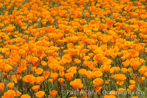
California Poppies, Rancho La Costa, Carlsbad.
Species: California poppy, Eschscholzia californica
Location: Rancho La Costa, Carlsbad, California
Image ID: 33119
Species: California poppy, Eschscholzia californica
Location: Rancho La Costa, Carlsbad, California
Image ID: 33119

Wildflowers, Rancho La Costa, Carlsbad.
Location: Rancho La Costa, Carlsbad, California
Image ID: 33121
Location: Rancho La Costa, Carlsbad, California
Image ID: 33121
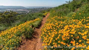
California Poppies, Rancho La Costa, Carlsbad.
Species: California poppy, Eschscholzia californica
Location: Rancho La Costa, Carlsbad, California
Image ID: 33161
Species: California poppy, Eschscholzia californica
Location: Rancho La Costa, Carlsbad, California
Image ID: 33161
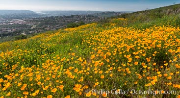
California Poppies, Rancho La Costa, Carlsbad.
Species: California poppy, Eschscholzia californica
Location: Rancho La Costa, Carlsbad, California
Image ID: 33162
Species: California poppy, Eschscholzia californica
Location: Rancho La Costa, Carlsbad, California
Image ID: 33162

Wildflowers, Rancho La Costa, Carlsbad.
Location: Rancho La Costa, Carlsbad, California
Image ID: 33204
Location: Rancho La Costa, Carlsbad, California
Image ID: 33204

Wildflowers, Rancho La Costa, Carlsbad.
Location: Rancho La Costa, Carlsbad, California
Image ID: 33205
Location: Rancho La Costa, Carlsbad, California
Image ID: 33205

Purple owls clover, Rancho La Costa, Carlsbad.
Location: Rancho La Costa, Carlsbad, California
Image ID: 33207
Location: Rancho La Costa, Carlsbad, California
Image ID: 33207

Wildflowers, Rancho La Costa, Carlsbad.
Location: Rancho La Costa, Carlsbad, California
Image ID: 33209
Location: Rancho La Costa, Carlsbad, California
Image ID: 33209

Wildflowers, Rancho La Costa, Carlsbad.
Location: Rancho La Costa, Carlsbad, California
Image ID: 33211
Location: Rancho La Costa, Carlsbad, California
Image ID: 33211
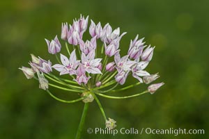
Wildflowers, Rancho La Costa, Carlsbad.
Location: Rancho La Costa, Carlsbad, California
Image ID: 33214
Location: Rancho La Costa, Carlsbad, California
Image ID: 33214
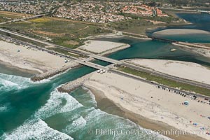
Aerial photo of Batiquitos Lagoon, Carlsbad. The Batiquitos Lagoon is a coastal wetland in southern Carlsbad, California. Part of the lagoon is designated as the Batiquitos Lagoon State Marine Conservation Area, run by the California Department of Fish and Game as a nature reserve.
Location: Carlsbad, Callifornia
Image ID: 30556
Location: Carlsbad, Callifornia
Image ID: 30556
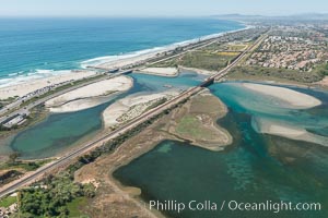
Aerial photo of Batiquitos Lagoon, Carlsbad. The Batiquitos Lagoon is a coastal wetland in southern Carlsbad, California. Part of the lagoon is designated as the Batiquitos Lagoon State Marine Conservation Area, run by the California Department of Fish and Game as a nature reserve.
Location: Carlsbad, Callifornia
Image ID: 30558
Location: Carlsbad, Callifornia
Image ID: 30558
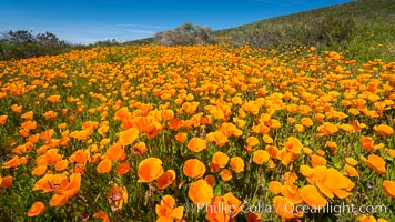
California Poppies, Rancho La Costa, Carlsbad.
Species: California poppy, Eschscholzia californica
Location: Rancho La Costa, Carlsbad, California
Image ID: 33122
Species: California poppy, Eschscholzia californica
Location: Rancho La Costa, Carlsbad, California
Image ID: 33122
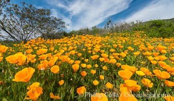
California Poppies, Rancho La Costa, Carlsbad.
Species: California poppy, Eschscholzia californica
Location: Rancho La Costa, Carlsbad, California
Image ID: 33129
Species: California poppy, Eschscholzia californica
Location: Rancho La Costa, Carlsbad, California
Image ID: 33129
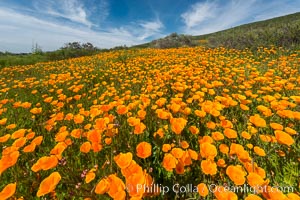
California Poppies, Rancho La Costa, Carlsbad.
Species: California poppy, Eschscholzia californica
Location: Rancho La Costa, Carlsbad, California
Image ID: 33131
Species: California poppy, Eschscholzia californica
Location: Rancho La Costa, Carlsbad, California
Image ID: 33131
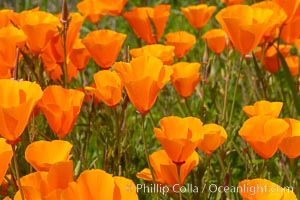
California Poppies, Rancho La Costa, Carlsbad.
Species: California poppy, Eschscholzia californica
Location: Rancho La Costa, Carlsbad, California
Image ID: 35182
Species: California poppy, Eschscholzia californica
Location: Rancho La Costa, Carlsbad, California
Image ID: 35182
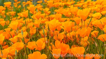
California Poppies, Rancho La Costa, Carlsbad.
Species: California poppy, Eschscholzia californica
Location: Rancho La Costa, Carlsbad, California
Image ID: 35183
Species: California poppy, Eschscholzia californica
Location: Rancho La Costa, Carlsbad, California
Image ID: 35183
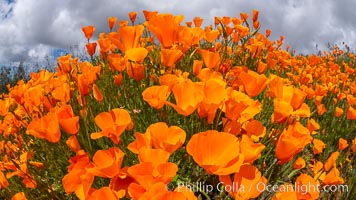
California Poppies, Rancho La Costa, Carlsbad.
Species: California poppy, Eschscholzia californica
Location: Rancho La Costa, Carlsbad, California
Image ID: 35192
Species: California poppy, Eschscholzia californica
Location: Rancho La Costa, Carlsbad, California
Image ID: 35192
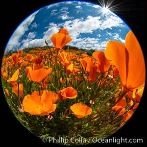
California Poppies, Rancho La Costa, Carlsbad.
Species: California poppy, Eschscholzia californica
Location: Rancho La Costa, Carlsbad, California
Image ID: 35208
Species: California poppy, Eschscholzia californica
Location: Rancho La Costa, Carlsbad, California
Image ID: 35208

Wildflowers, Rancho La Costa, Carlsbad.
Location: Rancho La Costa, Carlsbad, California
Image ID: 33222
Location: Rancho La Costa, Carlsbad, California
Image ID: 33222

Purple owls clover, Rancho La Costa, Carlsbad.
Location: Rancho La Costa, Carlsbad, California
Image ID: 33262
Location: Rancho La Costa, Carlsbad, California
Image ID: 33262
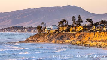
Terramar Sunset, viewed from North Ponto with Oceanside and Camp Pendleton in the distance. Rising in the distance is San Onofre Mountain (1722') topped by a tall signal tower, one of the southern peaks in the Santa Ana Mountains.
Location: Carlsbad, California
Image ID: 36743
Location: Carlsbad, California
Image ID: 36743
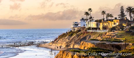
Terramar Point at Sunset, in South Carlsbad. Seacliffs, bluffs, beach and reef exposed at low tide.
Location: Carlsbad, California
Image ID: 37709
Panorama dimensions: 5154 x 11837
Location: Carlsbad, California
Image ID: 37709
Panorama dimensions: 5154 x 11837
