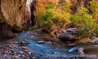
Fall Colors in the Virgin River Narrows, Zion National Park, Utah.
Location: Virgin River Narrows, Zion National Park, Utah
Image ID: 32612
Panorama dimensions: 5380 x 8954
Location: Virgin River Narrows, Zion National Park, Utah
Image ID: 32612
Panorama dimensions: 5380 x 8954
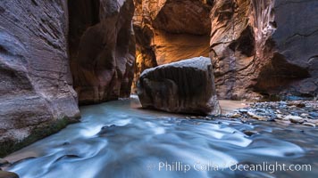
The Virgin River Narrows, where the Virgin River has carved deep, narrow canyons through the Zion National Park sandstone, creating one of the finest hikes in the world.
Location: Virgin River Narrows, Zion National Park, Utah
Image ID: 32620
Location: Virgin River Narrows, Zion National Park, Utah
Image ID: 32620
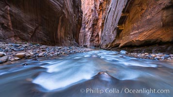
The Virgin River Narrows, where the Virgin River has carved deep, narrow canyons through the Zion National Park sandstone, creating one of the finest hikes in the world.
Location: Virgin River Narrows, Zion National Park, Utah
Image ID: 32623
Location: Virgin River Narrows, Zion National Park, Utah
Image ID: 32623
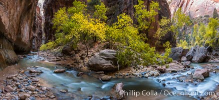
Fall Colors in the Virgin River Narrows, Zion National Park, Utah.
Location: Virgin River Narrows, Zion National Park, Utah
Image ID: 32631
Panorama dimensions: 6427 x 14033
Location: Virgin River Narrows, Zion National Park, Utah
Image ID: 32631
Panorama dimensions: 6427 x 14033
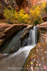
Fall Colors in Kanarra Creek Canyon, Utah.
Location: Kanarra Creek, Kanarraville, Utah
Image ID: 32647
Location: Kanarra Creek, Kanarraville, Utah
Image ID: 32647
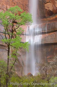
Waterfall at Temple of Sinawava during peak flow following spring rainstorm. Zion Canyon.
Location: Temple of Sinawava, Zion National Park, Utah
Image ID: 12452
Location: Temple of Sinawava, Zion National Park, Utah
Image ID: 12452
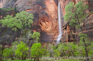
Waterfall at Temple of Sinawava during peak flow following spring rainstorm. Zion Canyon.
Location: Temple of Sinawava, Zion National Park, Utah
Image ID: 12469
Location: Temple of Sinawava, Zion National Park, Utah
Image ID: 12469
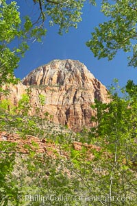
Red sandstone peaks above the Parus trail in Zion National Park.
Location: Zion National Park, Utah
Image ID: 12485
Location: Zion National Park, Utah
Image ID: 12485
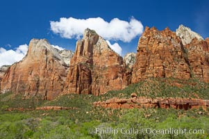
Court of the Patriarchs, a series of red sandstone peaks, rise above Zion Canyon.
Location: Zion National Park, Utah
Image ID: 12498
Location: Zion National Park, Utah
Image ID: 12498
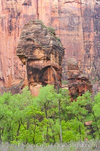
The Preacher and the Pulpit, a pair of freestanding sandstone columns in the Temple of Sinawava, are surrounded by cottonwoods with their deep green spring foliage. Zion Canyon.
Location: Zion National Park, Utah
Image ID: 12501
Location: Zion National Park, Utah
Image ID: 12501
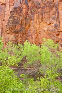
Cottonwoods with their deep green spring foliage contrast with the rich red Navaho sandstone cliffs of Zion Canyon.
Location: Zion National Park, Utah
Image ID: 12509
Location: Zion National Park, Utah
Image ID: 12509
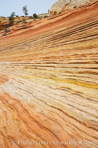
Navajo sandstone forms the cliffs and walls of Zion National Park. The sandstone reaches a thickness of 2300 feet and consists of ancient cemented desert sand dunes. Horizontal lines, commonly called crossbedding, represent layers of wind-blown sand that built up into sand dunes. These dunes were then buried, and the sand grains glued together by calcite and iron oxide to form sandstone.
Location: Zion National Park, Utah
Image ID: 12519
Location: Zion National Park, Utah
Image ID: 12519
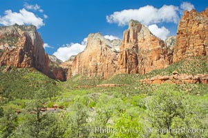
Court of the Patriarchs, named for the three Hebrew prophets Abraham, Isaac and Jacob.
Location: Court of the Patriarchs, Zion National Park, Utah
Image ID: 12805
Location: Court of the Patriarchs, Zion National Park, Utah
Image ID: 12805
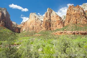
Court of the Patriarchs, named for the three Hebrew prophets Abraham, Isaac and Jacob.
Location: Court of the Patriarchs, Zion National Park, Utah
Image ID: 12807
Location: Court of the Patriarchs, Zion National Park, Utah
Image ID: 12807
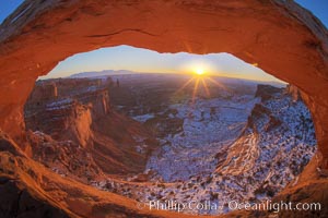
Mesa Arch spans 90 feet and stands at the edge of a mesa precipice thousands of feet above the Colorado River gorge. For a few moments at sunrise the underside of the arch glows dramatically red and orange.
Location: Island in the Sky, Canyonlands National Park, Utah
Image ID: 18085
Location: Island in the Sky, Canyonlands National Park, Utah
Image ID: 18085
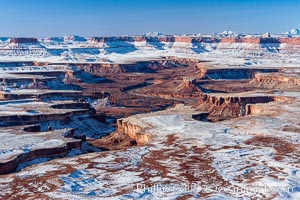
Soda Springs Basin in Canyonlands National Park, snow covered mesas and canyons, with the Green River far below, not far from its confluence with the Colorado River. Island in the Sky.
Location: Canyonlands National Park, Utah
Image ID: 18093
Location: Canyonlands National Park, Utah
Image ID: 18093
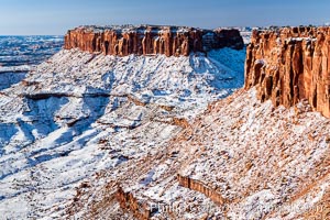
Canyonlands National Park, winter, viewed from Grandview Point. Island in the Sky.
Location: Canyonlands National Park, Utah
Image ID: 18097
Location: Canyonlands National Park, Utah
Image ID: 18097
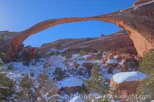
Landscape Arch in winter. Landscape Arch has an amazing 306-foot span.
Location: Landscape Arch, Arches National Park, Utah
Image ID: 18115
Location: Landscape Arch, Arches National Park, Utah
Image ID: 18115
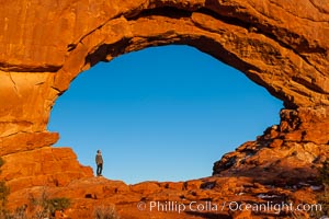
Hiker in North Window, sunset, western face. North Window is a natural sandstone arch 90 feet wide and 48 feet high.
Location: North Window, Arches National Park, Utah
Image ID: 18160
Location: North Window, Arches National Park, Utah
Image ID: 18160
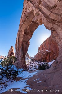
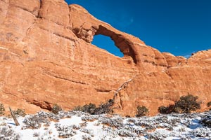
Pine Tree Arch on the Devil's Garden Trail in Arches National Park.
Location: Pine Tree Arch, Arches National Park, Utah
Image ID: 18186
Location: Pine Tree Arch, Arches National Park, Utah
Image ID: 18186
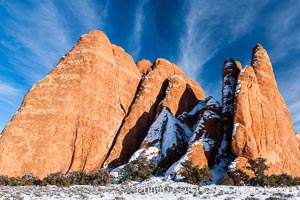
Fins. The vertical slabs of Entrada sandstone may become natural sandstone arches.
Location: Arches National Park, Utah
Image ID: 18187
Location: Arches National Park, Utah
Image ID: 18187
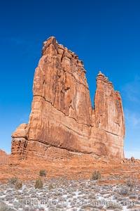
The Organ at Courthouse Towers, narrow sandstone fins towering above the surrounding flatlands.
Location: Courthouse Towers, Arches National Park, Utah
Image ID: 18195
Location: Courthouse Towers, Arches National Park, Utah
Image ID: 18195
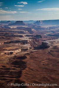
Soda Springs Basin from Green River Overlook, Island in the Sky, Canyonlands National Park, Utah.
Location: Canyonlands National Park, Utah
Image ID: 27840
Location: Canyonlands National Park, Utah
Image ID: 27840
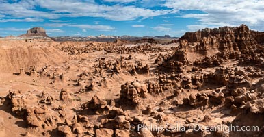
Hoodoos in Goblin Valley State Park, aerial panorama. The "goblins" are technically known as hoodoos, formed through the gradual erosion of Entrada sandstone deposited 170 millions years ago. Aerial panoramic photograph.
Location: Goblin Valley State Park, Utah
Image ID: 37957
Location: Goblin Valley State Park, Utah
Image ID: 37957
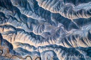
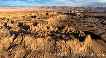
Erosion patterns in the Utah Badlands, aerial abstract photo.
Location: Hanksville, Utah
Image ID: 38017
Location: Hanksville, Utah
Image ID: 38017
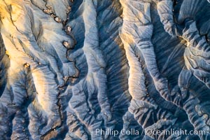
Erosion patterns in the Utah Badlands, aerial abstract photo.
Location: Hanksville, Utah
Image ID: 38018
Location: Hanksville, Utah
Image ID: 38018
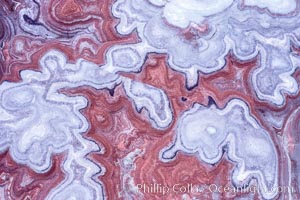
Fantastic colorful sedimentary patterns, Bentonite layers are seen as striations exposed in the Utah Badlands, part of the Brushy Basin shale member of the Morrison Formation. This layer was formed during Jurassic times when mud, silt, fine sand, and volcanic ash were deposited in swamps and lakes. Aerial photograph.
Location: Utah
Image ID: 38019
Location: Utah
Image ID: 38019
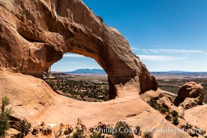
Wilson Arch aerial photo, Moab, Utah. Wilson Arch has a span of 91 feet (28 m) and height of 46 feet (14 m).
Location: Wilson Arch, Moab, Utah
Image ID: 38022
Location: Wilson Arch, Moab, Utah
Image ID: 38022
