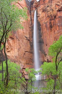
Waterfall at Temple of Sinawava during peak flow following spring rainstorm. Zion Canyon.
Location: Temple of Sinawava, Zion National Park, Utah
Image ID: 12450
Location: Temple of Sinawava, Zion National Park, Utah
Image ID: 12450
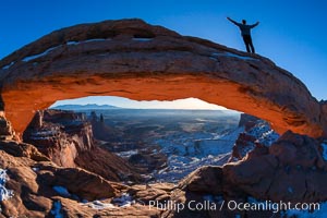
Extended High Mountain pose, Utthita Tadasana, sunrise on Mesa Arch, Utah. An exuberant hiker greets the dawning sun from atop Mesa Arch.
Location: Island in the Sky, Canyonlands National Park, Utah
Image ID: 18036
Location: Island in the Sky, Canyonlands National Park, Utah
Image ID: 18036
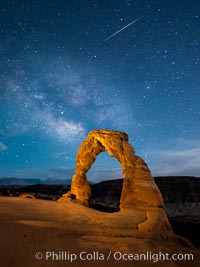
Milky Way and Shooting Star over Delicate Arch, as stars cover the night sky.
Location: Arches National Park, Utah
Image ID: 27854
Location: Arches National Park, Utah
Image ID: 27854
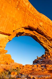
Hiker in North Window, sunset, western face. North Window is a natural sandstone arch 90 feet wide and 48 feet high.
Location: North Window, Arches National Park, Utah
Image ID: 18159
Location: North Window, Arches National Park, Utah
Image ID: 18159
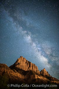
Milky Way over the Watchman, Zion National Park. The Milky Way galaxy rises in the night sky above the the Watchman.
Location: Zion National Park, Utah
Image ID: 28586
Location: Zion National Park, Utah
Image ID: 28586
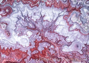
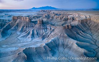
The Tree of Eons, a spectacular dendritic formation in the Bentonite Hills of Utah. Fantastic colorful sedimentary patterns, ancient Bentonite layers are exposed through erosion in the Utah Badlands. The Bentonite Hills are composed of the Brushy Basin shale member of the Morrison Formation. This layer was formed during Jurassic times when mud, silt, fine sand, and volcanic ash were deposited in swamps and lakes. Photographed just before sunrise with soft pre-dawn illumination. Aerial panoramic photograph.
Location: Utah
Image ID: 37951
Panorama dimensions: 11000 x 15000
Location: Utah
Image ID: 37951
Panorama dimensions: 11000 x 15000
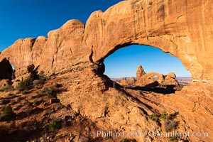
Tracy greets the dawn, with Turret Arch in the distance viewed through North Window at Sunrise.
Location: North Window, Arches National Park, Utah
Image ID: 37860
Location: North Window, Arches National Park, Utah
Image ID: 37860
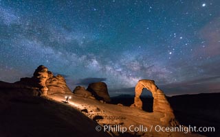
Light Painting and the Milky Way and Stars over Delicate Arch, at night, Arches National Park, Utah.
Location: Delicate Arch, Arches National Park, Utah
Image ID: 29288
Location: Delicate Arch, Arches National Park, Utah
Image ID: 29288
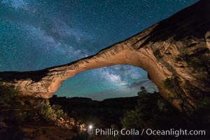
Owachomo Bridge and Milky Way. Owachomo Bridge, a natural stone bridge standing 106' high and spanning 130' wide,stretches across a canyon with the Milky Way crossing the night sky.
Location: Owachomo Bridge, Natural Bridges National Monument, Utah
Image ID: 28541
Location: Owachomo Bridge, Natural Bridges National Monument, Utah
Image ID: 28541
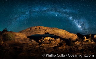
Panorama of the Milky Way over Mesa Arch.
Location: Mesa Arch, Canyonlands National Park, Utah
Image ID: 27824
Panorama dimensions: 4790 x 7815
Location: Mesa Arch, Canyonlands National Park, Utah
Image ID: 27824
Panorama dimensions: 4790 x 7815
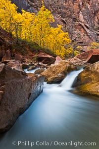
The Virgin River flows by autumn cottonwood trees, part of the Virgin River Narrows. This is a fantastic hike in fall with the comfortable temperatures, beautiful fall colors and light crowds.
Location: Virgin River Narrows, Zion National Park, Utah
Image ID: 26096
Location: Virgin River Narrows, Zion National Park, Utah
Image ID: 26096
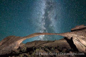
Landscape Arch and Milky Way, stars rise over the arch at night.
Location: Arches National Park, Utah
Image ID: 27868
Location: Arches National Park, Utah
Image ID: 27868
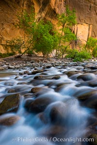
The Virgin River Narrows, where the Virgin River has carved deep, narrow canyons through the Zion National Park sandstone, creating one of the finest hikes in the world.
Location: Virgin River Narrows, Zion National Park, Utah
Image ID: 28575
Location: Virgin River Narrows, Zion National Park, Utah
Image ID: 28575
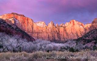
West Temple, The Sundial and the Altar of Sacrifice illuminated by soft alpenglow, about 20 minutes before sunrise.
Location: Zion National Park, Utah
Image ID: 37788
Location: Zion National Park, Utah
Image ID: 37788
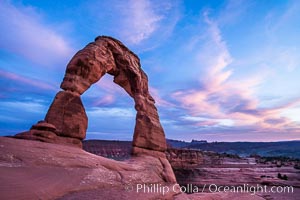
Delicate Arch at Sunset, Arches National Park.
Location: Delicate Arch, Arches National Park, Utah
Image ID: 29283
Location: Delicate Arch, Arches National Park, Utah
Image ID: 29283
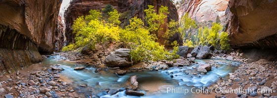
Fall Colors in the Virgin River Narrows, Zion National Park, Utah.
Location: Virgin River Narrows, Zion National Park, Utah
Image ID: 32634
Panorama dimensions: 5145 x 14424
Location: Virgin River Narrows, Zion National Park, Utah
Image ID: 32634
Panorama dimensions: 5145 x 14424
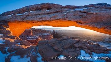
Mesa Arch spans 90 feet and stands at the edge of a mesa precipice thousands of feet above the Colorado River gorge. For a few moments at sunrise the underside of the arch glows dramatically red and orange.
Location: Island in the Sky, Canyonlands National Park, Utah
Image ID: 18040
Location: Island in the Sky, Canyonlands National Park, Utah
Image ID: 18040
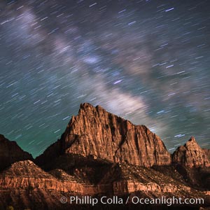
Milky Way over the Watchman, Zion National Park. The Milky Way galaxy rises in the night sky above the the Watchman.
Location: Zion National Park, Utah
Image ID: 28587
Location: Zion National Park, Utah
Image ID: 28587
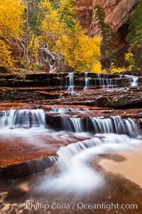
Archangel Falls in autumn, near the Subway in North Creek Canyon, with maples and cottonwoods turning fall colors.
Location: Zion National Park, Utah
Image ID: 26097
Location: Zion National Park, Utah
Image ID: 26097
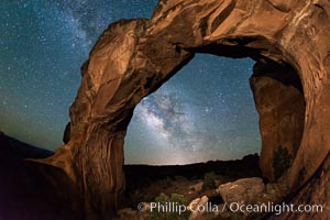
Milky Way and Stars over Broken Arch, Arches National Park, Utah.
Location: Broken Arch, Arches National Park, Utah
Image ID: 29238
Location: Broken Arch, Arches National Park, Utah
Image ID: 29238
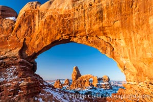
Turret Arch through North Window, winter, sunrise.
Location: North Window, Arches National Park, Utah
Image ID: 18120
Location: North Window, Arches National Park, Utah
Image ID: 18120

Sunset at Dead Horse Point Overlook, with the Colorado River flowing 2,000 feet below. 300 million years of erosion has carved the expansive canyons, cliffs and walls below and surrounding Deadhorse Point.
Location: Dead Horse Point State Park, Utah
Image ID: 27823
Panorama dimensions: 5303 x 17695
Location: Dead Horse Point State Park, Utah
Image ID: 27823
Panorama dimensions: 5303 x 17695
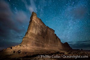
Stars over the Tower of Babel, starry night, Arches National Park, Utah.
Location: Arches National Park, Utah
Image ID: 27847
Location: Arches National Park, Utah
Image ID: 27847
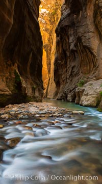
The Virgin River Narrows, where the Virgin River has carved deep, narrow canyons through the Zion National Park sandstone, creating one of the finest hikes in the world.
Location: Virgin River Narrows, Zion National Park, Utah
Image ID: 28583
Location: Virgin River Narrows, Zion National Park, Utah
Image ID: 28583
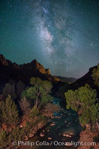
Milky Way over the Watchman, Zion National Park. The Milky Way galaxy rises in the night sky above the the Watchman.
Location: Zion National Park, Utah
Image ID: 28590
Location: Zion National Park, Utah
Image ID: 28590
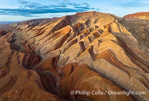
Aerial Photo of Raplee Ridge near Mexican Hat, Utah. Raplee Ridge is a spectacular series of multicolored triangular flatirons near the San Juan River. Often called "the Raplee Anticline" the geologic structure is in fact better described as a monocline, according to the Utah Geological Survey.
Location: Mexican Hat, Utah
Image ID: 39489
Location: Mexican Hat, Utah
Image ID: 39489
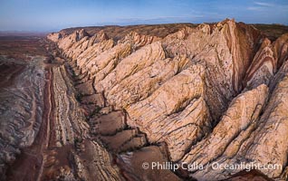
Aerial photo of the San Rafael Reef at dawn. A fold in the Earth's crust leads to this inclined section of the San Rafael Reef, at the eastern edge of the San Rafael Swell. Clearly seen are the characteristic triangular flatiron erosion patterns that typical this formation. The colors seen here arise primarily from Navajo and Wingate sandstone.
Location: Utah
Image ID: 39787
Location: Utah
Image ID: 39787
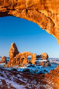
Sunrise light on Turret Arch viewed through North Window, winter.
Location: North Window, Arches National Park, Utah
Image ID: 18119
Location: North Window, Arches National Park, Utah
Image ID: 18119
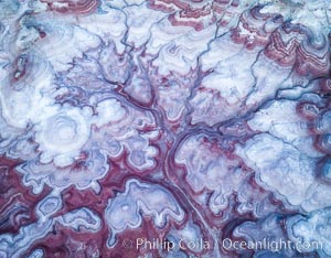
Pre-Dawn over the Tree of Eons, Utah. The Tree of Eons is a spectacular geologic sight near the San Rafael Swell. Erosion has cut a "tree" through red, blue, purple and white layers of the Chinle formation. The Tree of Eons is a superb example of dendritic erosion and to really appreciate the complex fractal-like details it must be observed from above. Photographed here in the soft, predawn light, it takes on magenta, red and purple hues just before the sun reaches it. Aerial panoramic photograph.
Location: Utah
Image ID: 38027
Location: Utah
Image ID: 38027
