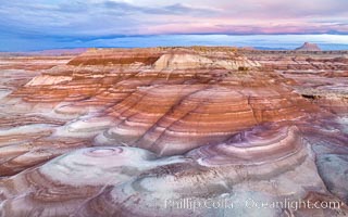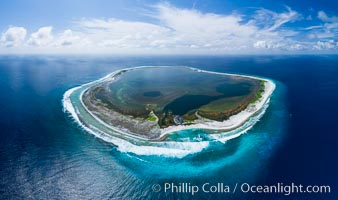
Aerial panorama of Clipperton Island, showing the entire atoll. Clipperton Island, a minor territory of France also known as Ile de la Passion, is a small (2.3 sq mi) but spectacular coral atoll in the eastern Pacific. By permit HC / 1485 / CAB (France).
Location: Clipperton Island, France
Image ID: 32835
Panorama dimensions: 5523 x 9328
Location: Clipperton Island, France
Image ID: 32835
Panorama dimensions: 5523 x 9328
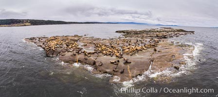
Steller Sea Lions atop Norris Rocks, Hornby Island and Vancouver Island, panoramic photo.
Species: Steller sea lion, Eumetopias jubatus
Location: British Columbia, Canada
Image ID: 34468
Panorama dimensions: 4590 x 10283
Species: Steller sea lion, Eumetopias jubatus
Location: British Columbia, Canada
Image ID: 34468
Panorama dimensions: 4590 x 10283
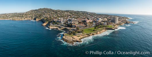
Aerial Panoramic Photo of Point La Jolla and La Jolla Cove, Boomer Beach, Scripps Park. Panoramic aerial photograph of La Jolla Cove and Scripps Parks (center), with La Jolla’s Mount Soledad rising above, La Jolla Shores and La Jolla Caves to the left and the La Jolla Coast with Children’s Pool (Casa Cove) to the right. The undersea reefs of Boomer Beach are seen through the clear, calm ocean waters. This extremely high resolution panorama will print 50″ high by 130″ long with no interpolation.
Location: La Jolla, California
Image ID: 30773
Panorama dimensions: 7744 x 20541
Location: La Jolla, California
Image ID: 30773
Panorama dimensions: 7744 x 20541
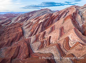
Aerial Photo of Raplee Ridge near Mexican Hat, Utah. Raplee Ridge is a spectacular series of multicolored triangular flatirons near the San Juan River. Often called "the Raplee Anticline" the geologic structure is in fact better described as a monocline, according to the Utah Geological Survey.
Location: Mexican Hat, Utah
Image ID: 39490
Location: Mexican Hat, Utah
Image ID: 39490
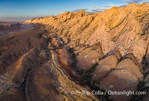
Aerial photo of the San Rafael Reef at dawn. A fold in the Earth's crust leads to this inclined section of the San Rafael Reef, at the eastern edge of the San Rafael Swell. Clearly seen are the characteristic triangular flatiron erosion patterns that typical this formation. The colors seen here arise primarily from Navajo and Wingate sandstone.
Location: Utah
Image ID: 39784
Location: Utah
Image ID: 39784
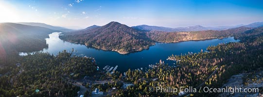
Bass Lake, Aerial Panoramic Photo.
Location: Bass Lake, California
Image ID: 38216
Panorama dimensions: 4947 x 13389
Location: Bass Lake, California
Image ID: 38216
Panorama dimensions: 4947 x 13389
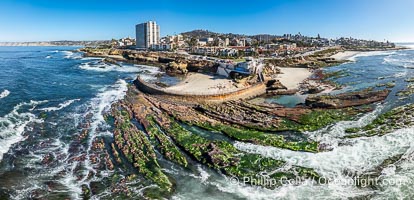
Children's Pool Reef Exposed at Extreme Low Tide, La Jolla, California. Aerial panoramic photograph.
Location: La Jolla, California
Image ID: 40711
Panorama dimensions: 5335 x 11037
Location: La Jolla, California
Image ID: 40711
Panorama dimensions: 5335 x 11037
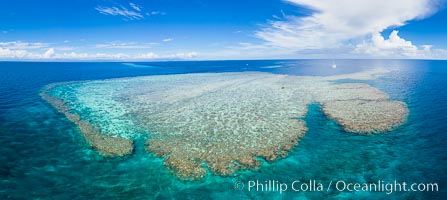
Aerial View of Vatu-i-Ra Coral Seascape, Fiji.
Location: Vatu I Ra Passage, Bligh Waters, Viti Levu Island, Fiji
Image ID: 34681
Panorama dimensions: 5837 x 13048
Location: Vatu I Ra Passage, Bligh Waters, Viti Levu Island, Fiji
Image ID: 34681
Panorama dimensions: 5837 x 13048
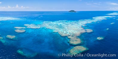
Aerial View of Namena Marine Reserve and Coral Reefs, Namena Island, Fiji.
Location: Namena Marine Reserve, Namena Island, Fiji
Image ID: 34687
Panorama dimensions: 4631 x 9150
Location: Namena Marine Reserve, Namena Island, Fiji
Image ID: 34687
Panorama dimensions: 4631 x 9150
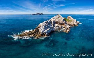
Middle Coronado Rock Island, aerial photo.
Location: Coronado Islands (Islas Coronado), Baja California, Mexico
Image ID: 35085
Panorama dimensions: 5420 x 8725
Location: Coronado Islands (Islas Coronado), Baja California, Mexico
Image ID: 35085
Panorama dimensions: 5420 x 8725
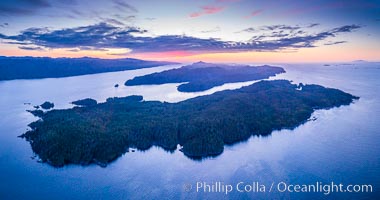
Balaklava Island at sunset, aerial photo, Vancouver Island, Canada.
Location: British Columbia, Canada
Image ID: 35328
Panorama dimensions: 4728 x 8986
Location: British Columbia, Canada
Image ID: 35328
Panorama dimensions: 4728 x 8986
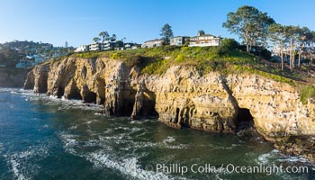
La Jolla Caves and the Coast Walk, La Jolla. Aerial panoramic photograph.
Location: La Jolla, California
Image ID: 37953
Location: La Jolla, California
Image ID: 37953
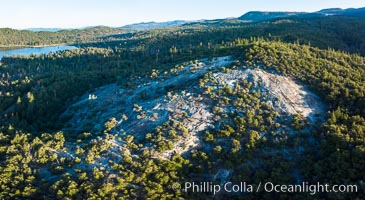
Glass Rock overlooking Bass Lake, California. Sierra Nevada. Aerial panoramic photograph.
Location: Bass Lake, California
Image ID: 37955
Location: Bass Lake, California
Image ID: 37955
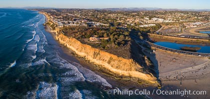
Solana Beach and Del Mar dog beach, aerial panoramic photo.
Location: Solana Beach, California
Image ID: 37968
Location: Solana Beach, California
Image ID: 37968
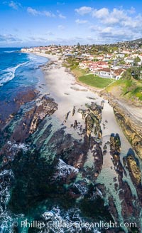
Exposed reef near Windansea, seen during King Low Tide, aerial panoramic photo.
Location: La Jolla, California
Image ID: 37972
Location: La Jolla, California
Image ID: 37972
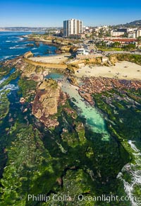
Childrens Pool Reef Exposed at Extreme Low King Tide, La Jolla, California. Aerial panoramic photograph.
Location: Children's Pool, La Jolla, California
Image ID: 37982
Location: Children's Pool, La Jolla, California
Image ID: 37982
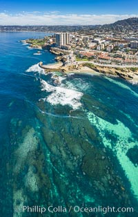
Childrens Pool Reef Exposed at Extreme Low King Tide, La Jolla, California. Aerial panoramic photograph.
Location: La Jolla, California
Image ID: 37986
Location: La Jolla, California
Image ID: 37986
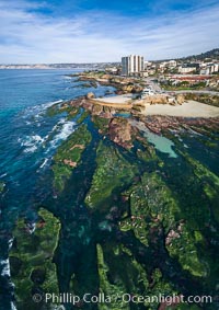
Childrens Pool Reef Exposed at Extreme Low King Tide, La Jolla, California. Aerial panoramic photograph.
Location: Children's Pool, La Jolla, California
Image ID: 37994
Location: Children's Pool, La Jolla, California
Image ID: 37994
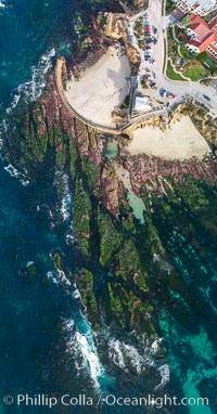
Childrens Pool Reef Exposed at Extreme Low King Tide, La Jolla, California. Aerial panoramic photograph.
Location: Children's Pool, La Jolla, California
Image ID: 37997
Panorama dimensions: 9573 x 5008
Location: Children's Pool, La Jolla, California
Image ID: 37997
Panorama dimensions: 9573 x 5008
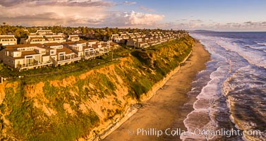
Grandview Beach, Aerial Photo, Encinitas and Carlsbad.
Location: Encinitas, California
Image ID: 38004
Location: Encinitas, California
Image ID: 38004
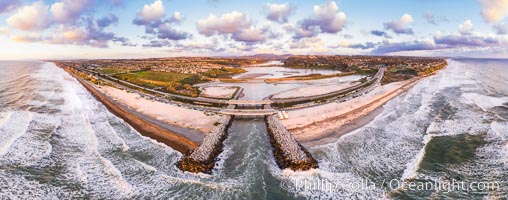
Batiquitos Lagoon and Ponto, stormy sunset, aerial photo.
Location: Carlsbad, California
Image ID: 38005
Panorama dimensions: 6406 x 16258
Location: Carlsbad, California
Image ID: 38005
Panorama dimensions: 6406 x 16258
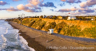
South Carlsbad State Beach and campground, aerial photo.
Location: Carlsbad, California
Image ID: 38006
Location: Carlsbad, California
Image ID: 38006
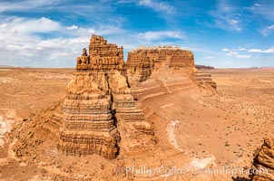
Molly's Castle, aerial view, Goblin Valley State Park.
Location: Mollys Castle, Goblin Valley State Park, Utah
Image ID: 38016
Location: Mollys Castle, Goblin Valley State Park, Utah
Image ID: 38016
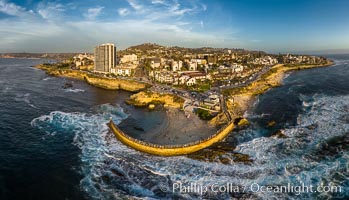
Childrens Pool seawall and Casa Cove aerial photo, La Jolla, California. Sunset. Aerial panoramic photograph.
Location: La Jolla, California
Image ID: 38037
Panorama dimensions: 5602 x 9774
Location: La Jolla, California
Image ID: 38037
Panorama dimensions: 5602 x 9774
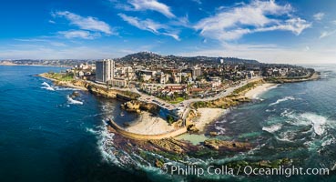
Childrens Pool Reef Exposed at Extreme Low Tide, La Jolla, California. Aerial panoramic photograph.
Location: La Jolla, California
Image ID: 38038
Panorama dimensions: 6176 x 11395
Location: La Jolla, California
Image ID: 38038
Panorama dimensions: 6176 x 11395
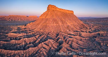
Factory Butte at sunrise. An exceptional example of a solitary butte surrounded by dramatically eroded badlands, Factory Butte stands alone on the San Rafael Swell.
Location: Factory Butte, Hanksville, Utah
Image ID: 38054
Location: Factory Butte, Hanksville, Utah
Image ID: 38054
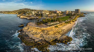
Point La Jolla and Scripps Park aerial photo, sunset, sea lions and sea gulls and tourists looking down on Boomer Beach. Aerial panoramic photo.
Location: La Jolla, California
Image ID: 38073
Panorama dimensions: 5257 x 9461
Location: La Jolla, California
Image ID: 38073
Panorama dimensions: 5257 x 9461
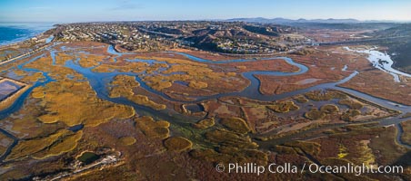
San Elijo Lagoon aerial photo, panorama.
Location: Encinitas, California
Image ID: 38138
Panorama dimensions: 3867 x 8738
Location: Encinitas, California
Image ID: 38138
Panorama dimensions: 3867 x 8738
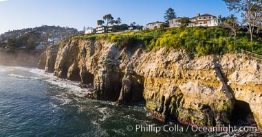
La Jolla Caves and Coastline, Goldfish Point, Aerial Panoramic Photo.
Location: La Jolla, California
Image ID: 38144
Location: La Jolla, California
Image ID: 38144
