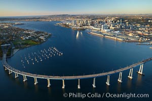
San Diego Coronado Bridge, known locally as the Coronado Bridge, links San Diego with Coronado, California. The bridge was completed in 1969 and was a toll bridge until 2002. It is 2.1 miles long and reaches a height of 200 feet above San Diego Bay. Coronado Island is to the left, and downtown San Diego is to the right in this view looking north.
Location: San Diego, California
Image ID: 22288
Location: San Diego, California
Image ID: 22288
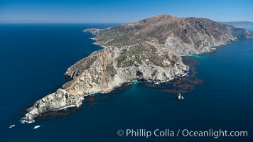
Aerial photo of the West End of Catalina Island.
Location: Catalina Island, California
Image ID: 25978
Location: Catalina Island, California
Image ID: 25978
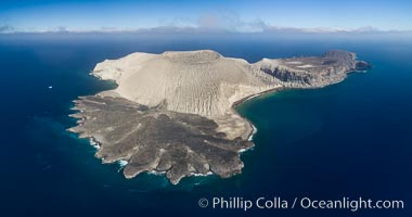
San Benedicto Island and Barcena crater, aerial photo, Revillagigedos Islands, Mexico.
Location: San Benedicto Island (Islas Revillagigedos), Baja California, Mexico
Image ID: 32914
Panorama dimensions: 4703 x 8937
Location: San Benedicto Island (Islas Revillagigedos), Baja California, Mexico
Image ID: 32914
Panorama dimensions: 4703 x 8937
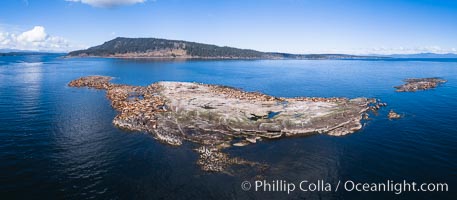
Steller Sea Lions atop Norris Rocks, Hornby Island in the distance, panoramic photo.
Species: Steller sea lion, Eumetopias jubatus
Location: British Columbia, Canada
Image ID: 34467
Panorama dimensions: 3758 x 8590
Species: Steller sea lion, Eumetopias jubatus
Location: British Columbia, Canada
Image ID: 34467
Panorama dimensions: 3758 x 8590
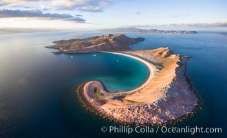
Isla San Francisquito, Aerial Photo, Sea of of Cortez.
Location: Isla San Francisquito, Baja California, Mexico
Image ID: 32441
Location: Isla San Francisquito, Baja California, Mexico
Image ID: 32441
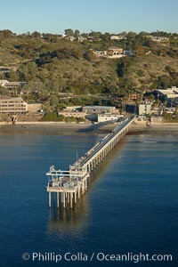
SIO Pier, Scripps Pier, La Jolla. The Scripps Institution of Oceanography research pier is 1090 feet long and was built of reinforced concrete in 1988, replacing the original wooden pier built in 1915. The Scripps Pier is home to a variety of sensing equipment above and below water that collects various oceanographic data. The Scripps research diving facility is located at the foot of the pier. Fresh seawater is pumped from the pier to the many tanks and facilities of SIO, including the Birch Aquarium. The Scripps Pier is named in honor of Ellen Browning Scripps, the most significant donor and benefactor of the Institution.
Location: Scripps Institution of Oceanography, La Jolla, California
Image ID: 22286
Location: Scripps Institution of Oceanography, La Jolla, California
Image ID: 22286
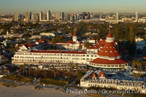
Hotel del Coronado, known affectionately as the Hotel Del. It was once the largest hotel in the world, and is one of the few remaining wooden Victorian beach resorts. It sits on the beach on Coronado Island, seen here with downtown San Diego in the distance. It is widely considered to be one of Americas most beautiful and classic hotels. Built in 1888, it was designated a National Historic Landmark in 1977.
Location: San Diego, California
Image ID: 22287
Location: San Diego, California
Image ID: 22287
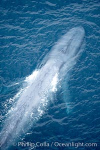
Blue whale, swimming through the open ocean.
Species: Blue whale, Balaenoptera musculus
Location: La Jolla, California
Image ID: 21248
Species: Blue whale, Balaenoptera musculus
Location: La Jolla, California
Image ID: 21248
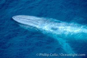
Blue whale. The sleek hydrodynamic shape of the enormous blue whale allows it to swim swiftly through the ocean, at times over one hundred miles in a single day.
Species: Blue whale, Balaenoptera musculus
Location: La Jolla, California
Image ID: 21250
Species: Blue whale, Balaenoptera musculus
Location: La Jolla, California
Image ID: 21250
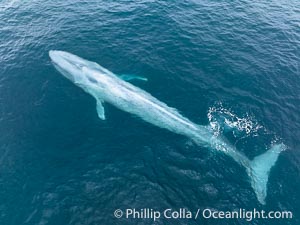
Aerial photo of blue whale near San Diego. This enormous blue whale glides at the surface of the ocean, resting and breathing before it dives to feed on subsurface krill.
Species: Blue whale, Balaenoptera musculus
Location: San Diego, California
Image ID: 39422
Species: Blue whale, Balaenoptera musculus
Location: San Diego, California
Image ID: 39422
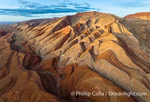
Aerial Photo of Raplee Ridge near Mexican Hat, Utah. Raplee Ridge is a spectacular series of multicolored triangular flatirons near the San Juan River. Often called "the Raplee Anticline" the geologic structure is in fact better described as a monocline, according to the Utah Geological Survey.
Location: Mexican Hat, Utah
Image ID: 39489
Location: Mexican Hat, Utah
Image ID: 39489
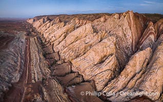
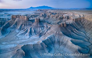
Aerial photo of the San Rafael Reef at dawn. A fold in the Earth's crust leads to this inclined section of the San Rafael Reef, at the eastern edge of the San Rafael Swell. Clearly seen are the characteristic triangular flatiron erosion patterns that typical this formation. The colors seen here arise primarily from Navajo and Wingate sandstone.
Location: Utah
Image ID: 39787
Location: Utah
Image ID: 39787
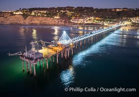
Holiday Christmas Lights on Scripps Pier, Blacks Beach and Scripps Institution of Oceanography, sunset, aerial.
Location: La Jolla, California
Image ID: 39879
Location: La Jolla, California
Image ID: 39879
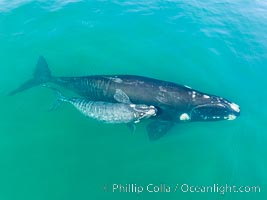
Southern right whale mother and calf, aerial photo, Eubalaena australis.
Species: Southern Right Whale, Eubalaena australis
Location: Puerto Piramides, Chubut, Argentina
Image ID: 38350
Species: Southern Right Whale, Eubalaena australis
Location: Puerto Piramides, Chubut, Argentina
Image ID: 38350
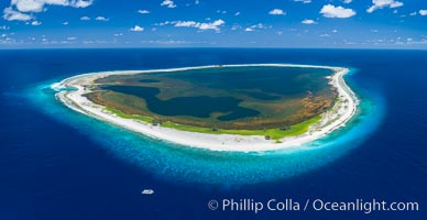
Aerial panorama of Clipperton Island, showing the entire atoll. Clipperton Island, a minor territory of France also known as Ile de la Passion, is a small (2.3 sq mi) but spectacular coral atoll in the eastern Pacific. By permit HC / 1485 / CAB (France).
Location: Clipperton Island, France
Image ID: 32889
Location: Clipperton Island, France
Image ID: 32889
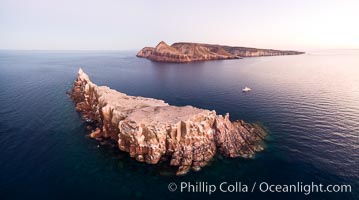
Los Islotes and Isla Partida, the northern part of Archipelago Espiritu Santo, Sea of Cortez, Aerial Photo. Islotes is famous for its friendly colony of California sea lions.
Location: Los Islotes, Baja California, Mexico
Image ID: 32402
Location: Los Islotes, Baja California, Mexico
Image ID: 32402
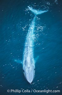
A huge blue whale swims through the open ocean in this aerial photograph. The blue whale is the largest animal ever to live on Earth.
Species: Blue whale, Balaenoptera musculus
Image ID: 02169
Species: Blue whale, Balaenoptera musculus
Image ID: 02169
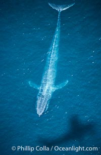
Blue whale aerial photo, with the shadow of the survey plane providing scale as to how huge the whale really is.
Species: Blue whale, Balaenoptera musculus
Image ID: 02168
Species: Blue whale, Balaenoptera musculus
Image ID: 02168
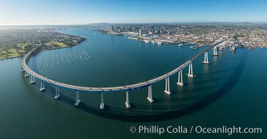
Panoramic Aerial Photo of San Diego Coronado Bay Bridge.
Location: San Diego, California
Image ID: 30789
Panorama dimensions: 7503 x 14441
Location: San Diego, California
Image ID: 30789
Panorama dimensions: 7503 x 14441
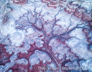
Pre-Dawn over the Tree of Eons, Utah. The Tree of Eons is a spectacular geologic sight near the San Rafael Swell. Erosion has cut a "tree" through red, blue, purple and white layers of the Chinle formation. The Tree of Eons is a superb example of dendritic erosion and to really appreciate the complex fractal-like details it must be observed from above. Photographed here in the soft, predawn light, it takes on magenta, red and purple hues just before the sun reaches it. Aerial panoramic photograph.
Location: Utah
Image ID: 38027
Location: Utah
Image ID: 38027
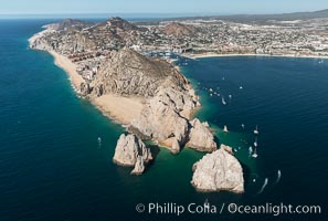
Aerial photograph of Land's End and the Arch, Cabo San Lucas, Mexico.
Location: Cabo San Lucas, Baja California, Mexico
Image ID: 28893
Location: Cabo San Lucas, Baja California, Mexico
Image ID: 28893
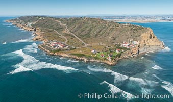
Aerial Photo of Cabrillo State Marine Reserve, Point Loma, San Diego.
Location: San Diego, California
Image ID: 30641
Location: San Diego, California
Image ID: 30641
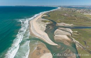
Aerial Photo of Tijuana River Mouth SMCA. Tijuana River Mouth State Marine Conservation Area borders Imperial Beach and the Mexican Border.
Location: Imperial Beach, California
Image ID: 30660
Location: Imperial Beach, California
Image ID: 30660
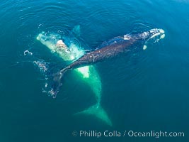
Courting group of southern right whales, aerial photo. Mating may occur as a result of this courting and social behavior. The white whale seen here is a serious player named El Copulador (the copulator) and is often seen in mating and courting groups of southern right whales at Peninsula Valdes. His light coloration is an indication that he was a white calf, but he did not darken as he aged in the way most white southern right whale calves do.
Species: Southern Right Whale, Eubalaena australis
Location: Puerto Piramides, Chubut, Argentina
Image ID: 38357
Species: Southern Right Whale, Eubalaena australis
Location: Puerto Piramides, Chubut, Argentina
Image ID: 38357
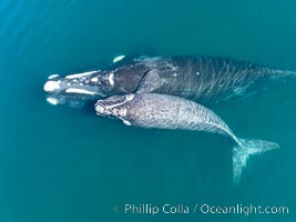
Southern right whale mother and calf, aerial photo, Eubalaena australis.
Species: Southern Right Whale, Eubalaena australis
Location: Puerto Piramides, Chubut, Argentina
Image ID: 38385
Species: Southern Right Whale, Eubalaena australis
Location: Puerto Piramides, Chubut, Argentina
Image ID: 38385
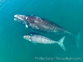
Southern right whale mother and calf, aerial photo, Eubalaena australis.
Species: Southern Right Whale, Eubalaena australis
Location: Puerto Piramides, Chubut, Argentina
Image ID: 38386
Species: Southern Right Whale, Eubalaena australis
Location: Puerto Piramides, Chubut, Argentina
Image ID: 38386
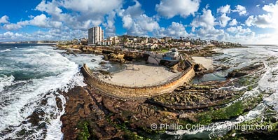
Children's Pool Reef Exposed at Extreme Low King Tide, La Jolla, California. Aerial panoramic photograph.
Location: La Jolla, California
Image ID: 40717
Panorama dimensions: 6423 x 12735
Location: La Jolla, California
Image ID: 40717
Panorama dimensions: 6423 x 12735
