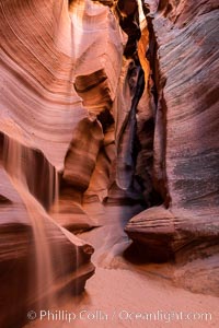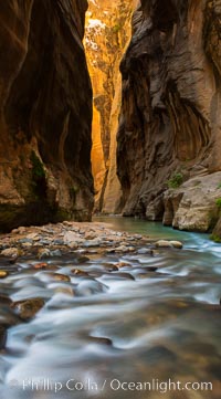
The Virgin River Narrows, where the Virgin River has carved deep, narrow canyons through the Zion National Park sandstone, creating one of the finest hikes in the world.
Location: Virgin River Narrows, Zion National Park, Utah
Image ID: 28583
Location: Virgin River Narrows, Zion National Park, Utah
Image ID: 28583
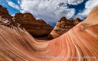
The Wave in the North Coyote Buttes, an area of fantastic eroded sandstone featuring beautiful swirls, wild colors, countless striations, and bizarre shapes set amidst the dramatic surrounding North Coyote Buttes of Arizona and Utah. The sandstone formations of the North Coyote Buttes, including the Wave, date from the Jurassic period. Managed by the Bureau of Land Management, the Wave is located in the Paria Canyon-Vermilion Cliffs Wilderness and is accessible on foot by permit only.
Location: North Coyote Buttes, Paria Canyon-Vermilion Cliffs Wilderness, Arizona
Image ID: 28601
Location: North Coyote Buttes, Paria Canyon-Vermilion Cliffs Wilderness, Arizona
Image ID: 28601
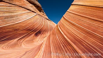
The Wave, an area of fantastic eroded sandstone featuring beautiful swirls, wild colors, countless striations, and bizarre shapes set amidst the dramatic surrounding North Coyote Buttes of Arizona and Utah. The sandstone formations of the North Coyote Buttes, including the Wave, date from the Jurassic period. Managed by the Bureau of Land Management, the Wave is located in the Paria Canyon-Vermilion Cliffs Wilderness and is accessible on foot by permit only.
Location: North Coyote Buttes, Paria Canyon-Vermilion Cliffs Wilderness, Arizona
Image ID: 20608
Location: North Coyote Buttes, Paria Canyon-Vermilion Cliffs Wilderness, Arizona
Image ID: 20608
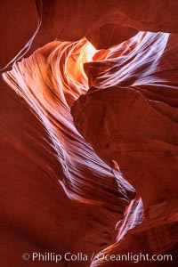
Upper Antelope Canyon, a deep, narrow and spectacular slot canyon lying on Navajo Tribal lands near Page, Arizona.
Location: Navajo Tribal Lands, Page, Arizona
Image ID: 35936
Location: Navajo Tribal Lands, Page, Arizona
Image ID: 35936
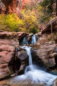
Fall Colors in Kanarra Creek Canyon, Utah.
Location: Kanarra Creek, Kanarraville, Utah
Image ID: 32639
Location: Kanarra Creek, Kanarraville, Utah
Image ID: 32639
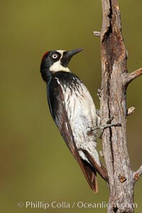
Acorn woodpecker, female.
Species: Acorn woodpecker, Melanerpes formicivorus
Location: Madera Canyon Recreation Area, Green Valley, Arizona
Image ID: 22906
Species: Acorn woodpecker, Melanerpes formicivorus
Location: Madera Canyon Recreation Area, Green Valley, Arizona
Image ID: 22906

Black-headed grosbeak, male.
Species: Black-headed grosbeak, Pheucticus melanocephalus
Location: Madera Canyon Recreation Area, Green Valley, Arizona
Image ID: 22911
Species: Black-headed grosbeak, Pheucticus melanocephalus
Location: Madera Canyon Recreation Area, Green Valley, Arizona
Image ID: 22911
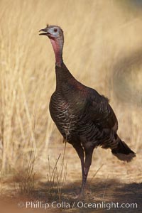
Wild turkey.
Species: Wild turkey, Meleagris gallopavo
Location: Madera Canyon Recreation Area, Green Valley, Arizona
Image ID: 22935
Species: Wild turkey, Meleagris gallopavo
Location: Madera Canyon Recreation Area, Green Valley, Arizona
Image ID: 22935
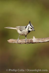
Bridled titmouse.
Species: Bridled titmouse, Baeolophus wollweberi
Location: Madera Canyon Recreation Area, Green Valley, Arizona
Image ID: 22941
Species: Bridled titmouse, Baeolophus wollweberi
Location: Madera Canyon Recreation Area, Green Valley, Arizona
Image ID: 22941
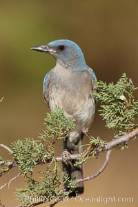
Mexican jay.
Species: Mexican jay, Aphelocoma ultramarina
Location: Madera Canyon Recreation Area, Green Valley, Arizona
Image ID: 22959
Species: Mexican jay, Aphelocoma ultramarina
Location: Madera Canyon Recreation Area, Green Valley, Arizona
Image ID: 22959
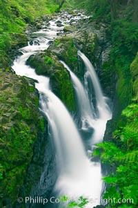
Sol Duc Falls. Sol Duc Falls is one of the largest and most beautiful waterfalls in Olympic National Park, seen here from a bridge that crosses the canyon just below the falls. Surrounding the falls is an old-growth forest of hemlocks and douglas firs, some of which are three hundred years in age.
Location: Sol Duc Springs, Olympic National Park, Washington
Image ID: 13747
Location: Sol Duc Springs, Olympic National Park, Washington
Image ID: 13747

Panorama of the Wave. The Wave is a sweeping, dramatic display of eroded sandstone, forged by eons of water and wind erosion, laying bare striations formed from compacted sand dunes over millenia. This panoramic picture is formed from thirteen individual photographs.
Location: North Coyote Buttes, Paria Canyon-Vermilion Cliffs Wilderness, Arizona
Image ID: 20700
Panorama dimensions: 4661 x 25458
Location: North Coyote Buttes, Paria Canyon-Vermilion Cliffs Wilderness, Arizona
Image ID: 20700
Panorama dimensions: 4661 x 25458
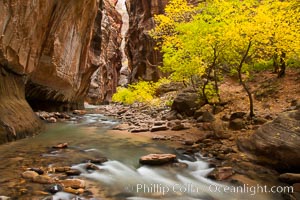
The Virgin River flows by autumn cottonwood trees, part of the Virgin River Narrows. This is a fantastic hike in fall with the comfortable temperatures, beautiful fall colors and light crowds.
Location: Virgin River Narrows, Zion National Park, Utah
Image ID: 26098
Location: Virgin River Narrows, Zion National Park, Utah
Image ID: 26098
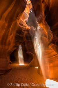
Light Beam in Upper Antelope Slot Canyon. Thin shafts of light briefly penetrate the convoluted narrows of Upper Antelope Slot Canyon, sending piercing beams through the sandstone maze to the sand floor below.
Location: Navajo Tribal Lands, Page, Arizona
Image ID: 28561
Location: Navajo Tribal Lands, Page, Arizona
Image ID: 28561
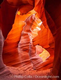
Lower Antelope Canyon, a deep, narrow and spectacular slot canyon lying on Navajo Tribal lands near Page, Arizona.
Location: Navajo Tribal Lands, Page, Arizona
Image ID: 26628
Location: Navajo Tribal Lands, Page, Arizona
Image ID: 26628
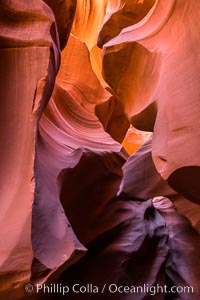
Lower Antelope Canyon, a deep, narrow and spectacular slot canyon lying on Navajo Tribal lands near Page, Arizona.
Location: Navajo Tribal Lands, Page, Arizona
Image ID: 28559
Location: Navajo Tribal Lands, Page, Arizona
Image ID: 28559
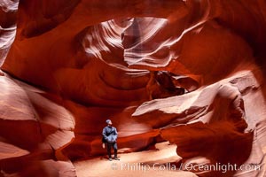
A hiker admiring the striated walls and dramatic light within Antelope Canyon, a deep narrow slot canyon formed by water and wind erosion.
Location: Navajo Tribal Lands, Page, Arizona
Image ID: 18009
Location: Navajo Tribal Lands, Page, Arizona
Image ID: 18009
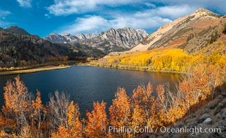
Sierra Nevada Fall Colors, North Lake, Bishop Creek Canyon.
Species: Quaking aspen, Populus tremuloides
Location: Bishop Creek Canyon, Sierra Nevada Mountains, California
Image ID: 36437
Panorama dimensions: 6440 x 10545
Species: Quaking aspen, Populus tremuloides
Location: Bishop Creek Canyon, Sierra Nevada Mountains, California
Image ID: 36437
Panorama dimensions: 6440 x 10545
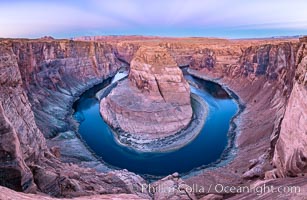
Belt of Venus over Horseshoe Bend on the Colorado River. The Colorado River makes a 180-degree turn at Horseshoe Bend. Here the river has eroded the Navajo sandstone for eons, digging a canyon 1100-feet deep. The Belt of Venus, or anti-twilight arch, is the shadow of the earth cast upon the atmosphere just above the horizon, and occurs a few minutes before sunrise or after sunset.
Location: Page, Arizona
Image ID: 37781
Panorama dimensions: 5719 x 8788
Location: Page, Arizona
Image ID: 37781
Panorama dimensions: 5719 x 8788
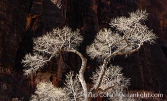
Fremont Cottonwood Tree in winter sillhouette against red Zion Canyon walls.
Location: Zion National Park, Utah
Image ID: 37795
Location: Zion National Park, Utah
Image ID: 37795
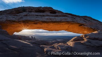
Mesa Arch Sunrise, Canyonlands National Park, Utah.
Location: Mesa Arch, Canyonlands National Park, Utah
Image ID: 29304
Location: Mesa Arch, Canyonlands National Park, Utah
Image ID: 29304
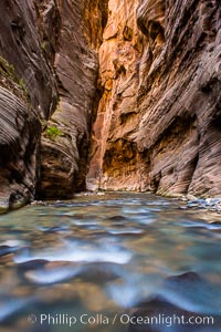
The Virgin River Narrows, where the Virgin River has carved deep, narrow canyons through the Zion National Park sandstone, creating one of the finest hikes in the world.
Location: Virgin River Narrows, Zion National Park, Utah
Image ID: 28578
Location: Virgin River Narrows, Zion National Park, Utah
Image ID: 28578
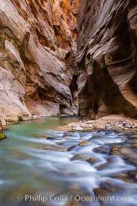
The Virgin River Narrows, where the Virgin River has carved deep, narrow canyons through the Zion National Park sandstone, creating one of the finest hikes in the world.
Location: Virgin River Narrows, Zion National Park, Utah
Image ID: 28579
Location: Virgin River Narrows, Zion National Park, Utah
Image ID: 28579
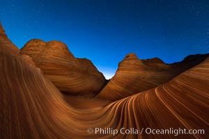
The Wave at Night, under a clear night sky full of stars. The Wave, an area of fantastic eroded sandstone featuring beautiful swirls, wild colors, countless striations, and bizarre shapes set amidst the dramatic surrounding North Coyote Buttes of Arizona and Utah. The sandstone formations of the North Coyote Buttes, including the Wave, date from the Jurassic period. Managed by the Bureau of Land Management, the Wave is located in the Paria Canyon-Vermilion Cliffs Wilderness and is accessible on foot by permit only.
Location: North Coyote Buttes, Paria Canyon-Vermilion Cliffs Wilderness, Arizona
Image ID: 28621
Location: North Coyote Buttes, Paria Canyon-Vermilion Cliffs Wilderness, Arizona
Image ID: 28621
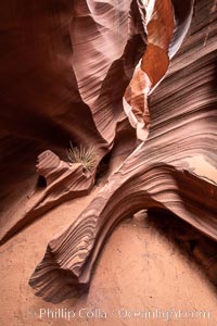
Rattlesnake Canyon, a beautiful slot canyon that is part of the larger Antelope Canyon system. Page, Arizona.
Location: Navajo Tribal Lands, Page, Arizona
Image ID: 36039
Location: Navajo Tribal Lands, Page, Arizona
Image ID: 36039
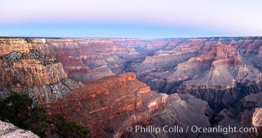
Belt of Venus over Grand Canyon at sunrise, viewed from Hopi Point on the south rim of Grand Canyon National Park. The Belt of Venus, or anti-twilight arch, is the shadow of the earth cast upon the atmosphere just above the horizon, and occurs a few minutes before sunrise or after sunset.
Location: Grand Canyon National Park, Arizona
Image ID: 37765
Panorama dimensions: 5409 x 10272
Location: Grand Canyon National Park, Arizona
Image ID: 37765
Panorama dimensions: 5409 x 10272
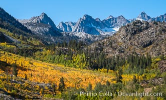
Aspen trees cover Bishop Creek Canyon above Aspendel.
Location: Bishop Creek Canyon, Sierra Nevada Mountains, California
Image ID: 35836
Location: Bishop Creek Canyon, Sierra Nevada Mountains, California
Image ID: 35836
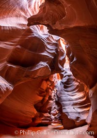
Upper Antelope Canyon, a deep, narrow and spectacular slot canyon lying on Navajo Tribal lands near Page, Arizona.
Location: Navajo Tribal Lands, Page, Arizona
Image ID: 35931
Location: Navajo Tribal Lands, Page, Arizona
Image ID: 35931

