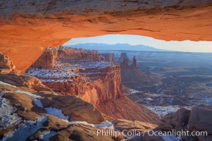
Mesa Arch spans 90 feet and stands at the edge of a mesa precipice thousands of feet above the Colorado River gorge. For a few moments at sunrise the underside of the arch glows dramatically red and orange.
Location: Island in the Sky, Canyonlands National Park, Utah
Image ID: 18080
Location: Island in the Sky, Canyonlands National Park, Utah
Image ID: 18080
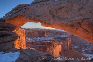
Mesa Arch spans 90 feet and stands at the edge of a mesa precipice thousands of feet above the Colorado River gorge. For a few moments at sunrise the underside of the arch glows dramatically red and orange.
Location: Island in the Sky, Canyonlands National Park, Utah
Image ID: 18081
Location: Island in the Sky, Canyonlands National Park, Utah
Image ID: 18081
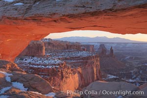
Mesa Arch spans 90 feet and stands at the edge of a mesa precipice thousands of feet above the Colorado River gorge. For a few moments at sunrise the underside of the arch glows dramatically red and orange.
Location: Island in the Sky, Canyonlands National Park, Utah
Image ID: 18082
Location: Island in the Sky, Canyonlands National Park, Utah
Image ID: 18082
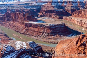
Dead Horse Point Overlook, with the Colorado River flowing 2,000 feet below. 300 million years of erosion has carved the expansive canyons, cliffs and walls below and surrounding Deadhorse Point.
Location: Deadhorse Point State Park, Utah
Image ID: 18091
Location: Deadhorse Point State Park, Utah
Image ID: 18091
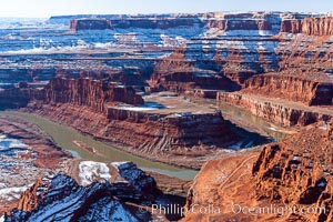
Dead Horse Point Overlook, with the Colorado River flowing 2,000 feet below. 300 million years of erosion has carved the expansive canyons, cliffs and walls below and surrounding Deadhorse Point.
Location: Deadhorse Point State Park, Utah
Image ID: 18092
Location: Deadhorse Point State Park, Utah
Image ID: 18092
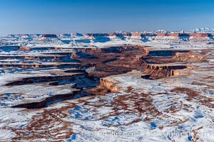
Canyonlands National Park, snow covered mesas and canyons, with the Green River far below, not far from its confluence with the Colorado River. Island in the Sky.
Location: Canyonlands National Park, Utah
Image ID: 18094
Location: Canyonlands National Park, Utah
Image ID: 18094
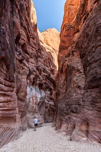
Hiker in Buckskin Gulch. A hiker considers the towering walls and narrow passageway of Buckskin Gulch, a dramatic slot canyon forged by centuries of erosion through sandstone. Buckskin Gulch is the worlds longest accessible slot canyon, running from the Paria River toward the Colorado River. Flash flooding is a serious danger in the narrows where there is no escape.
Location: Buckskin Gulch, Paria Canyon-Vermilion Cliffs Wilderness, Arizona
Image ID: 20711
Location: Buckskin Gulch, Paria Canyon-Vermilion Cliffs Wilderness, Arizona
Image ID: 20711
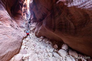
Hiker in Buckskin Gulch. A hiker considers the towering walls and narrow passageway of Buckskin Gulch, a dramatic slot canyon forged by centuries of erosion through sandstone. Buckskin Gulch is the worlds longest accessible slot canyon, running from the Paria River toward the Colorado River. Flash flooding is a serious danger in the narrows where there is no escape.
Location: Buckskin Gulch, Paria Canyon-Vermilion Cliffs Wilderness, Arizona
Image ID: 20712
Location: Buckskin Gulch, Paria Canyon-Vermilion Cliffs Wilderness, Arizona
Image ID: 20712
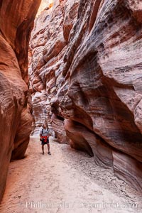
Hiker in Buckskin Gulch. A hiker considers the towering walls and narrow passageway of Buckskin Gulch, a dramatic slot canyon forged by centuries of erosion through sandstone. Buckskin Gulch is the worlds longest accessible slot canyon, running from the Paria River toward the Colorado River. Flash flooding is a serious danger in the narrows where there is no escape.
Location: Buckskin Gulch, Paria Canyon-Vermilion Cliffs Wilderness, Arizona
Image ID: 20713
Location: Buckskin Gulch, Paria Canyon-Vermilion Cliffs Wilderness, Arizona
Image ID: 20713
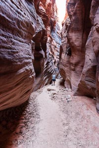
Hiker in Buckskin Gulch. A hiker considers the towering walls and narrow passageway of Buckskin Gulch, a dramatic slot canyon forged by centuries of erosion through sandstone. Buckskin Gulch is the worlds longest accessible slot canyon, running from the Paria River toward the Colorado River. Flash flooding is a serious danger in the narrows where there is no escape.
Location: Buckskin Gulch, Paria Canyon-Vermilion Cliffs Wilderness, Arizona
Image ID: 20719
Location: Buckskin Gulch, Paria Canyon-Vermilion Cliffs Wilderness, Arizona
Image ID: 20719
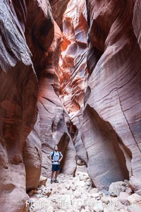
Hiker in Buckskin Gulch. A hiker considers the towering walls and narrow passageway of Buckskin Gulch, a dramatic slot canyon forged by centuries of erosion through sandstone. Buckskin Gulch is the worlds longest accessible slot canyon, running from the Paria River toward the Colorado River. Flash flooding is a serious danger in the narrows where there is no escape.
Location: Buckskin Gulch, Paria Canyon-Vermilion Cliffs Wilderness, Arizona
Image ID: 20721
Location: Buckskin Gulch, Paria Canyon-Vermilion Cliffs Wilderness, Arizona
Image ID: 20721
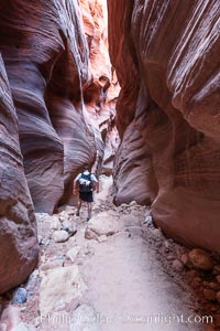
Hiker in Buckskin Gulch. A hiker considers the towering walls and narrow passageway of Buckskin Gulch, a dramatic slot canyon forged by centuries of erosion through sandstone. Buckskin Gulch is the worlds longest accessible slot canyon, running from the Paria River toward the Colorado River. Flash flooding is a serious danger in the narrows where there is no escape.
Location: Buckskin Gulch, Paria Canyon-Vermilion Cliffs Wilderness, Arizona
Image ID: 20722
Location: Buckskin Gulch, Paria Canyon-Vermilion Cliffs Wilderness, Arizona
Image ID: 20722
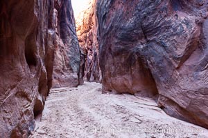
Buckskin Gulch. Rising above a sand wash are the towering walls and narrow passageways of Buckskin Gulch, a dramatic slot canyon forged by centuries of erosion through sandstone. Buckskin Gulch is the worlds longest accessible slot canyon, running from the Paria River toward the Colorado River. Flash flooding is a serious danger in the narrows where there is no escape.
Location: Buckskin Gulch, Paria Canyon-Vermilion Cliffs Wilderness, Arizona
Image ID: 20724
Location: Buckskin Gulch, Paria Canyon-Vermilion Cliffs Wilderness, Arizona
Image ID: 20724
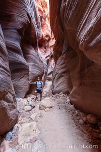
Hiker in Buckskin Gulch. A hiker considers the towering walls and narrow passageway of Buckskin Gulch, a dramatic slot canyon forged by centuries of erosion through sandstone. Buckskin Gulch is the worlds longest accessible slot canyon, running from the Paria River toward the Colorado River. Flash flooding is a serious danger in the narrows where there is no escape.
Location: Buckskin Gulch, Paria Canyon-Vermilion Cliffs Wilderness, Arizona
Image ID: 20729
Location: Buckskin Gulch, Paria Canyon-Vermilion Cliffs Wilderness, Arizona
Image ID: 20729
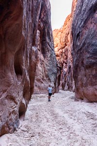
Hiker in Buckskin Gulch. A hiker considers the towering walls and narrow passageway of Buckskin Gulch, a dramatic slot canyon forged by centuries of erosion through sandstone. Buckskin Gulch is the worlds longest accessible slot canyon, running from the Paria River toward the Colorado River. Flash flooding is a serious danger in the narrows where there is no escape.
Location: Buckskin Gulch, Paria Canyon-Vermilion Cliffs Wilderness, Arizona
Image ID: 20770
Location: Buckskin Gulch, Paria Canyon-Vermilion Cliffs Wilderness, Arizona
Image ID: 20770
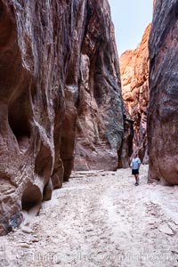
Hiker in Buckskin Gulch. A hiker considers the towering walls and narrow passageway of Buckskin Gulch, a dramatic slot canyon forged by centuries of erosion through sandstone. Buckskin Gulch is the worlds longest accessible slot canyon, running from the Paria River toward the Colorado River. Flash flooding is a serious danger in the narrows where there is no escape.
Location: Buckskin Gulch, Paria Canyon-Vermilion Cliffs Wilderness, Arizona
Image ID: 20771
Location: Buckskin Gulch, Paria Canyon-Vermilion Cliffs Wilderness, Arizona
Image ID: 20771
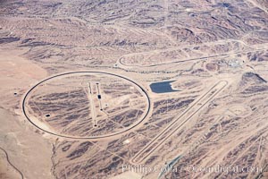
A top secret, high security alien spaceship depot in the desert east of the Colorado River. Long suspected but only confirmed to exist for the first time with this photograph, this is a derivative high tech interstellar flight complex arising from work originally conducted at the (nonexistant) Area 51. Strangely, certain curious aspects of this location, such as the circle and long oval tracks which support landings and liftoff of gravity drive Martian and Saturnian craft, are not shown on Google Earth, while other features in this photograph area such as the long ovoid skateboard track are indeed seen on Google Earth and can be matched to this image. The US Government will likely deny the mere existence of this bizarre Martian landing area.
Location: Alien Spaceship Landing Field, California
Image ID: 22130
Location: Alien Spaceship Landing Field, California
Image ID: 22130
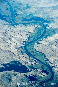
Colorado River, showing Martinez Lake (top right), Senator Wash Reservoir (lower left), Squaw Lake (center bottom).
Location: Colorado River, California
Image ID: 22131
Location: Colorado River, California
Image ID: 22131