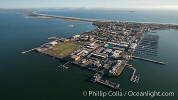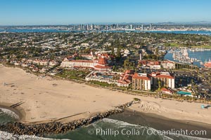
Aerial Photo of San Diego Coronado Bridge, known locally as the Coronado Bridge, links San Diego with Coronado, California. The bridge was completed in 1969 and was a toll bridge until 2002. It is 2.1 miles long and reaches a height of 200 feet above San Diego Bay. Coronado Island is to the left, and downtown San Diego is to the right in this view looking north.
Image ID: 30763
Image ID: 30763
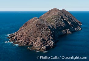
North Coronado Island, Mexico, southern point looking north, aerial photograph.
Location: Coronado Islands (Islas Coronado), Baja California, Mexico
Image ID: 29054
Location: Coronado Islands (Islas Coronado), Baja California, Mexico
Image ID: 29054
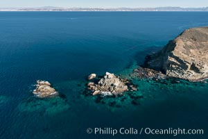
South Coronado Island, Mexico, northern point showing underwater reef structure, aerial photograph.
Location: Coronado Islands (Islas Coronado), Baja California, Mexico
Image ID: 29061
Location: Coronado Islands (Islas Coronado), Baja California, Mexico
Image ID: 29061
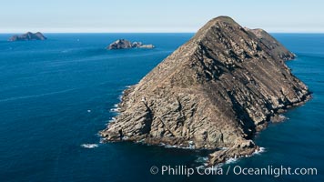
South Coronado Island, Mexico, southern point looking north, Middle and North Islands in the distance, aerial photograph.
Location: Coronado Islands (Islas Coronado), Baja California, Mexico
Image ID: 29063
Location: Coronado Islands (Islas Coronado), Baja California, Mexico
Image ID: 29063
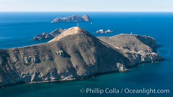
South Coronado Island, Mexico, eastern side, Middle and North Islands in the distance, aerial photograph.
Location: Coronado Islands (Islas Coronado), Baja California, Mexico
Image ID: 29065
Location: Coronado Islands (Islas Coronado), Baja California, Mexico
Image ID: 29065
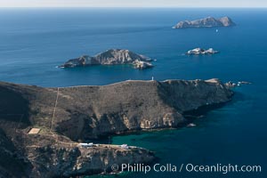
South Coronado Island, Mexico, eastern side, Middle and North Islands in the distance, aerial photograph.
Location: Coronado Islands (Islas Coronado), Baja California, Mexico
Image ID: 29067
Location: Coronado Islands (Islas Coronado), Baja California, Mexico
Image ID: 29067
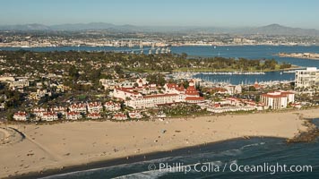
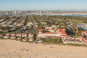
Aerial Photo of Hotel Del Coronado.
Image ID: 30760
Image ID: 30760
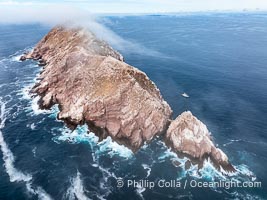
North Coronado Island, Mexico, southern point and keyhole looking north, clouds hugging the top of the island, San Diego in the distance, aerial photograph.
Location: Coronado Islands (Islas Coronado), Baja California, Mexico
Image ID: 40775
Location: Coronado Islands (Islas Coronado), Baja California, Mexico
Image ID: 40775
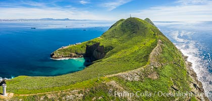
South Coronado Island, aerial photo.
Location: Coronado Islands (Islas Coronado), Baja California, Mexico
Image ID: 35090
Panorama dimensions: 4400 x 9241
Location: Coronado Islands (Islas Coronado), Baja California, Mexico
Image ID: 35090
Panorama dimensions: 4400 x 9241

Middle Coronado Island, aerial photo.
Location: Coronado Islands (Islas Coronado), Baja California, Mexico
Image ID: 35101
Panorama dimensions: 5185 x 12820
Location: Coronado Islands (Islas Coronado), Baja California, Mexico
Image ID: 35101
Panorama dimensions: 5185 x 12820
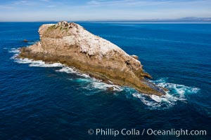
Middle Coronado Island, aerial photo.
Location: Coronado Islands (Islas Coronado), Baja California, Mexico
Image ID: 35102
Location: Coronado Islands (Islas Coronado), Baja California, Mexico
Image ID: 35102
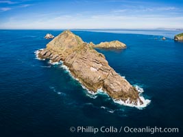
Middle Coronado Island, aerial photo.
Location: Coronado Islands (Islas Coronado), Baja California, Mexico
Image ID: 35103
Location: Coronado Islands (Islas Coronado), Baja California, Mexico
Image ID: 35103
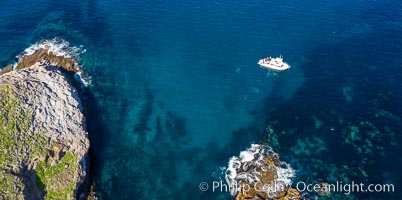
Middle Coronado Island, aerial photo.
Location: Coronado Islands (Islas Coronado), Baja California, Mexico
Image ID: 35104
Location: Coronado Islands (Islas Coronado), Baja California, Mexico
Image ID: 35104

Middle Coronado Island, aerial photo.
Location: Coronado Islands (Islas Coronado), Baja California, Mexico
Image ID: 35105
Location: Coronado Islands (Islas Coronado), Baja California, Mexico
Image ID: 35105
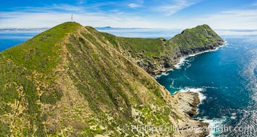
South Coronado Island, aerial photo.
Location: Coronado Islands (Islas Coronado), Baja California, Mexico
Image ID: 35107
Location: Coronado Islands (Islas Coronado), Baja California, Mexico
Image ID: 35107
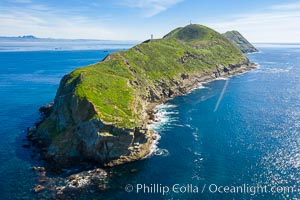
South Coronado Island, aerial photo.
Location: Coronado Islands (Islas Coronado), Baja California, Mexico
Image ID: 35108
Location: Coronado Islands (Islas Coronado), Baja California, Mexico
Image ID: 35108

Aerial Photo of North Coronado Island, Baja California, Mexico.
Location: Coronado Islands (Islas Coronado), Baja California, Mexico
Image ID: 35895
Location: Coronado Islands (Islas Coronado), Baja California, Mexico
Image ID: 35895
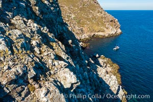
North Coronado Island aerial photo, Baja California, Mexico.
Image ID: 36517
Image ID: 36517
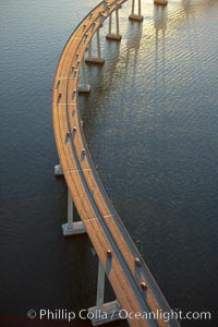
San Diego Coronado Bridge, known locally as the Coronado Bridge, links San Diego with Coronado, California. The bridge was completed in 1969 and was a toll bridge until 2002. It is 2.1 miles long and reaches a height of 200 feet above San Diego Bay.
Location: San Diego, California
Image ID: 22327
Location: San Diego, California
Image ID: 22327
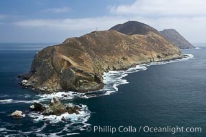
South Coronado Island, north end viewed from the north.
Location: Coronado Islands (Islas Coronado), Baja California, Mexico
Image ID: 21324
Location: Coronado Islands (Islas Coronado), Baja California, Mexico
Image ID: 21324
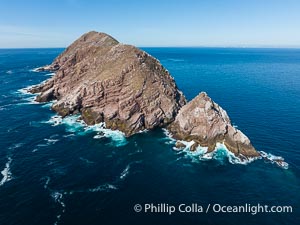
North Coronado Island viewed from the South, near Tijuana, Mexico, aerial photograph. Islas Coronado.
Location: Coronado Islands (Islas Coronado), Baja California, Mexico
Image ID: 39990
Location: Coronado Islands (Islas Coronado), Baja California, Mexico
Image ID: 39990
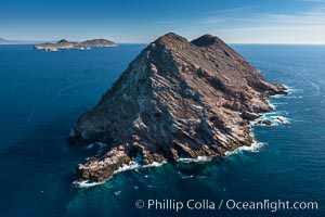
North Coronado Island, Mexico, northern point looking south with Middle and South Islands in the distance, aerial photograph.
Location: Coronado Islands (Islas Coronado), Baja California, Mexico
Image ID: 29051
Location: Coronado Islands (Islas Coronado), Baja California, Mexico
Image ID: 29051
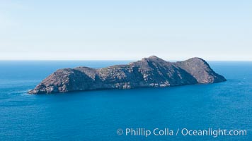
North Coronado Island, Mexico, aerial photograph.
Location: Coronado Islands (Islas Coronado), Baja California, Mexico
Image ID: 29055
Location: Coronado Islands (Islas Coronado), Baja California, Mexico
Image ID: 29055
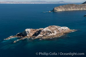
Middle Grounds in Mexico's Coronado Islands, aerial photograph.
Location: Coronado Islands (Islas Coronado), Baja California, Mexico
Image ID: 29056
Location: Coronado Islands (Islas Coronado), Baja California, Mexico
Image ID: 29056
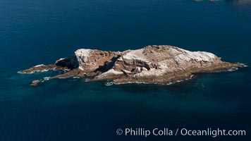
Middle Grounds in Mexico's Coronado Islands, aerial photograph.
Location: Coronado Islands (Islas Coronado), Baja California, Mexico
Image ID: 29057
Location: Coronado Islands (Islas Coronado), Baja California, Mexico
Image ID: 29057
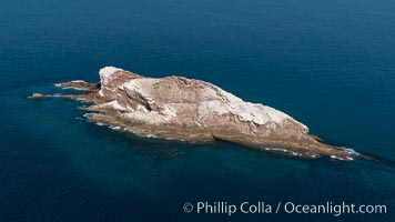
Middle Grounds in Mexico's Coronado Islands, aerial photograph.
Location: Coronado Islands (Islas Coronado), Baja California, Mexico
Image ID: 29058
Location: Coronado Islands (Islas Coronado), Baja California, Mexico
Image ID: 29058
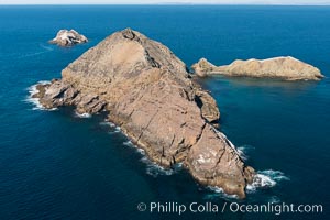
Middle Coronado Island, Mexico, looking north with San Diego and Point Loma in the distance, aerial photograph.
Location: Coronado Islands (Islas Coronado), Baja California, Mexico
Image ID: 29059
Location: Coronado Islands (Islas Coronado), Baja California, Mexico
Image ID: 29059
