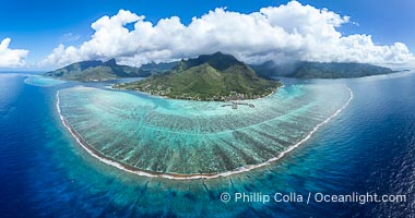
Barrier Reef around Moorea Island, French Polynesia. Cook's Bay to the left, Opunohu Bay to the right. The outer reef slope is seen adjacent to deep blue oceanic water with white waves breaking against the reef edge. Next, a wide shallow reef flat occurs dotted with coral bommies. Inside of that, a shallow protected lagoon is formed against the island. Tall, rugged, eroded mountains are seen hinting at the age of the ancient volcano that originally formed the island and that is now sinking back down, leaving the encircling reef behind.
Location: Moorea, French Polynesia, France
Image ID: 40673
Panorama dimensions: 6073 x 11526
Location: Moorea, French Polynesia, France
Image ID: 40673
Panorama dimensions: 6073 x 11526
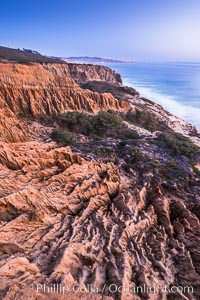
Torrey Pines Cliffs and Pacific Ocean, Razor Point view to La Jolla, San Diego, California.
Location: Torrey Pines State Reserve, San Diego, California
Image ID: 28485
Location: Torrey Pines State Reserve, San Diego, California
Image ID: 28485
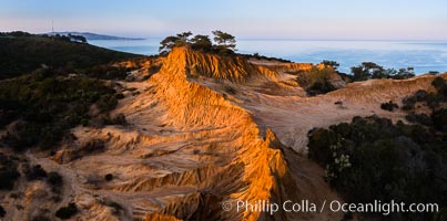
Broken Hill and view to La Jolla, panoramic photograph, from Torrey Pines State Reserve, sunrise.
Location: Torrey Pines State Reserve, San Diego, California
Image ID: 28464
Panorama dimensions: 3867 x 7787
Location: Torrey Pines State Reserve, San Diego, California
Image ID: 28464
Panorama dimensions: 3867 x 7787
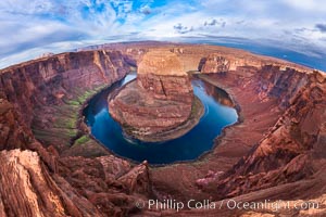
Horseshoe Bend. The Colorado River makes a 180-degree turn at Horseshoe Bend. Here the river has eroded the Navajo sandstone for eons, digging a canyon 1100-feet deep.
Location: Horseshoe Bend, Page, Arizona
Image ID: 26602
Location: Horseshoe Bend, Page, Arizona
Image ID: 26602
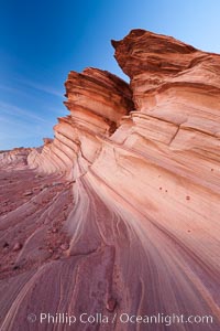
The Great Wall, Navajo Tribal Lands, Arizona. Sandstone "fins", eroded striations that depict how sandstone -- ancient compressed sand -- was laid down in layers over time. Now exposed, the layer erode at different rates, forming delicate "fins" that stretch for long distances.
Location: Navajo Tribal Lands, Page, Arizona
Image ID: 26643
Location: Navajo Tribal Lands, Page, Arizona
Image ID: 26643
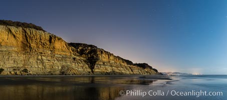
Torrey Pines Cliffs lit at night by a full moon, low tide reflections.
Location: Torrey Pines State Reserve, San Diego, California
Image ID: 28455
Panorama dimensions: 3623 x 8213
Location: Torrey Pines State Reserve, San Diego, California
Image ID: 28455
Panorama dimensions: 3623 x 8213
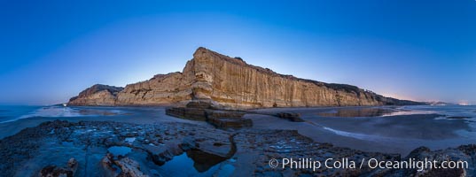
Torrey Pines Cliffs lit at night by a full moon, low tide reflections.
Location: Torrey Pines State Reserve, San Diego, California
Image ID: 28463
Panorama dimensions: 5072 x 13623
Location: Torrey Pines State Reserve, San Diego, California
Image ID: 28463
Panorama dimensions: 5072 x 13623
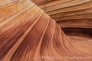
The Wave in the North Coyote Buttes, an area of fantastic eroded sandstone featuring beautiful swirls, wild colors, countless striations, and bizarre shapes set amidst the dramatic surrounding North Coyote Buttes of Arizona and Utah. The sandstone formations of the North Coyote Buttes, including the Wave, date from the Jurassic period. Managed by the Bureau of Land Management, the Wave is located in the Paria Canyon-Vermilion Cliffs Wilderness and is accessible on foot by permit only.
Location: North Coyote Buttes, Paria Canyon-Vermilion Cliffs Wilderness, Arizona
Image ID: 28602
Location: North Coyote Buttes, Paria Canyon-Vermilion Cliffs Wilderness, Arizona
Image ID: 28602
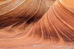
The Wave in the North Coyote Buttes, an area of fantastic eroded sandstone featuring beautiful swirls, wild colors, countless striations, and bizarre shapes set amidst the dramatic surrounding North Coyote Buttes of Arizona and Utah. The sandstone formations of the North Coyote Buttes, including the Wave, date from the Jurassic period. Managed by the Bureau of Land Management, the Wave is located in the Paria Canyon-Vermilion Cliffs Wilderness and is accessible on foot by permit only.
Location: North Coyote Buttes, Paria Canyon-Vermilion Cliffs Wilderness, Arizona
Image ID: 28603
Location: North Coyote Buttes, Paria Canyon-Vermilion Cliffs Wilderness, Arizona
Image ID: 28603
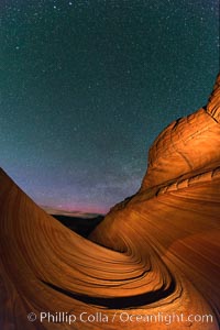
The Wave at Night, under a clear night sky full of stars. The Wave, an area of fantastic eroded sandstone featuring beautiful swirls, wild colors, countless striations, and bizarre shapes set amidst the dramatic surrounding North Coyote Buttes of Arizona and Utah. The sandstone formations of the North Coyote Buttes, including the Wave, date from the Jurassic period. Managed by the Bureau of Land Management, the Wave is located in the Paria Canyon-Vermilion Cliffs Wilderness and is accessible on foot by permit only.
Location: North Coyote Buttes, Paria Canyon-Vermilion Cliffs Wilderness, Arizona
Image ID: 28623
Location: North Coyote Buttes, Paria Canyon-Vermilion Cliffs Wilderness, Arizona
Image ID: 28623
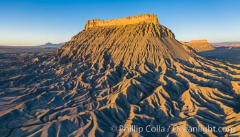
Factory Butte at sunrise, aerial photo, Utah. An exceptional example of solitary butte surrounded by dramatically eroded badlands, Factory Butte stands alone on the San Rafael Swell.
Location: Factory Butte, Hanksville, Utah
Image ID: 38076
Location: Factory Butte, Hanksville, Utah
Image ID: 38076
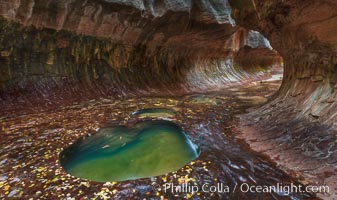
The Subway, a iconic eroded sandstone formation in Zion National Park.
Location: The Subway, Zion National Park, Utah
Image ID: 26093
Location: The Subway, Zion National Park, Utah
Image ID: 26093
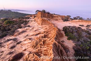
Sunrise over Broken Hill, overlooking La Jolla and the Pacific Ocean, Torrey Pines State Reserve.
Location: Torrey Pines State Reserve, San Diego, California
Image ID: 35849
Location: Torrey Pines State Reserve, San Diego, California
Image ID: 35849
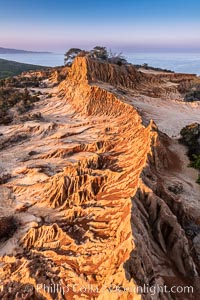
Sunrise over Broken Hill, overlooking La Jolla and the Pacific Ocean, Torrey Pines State Reserve.
Location: Torrey Pines State Reserve, San Diego, California
Image ID: 35850
Location: Torrey Pines State Reserve, San Diego, California
Image ID: 35850
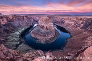
Spectacular Horseshoe Bend sunrise. The Colorado River makes a 180-degree turn at Horseshoe Bend. Here the river has eroded the Navajo sandstone for eons, digging a canyon 1100-feet deep.
Location: Horseshoe Bend, Page, Arizona
Image ID: 35941
Location: Horseshoe Bend, Page, Arizona
Image ID: 35941
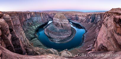
Predawn light on Horseshoe Bend. The Colorado River makes a 180-degree turn at Horseshoe Bend. Here the river has eroded the Navajo sandstone for eons, digging a canyon 1100-feet deep.
Location: Horseshoe Bend, Page, Arizona
Image ID: 36005
Panorama dimensions: 5468 x 11169
Location: Horseshoe Bend, Page, Arizona
Image ID: 36005
Panorama dimensions: 5468 x 11169
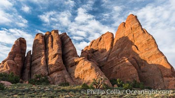
Sunrise light touches the Fins. Sandstone fins stand on edge. Vertical fractures separate standing plates of sandstone that are eroded into freestanding fins, that may one day further erode into arches.
Location: Arches National Park, Utah
Image ID: 29255
Location: Arches National Park, Utah
Image ID: 29255
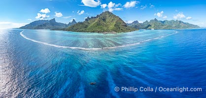
Barrier Reef around Moorea Island, French Polynesia. The outer reef slope is seen adjacent to deep blue oceanic water with white waves breaking against the reef edge. Next, a wide shallow reef flat occurs dotted with coral bommies. Inside of that, a shallow protected lagoon is formed against the island. Tall, rugged, eroded mountains are seen hinting at the age of the ancient volcano that originally formed the island and that is now sinking back down, leaving the encircling reef behind.
Location: Moorea, French Polynesia, France
Image ID: 40677
Panorama dimensions: 5104 x 10658
Location: Moorea, French Polynesia, France
Image ID: 40677
Panorama dimensions: 5104 x 10658
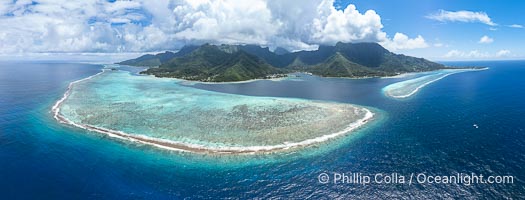
Barrier Reef around Moorea Island, French Polynesia. The outer reef slope is seen adjacent to deep blue oceanic water with white waves breaking against the reef edge. Next, a wide shallow reef flat occurs dotted with coral bommies. Inside of that, a shallow protected lagoon is formed against the island. Tall, rugged, eroded mountains are seen hinting at the age of the ancient volcano that originally formed the island and that is now sinking back down, leaving the encircling reef behind.
Location: Moorea, French Polynesia, France
Image ID: 40678
Panorama dimensions: 4911 x 12893
Location: Moorea, French Polynesia, France
Image ID: 40678
Panorama dimensions: 4911 x 12893
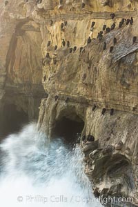
Sea cliffs and sea caves at sea level, made of sandstone and eroded by waves and tides.
Location: La Jolla, California
Image ID: 30166
Location: La Jolla, California
Image ID: 30166
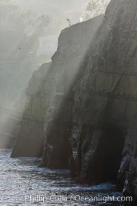
Sea cliffs and sea caves at sea level, made of sandstone and eroded by waves and tides.
Location: La Jolla, California
Image ID: 30173
Location: La Jolla, California
Image ID: 30173
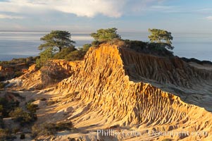
Broken Hill with the Pacific Ocean in the distance. Broken Hill is an ancient, compacted sand dune that was uplifted to its present location and is now eroding.
Location: Torrey Pines State Reserve, San Diego, California
Image ID: 14758
Location: Torrey Pines State Reserve, San Diego, California
Image ID: 14758
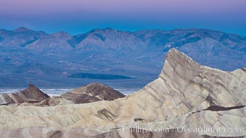
Zabriskie Point, sunrise. Manly Beacon rises in the center of an eroded, curiously banded area of sedimentary rock, with the Panamint Mountains visible in the distance.
Location: Zabriskie Point, Death Valley National Park, California
Image ID: 15585
Location: Zabriskie Point, Death Valley National Park, California
Image ID: 15585
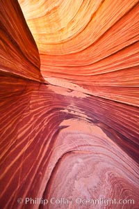
The Wave, an area of fantastic eroded sandstone featuring beautiful swirls, wild colors, countless striations, and bizarre shapes set amidst the dramatic surrounding North Coyote Buttes of Arizona and Utah. The sandstone formations of the North Coyote Buttes, including the Wave, date from the Jurassic period. Managed by the Bureau of Land Management, the Wave is located in the Paria Canyon-Vermilion Cliffs Wilderness and is accessible on foot by permit only.
Location: North Coyote Buttes, Paria Canyon-Vermilion Cliffs Wilderness, Arizona
Image ID: 20609
Location: North Coyote Buttes, Paria Canyon-Vermilion Cliffs Wilderness, Arizona
Image ID: 20609
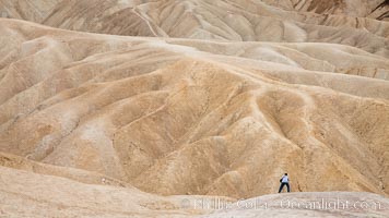
Eroded hillsides near Zabriskie Point and Gower Wash.
Location: Zabriskie Point, Death Valley National Park, California
Image ID: 25255
Location: Zabriskie Point, Death Valley National Park, California
Image ID: 25255
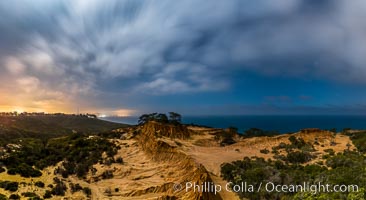
Torrey Pines State Reserve at Night, stars and clouds fill the night sky with the lights of La Jolla visible in the distance.
Location: Torrey Pines State Reserve, San Diego, California
Image ID: 28405
Panorama dimensions: 6607 x 12076
Location: Torrey Pines State Reserve, San Diego, California
Image ID: 28405
Panorama dimensions: 6607 x 12076
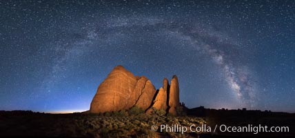
Milky Way over Sandstone Fins. Sandstone fins stand on edge. Vertical fractures separate standing plates of sandstone that are eroded into freestanding fins, that may one day further erode into arches.
Location: Arches National Park, Utah
Image ID: 29253
Panorama dimensions: 7791 x 15529
Location: Arches National Park, Utah
Image ID: 29253
Panorama dimensions: 7791 x 15529
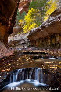
The Subway, a iconic eroded sandstone formation in Zion National Park.
Location: The Subway, Zion National Park, Utah
Image ID: 26094
Location: The Subway, Zion National Park, Utah
Image ID: 26094
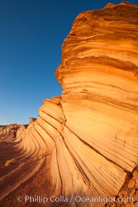
The Great Wall, Navajo Tribal Lands, Arizona. Sandstone "fins", eroded striations that depict how sandstone -- ancient compressed sand -- was laid down in layers over time. Now exposed, the layer erode at different rates, forming delicate "fins" that stretch for long distances.
Location: Navajo Tribal Lands, Page, Arizona
Image ID: 26644
Location: Navajo Tribal Lands, Page, Arizona
Image ID: 26644
