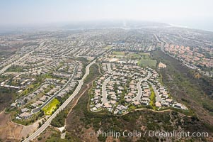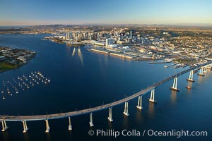
San Diego Coronado Bridge, known locally as the Coronado Bridge, links San Diego with Coronado, California. The bridge was completed in 1969 and was a toll bridge until 2002. It is 2.1 miles long and reaches a height of 200 feet above San Diego Bay. Coronado Island is to the left, and downtown San Diego is to the right in this view looking north.
Location: San Diego, California
Image ID: 22365
Location: San Diego, California
Image ID: 22365
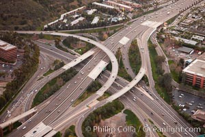
Freeway intersection, Interstate 8 and Highway 163, looking west.
Location: San Diego, California
Image ID: 22392
Location: San Diego, California
Image ID: 22392
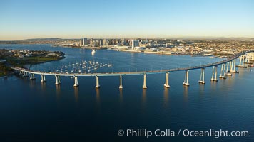
San Diego Coronado Bridge, known locally as the Coronado Bridge, links San Diego with Coronado, California. The bridge was completed in 1969 and was a toll bridge until 2002. It is 2.1 miles long and reaches a height of 200 feet above San Diego Bay. Coronado Island is to the left, and downtown San Diego is to the right in this view looking north.
Location: San Diego, California
Image ID: 22401
Location: San Diego, California
Image ID: 22401
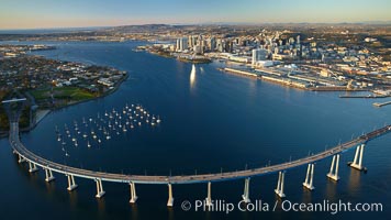
San Diego Coronado Bridge, known locally as the Coronado Bridge, links San Diego with Coronado, California. The bridge was completed in 1969 and was a toll bridge until 2002. It is 2.1 miles long and reaches a height of 200 feet above San Diego Bay. Coronado Island is to the left, and downtown San Diego is to the right in this view looking north.
Location: San Diego, California
Image ID: 22432
Location: San Diego, California
Image ID: 22432
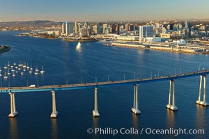
San Diego Coronado Bridge, known locally as the Coronado Bridge, links San Diego with Coronado, California. The bridge was completed in 1969 and was a toll bridge until 2002. It is 2.1 miles long and reaches a height of 200 feet above San Diego Bay. Coronado Island is to the left, and downtown San Diego is to the right in this view looking north.
Location: San Diego, California
Image ID: 22433
Location: San Diego, California
Image ID: 22433
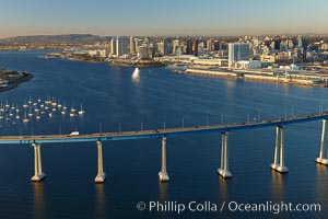
San Diego Coronado Bridge, known locally as the Coronado Bridge, links San Diego with Coronado, California. The bridge was completed in 1969 and was a toll bridge until 2002. It is 2.1 miles long and reaches a height of 200 feet above San Diego Bay. Coronado Island is to the left, and downtown San Diego is to the right in this view looking north.
Location: San Diego, California
Image ID: 22460
Location: San Diego, California
Image ID: 22460
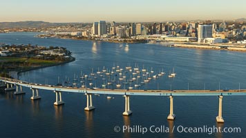
San Diego Coronado Bridge, known locally as the Coronado Bridge, links San Diego with Coronado, California. The bridge was completed in 1969 and was a toll bridge until 2002. It is 2.1 miles long and reaches a height of 200 feet above San Diego Bay. Coronado Island is to the left, and downtown San Diego is to the right in this view looking north.
Location: San Diego, California
Image ID: 22461
Location: San Diego, California
Image ID: 22461
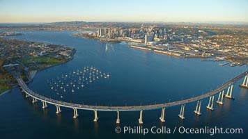
San Diego Coronado Bridge, known locally as the Coronado Bridge, links San Diego with Coronado, California. The bridge was completed in 1969 and was a toll bridge until 2002. It is 2.1 miles long and reaches a height of 200 feet above San Diego Bay. Coronado Island is to the left, and downtown San Diego is to the right in this view looking north.
Location: San Diego, California
Image ID: 22466
Location: San Diego, California
Image ID: 22466
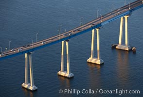
San Diego Coronado Bridge, known locally as the Coronado Bridge, links San Diego with Coronado, California. The bridge was completed in 1969 and was a toll bridge until 2002. It is 2.1 miles long and reaches a height of 200 feet above San Diego Bay.
Location: San Diego, California
Image ID: 22341
Location: San Diego, California
Image ID: 22341
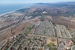
Camp Pendleton, viewed toward the north, including Pacific ocean and Interstate 5 freeway. Marine Corps Base Camp Pendleton.
Location: Marine Corps Base Camp Pendleton, California
Image ID: 25995
Location: Marine Corps Base Camp Pendleton, California
Image ID: 25995
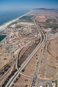
Camp Pendleton, viewed toward the north, including Pacific ocean and Interstate 5 freeway. Marine Corps Base Camp Pendleton.
Location: Marine Corps Base Camp Pendleton, California
Image ID: 25996
Location: Marine Corps Base Camp Pendleton, California
Image ID: 25996
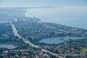
Aerial view of coastal Carlsbad and Oceanside, looking south. The I-5 freeway and Buena Vista Lagoon are seen in the center of the photo.
Image ID: 26045
Image ID: 26045
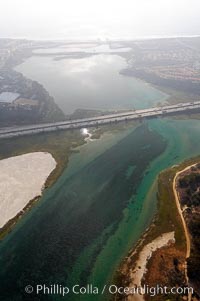
Batiquitos Lagoon aerial view, showing coastline and Interstate 5 freeway.
Location: Carlsbad, California
Image ID: 21339
Location: Carlsbad, California
Image ID: 21339
