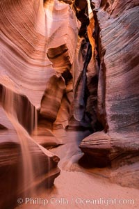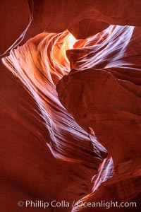
Upper Antelope Canyon, a deep, narrow and spectacular slot canyon lying on Navajo Tribal lands near Page, Arizona.
Location: Navajo Tribal Lands, Page, Arizona
Image ID: 35936
Location: Navajo Tribal Lands, Page, Arizona
Image ID: 35936
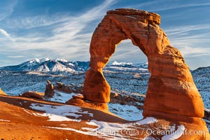
Delicate Arch, dusted with snow, at sunset, with the snow-covered La Sal mountains in the distance. Delicate Arch stands 45 feet high, with a span of 33 feet, atop of bowl of slickrock sandstone.
Location: Delicate Arch, Arches National Park, Utah
Image ID: 18104
Location: Delicate Arch, Arches National Park, Utah
Image ID: 18104
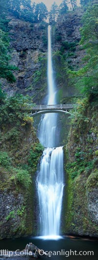
Multnomah Falls. Plummeting 620 feet from its origins on Larch Mountain, Multnomah Falls is the second highest year-round waterfall in the United States. Nearly two million visitors a year come to see this ancient waterfall making it Oregon's number one public destination.
Location: Multnomah Falls, Columbia River Gorge National Scenic Area, Oregon
Image ID: 19313
Panorama dimensions: 12453 x 4705
Location: Multnomah Falls, Columbia River Gorge National Scenic Area, Oregon
Image ID: 19313
Panorama dimensions: 12453 x 4705

Panorama of the Wave. The Wave is a sweeping, dramatic display of eroded sandstone, forged by eons of water and wind erosion, laying bare striations formed from compacted sand dunes over millenia. This panoramic picture is formed from thirteen individual photographs.
Location: North Coyote Buttes, Paria Canyon-Vermilion Cliffs Wilderness, Arizona
Image ID: 20700
Panorama dimensions: 4661 x 25458
Location: North Coyote Buttes, Paria Canyon-Vermilion Cliffs Wilderness, Arizona
Image ID: 20700
Panorama dimensions: 4661 x 25458
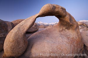
Mobius Arch at sunrise, with Mount Whitney (the tallest peak in the continental United States), Lone Pine Peak and snow-covered Sierra Nevada Range framed within the arch. Mobius Arch is a 17-foot-wide natural rock arch in the scenic Alabama Hills Recreational Area near Lone Pine, California.
Location: Alabama Hills Recreational Area, California
Image ID: 21729
Location: Alabama Hills Recreational Area, California
Image ID: 21729
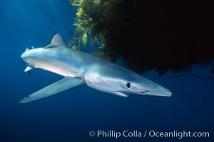
Blue shark and offshore drift kelp paddy, open ocean.
Species: Blue shark, Macrocystis pyrifera, Prionace glauca
Location: San Diego, California
Image ID: 01078
Species: Blue shark, Macrocystis pyrifera, Prionace glauca
Location: San Diego, California
Image ID: 01078

Blue shark and offshore drift kelp paddy, open ocean.
Species: Blue shark, Macrocystis pyrifera, Prionace glauca
Location: San Diego, California
Image ID: 01081
Species: Blue shark, Macrocystis pyrifera, Prionace glauca
Location: San Diego, California
Image ID: 01081
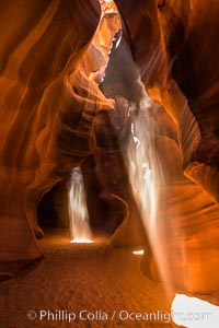
Light Beam in Upper Antelope Slot Canyon. Thin shafts of light briefly penetrate the convoluted narrows of Upper Antelope Slot Canyon, sending piercing beams through the sandstone maze to the sand floor below.
Location: Navajo Tribal Lands, Page, Arizona
Image ID: 28561
Location: Navajo Tribal Lands, Page, Arizona
Image ID: 28561
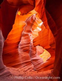
Lower Antelope Canyon, a deep, narrow and spectacular slot canyon lying on Navajo Tribal lands near Page, Arizona.
Location: Navajo Tribal Lands, Page, Arizona
Image ID: 26628
Location: Navajo Tribal Lands, Page, Arizona
Image ID: 26628
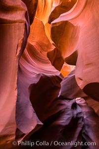
Lower Antelope Canyon, a deep, narrow and spectacular slot canyon lying on Navajo Tribal lands near Page, Arizona.
Location: Navajo Tribal Lands, Page, Arizona
Image ID: 28559
Location: Navajo Tribal Lands, Page, Arizona
Image ID: 28559
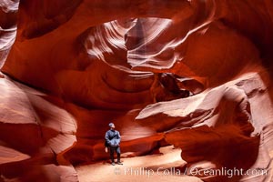
A hiker admiring the striated walls and dramatic light within Antelope Canyon, a deep narrow slot canyon formed by water and wind erosion.
Location: Navajo Tribal Lands, Page, Arizona
Image ID: 18009
Location: Navajo Tribal Lands, Page, Arizona
Image ID: 18009
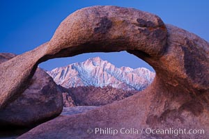
Mobius Arch at sunrise, framing snow dusted Lone Pine Peak and the Sierra Nevada Range in the background. Also known as Galen's Arch, Mobius Arch is found in the Alabama Hills Recreational Area near Lone Pine.
Location: Alabama Hills Recreational Area, California
Image ID: 27627
Location: Alabama Hills Recreational Area, California
Image ID: 27627
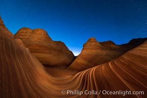
The Wave at Night, under a clear night sky full of stars. The Wave, an area of fantastic eroded sandstone featuring beautiful swirls, wild colors, countless striations, and bizarre shapes set amidst the dramatic surrounding North Coyote Buttes of Arizona and Utah. The sandstone formations of the North Coyote Buttes, including the Wave, date from the Jurassic period. Managed by the Bureau of Land Management, the Wave is located in the Paria Canyon-Vermilion Cliffs Wilderness and is accessible on foot by permit only.
Location: North Coyote Buttes, Paria Canyon-Vermilion Cliffs Wilderness, Arizona
Image ID: 28621
Location: North Coyote Buttes, Paria Canyon-Vermilion Cliffs Wilderness, Arizona
Image ID: 28621
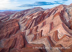
Aerial Photo of Raplee Ridge near Mexican Hat, Utah. Raplee Ridge is a spectacular series of multicolored triangular flatirons near the San Juan River. Often called "the Raplee Anticline" the geologic structure is in fact better described as a monocline, according to the Utah Geological Survey.
Location: Mexican Hat, Utah
Image ID: 39490
Location: Mexican Hat, Utah
Image ID: 39490
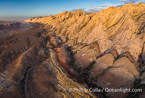
Aerial photo of the San Rafael Reef at dawn. A fold in the Earth's crust leads to this inclined section of the San Rafael Reef, at the eastern edge of the San Rafael Swell. Clearly seen are the characteristic triangular flatiron erosion patterns that typical this formation. The colors seen here arise primarily from Navajo and Wingate sandstone.
Location: Utah
Image ID: 39784
Location: Utah
Image ID: 39784
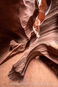
Rattlesnake Canyon, a beautiful slot canyon that is part of the larger Antelope Canyon system. Page, Arizona.
Location: Navajo Tribal Lands, Page, Arizona
Image ID: 36039
Location: Navajo Tribal Lands, Page, Arizona
Image ID: 36039
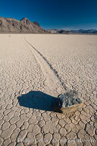
A sliding rock of the Racetrack Playa. The sliding rocks, or sailing stones, move across the mud flats of the Racetrack Playa, leaving trails behind in the mud. The explanation for their movement is not known with certainty, but many believe wind pushes the rocks over wet and perhaps icy mud in winter.
Location: Racetrack Playa, Death Valley National Park, California
Image ID: 25239
Location: Racetrack Playa, Death Valley National Park, California
Image ID: 25239
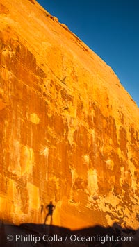
Rising sun creates the photographers shadow on a sandstone wall.
Location: Valley of Fire State Park, Nevada
Image ID: 26474
Location: Valley of Fire State Park, Nevada
Image ID: 26474
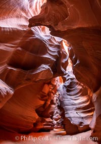
Upper Antelope Canyon, a deep, narrow and spectacular slot canyon lying on Navajo Tribal lands near Page, Arizona.
Location: Navajo Tribal Lands, Page, Arizona
Image ID: 35931
Location: Navajo Tribal Lands, Page, Arizona
Image ID: 35931
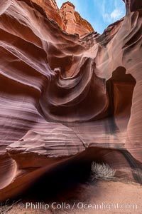
Owl Canyon, a beautiful slot canyon that is part of the larger Antelope Canyon system. Page, Arizona.
Location: Navajo Tribal Lands, Page, Arizona
Image ID: 36030
Location: Navajo Tribal Lands, Page, Arizona
Image ID: 36030
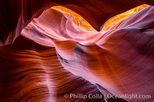
Lower Antelope Canyon, a deep, narrow and spectacular slot canyon lying on Navajo Tribal lands near Page, Arizona.
Location: Navajo Tribal Lands, Page, Arizona
Image ID: 37771
Location: Navajo Tribal Lands, Page, Arizona
Image ID: 37771
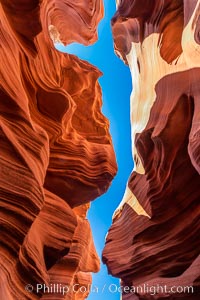
Lower Antelope Canyon, a deep, narrow and spectacular slot canyon lying on Navajo Tribal lands near Page, Arizona.
Location: Navajo Tribal Lands, Page, Arizona
Image ID: 37774
Location: Navajo Tribal Lands, Page, Arizona
Image ID: 37774
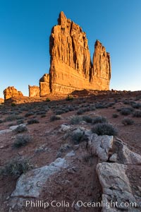
The Organ at sunrise, Courthouse Towers, Arches National Park.
Location: Courthouse Towers, Arches National Park, Utah
Image ID: 37859
Location: Courthouse Towers, Arches National Park, Utah
Image ID: 37859
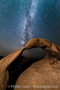
Milky Way galaxy over Mobius Arch at night, Alabama Hills.
Location: Alabama Hills Recreational Area, California
Image ID: 29409
Location: Alabama Hills Recreational Area, California
Image ID: 29409

The Windows at sunset, Arches National Park.
Location: North Window, Arches National Park, Utah
Image ID: 37868
Panorama dimensions: 5203 x 16982
Location: North Window, Arches National Park, Utah
Image ID: 37868
Panorama dimensions: 5203 x 16982
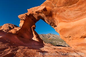
Arch Rock at sunrise, Valley of Fire State Park. Natural arch formed in sandstone. Sunrise with the full moon setting over mountains in the distance.
Location: Valley of Fire State Park, Nevada
Image ID: 26472
Location: Valley of Fire State Park, Nevada
Image ID: 26472
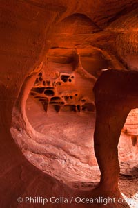
Fire Arch or Windstone Arch, also known as Fire Cave, is a tiny cave with a miniature arch and a group of natural pocket holes. Many people walk by this cave without realizing it is there!.
Location: Valley of Fire State Park, Nevada
Image ID: 26475
Location: Valley of Fire State Park, Nevada
Image ID: 26475
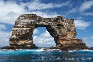
Darwin's Arch, a dramatic 50-foot tall natural lava arch, rises above the ocean a short distance offshore of Darwin Island. On June 10, 2021, Darwin's Arch broke and fell into the ocean, leaving behind two partial pillars.
Location: Darwin Island, Galapagos Islands, Ecuador
Image ID: 16621
Location: Darwin Island, Galapagos Islands, Ecuador
Image ID: 16621
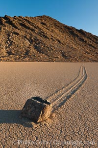
Sailing stone on the Racetrack Playa. The sliding rocks, or sailing stones, move across the mud flats of the Racetrack Playa, leaving trails behind in the mud. The explanation for their movement is not known with certainty, but many believe wind pushes the rocks over wet and perhaps icy mud in winter.
Location: Racetrack Playa, Death Valley National Park, California
Image ID: 27691
Location: Racetrack Playa, Death Valley National Park, California
Image ID: 27691
