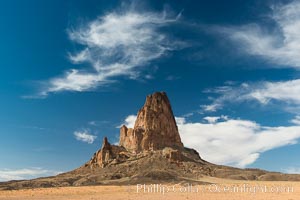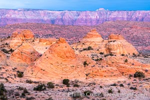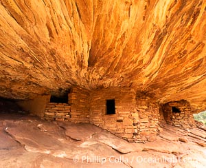
House on Fire Ruin in Mule Canyon, Utah. Part of the Bears Ears National Monument, House on Fire Ruin is an ancestral Puebloan ruin that appears to burst into flames when reflected sunlight hits the ceiling above the ruin.
Location: Bears Ears National Monument, Utah
Image ID: 39373
Location: Bears Ears National Monument, Utah
Image ID: 39373
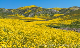
Wildflowers bloom across Carrizo Plains National Monument, during the 2017 Superbloom.
Location: Carrizo Plain National Monument, California
Image ID: 33236
Location: Carrizo Plain National Monument, California
Image ID: 33236
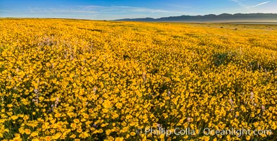
A Panorama of Wildflowers blooms across Carrizo Plains National Monument, during the 2017 Superbloom.
Location: Carrizo Plain National Monument, California
Image ID: 33254
Panorama dimensions: 5665 x 11153
Location: Carrizo Plain National Monument, California
Image ID: 33254
Panorama dimensions: 5665 x 11153
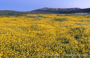
Wildflowers bloom across Carrizo Plains National Monument, during the 2017 Superbloom.
Location: Carrizo Plain National Monument, California
Image ID: 33226
Location: Carrizo Plain National Monument, California
Image ID: 33226
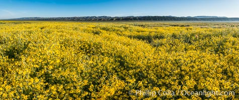
A Panorama of Wildflowers blooms across Carrizo Plains National Monument, during the 2017 Superbloom.
Location: Carrizo Plain National Monument, California
Image ID: 33230
Panorama dimensions: 4570 x 10851
Location: Carrizo Plain National Monument, California
Image ID: 33230
Panorama dimensions: 4570 x 10851
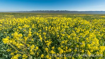
Mustard and other Wildflowers bloom across Carrizo Plains National Monument, during the 2017 Superbloom.
Location: Carrizo Plain National Monument, California
Image ID: 33231
Location: Carrizo Plain National Monument, California
Image ID: 33231
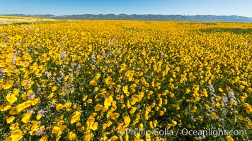
Wildflowers bloom across Carrizo Plains National Monument, during the 2017 Superbloom.
Location: Carrizo Plain National Monument, California
Image ID: 33232
Location: Carrizo Plain National Monument, California
Image ID: 33232
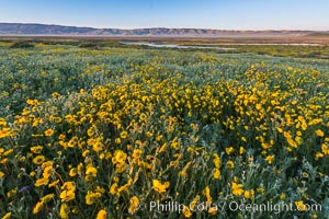
Wildflowers bloom across Carrizo Plains National Monument, during the 2017 Superbloom.
Location: Carrizo Plain National Monument, California
Image ID: 33253
Location: Carrizo Plain National Monument, California
Image ID: 33253

A Panorama of Wildflowers blooms across Carrizo Plains National Monument, during the 2017 Superbloom.
Location: Carrizo Plain National Monument, California
Image ID: 33228
Panorama dimensions: 3798 x 15587
Location: Carrizo Plain National Monument, California
Image ID: 33228
Panorama dimensions: 3798 x 15587
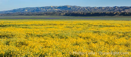
A Panorama of Wildflowers blooms across Carrizo Plains National Monument, during the 2017 Superbloom.
Location: Carrizo Plain National Monument, California
Image ID: 33229
Panorama dimensions: 3533 x 8004
Location: Carrizo Plain National Monument, California
Image ID: 33229
Panorama dimensions: 3533 x 8004
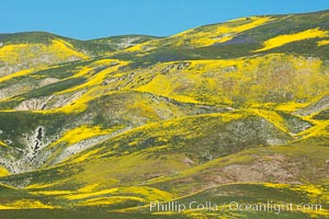
Wildflowers bloom across Carrizo Plains National Monument, during the 2017 Superbloom.
Location: Carrizo Plain National Monument, California
Image ID: 33234
Location: Carrizo Plain National Monument, California
Image ID: 33234
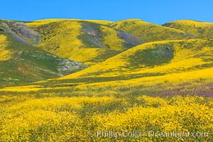
Wildflowers bloom across Carrizo Plains National Monument, during the 2017 Superbloom.
Location: Carrizo Plain National Monument, California
Image ID: 33235
Location: Carrizo Plain National Monument, California
Image ID: 33235
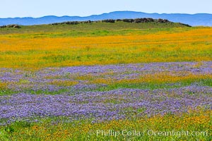
Wildflowers bloom across Carrizo Plains National Monument, during the 2017 Superbloom.
Location: Carrizo Plain National Monument, California
Image ID: 33238
Location: Carrizo Plain National Monument, California
Image ID: 33238

A Panorama of Wildflowers blooms across Carrizo Plains National Monument, during the 2017 Superbloom.
Location: Carrizo Plain National Monument, California
Image ID: 33239
Panorama dimensions: 3737 x 18001
Location: Carrizo Plain National Monument, California
Image ID: 33239
Panorama dimensions: 3737 x 18001
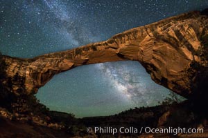
Owachomo Bridge and Milky Way. Owachomo Bridge, a natural stone bridge standing 106' high and spanning 130' wide,stretches across a canyon with the Milky Way crossing the night sky.
Location: Owachomo Bridge, Natural Bridges National Monument, Utah
Image ID: 28545
Location: Owachomo Bridge, Natural Bridges National Monument, Utah
Image ID: 28545
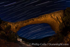
Owachomo Bridge and Star Trails, at night. Owachomo Bridge, a natural stone bridge standing 106' high and spanning 130' wide,stretches across a canyon with the Milky Way crossing the night sky.
Location: Owachomo Bridge, Natural Bridges National Monument, Utah
Image ID: 28550
Location: Owachomo Bridge, Natural Bridges National Monument, Utah
Image ID: 28550
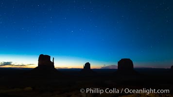
Monument Valley panorama, sunrise, dawn, stars in the sky.
Location: Monument Valley, Arizona
Image ID: 28598
Location: Monument Valley, Arizona
Image ID: 28598
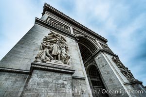
Arc de Triomphe. The Arc de Triomphe (Arc de Triomphe de l'Etoile) is one of the most famous monuments in Paris. It stands in the centre of the Place Charles de Gaulle (originally named Place de l'Etoile), at the western end of the Champs-Elysees. The Arc de Triomphe (in English: "Triumphal Arch") honors those who fought and died for France in the French Revolutionary and the Napoleonic Wars, with the names of all French victories and generals inscribed on its inner and outer surfaces. Beneath its vault lies the Tomb of the Unknown Soldier from World War I. The monument was designed by Jean Chalgrin in 1806, and its iconographic program pitted heroically nude French youths against bearded Germanic warriors in chain mail. It set the tone for public monuments, with triumphant patriotic messages. The monument stands 50 metres (164 ft) in height, 45 m (148 ft) wide and 22 m (72 ft) deep.
Location: Arc de Triomphe, Paris, France
Image ID: 28083
Location: Arc de Triomphe, Paris, France
Image ID: 28083
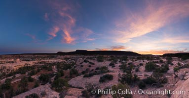
Panorama of Natural Bridges National Monument at sunset. Owachomo Bridge is visible at far left, while Natural Bridges National Monument lies under a beautiful sunset.
Location: Natural Bridges National Monument, Utah
Image ID: 28551
Panorama dimensions: 5257 x 10075
Location: Natural Bridges National Monument, Utah
Image ID: 28551
Panorama dimensions: 5257 x 10075
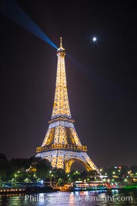
River Seine, Full Moon and Eiffel Tower at night, Paris. La Tour Eiffel. The Eiffel Tower is an iron lattice tower located on the Champ de Mars in Paris, named after the engineer Gustave Eiffel, who designed the tower in 1889 as the entrance arch to the 1889 World's Fair. The Eiffel tower is the tallest structure in Paris and the most-visited paid monument in the world.
Location: Tour Eiffel, Paris, France
Image ID: 28203
Location: Tour Eiffel, Paris, France
Image ID: 28203
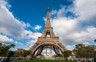
La Tour Eiffel, The Eiffel Tower is an iron lattice tower located on the Champ de Mars in Paris, named after the engineer Gustave Eiffel, who designed the tower in 1889 as the entrance arch to the 1889 World's Fair. The Eiffel tower is the tallest structure in Paris and the most-visited paid monument in the world.
Location: Tour Eiffel, Paris, France
Image ID: 28113
Location: Tour Eiffel, Paris, France
Image ID: 28113
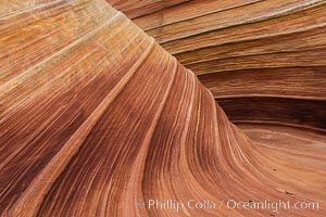
The Wave in the North Coyote Buttes, an area of fantastic eroded sandstone featuring beautiful swirls, wild colors, countless striations, and bizarre shapes set amidst the dramatic surrounding North Coyote Buttes of Arizona and Utah. The sandstone formations of the North Coyote Buttes, including the Wave, date from the Jurassic period. Managed by the Bureau of Land Management, the Wave is located in the Paria Canyon-Vermilion Cliffs Wilderness and is accessible on foot by permit only.
Location: North Coyote Buttes, Paria Canyon-Vermilion Cliffs Wilderness, Arizona
Image ID: 28602
Location: North Coyote Buttes, Paria Canyon-Vermilion Cliffs Wilderness, Arizona
Image ID: 28602
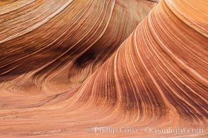
The Wave in the North Coyote Buttes, an area of fantastic eroded sandstone featuring beautiful swirls, wild colors, countless striations, and bizarre shapes set amidst the dramatic surrounding North Coyote Buttes of Arizona and Utah. The sandstone formations of the North Coyote Buttes, including the Wave, date from the Jurassic period. Managed by the Bureau of Land Management, the Wave is located in the Paria Canyon-Vermilion Cliffs Wilderness and is accessible on foot by permit only.
Location: North Coyote Buttes, Paria Canyon-Vermilion Cliffs Wilderness, Arizona
Image ID: 28603
Location: North Coyote Buttes, Paria Canyon-Vermilion Cliffs Wilderness, Arizona
Image ID: 28603
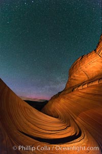
The Wave at Night, under a clear night sky full of stars. The Wave, an area of fantastic eroded sandstone featuring beautiful swirls, wild colors, countless striations, and bizarre shapes set amidst the dramatic surrounding North Coyote Buttes of Arizona and Utah. The sandstone formations of the North Coyote Buttes, including the Wave, date from the Jurassic period. Managed by the Bureau of Land Management, the Wave is located in the Paria Canyon-Vermilion Cliffs Wilderness and is accessible on foot by permit only.
Location: North Coyote Buttes, Paria Canyon-Vermilion Cliffs Wilderness, Arizona
Image ID: 28623
Location: North Coyote Buttes, Paria Canyon-Vermilion Cliffs Wilderness, Arizona
Image ID: 28623
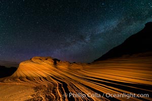
The Second Wave at Night. The Second Wave, a spectacular sandstone formation in the North Coyote Buttes, lies under a sky full of stars.
Location: North Coyote Buttes, Paria Canyon-Vermilion Cliffs Wilderness, Arizona
Image ID: 28628
Location: North Coyote Buttes, Paria Canyon-Vermilion Cliffs Wilderness, Arizona
Image ID: 28628
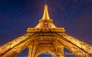
La Tour Eiffel. The Eiffel Tower is an iron lattice tower located on the Champ de Mars in Paris, named after the engineer Gustave Eiffel, who designed the tower in 1889 as the entrance arch to the 1889 World's Fair. The Eiffel tower is the tallest structure in Paris and the most-visited paid monument in the world.
Location: Tour Eiffel, Paris, France
Image ID: 35608
Location: Tour Eiffel, Paris, France
Image ID: 35608
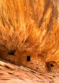
House on Fire Ruin in Mule Canyon, Utah. Part of the Bears Ears National Monument, House on Fire Ruin is an ancestral Puebloan ruin that appears to burst into flames when reflected sunlight hits the ceiling above the ruin.
Location: Bears Ears National Monument, Utah
Image ID: 39372
Location: Bears Ears National Monument, Utah
Image ID: 39372
