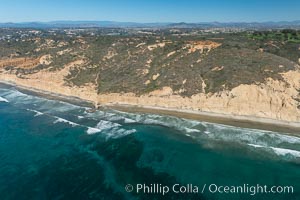
Torrey Pines seacliffs, rising up to 300 feet above the ocean, stretch from Del Mar to La Jolla. On the mesa atop the bluffs are found Torrey pine trees, one of the rare species of pines in the world.
Location: Torrey Pines State Reserve, San Diego, California
Image ID: 30673
Location: Torrey Pines State Reserve, San Diego, California
Image ID: 30673
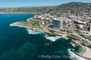
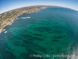
Aerial Photo of La Jolla coastline, showing underwater reefs and Mount Soledad.
Location: La Jolla, California
Image ID: 30676
Location: La Jolla, California
Image ID: 30676
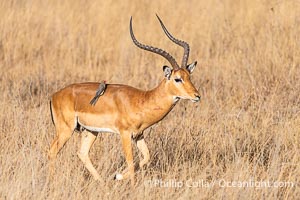
Red-Billed Oxpecker on Impala, Nairobi National Park.
Species: Impala, Red-Billed Oxpecker, Aepyceros melampus, Buphagus erythrorhynchus
Location: Nairobi National Park, Kenya
Image ID: 39543
Panorama dimensions: 5597 x 8396
Species: Impala, Red-Billed Oxpecker, Aepyceros melampus, Buphagus erythrorhynchus
Location: Nairobi National Park, Kenya
Image ID: 39543
Panorama dimensions: 5597 x 8396
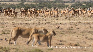
Herd of Impala are Alert to Passing Lions, Mara North Conservancy, Kenya.
Species: African lion, Panthera leo
Location: Mara North Conservancy, Kenya
Image ID: 39671
Panorama dimensions: 4817 x 8564
Species: African lion, Panthera leo
Location: Mara North Conservancy, Kenya
Image ID: 39671
Panorama dimensions: 4817 x 8564
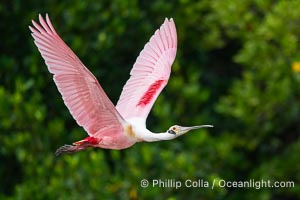
Roseate Spoonbill in Flight, Platalea ajaja, Alafia Banks, Florida.
Species: Roseate Spoonbill, Platalea ajaja
Location: Alafia Banks Critical Wildlife Area, Tampa, Florida
Image ID: 40536
Species: Roseate Spoonbill, Platalea ajaja
Location: Alafia Banks Critical Wildlife Area, Tampa, Florida
Image ID: 40536
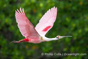
Roseate Spoonbill in Flight, Platalea ajaja, Alafia Banks, Florida.
Species: Roseate Spoonbill, Platalea ajaja
Location: Alafia Banks Critical Wildlife Area, Tampa, Florida
Image ID: 40539
Species: Roseate Spoonbill, Platalea ajaja
Location: Alafia Banks Critical Wildlife Area, Tampa, Florida
Image ID: 40539
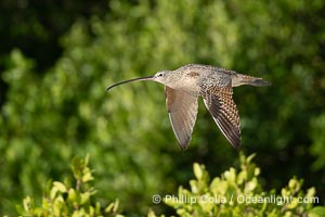
American Curlew, Rusty Curlew in flight, Numenius americanus, Alafia Banks, Florida.
Species: American Curlew, Numenius americanus
Location: Alafia Banks Critical Wildlife Area, Tampa, Florida
Image ID: 40541
Species: American Curlew, Numenius americanus
Location: Alafia Banks Critical Wildlife Area, Tampa, Florida
Image ID: 40541
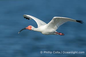
White Ibis in flight, Eudocimus albus, Alafia Banks, Florida.
Species: White Ibis, Eudocimus albus
Location: Alafia Banks Critical Wildlife Area, Tampa, Florida
Image ID: 40545
Species: White Ibis, Eudocimus albus
Location: Alafia Banks Critical Wildlife Area, Tampa, Florida
Image ID: 40545
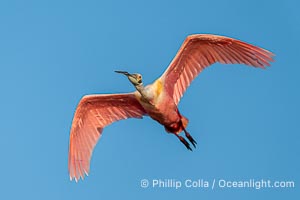
Roseate Spoonbill in Flight, Platalea ajaja, Alafia Banks, Florida.
Species: Roseate Spoonbill, Platalea ajaja
Location: Alafia Banks Critical Wildlife Area, Tampa, Florida
Image ID: 40550
Species: Roseate Spoonbill, Platalea ajaja
Location: Alafia Banks Critical Wildlife Area, Tampa, Florida
Image ID: 40550
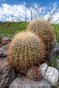
Barrel cactus, Glorietta Canyon. Heavy winter rains led to a historic springtime bloom in 2005, carpeting the entire desert in vegetation and color for months.
Species: Red barrel cactus, Ferocactus cylindraceus
Location: Anza-Borrego Desert State Park, Borrego Springs, California
Image ID: 10906
Species: Red barrel cactus, Ferocactus cylindraceus
Location: Anza-Borrego Desert State Park, Borrego Springs, California
Image ID: 10906
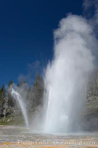
Grand Geyser erupts (right) with a simultaneous eruption from Vent Geyser (left). Grand Geyser is a fountain-type geyser reaching 200 feet in height and lasting up to 12 minutes. Grand Geyser is considered the tallest predictable geyser in the world, erupting about every 12 hours. It is often accompanied by burst or eruptions from Vent Geyser and Turban Geyser just to its left. Upper Geyser Basin.
Location: Upper Geyser Basin, Yellowstone National Park, Wyoming
Image ID: 13457
Location: Upper Geyser Basin, Yellowstone National Park, Wyoming
Image ID: 13457
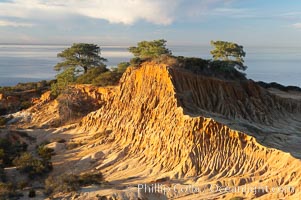
Broken Hill with the Pacific Ocean in the distance. Broken Hill is an ancient, compacted sand dune that was uplifted to its present location and is now eroding.
Location: Torrey Pines State Reserve, San Diego, California
Image ID: 14758
Location: Torrey Pines State Reserve, San Diego, California
Image ID: 14758
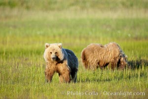
Juvenile brown bears near Johnson River. Before reaching adulthood and competition for mating, it is common for juvenile brown bears to seek one another for companionship after leaving the security of their mothers.
Species: Brown bear, Ursus arctos
Location: Johnson River, Lake Clark National Park, Alaska
Image ID: 19171
Species: Brown bear, Ursus arctos
Location: Johnson River, Lake Clark National Park, Alaska
Image ID: 19171
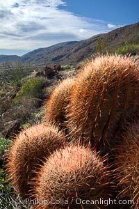
Red barrel cactus, Glorietta Canyon, Anza-Borrego Desert State Park.
Species: Red barrel cactus, Ferocactus cylindraceus
Location: Anza-Borrego Desert State Park, Borrego Springs, California
Image ID: 24302
Species: Red barrel cactus, Ferocactus cylindraceus
Location: Anza-Borrego Desert State Park, Borrego Springs, California
Image ID: 24302
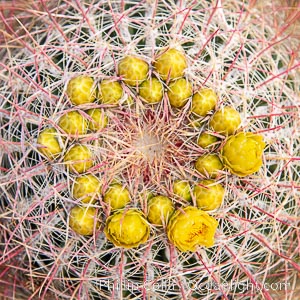
Red barrel flower bloom, cactus detail, spines and flower on top of the cactus, Glorietta Canyon, Anza-Borrego Desert State Park.
Species: Red barrel cactus, Ferocactus cylindraceus
Location: Anza-Borrego Desert State Park, Borrego Springs, California
Image ID: 24303
Species: Red barrel cactus, Ferocactus cylindraceus
Location: Anza-Borrego Desert State Park, Borrego Springs, California
Image ID: 24303
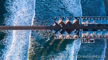
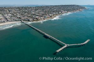
Aerial Photo of Crystal Pier, 872 feet long and built in 1925, extends out into the Pacific Ocean from the town of Pacific Beach.
Location: San Diego, California
Image ID: 38229
Location: San Diego, California
Image ID: 38229
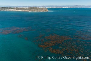
Aerial Photo of Kelp Forests at Cabrillo State Marine Reserve, Point Loma, San Diego.
Location: San Diego, California
Image ID: 30642
Location: San Diego, California
Image ID: 30642
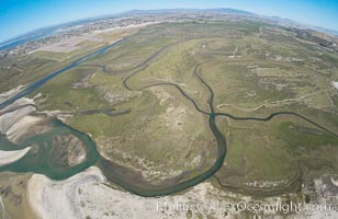
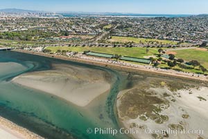
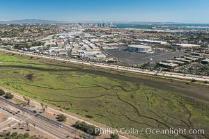
Aerial Photo of Tijuana River Mouth SMCA. Tijuana River Mouth State Marine Conservation Area borders Imperial Beach and the Mexican Border.
Location: Imperial Beach, California
Image ID: 30659
Location: Imperial Beach, California
Image ID: 30659
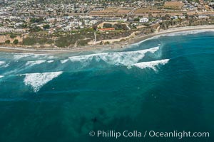
Aerial Photo of Swamis Marine Conservation Area. Swamis State Marine Conservation Area (SMCA) is a marine protected area that extends offshore of Encinitas in San Diego County.
Location: Encinitas, California
Image ID: 30574
Location: Encinitas, California
Image ID: 30574
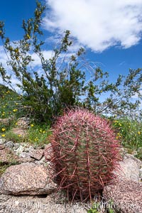
Barrel cactus, Glorietta Canyon. Heavy winter rains led to a historic springtime bloom in 2005, carpeting the entire desert in vegetation and color for months.
Species: Red barrel cactus, Ferocactus cylindraceus
Location: Anza-Borrego Desert State Park, Borrego Springs, California
Image ID: 10905
Species: Red barrel cactus, Ferocactus cylindraceus
Location: Anza-Borrego Desert State Park, Borrego Springs, California
Image ID: 10905
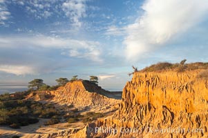
Broken Hill is an ancient, compacted sand dune that was uplifted to its present location and is now eroding.
Location: Torrey Pines State Reserve, San Diego, California
Image ID: 18930
Location: Torrey Pines State Reserve, San Diego, California
Image ID: 18930
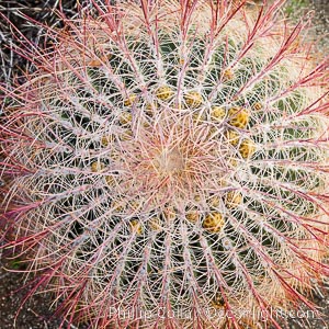
Red barrel cactus detail, spines on top of the cactus, Glorietta Canyon, Anza-Borrego Desert State Park.
Species: Red barrel cactus, Ferocactus cylindraceus
Location: Anza-Borrego Desert State Park, Borrego Springs, California
Image ID: 24308
Species: Red barrel cactus, Ferocactus cylindraceus
Location: Anza-Borrego Desert State Park, Borrego Springs, California
Image ID: 24308
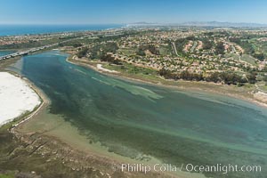
Aerial photo of Batiquitos Lagoon, Carlsbad. The Batiquitos Lagoon is a coastal wetland in southern Carlsbad, California. Part of the lagoon is designated as the Batiquitos Lagoon State Marine Conservation Area, run by the California Department of Fish and Game as a nature reserve.
Location: Carlsbad, Callifornia
Image ID: 30561
Location: Carlsbad, Callifornia
Image ID: 30561
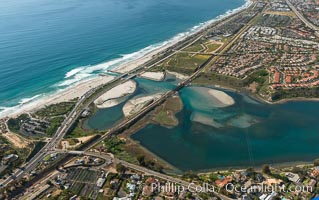
Aerial photo of Batiquitos Lagoon, Carlsbad. The Batiquitos Lagoon is a coastal wetland in southern Carlsbad, California. Part of the lagoon is designated as the Batiquitos Lagoon State Marine Conservation Area, run by the California Department of Fish and Game as a nature reserve.
Location: Carlsbad, Callifornia
Image ID: 30572
Location: Carlsbad, Callifornia
Image ID: 30572
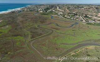
Aerial Photo of San Elijo Lagoon. San Elijo Lagoon Ecological Reserve is one of the largest remaining coastal wetlands in San Diego County, California, on the border of Encinitas, Solana Beach and Rancho Santa Fe.
Location: Encinitas, California
Image ID: 30584
Location: Encinitas, California
Image ID: 30584
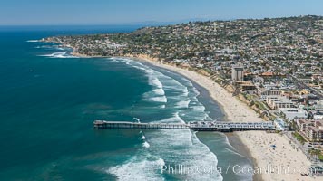
Aerial Photo of Crystal Pier, 872 feet long and built in 1925, extends out into the Pacific Ocean from the town of Pacific Beach. Mission Bay and downtown San Diego are seen in the distance.
Location: San Diego, California
Image ID: 30683
Location: San Diego, California
Image ID: 30683
