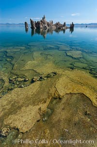
Tufa towers rise from Mono Lake. Tufa towers are formed when underwater springs rich in calcium mix with lakewater rich in carbonates, forming calcium carbonate (limestone) structures below the surface of the lake. The towers were eventually revealed when the water level in the lake was lowered starting in 1941. South tufa grove, Navy Beach.
Location: Mono Lake, California
Image ID: 09929
Location: Mono Lake, California
Image ID: 09929
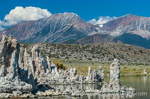
Tufa towers rise from Mono Lake with the Eastern Sierra visible in the distance. Tufa towers are formed when underwater springs rich in calcium mix with lakewater rich in carbonates, forming calcium carbonate (limestone) structures below the surface of the lake. The towers were eventually revealed when the water level in the lake was lowered starting in 1941. South tufa grove, Navy Beach.
Location: Mono Lake, California
Image ID: 09932
Location: Mono Lake, California
Image ID: 09932
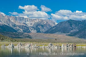
Tufa towers rise from Mono Lake with the Eastern Sierra visible in the distance. Tufa towers are formed when underwater springs rich in calcium mix with lakewater rich in carbonates, forming calcium carbonate (limestone) structures below the surface of the lake. The towers were eventually revealed when the water level in the lake was lowered starting in 1941. South tufa grove, Navy Beach.
Location: Mono Lake, California
Image ID: 09937
Location: Mono Lake, California
Image ID: 09937
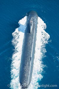
Nuclear submarine at the surface of the ocean, aerial photo.
Location: San Diego, California
Image ID: 29068
Location: San Diego, California
Image ID: 29068
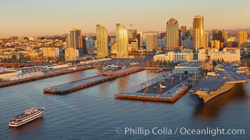
Downtown San Diego bayfront, Marina District, with the USS Midway Navy aircraft carrier (right), cruise ship terminal (left) and high rise office buildings towering over North Harbor Drive along San Diego Bay.
Location: San Diego, California
Image ID: 22308
Location: San Diego, California
Image ID: 22308
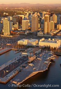
Downtown San Diego and USS Midway. The USS Midway was a US Navy aircraft carrier, launched in 1945 and active through the Vietnam War and Operation Desert Storm, as of 2008 a museum along the downtown waterfront in San Diego.
Location: San Diego, California
Image ID: 22348
Location: San Diego, California
Image ID: 22348
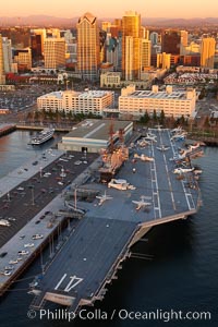
Downtown San Diego and USS Midway. The USS Midway was a US Navy aircraft carrier, launched in 1945 and active through the Vietnam War and Operation Desert Storm, as of 2008 a museum along the downtown waterfront in San Diego.
Location: San Diego, California
Image ID: 22355
Location: San Diego, California
Image ID: 22355
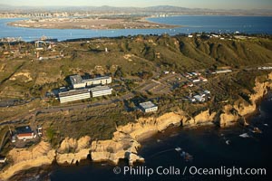
Point Loma peninsula, with scalloped sandstone cliffs edging the Pacific Ocean. San Diego Bay, Coronado Island and the high rises of downtown San Diego are seen beyond. Navy facilities, including SPAWAR (Space and Naval Warfare) building 600 in left center, are scattered along this section of Point Loma.
Location: San Diego, California
Image ID: 22363
Location: San Diego, California
Image ID: 22363
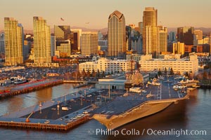
Downtown San Diego and USS Midway. The USS Midway was a US Navy aircraft carrier, launched in 1945 and active through the Vietnam War and Operation Desert Storm, as of 2008 a museum along the downtown waterfront in San Diego.
Location: San Diego, California
Image ID: 22389
Location: San Diego, California
Image ID: 22389
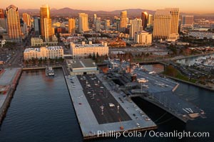
San Diego downtown waterfront, with USS Midway aircraft carrier and Navy museum (right), sunset.
Location: San Diego, California
Image ID: 22391
Location: San Diego, California
Image ID: 22391
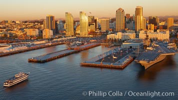
Downtown San Diego bayfront, Marina District, with the USS Midway Navy aircraft carrier (right), cruise ship terminal (left) and high rise office buildings towering over North Harbor Drive along San Diego Bay.
Location: San Diego, California
Image ID: 22403
Location: San Diego, California
Image ID: 22403
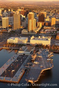
Downtown San Diego and USS Midway. The USS Midway was a US Navy aircraft carrier, launched in 1945 and active through the Vietnam War and Operation Desert Storm, as of 2008 a museum along the downtown waterfront in San Diego.
Location: San Diego, California
Image ID: 22429
Location: San Diego, California
Image ID: 22429
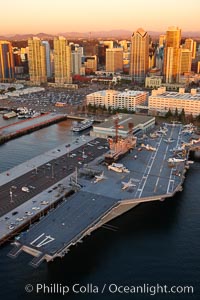
Downtown San Diego and USS Midway. The USS Midway was a US Navy aircraft carrier, launched in 1945 and active through the Vietnam War and Operation Desert Storm, as of 2008 a museum along the downtown waterfront in San Diego.
Location: San Diego, California
Image ID: 22430
Location: San Diego, California
Image ID: 22430
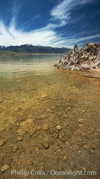
Tufa towers rise from Mono Lake. Tufa towers are formed when underwater springs rich in calcium mix with lakewater rich in carbonates, forming calcium carbonate (limestone) structures below the surface of the lake. The towers were eventually revealed when the water level in the lake was lowered starting in 1941. South tufa grove, Navy Beach.
Location: Mono Lake, California
Image ID: 23173
Location: Mono Lake, California
Image ID: 23173
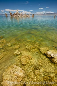
Tufa towers rise from Mono Lake. Tufa towers are formed when underwater springs rich in calcium mix with lakewater rich in carbonates, forming calcium carbonate (limestone) structures below the surface of the lake. The towers were eventually revealed when the water level in the lake was lowered starting in 1941. South tufa grove, Navy Beach.
Location: Mono Lake, California
Image ID: 23174
Location: Mono Lake, California
Image ID: 23174
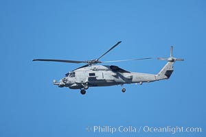
United States Navy helicopter in flight.
Image ID: 20344
Image ID: 20344
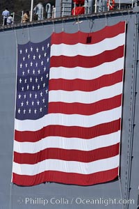
American flag, huge, hanging on the side of a Navy ship.
Location: San Diego, California
Image ID: 21484
Location: San Diego, California
Image ID: 21484
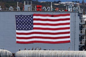
American flag, huge, hanging on the side of a Navy ship.
Location: San Diego, California
Image ID: 21485
Location: San Diego, California
Image ID: 21485
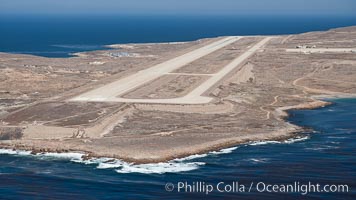
Navy airstrip landing strip on San Clemente Island.
Location: San Clemente Island, California
Image ID: 26017
Location: San Clemente Island, California
Image ID: 26017
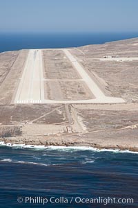
Navy airstrip landing strip on San Clemente Island.
Location: San Clemente Island, California
Image ID: 26018
Location: San Clemente Island, California
Image ID: 26018
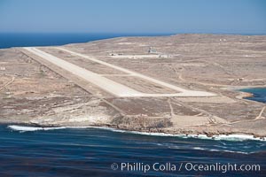
Navy airstrip landing strip on San Clemente Island.
Location: San Clemente Island, California
Image ID: 26019
Location: San Clemente Island, California
Image ID: 26019
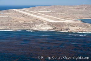
Navy airstrip landing strip on San Clemente Island.
Location: San Clemente Island, California
Image ID: 26020
Location: San Clemente Island, California
Image ID: 26020
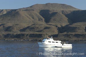
Dive boat Conception at anchor in Pyramid Cove. San Clemente Island is used as a US Navy bombing target. Its offshore kelp forests offer spectacular diving.
Location: San Clemente Island, California
Image ID: 07498
Location: San Clemente Island, California
Image ID: 07498
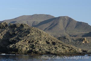
Rugged, volcanic coastline of San Clemente Island at Pyramid Cove, near the islands southeastern tip. San Clemente Island is used as a US Navy bombing target.
Location: San Clemente Island, California
Image ID: 07499
Location: San Clemente Island, California
Image ID: 07499
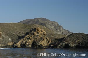
Rugged, volcanic coastline of San Clemente Island at Pyramid Cove, near the islands southeastern tip. San Clemente Island is used as a US Navy bombing target.
Location: San Clemente Island, California
Image ID: 07502
Location: San Clemente Island, California
Image ID: 07502
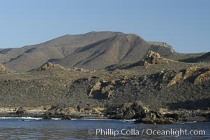
Rugged, volcanic coastline of San Clemente Island at Pyramid Cove, near the islands southeastern tip. San Clemente Island is used as a US Navy bombing target.
Location: San Clemente Island, California
Image ID: 07503
Location: San Clemente Island, California
Image ID: 07503
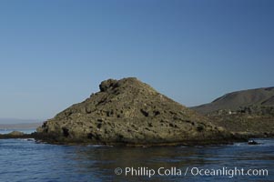
China Hat Point, a prominent feature along the rugged coastline of San Clemente Island at Pyramid Cove, near the islands southeastern tip. San Clemente Island is used as a US Navy bombing target.
Location: San Clemente Island, California
Image ID: 07504
Location: San Clemente Island, California
Image ID: 07504
