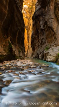
The Virgin River Narrows, where the Virgin River has carved deep, narrow canyons through the Zion National Park sandstone, creating one of the finest hikes in the world.
Location: Virgin River Narrows, Zion National Park, Utah
Image ID: 28583
Location: Virgin River Narrows, Zion National Park, Utah
Image ID: 28583
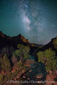
Milky Way over the Watchman, Zion National Park. The Milky Way galaxy rises in the night sky above the the Watchman.
Location: Zion National Park, Utah
Image ID: 28590
Location: Zion National Park, Utah
Image ID: 28590
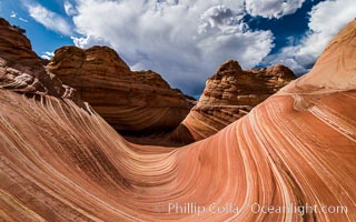
The Wave in the North Coyote Buttes, an area of fantastic eroded sandstone featuring beautiful swirls, wild colors, countless striations, and bizarre shapes set amidst the dramatic surrounding North Coyote Buttes of Arizona and Utah. The sandstone formations of the North Coyote Buttes, including the Wave, date from the Jurassic period. Managed by the Bureau of Land Management, the Wave is located in the Paria Canyon-Vermilion Cliffs Wilderness and is accessible on foot by permit only.
Location: North Coyote Buttes, Paria Canyon-Vermilion Cliffs Wilderness, Arizona
Image ID: 28601
Location: North Coyote Buttes, Paria Canyon-Vermilion Cliffs Wilderness, Arizona
Image ID: 28601
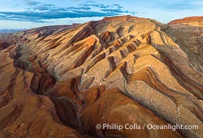
Aerial Photo of Raplee Ridge near Mexican Hat, Utah. Raplee Ridge is a spectacular series of multicolored triangular flatirons near the San Juan River. Often called "the Raplee Anticline" the geologic structure is in fact better described as a monocline, according to the Utah Geological Survey.
Location: Mexican Hat, Utah
Image ID: 39489
Location: Mexican Hat, Utah
Image ID: 39489
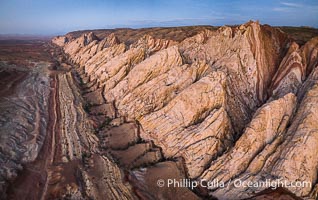
Aerial photo of the San Rafael Reef at dawn. A fold in the Earth's crust leads to this inclined section of the San Rafael Reef, at the eastern edge of the San Rafael Swell. Clearly seen are the characteristic triangular flatiron erosion patterns that typical this formation. The colors seen here arise primarily from Navajo and Wingate sandstone.
Location: Utah
Image ID: 39787
Location: Utah
Image ID: 39787
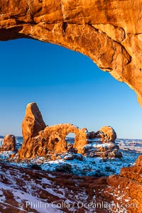
Sunrise light on Turret Arch viewed through North Window, winter.
Location: North Window, Arches National Park, Utah
Image ID: 18119
Location: North Window, Arches National Park, Utah
Image ID: 18119
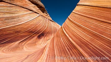
The Wave, an area of fantastic eroded sandstone featuring beautiful swirls, wild colors, countless striations, and bizarre shapes set amidst the dramatic surrounding North Coyote Buttes of Arizona and Utah. The sandstone formations of the North Coyote Buttes, including the Wave, date from the Jurassic period. Managed by the Bureau of Land Management, the Wave is located in the Paria Canyon-Vermilion Cliffs Wilderness and is accessible on foot by permit only.
Location: North Coyote Buttes, Paria Canyon-Vermilion Cliffs Wilderness, Arizona
Image ID: 20608
Location: North Coyote Buttes, Paria Canyon-Vermilion Cliffs Wilderness, Arizona
Image ID: 20608
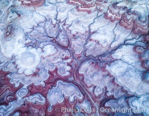
Pre-Dawn over the Tree of Eons, Utah. The Tree of Eons is a spectacular geologic sight near the San Rafael Swell. Erosion has cut a "tree" through red, blue, purple and white layers of the Chinle formation. The Tree of Eons is a superb example of dendritic erosion and to really appreciate the complex fractal-like details it must be observed from above. Photographed here in the soft, predawn light, it takes on magenta, red and purple hues just before the sun reaches it. Aerial panoramic photograph.
Location: Utah
Image ID: 38027
Location: Utah
Image ID: 38027
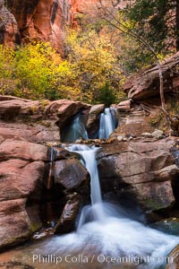
Fall Colors in Kanarra Creek Canyon, Utah.
Location: Kanarra Creek, Kanarraville, Utah
Image ID: 32639
Location: Kanarra Creek, Kanarraville, Utah
Image ID: 32639
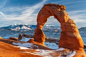
Delicate Arch, dusted with snow, at sunset, with the snow-covered La Sal mountains in the distance. Delicate Arch stands 45 feet high, with a span of 33 feet, atop of bowl of slickrock sandstone.
Location: Delicate Arch, Arches National Park, Utah
Image ID: 18104
Location: Delicate Arch, Arches National Park, Utah
Image ID: 18104
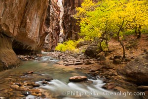
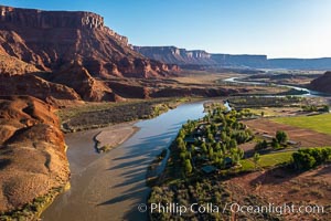
The Virgin River flows by autumn cottonwood trees, part of the Virgin River Narrows. This is a fantastic hike in fall with the comfortable temperatures, beautiful fall colors and light crowds.
Location: Virgin River Narrows, Zion National Park, Utah
Image ID: 26098
Location: Virgin River Narrows, Zion National Park, Utah
Image ID: 26098
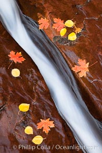
Water rushes through a narrow crack, in the red sandstone of Zion National Park, with fallen autumn leaves.
Location: Zion National Park, Utah
Image ID: 26100
Location: Zion National Park, Utah
Image ID: 26100
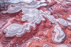
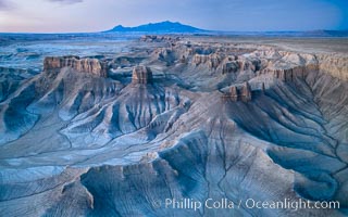
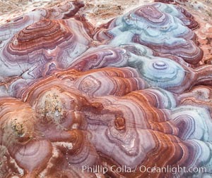
Fantastic colorful sedimentary patterns of Bentonite layers, seen as striations exposed in the Utah Badlands. The Bentonite Hills are composed of the Brushy Basin shale member of the Morrison Formation formed during Jurassic times when mud, silt, fine sand, and volcanic ash were deposited in swamps and lakes into layers, now revealed through erosion. Aerial photograph.
Location: Utah
Image ID: 37947
Location: Utah
Image ID: 37947
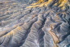
Erosion patterns in the Utah Badlands, aerial abstract photo.
Location: Hanksville, Utah
Image ID: 37948
Location: Hanksville, Utah
Image ID: 37948
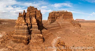
Molly's Castle, aerial view, Goblin Valley State Park. Curtis Formation whiteish caprock is on top, with reddish Entrada Sandstone below, both of Jurassic era. Molly's castle lies in the San Rafael desert near Goblin Valley, and drains into the Colorado River watershed. Aerial panoramic photograph.
Location: Goblin Valley State Park, Utah
Image ID: 37950
Location: Goblin Valley State Park, Utah
Image ID: 37950
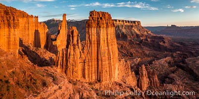
Fisher Towers at sunset, near Moab, Utah. Fisher Towers are a series of towers made of Cutler sandstone capped with Moenkopi sandstone and caked with a stucco of red mud located near Moab, Utah.
Location: Fisher Towers, Moab, Utah
Image ID: 38225
Location: Fisher Towers, Moab, Utah
Image ID: 38225
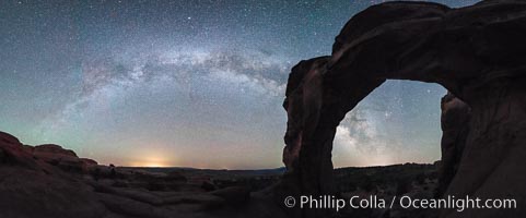
Milky Way and Stars over Broken Arch, Arches National Park, Utah.
Location: Broken Arch, Arches National Park, Utah
Image ID: 29237
Panorama dimensions: 5882 x 15117
Location: Broken Arch, Arches National Park, Utah
Image ID: 29237
Panorama dimensions: 5882 x 15117
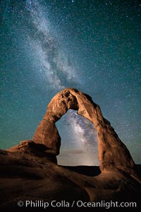
Milky Way arches over Delicate Arch, as stars cover the night sky.
Location: Arches National Park, Utah
Image ID: 27850
Location: Arches National Park, Utah
Image ID: 27850
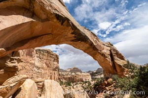
Hickman Bridge, Capitol Reef National Park.
Location: Capitol Reef National Park, Utah
Image ID: 37011
Location: Capitol Reef National Park, Utah
Image ID: 37011
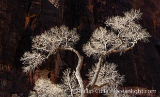
Fremont Cottonwood Tree in winter sillhouette against red Zion Canyon walls.
Location: Zion National Park, Utah
Image ID: 37795
Location: Zion National Park, Utah
Image ID: 37795
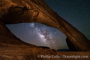
Milky Way and Stars through Wilson Arch. Wilson Arch rises high above route 191 in eastern Utah, with a span of 91 feet and a height of 46 feet.
Location: Wilson Arch, Moab, Utah
Image ID: 29275
Location: Wilson Arch, Moab, Utah
Image ID: 29275
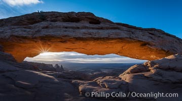
Mesa Arch Sunrise, Canyonlands National Park, Utah.
Location: Mesa Arch, Canyonlands National Park, Utah
Image ID: 29304
Location: Mesa Arch, Canyonlands National Park, Utah
Image ID: 29304
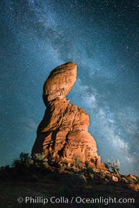
Balanced Rock and Milky Way stars at night.
Location: Balanced Rock, Arches National Park, Utah
Image ID: 27835
Location: Balanced Rock, Arches National Park, Utah
Image ID: 27835
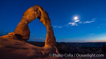
Delicate Arch and the Moon at Sunset. The moon and clouds, with stars showing faintly in the sky, as sunset fades into night.
Location: Arches National Park, Utah
Image ID: 27859
Location: Arches National Park, Utah
Image ID: 27859
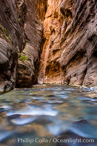
The Virgin River Narrows, where the Virgin River has carved deep, narrow canyons through the Zion National Park sandstone, creating one of the finest hikes in the world.
Location: Virgin River Narrows, Zion National Park, Utah
Image ID: 28578
Location: Virgin River Narrows, Zion National Park, Utah
Image ID: 28578
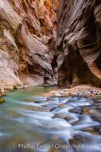
The Virgin River Narrows, where the Virgin River has carved deep, narrow canyons through the Zion National Park sandstone, creating one of the finest hikes in the world.
Location: Virgin River Narrows, Zion National Park, Utah
Image ID: 28579
Location: Virgin River Narrows, Zion National Park, Utah
Image ID: 28579
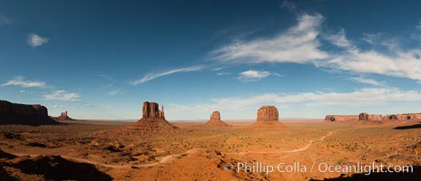
Monument Valley panorama.
Location: Monument Valley, Arizona
Image ID: 28597
Panorama dimensions: 6429 x 14925
Location: Monument Valley, Arizona
Image ID: 28597
Panorama dimensions: 6429 x 14925
