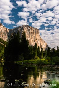
El Capitan and clouds lit by full moon, stars, evening.
Location: El Capitan, Yosemite National Park, California
Image ID: 28695
Location: El Capitan, Yosemite National Park, California
Image ID: 28695
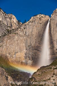
Upper Yosemite Falls and lunar rainbow, moonbow. A lunar rainbow (moonbow) can be seen to the left of Yosemite Falls, where the moon illuminates the spray of the falls.
Location: Yosemite Falls, Yosemite National Park, California
Image ID: 27751
Location: Yosemite Falls, Yosemite National Park, California
Image ID: 27751
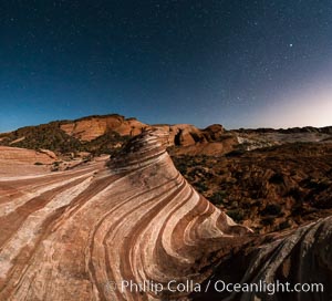
The Fire Wave by Moonlight, stars and the night sky, Valley of Fire State Park.
Location: Valley of Fire State Park, Nevada
Image ID: 28442
Panorama dimensions: 6250 x 6887
Location: Valley of Fire State Park, Nevada
Image ID: 28442
Panorama dimensions: 6250 x 6887
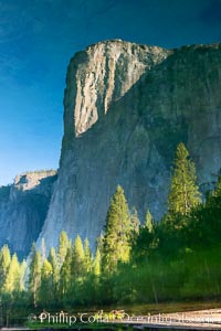
El Capitan reflection mirrored in the Merced River, Yosemite National Park.
Location: Yosemite National Park, California
Image ID: 36351
Location: Yosemite National Park, California
Image ID: 36351
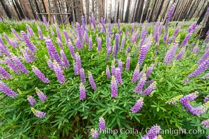
Lupine bloom in burned area after a forest fire, near Wawona, Yosemite National Park.
Location: Yosemite National Park, California
Image ID: 36366
Location: Yosemite National Park, California
Image ID: 36366
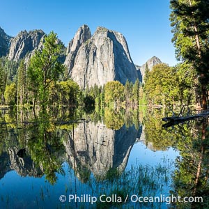
Cathedral Rocks reflected in a meadow flooded by the Merced River, historical snowmelt following record snowfall floods Yosemite Valley in May 2023.
Location: Yosemite National Park, California
Image ID: 39375
Location: Yosemite National Park, California
Image ID: 39375
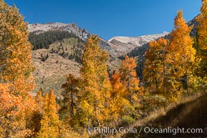
Aspens show fall colors in Mineral King Valley, part of Sequoia National Park in the southern Sierra Nevada, California.
Location: Mineral King, Sequoia National Park, California
Image ID: 32298
Location: Mineral King, Sequoia National Park, California
Image ID: 32298
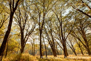
Black oaks in autumn in Yosemite National Park, fall colors, Quercus kelloggii.
Species: Black oak, Quercus kelloggii
Location: Yosemite National Park, California
Image ID: 36462
Species: Black oak, Quercus kelloggii
Location: Yosemite National Park, California
Image ID: 36462
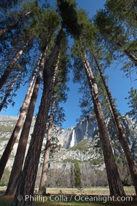
Yosemite Falls and tall pine trees, viewed from Cook's Meadow.
Location: Yosemite Falls, Yosemite National Park, California
Image ID: 22746
Location: Yosemite Falls, Yosemite National Park, California
Image ID: 22746
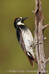
Acorn woodpecker, female.
Species: Acorn woodpecker, Melanerpes formicivorus
Location: Madera Canyon Recreation Area, Green Valley, Arizona
Image ID: 22906
Species: Acorn woodpecker, Melanerpes formicivorus
Location: Madera Canyon Recreation Area, Green Valley, Arizona
Image ID: 22906
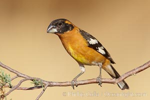
Black-headed grosbeak, male.
Species: Black-headed grosbeak, Pheucticus melanocephalus
Location: Madera Canyon Recreation Area, Green Valley, Arizona
Image ID: 22911
Species: Black-headed grosbeak, Pheucticus melanocephalus
Location: Madera Canyon Recreation Area, Green Valley, Arizona
Image ID: 22911
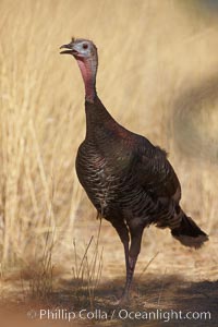
Wild turkey.
Species: Wild turkey, Meleagris gallopavo
Location: Madera Canyon Recreation Area, Green Valley, Arizona
Image ID: 22935
Species: Wild turkey, Meleagris gallopavo
Location: Madera Canyon Recreation Area, Green Valley, Arizona
Image ID: 22935
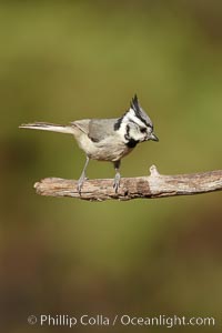
Bridled titmouse.
Species: Bridled titmouse, Baeolophus wollweberi
Location: Madera Canyon Recreation Area, Green Valley, Arizona
Image ID: 22941
Species: Bridled titmouse, Baeolophus wollweberi
Location: Madera Canyon Recreation Area, Green Valley, Arizona
Image ID: 22941
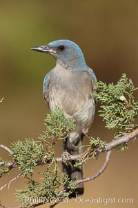
Mexican jay.
Species: Mexican jay, Aphelocoma ultramarina
Location: Madera Canyon Recreation Area, Green Valley, Arizona
Image ID: 22959
Species: Mexican jay, Aphelocoma ultramarina
Location: Madera Canyon Recreation Area, Green Valley, Arizona
Image ID: 22959
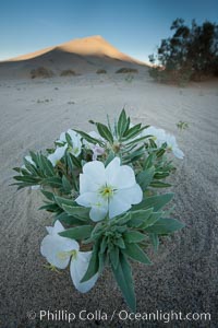
Eureka Valley Dune Evening Primrose. A federally endangered plant, Oenothera californica eurekensis is a perennial herb that produces white flowers from April to June. These flowers turn red as they age. The Eureka Dunes evening-primrose is found only in the southern portion of Eureka Valley Sand Dunes system in Indigo County, California.
Species: Eureka valley dune evening primrose, Oenothera californica eurekensis, Oenothera deltoides
Location: Eureka Dunes, Death Valley National Park, California
Image ID: 25237
Species: Eureka valley dune evening primrose, Oenothera californica eurekensis, Oenothera deltoides
Location: Eureka Dunes, Death Valley National Park, California
Image ID: 25237
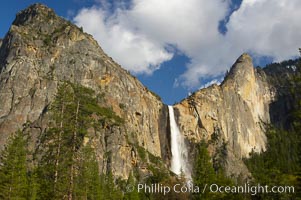
Bridalveil Falls at sunset, with clouds and blue sky in the background. Bridalveil Falls in Yosemite drops 620 feet (188 m) from a hanging valley to the floor of Yosemite Valley.
Location: Bridalveil Falls, Yosemite National Park, California
Image ID: 12646
Location: Bridalveil Falls, Yosemite National Park, California
Image ID: 12646
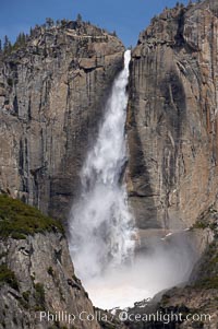
Upper Yosemite Falls near peak flow in spring. Yosemite Falls, at 2425 feet tall (730m) is the tallest waterfall in North America and fifth tallest in the world. Yosemite Valley.
Location: Yosemite Falls, Yosemite National Park, California
Image ID: 16066
Location: Yosemite Falls, Yosemite National Park, California
Image ID: 16066
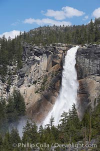
Nevada Falls marks where the Merced River plummets almost 600 through a joint in the Little Yosemite Valley, shooting out from a sheer granite cliff and then down to a boulder pile far below.
Location: Nevada Falls, Yosemite National Park, California
Image ID: 16114
Location: Nevada Falls, Yosemite National Park, California
Image ID: 16114
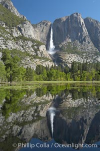
Yosemite Falls is reflected in a springtime pool in flooded Cooks Meadow, Yosemite Valley.
Location: Yosemite Falls, Yosemite National Park, California
Image ID: 16135
Location: Yosemite Falls, Yosemite National Park, California
Image ID: 16135
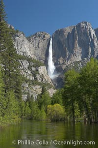
Yosemite Falls rises above the Merced River, viewed from the Swinging Bridge. The 2425 falls is the tallest in North America. Yosemite Valley.
Location: Yosemite Falls, Yosemite National Park, California
Image ID: 16143
Location: Yosemite Falls, Yosemite National Park, California
Image ID: 16143
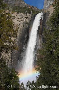
Bridalveil Falls with a rainbow forming in its spray, dropping 620 into Yosemite Valley, displaying peak water flow in spring months from deep snowpack and warm weather melt. Yosemite Valley.
Location: Bridalveil Falls, Yosemite National Park, California
Image ID: 16160
Location: Bridalveil Falls, Yosemite National Park, California
Image ID: 16160

Monument Valley panorama, a composite of twelve individual photographs.
Location: Monument Valley, Arizona
Image ID: 20901
Panorama dimensions: 3303 x 30000
Location: Monument Valley, Arizona
Image ID: 20901
Panorama dimensions: 3303 x 30000
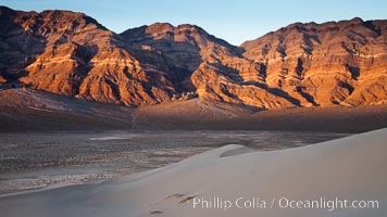
Sunset on the Last Chance Mountain Range, seen from Eureka Valley Sand Dunes.
Location: Eureka Dunes, Death Valley National Park, California
Image ID: 25238
Location: Eureka Dunes, Death Valley National Park, California
Image ID: 25238
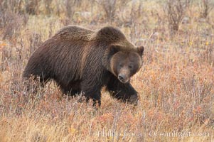
Grizzly bear in Yellowstone National Park in autumn, fall, walking through brown grasses.
Species: Grizzly bear, Ursus arctos horribilis
Location: Lamar Valley, Yellowstone National Park, Wyoming
Image ID: 19614
Species: Grizzly bear, Ursus arctos horribilis
Location: Lamar Valley, Yellowstone National Park, Wyoming
Image ID: 19614
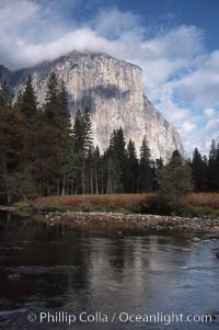
El Capitan and Merced River, Yosemite Valley.
Location: El Capitan, Yosemite National Park, California
Image ID: 05413
Location: El Capitan, Yosemite National Park, California
Image ID: 05413
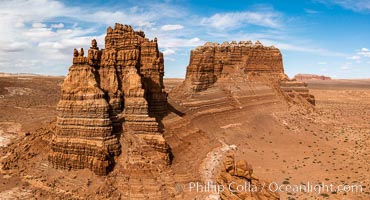
Molly's Castle, aerial view, Goblin Valley State Park. Curtis Formation whiteish caprock is on top, with reddish Entrada Sandstone below, both of Jurassic era. Molly's castle lies in the San Rafael desert near Goblin Valley, and drains into the Colorado River watershed. Aerial panoramic photograph.
Location: Goblin Valley State Park, Utah
Image ID: 37950
Location: Goblin Valley State Park, Utah
Image ID: 37950
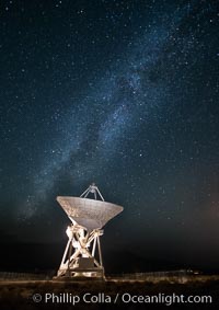
Radio telescope antenna, part of the Very Long Baseline Array (VLBA). The Very Long Baseline Array (VLBA) is a system of ten radio telescopes which are operated remotely from their Array Operations Center located in Socorro, New Mexico, as a part of the National Radio Astronomy Observatory (NRAO). These ten radio antennas work together as an array that forms the longest system in the world that uses very long baseline interferometry.
Location: Big Pine, California
Image ID: 28787
Location: Big Pine, California
Image ID: 28787
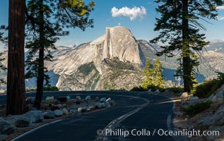
Half Dome and the Glacier Point Road, Yosemite National Park.
Location: Yosemite National Park, California
Image ID: 36380
Location: Yosemite National Park, California
Image ID: 36380
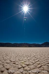
Racetrack Playa, an ancient lake now dried and covered with dessicated mud.
Location: Racetrack Playa, Death Valley National Park, California
Image ID: 25263
Location: Racetrack Playa, Death Valley National Park, California
Image ID: 25263
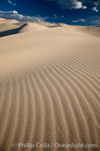
Eureka Dunes. The Eureka Valley Sand Dunes are California's tallest sand dunes, and one of the tallest in the United States. Rising 680' above the floor of the Eureka Valley, the Eureka sand dunes are home to several endangered species, as well as "singing sand" that makes strange sounds when it shifts. Located in the remote northern portion of Death Valley National Park, the Eureka Dunes see very few visitors.
Location: Eureka Dunes, Death Valley National Park, California
Image ID: 25250
Location: Eureka Dunes, Death Valley National Park, California
Image ID: 25250