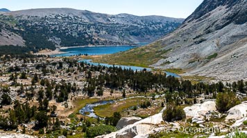
Greenstone Lake and Saddlebag Lake in the 20 Lakes Basin, Hoover Wilderness.
Location: 20 Lakes Basin, Hoover Wilderness, California
Image ID: 36428
Location: 20 Lakes Basin, Hoover Wilderness, California
Image ID: 36428
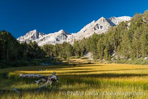
Meadow and Sierra Nevada peak Bear Creek Spire at sunrise, Little Lakes Valley, John Muir Wilderness, Inyo National Forest.
Location: Little Lakes Valley, Inyo National Forest, California
Image ID: 31176
Location: Little Lakes Valley, Inyo National Forest, California
Image ID: 31176

Panorama of the Minarets at sunrise, near Mammoth Mountain. The Minarets are a series of seventeen jagged peaks in the Ritter Range, west of Mammoth Mountain in the Ansel Adams Wilderness. These basalt peaks were carved by glaciers on both sides of the range. The highest of the Minarets stands 12,281 feet above sea level.
Location: Mammoth Lakes, California
Image ID: 19126
Panorama dimensions: 3249 x 29914
Location: Mammoth Lakes, California
Image ID: 19126
Panorama dimensions: 3249 x 29914
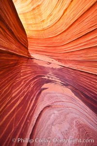
The Wave, an area of fantastic eroded sandstone featuring beautiful swirls, wild colors, countless striations, and bizarre shapes set amidst the dramatic surrounding North Coyote Buttes of Arizona and Utah. The sandstone formations of the North Coyote Buttes, including the Wave, date from the Jurassic period. Managed by the Bureau of Land Management, the Wave is located in the Paria Canyon-Vermilion Cliffs Wilderness and is accessible on foot by permit only.
Location: North Coyote Buttes, Paria Canyon-Vermilion Cliffs Wilderness, Arizona
Image ID: 20609
Location: North Coyote Buttes, Paria Canyon-Vermilion Cliffs Wilderness, Arizona
Image ID: 20609
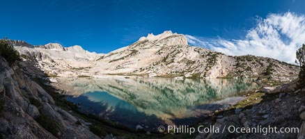
North Peak (12242'), Conness Lake and green glacial meltwater, Hoover Wilderness.
Location: Conness Lakes Basin, Hoover Wilderness, California
Image ID: 31059
Panorama dimensions: 6071 x 13284
Location: Conness Lakes Basin, Hoover Wilderness, California
Image ID: 31059
Panorama dimensions: 6071 x 13284
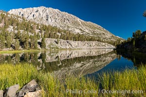
Panorama of Box Lake, morning, Little Lakes Valley, John Muir Wilderness, Inyo National Forest.
Location: Little Lakes Valley, Inyo National Forest, California
Image ID: 31177
Location: Little Lakes Valley, Inyo National Forest, California
Image ID: 31177
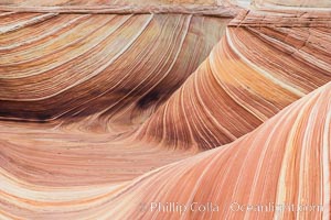
The Wave in the North Coyote Buttes, an area of fantastic eroded sandstone featuring beautiful swirls, wild colors, countless striations, and bizarre shapes set amidst the dramatic surrounding North Coyote Buttes of Arizona and Utah. The sandstone formations of the North Coyote Buttes, including the Wave, date from the Jurassic period. Managed by the Bureau of Land Management, the Wave is located in the Paria Canyon-Vermilion Cliffs Wilderness and is accessible on foot by permit only.
Location: North Coyote Buttes, Paria Canyon-Vermilion Cliffs Wilderness, Arizona
Image ID: 28609
Location: North Coyote Buttes, Paria Canyon-Vermilion Cliffs Wilderness, Arizona
Image ID: 28609
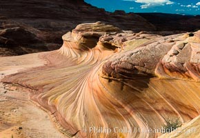
The Second Wave at sunset. The Second Wave, a curiously-shaped sandstone swirl, takes on rich warm tones and dramatic shadowed textures at sunset. Set in the North Coyote Buttes of Arizona and Utah, the Second Wave is characterized by striations revealing layers of sedimentary deposits, a visible historical record depicting eons of submarine geology.
Location: North Coyote Buttes, Paria Canyon-Vermilion Cliffs Wilderness, Arizona
Image ID: 28615
Location: North Coyote Buttes, Paria Canyon-Vermilion Cliffs Wilderness, Arizona
Image ID: 28615
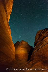
The Wave at Night, under a clear night sky full of stars. The Wave, an area of fantastic eroded sandstone featuring beautiful swirls, wild colors, countless striations, and bizarre shapes set amidst the dramatic surrounding North Coyote Buttes of Arizona and Utah. The sandstone formations of the North Coyote Buttes, including the Wave, date from the Jurassic period. Managed by the Bureau of Land Management, the Wave is located in the Paria Canyon-Vermilion Cliffs Wilderness and is accessible on foot by permit only.
Location: North Coyote Buttes, Paria Canyon-Vermilion Cliffs Wilderness, Arizona
Image ID: 28624
Location: North Coyote Buttes, Paria Canyon-Vermilion Cliffs Wilderness, Arizona
Image ID: 28624
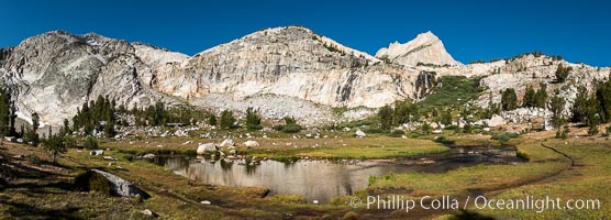
Lee Vining Creek below Conness Lakes, Twenty Lakes Basin near Conness Lakes.
Location: 20 Lakes Basin, Hoover Wilderness, California
Image ID: 36423
Panorama dimensions: 4990 x 13869
Location: 20 Lakes Basin, Hoover Wilderness, California
Image ID: 36423
Panorama dimensions: 4990 x 13869
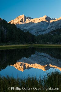
Bear Creek Spire over Marsh Lake at Sunrise, Little Lakes Valley, John Muir Wilderness, Inyo National Forest.
Location: Little Lakes Valley, Inyo National Forest, California
Image ID: 31167
Location: Little Lakes Valley, Inyo National Forest, California
Image ID: 31167
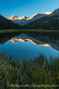
Bear Creek Spire over Marsh Lake at Sunrise, Little Lakes Valley, John Muir Wilderness, Inyo National Forest.
Location: Little Lakes Valley, Inyo National Forest, California
Image ID: 31168
Location: Little Lakes Valley, Inyo National Forest, California
Image ID: 31168
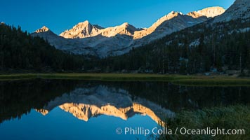
Bear Creek Spire over Marsh Lake at Sunrise, Little Lakes Valley, John Muir Wilderness, Inyo National Forest.
Location: Little Lakes Valley, Inyo National Forest, California
Image ID: 31169
Location: Little Lakes Valley, Inyo National Forest, California
Image ID: 31169
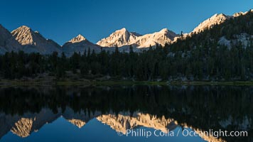
Bear Creek Spire over Heart Lake at Sunrise, Little Lakes Valley, John Muir Wilderness, Inyo National Forest.
Location: Little Lakes Valley, Inyo National Forest, California
Image ID: 31170
Location: Little Lakes Valley, Inyo National Forest, California
Image ID: 31170
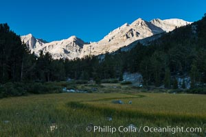
Meadow and Sierra Nevada peak Bear Creek Spire at sunrise, Little Lakes Valley, John Muir Wilderness, Inyo National Forest.
Location: Little Lakes Valley, Inyo National Forest, California
Image ID: 31171
Location: Little Lakes Valley, Inyo National Forest, California
Image ID: 31171
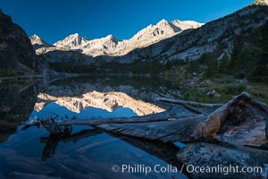
Bear Creek Spire over Long Lake at Sunrise, Little Lakes Valley, John Muir Wilderness, Inyo National Forest.
Location: Little Lakes Valley, Inyo National Forest, California
Image ID: 31172
Location: Little Lakes Valley, Inyo National Forest, California
Image ID: 31172
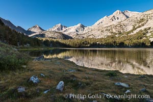
Panorama of Bear Creek Spire over Long Lake at Sunrise, Little Lakes Valley, John Muir Wilderness, Inyo National Forest.
Location: Little Lakes Valley, Inyo National Forest, California
Image ID: 31174
Location: Little Lakes Valley, Inyo National Forest, California
Image ID: 31174

Panorama of Long Lake at Sunrise, Little Lakes Valley, John Muir Wilderness, Inyo National Forest.
Location: Little Lakes Valley, Inyo National Forest, California
Image ID: 31175
Panorama dimensions: 6804 x 22088
Location: Little Lakes Valley, Inyo National Forest, California
Image ID: 31175
Panorama dimensions: 6804 x 22088

Panorama of Box Lake, morning, Little Lakes Valley, John Muir Wilderness, Inyo National Forest.
Location: Little Lakes Valley, Inyo National Forest, California
Image ID: 31178
Panorama dimensions: 4029 x 14311
Location: Little Lakes Valley, Inyo National Forest, California
Image ID: 31178
Panorama dimensions: 4029 x 14311

Panorama of Box Lake, morning, Little Lakes Valley, John Muir Wilderness, Inyo National Forest.
Location: Little Lakes Valley, Inyo National Forest, California
Image ID: 31179
Panorama dimensions: 5764 x 20753
Location: Little Lakes Valley, Inyo National Forest, California
Image ID: 31179
Panorama dimensions: 5764 x 20753
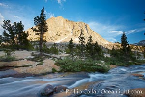
Fletcher Peak (11407') at sunset, viewed from Vogelsang High Sierra Camp in Yosemite's high country.
Location: Yosemite National Park, California
Image ID: 23203
Location: Yosemite National Park, California
Image ID: 23203
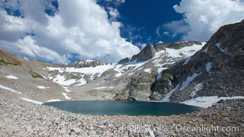
Nameless Lake (10709'), surrounded by glacier-sculpted granite peaks of the Cathedral Range, near Vogelsang High Sierra Camp.
Location: Yosemite National Park, California
Image ID: 23205
Location: Yosemite National Park, California
Image ID: 23205
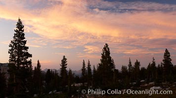
Sunset clouds and trees, Vogelsang High Sierra Camp, summer in Yosemite's high country.
Location: Yosemite National Park, California
Image ID: 23207
Location: Yosemite National Park, California
Image ID: 23207
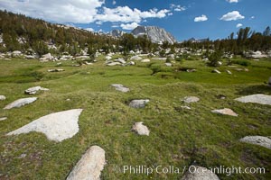
Alpine meadow in Yosemite's High Sierra, on approach on the John Muir Trail to Vogelsang High Sierra Camp, looking south.
Location: Yosemite National Park, California
Image ID: 23209
Location: Yosemite National Park, California
Image ID: 23209
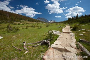
Alpine meadow and John Muir Trail, in Yosemite's high country on approach to Vogelsang High Sierra Camp.
Location: Yosemite National Park, California
Image ID: 23212
Location: Yosemite National Park, California
Image ID: 23212
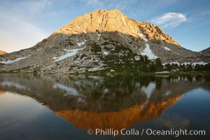
Fletcher Peak (11407') rises above Fletcher Lake (10174'), near Vogelsang High Sierra Camp in Yosemite's high country.
Location: Yosemite National Park, California
Image ID: 23213
Location: Yosemite National Park, California
Image ID: 23213
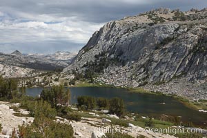
Spectacular Vogelsang Lake in Yosemite's High Sierra, with Fletcher Peak (11407') to the right and Choo-choo Ridge in the distance, near Vogelsang High Sierra Camp.
Location: Yosemite National Park, California
Image ID: 23214
Location: Yosemite National Park, California
Image ID: 23214
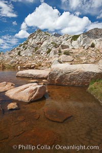
Alpine pond and ridge near Vogelsang Peak, near Vogelsang Pass (10685') in Yosemite's high country.
Location: Yosemite National Park, California
Image ID: 23215
Location: Yosemite National Park, California
Image ID: 23215
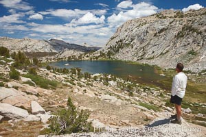
Hiker views Vogelsang Lake and the western buttress of Fletcher Peak from a vantage point near Vogelsang Pass, looking north.
Location: Yosemite National Park, California
Image ID: 23216
Location: Yosemite National Park, California
Image ID: 23216
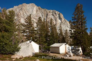
Fletcher Peak (11407') rises above Vogelsang High Sierra Camp, in Yosemite's high country.
Location: Yosemite National Park, California
Image ID: 23218
Location: Yosemite National Park, California
Image ID: 23218