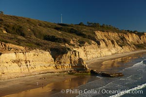
Torrey Pines seacliffs, rising up to 300 feet above the ocean, stretch from Del Mar to La Jolla. On the mesa atop the bluffs are found Torrey pine trees, one of the rare species of pines in the world.
Location: Torrey Pines State Reserve, San Diego, California
Image ID: 22311
Location: Torrey Pines State Reserve, San Diego, California
Image ID: 22311
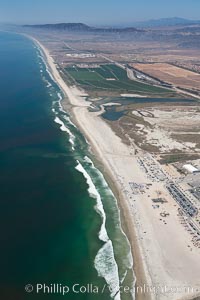
Camp Pendleton, Pacific coastline, north of San Diego county and the city of Oceanside. Marine Corps Base Camp Pendleton.
Location: Marine Corps Base Camp Pendleton, California
Image ID: 25980
Location: Marine Corps Base Camp Pendleton, California
Image ID: 25980

Aerial Panoramic Photo of Sunset Cliffs San Diego, Pappy's Point, Claiborne Cove.
Location: San Diego, California
Image ID: 30790
Panorama dimensions: 8011 x 28354
Location: San Diego, California
Image ID: 30790
Panorama dimensions: 8011 x 28354
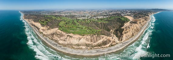
Aerial panorama of Blacks Beach, Torrey Pines Golf Course (south course), and views to La Jolla (south) and Carlsbad (north).
Location: La Jolla, California
Image ID: 30851
Panorama dimensions: 6962 x 19824
Location: La Jolla, California
Image ID: 30851
Panorama dimensions: 6962 x 19824
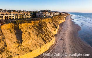
Solana Beach sea cliffs and coastline, aerial view.
Location: Solana Beach, California
Image ID: 38024
Location: Solana Beach, California
Image ID: 38024
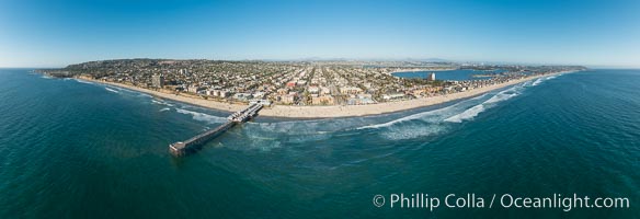
Aerial Panoramic Photo of Crystal Pier and Pacific Beach Coastline.
Location: San Diego, California
Image ID: 30780
Panorama dimensions: 7163 x 20930
Location: San Diego, California
Image ID: 30780
Panorama dimensions: 7163 x 20930
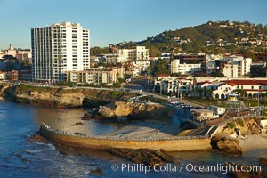
The Children's Pool in La Jolla, also known as Casa Cove, is a small pocket cove protected by a curving seawall, with the rocky coastline and cottages and homes of La Jolla seen behind it.
Location: La Jolla, California
Image ID: 22302
Location: La Jolla, California
Image ID: 22302
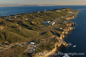
Point Loma peninsula, with scalloped sandstone cliffs edging the Pacific Ocean, looking south. Navy facilities are scattered along this section of Point Loma.
Location: San Diego, California
Image ID: 22305
Location: San Diego, California
Image ID: 22305
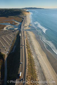
Coast Highway 101, looking south from Del Mar, with Los Penasquitos Marsh on the left and the cliffs of Torrey Pines State Reserve and La Jolla in the distance.
Location: San Diego, California
Image ID: 22310
Location: San Diego, California
Image ID: 22310
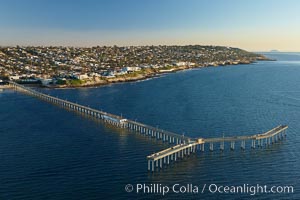
Ocean Beach Pier, also known as the OB Pier or Ocean Beach Municipal Pier, is the longest concrete pier on the West Coast measuring 1971 feet (601 m) long. Sunset Cliffs and Point Loma extend off to the south.
Location: San Diego, California
Image ID: 22459
Location: San Diego, California
Image ID: 22459
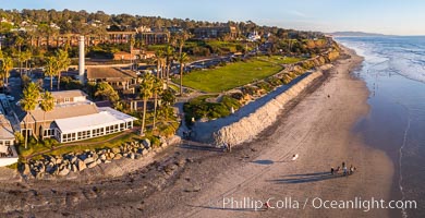
Powerhouse Park and Beach in Del Mar at sunset, aerial photo.
Location: Del Mar, California
Image ID: 38106
Location: Del Mar, California
Image ID: 38106
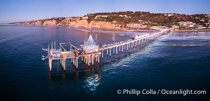
Holiday Christmas Lights on Scripps Pier, Blacks Beach and Scripps Institution of Oceanography, sunset, aerial.
Location: La Jolla, California
Image ID: 39881
Location: La Jolla, California
Image ID: 39881
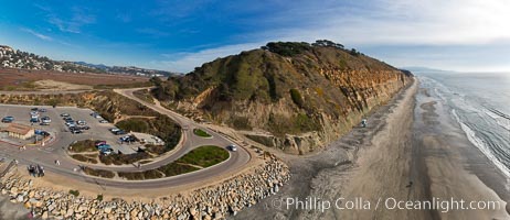
Torrey Pines balloon aerial survey photo. Torrey Pines seacliffs, rising up to 300 feet above the ocean, stretch from Del Mar to La Jolla. On the mesa atop the bluffs are found Torrey pine trees, one of the rare species of pines in the world. Peregrine falcons nest at the edge of the cliffs. This photo was made as part of an experimental balloon aerial photographic survey flight over Torrey Pines State Reserve, by permission of Torrey Pines State Reserve.
Location: Torrey Pines State Reserve, San Diego, California
Image ID: 27277
Panorama dimensions: 4253 x 9829
Location: Torrey Pines State Reserve, San Diego, California
Image ID: 27277
Panorama dimensions: 4253 x 9829
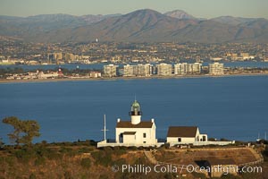
Old Point Loma Lighthouse, sitting high atop the end of Point Loma peninsula, seen here with San Diego Bay and downtown San Diego in the distance. The old Point Loma lighthouse operated from 1855 to 1891 above the entrance to San Diego Bay. It is now a maintained by the National Park Service and is part of Cabrillo National Monument.
Location: San Diego, California
Image ID: 22301
Location: San Diego, California
Image ID: 22301
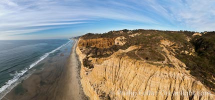
Torrey Pines balloon aerial survey photo. Torrey Pines seacliffs, rising up to 300 feet above the ocean, stretch from Del Mar to La Jolla. On the mesa atop the bluffs are found Torrey pine trees, one of the rare species of pines in the world. Peregrine falcons nest at the edge of the cliffs. This photo was made as part of an experimental balloon aerial photographic survey flight over Torrey Pines State Reserve, by permission of Torrey Pines State Reserve.
Location: Torrey Pines State Reserve, San Diego, California
Image ID: 27272
Panorama dimensions: 3989 x 8568
Location: Torrey Pines State Reserve, San Diego, California
Image ID: 27272
Panorama dimensions: 3989 x 8568
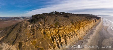
Torrey Pines balloon aerial survey photo. Torrey Pines seacliffs, rising up to 300 feet above the ocean, stretch from Del Mar to La Jolla. On the mesa atop the bluffs are found Torrey pine trees, one of the rare species of pines in the world. Peregrine falcons nest at the edge of the cliffs. This photo was made as part of an experimental balloon aerial photographic survey flight over Torrey Pines State Reserve, by permission of Torrey Pines State Reserve.
Location: Torrey Pines State Reserve, San Diego, California
Image ID: 27275
Panorama dimensions: 4352 x 9728
Location: Torrey Pines State Reserve, San Diego, California
Image ID: 27275
Panorama dimensions: 4352 x 9728
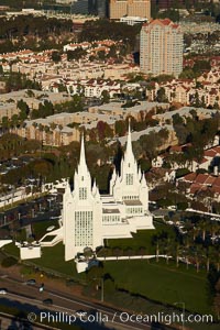
San Diego Mormon Temple, is seen amid the office and apartment buildings and shopping malls of University City.
Location: La Jolla, California
Image ID: 22292
Location: La Jolla, California
Image ID: 22292
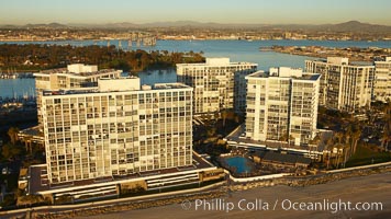
Coronado Shores, a group of 10 condominium buildings south of the Hotel Del, on the water on Coronado Island.
Location: San Diego, California
Image ID: 22297
Location: San Diego, California
Image ID: 22297
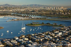
Mission Bay is the largest man-made aquatic park in the country. It spans 4,235 acres and is split nearly evenly between land and water. It is situated between the communities of Pacific Beach, Mission Beach, Bay Park and bordered on the south by the San Diego River channel. Once named "False Bay" by Juan Cabrillo in 1542, the tidelands were dredged in the 1940's creating the basins and islands of what is now Mission Bay.
Location: San Diego, California
Image ID: 22324
Location: San Diego, California
Image ID: 22324