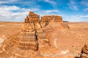
Molly's Castle, aerial view, Goblin Valley State Park.
Location: Mollys Castle, Goblin Valley State Park, Utah
Image ID: 38016
Location: Mollys Castle, Goblin Valley State Park, Utah
Image ID: 38016
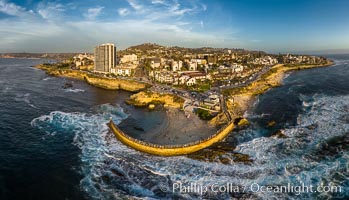
Childrens Pool seawall and Casa Cove aerial photo, La Jolla, California. Sunset. Aerial panoramic photograph.
Location: La Jolla, California
Image ID: 38037
Panorama dimensions: 5602 x 9774
Location: La Jolla, California
Image ID: 38037
Panorama dimensions: 5602 x 9774
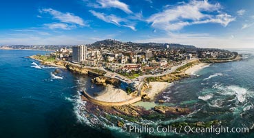
Childrens Pool Reef Exposed at Extreme Low Tide, La Jolla, California. Aerial panoramic photograph.
Location: La Jolla, California
Image ID: 38038
Panorama dimensions: 6176 x 11395
Location: La Jolla, California
Image ID: 38038
Panorama dimensions: 6176 x 11395
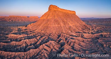
Factory Butte at sunrise. An exceptional example of a solitary butte surrounded by dramatically eroded badlands, Factory Butte stands alone on the San Rafael Swell.
Location: Factory Butte, Hanksville, Utah
Image ID: 38054
Location: Factory Butte, Hanksville, Utah
Image ID: 38054
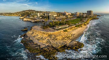
Point La Jolla and Scripps Park aerial photo, sunset, sea lions and sea gulls and tourists looking down on Boomer Beach. Aerial panoramic photo.
Location: La Jolla, California
Image ID: 38073
Panorama dimensions: 5257 x 9461
Location: La Jolla, California
Image ID: 38073
Panorama dimensions: 5257 x 9461
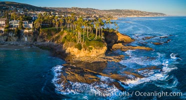
Twin Points, Crescent Bay and Shaws Cove, Laguna Beach Coastline, Aerial Photo.
Location: Laguna Beach, California
Image ID: 38081
Location: Laguna Beach, California
Image ID: 38081
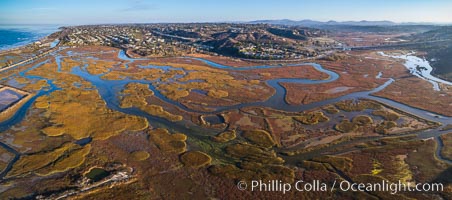
San Elijo Lagoon aerial photo, panorama.
Location: Encinitas, California
Image ID: 38138
Panorama dimensions: 3867 x 8738
Location: Encinitas, California
Image ID: 38138
Panorama dimensions: 3867 x 8738
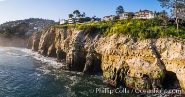
La Jolla Caves and Coastline, Goldfish Point, Aerial Panoramic Photo.
Location: La Jolla, California
Image ID: 38144
Location: La Jolla, California
Image ID: 38144

La Quinta and Coachella Valley, aerial view, panorama.
Location: La Quinta, California
Image ID: 38154
Panorama dimensions: 3812 x 11549
Location: La Quinta, California
Image ID: 38154
Panorama dimensions: 3812 x 11549

Honolua Bay in West Maui aerial photo, morning, with snorkel boat at anchor, panorama.
Location: Honolua Bay, Maui, Hawaii
Image ID: 38156
Location: Honolua Bay, Maui, Hawaii
Image ID: 38156
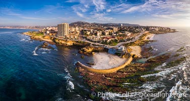
Aerial Panoramic Photo of Children's Pool, Casa Cove and La Jolla Coastline. The underwater reef is exposed by extreme low tide.
Location: La Jolla, California
Image ID: 38158
Panorama dimensions: 5603 x 10574
Location: La Jolla, California
Image ID: 38158
Panorama dimensions: 5603 x 10574
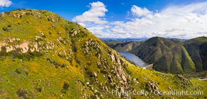
Spring Flowers and Grasses above Lake Hodges, aerial panoramic photo, Del Dios and Lake Hodges, San Diego.
Location: Del Dios, San Diego, California
Image ID: 38164
Panorama dimensions: 5142 x 10802
Location: Del Dios, San Diego, California
Image ID: 38164
Panorama dimensions: 5142 x 10802
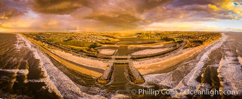
Batiquitos Lagoon and Ponto, stormy sunset, aerial panoramic photograph.
Location: Carlsbad, California
Image ID: 38168
Panorama dimensions: 6429 x 15646
Location: Carlsbad, California
Image ID: 38168
Panorama dimensions: 6429 x 15646
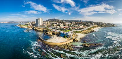
Childrens Pool Reef Exposed at Extreme Low Tide, La Jolla, California. Aerial panoramic photograph.
Location: La Jolla, California
Image ID: 38169
Panorama dimensions: 5916 x 12237
Location: La Jolla, California
Image ID: 38169
Panorama dimensions: 5916 x 12237
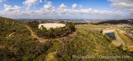
Water Tower Hill and Denk Mountain, and view to the west, highest point in Carlsbad.
Image ID: 38203
Image ID: 38203
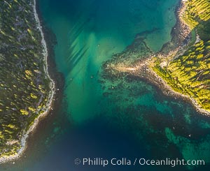
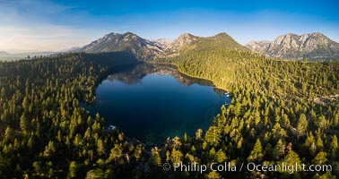
Emerald Bay Lake Tahoe, aerial panoramic photo of the mouth of the bay, early morning.
Location: Lake Tahoe, California
Image ID: 38256
Location: Lake Tahoe, California
Image ID: 38256
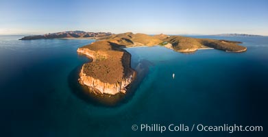
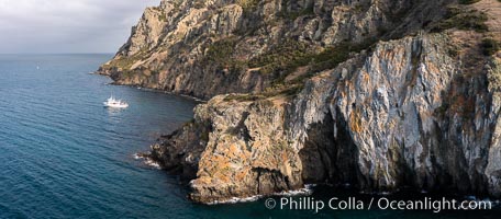
Punta Colorada and San Gabriel Bay, aerial photo, Isla Espiritu Santo, Sea of Cortez, Mexico.
Location: Isla Espiritu Santo, Baja California, Mexico
Image ID: 32368
Panorama dimensions: 4828 x 9449
Location: Isla Espiritu Santo, Baja California, Mexico
Image ID: 32368
Panorama dimensions: 4828 x 9449
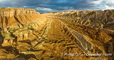
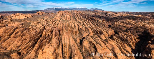
Aerial View of the San Rafael Reef, Utah. This is a canyon-like section of the San Rafael Reef, photographed at sunrise. The "reef proper" is on the right, with its characteristic triangular flatiron erosion. The canyon in the center is a fold in the Earth's crust affiliated with the boundary of the San Rafael Swell. The colors seen here arise primarily from Navajo and Wingate sandstone.
Location: Utah
Image ID: 39497
Panorama dimensions: 4490 x 8439
Location: Utah
Image ID: 39497
Panorama dimensions: 4490 x 8439
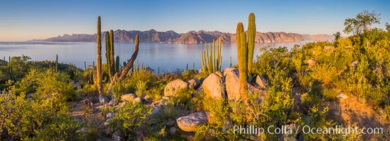
Cardon Cactus on Isla San Jose, Aerial View, Baja California.
Species: Cardon cactus, Elephant cactus, Pachycereus pringlei
Location: Isla San Jose, Baja California, Mexico
Image ID: 33688
Panorama dimensions: 3155 x 8689
Species: Cardon cactus, Elephant cactus, Pachycereus pringlei
Location: Isla San Jose, Baja California, Mexico
Image ID: 33688
Panorama dimensions: 3155 x 8689
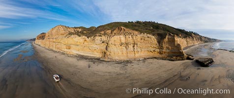
Torrey Pines balloon aerial survey photo. Torrey Pines seacliffs, rising up to 300 feet above the ocean, stretch from Del Mar to La Jolla. On the mesa atop the bluffs are found Torrey pine trees, one of the rare species of pines in the world. Peregrine falcons nest at the edge of the cliffs. This photo was made as part of an experimental balloon aerial photographic survey flight over Torrey Pines State Reserve, by permission of Torrey Pines State Reserve.
Location: Torrey Pines State Reserve, San Diego, California
Image ID: 27271
Panorama dimensions: 5001 x 11896
Location: Torrey Pines State Reserve, San Diego, California
Image ID: 27271
Panorama dimensions: 5001 x 11896
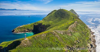
South Coronado Island, aerial photo.
Location: Coronado Islands (Islas Coronado), Baja California, Mexico
Image ID: 35091
Location: Coronado Islands (Islas Coronado), Baja California, Mexico
Image ID: 35091

Aerial Panorama of La Jolla, University City, showing (from left) University of California at San Diego, University City, Scripps Institution of Oceanography, La Jolla Shores, Point La Jolla, Mount Soledad, in the background some of the mountains to the east of San Diego. The highest peak in the center of the panoram is Cuyamaca Peak (6512') while the rocky peak directly in front of it is El Cajon Mountain (3675').
Image ID: 29098
Panorama dimensions: 3881 x 20864
Image ID: 29098
Panorama dimensions: 3881 x 20864
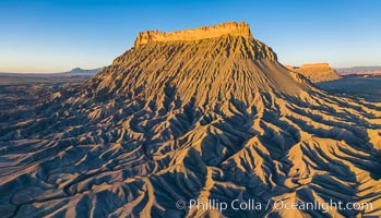
Factory Butte at sunrise, aerial photo, Utah. An exceptional example of solitary butte surrounded by dramatically eroded badlands, Factory Butte stands alone on the San Rafael Swell.
Location: Factory Butte, Hanksville, Utah
Image ID: 38076
Location: Factory Butte, Hanksville, Utah
Image ID: 38076
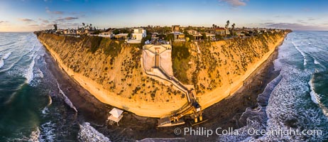
Stone Steps Beach at Sunset, Aerial Panorama, Encinitas, California.
Location: Encinitas, California
Image ID: 38093
Panorama dimensions: 7281 x 16824
Location: Encinitas, California
Image ID: 38093
Panorama dimensions: 7281 x 16824
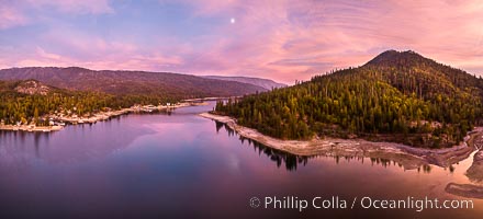
Moonrise and spectacular pink sunset over Bass Lake, Goat Mountain rises to the right, aerial panoramic photo.
Location: Bass Lake, California
Image ID: 38529
Panorama dimensions: 4326 x 9518
Location: Bass Lake, California
Image ID: 38529
Panorama dimensions: 4326 x 9518
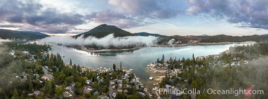
Mist and storm clouds over Bass Lake, aerial photo, autumn.
Location: Bass Lake, California
Image ID: 38531
Panorama dimensions: 4846 x 13021
Location: Bass Lake, California
Image ID: 38531
Panorama dimensions: 4846 x 13021
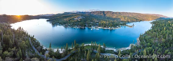
Aerial Panorama of Bass Lake near Oakhurst, California, at sunset.
Location: Bass Lake, California
Image ID: 38212
Panorama dimensions: 4883 x 13879
Location: Bass Lake, California
Image ID: 38212
Panorama dimensions: 4883 x 13879
