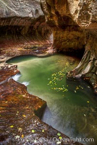
The Subway, a iconic eroded sandstone formation in Zion National Park.
Location: The Subway, Zion National Park, Utah
Image ID: 26095
Location: The Subway, Zion National Park, Utah
Image ID: 26095
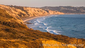
Black's Beach and Torrey Pines Cliffs and Pacific Ocean, Razor Point view to La Jolla, San Diego, California.
Location: Torrey Pines State Reserve, San Diego, California
Image ID: 28490
Location: Torrey Pines State Reserve, San Diego, California
Image ID: 28490
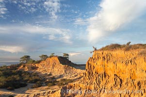
Broken Hill is an ancient, compacted sand dune that was uplifted to its present location and is now eroding.
Location: Torrey Pines State Reserve, San Diego, California
Image ID: 18930
Location: Torrey Pines State Reserve, San Diego, California
Image ID: 18930
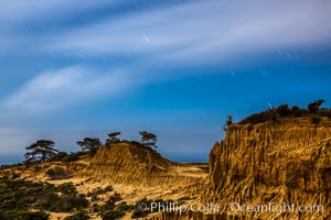
Torrey Pines State Reserve at Night, stars and clouds fill the night sky, the Pacific Ocean in the distance.
Location: Torrey Pines State Reserve, San Diego, California
Image ID: 28402
Location: Torrey Pines State Reserve, San Diego, California
Image ID: 28402
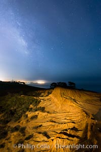
The Milky Way rises over La Jolla, viewed from Broken Hill in Torrey Pines State Reserve.
Location: Torrey Pines State Reserve, San Diego, California
Image ID: 28393
Location: Torrey Pines State Reserve, San Diego, California
Image ID: 28393
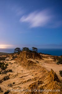
Torrey Pines State Reserve at Night, stars and clouds fill the night sky with the lights of La Jolla visible in the distance.
Location: Torrey Pines State Reserve, San Diego, California
Image ID: 28404
Location: Torrey Pines State Reserve, San Diego, California
Image ID: 28404
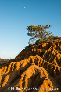
Full moon, Torrey Pine and eroded sandstone. The Torrey Pine is the rarest native pine tree in the United States, is native to the coastal chaparral of San Diego County. A subspecies of the Torrey Pine is found in a small grove on Santa Rosa island, one of Californias Channel Islands.
Species: Torrey pine, Pinus torreyana
Location: La Jolla, California
Image ID: 28987
Species: Torrey pine, Pinus torreyana
Location: La Jolla, California
Image ID: 28987
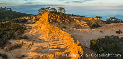
Broken Hill and view to La Jolla, from Torrey Pines State Reserve, sunrise.
Location: Torrey Pines State Reserve, San Diego, California
Image ID: 28396
Location: Torrey Pines State Reserve, San Diego, California
Image ID: 28396
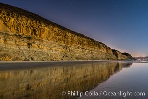
Torrey Pines Cliffs lit at night by a full moon, low tide reflections.
Location: Torrey Pines State Reserve, San Diego, California
Image ID: 28454
Location: Torrey Pines State Reserve, San Diego, California
Image ID: 28454
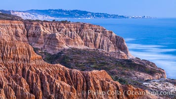
Torrey Pines Cliffs and Pacific Ocean, Razor Point view to La Jolla, San Diego, California.
Location: Torrey Pines State Reserve, San Diego, California
Image ID: 28497
Location: Torrey Pines State Reserve, San Diego, California
Image ID: 28497
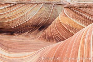
The Wave in the North Coyote Buttes, an area of fantastic eroded sandstone featuring beautiful swirls, wild colors, countless striations, and bizarre shapes set amidst the dramatic surrounding North Coyote Buttes of Arizona and Utah. The sandstone formations of the North Coyote Buttes, including the Wave, date from the Jurassic period. Managed by the Bureau of Land Management, the Wave is located in the Paria Canyon-Vermilion Cliffs Wilderness and is accessible on foot by permit only.
Location: North Coyote Buttes, Paria Canyon-Vermilion Cliffs Wilderness, Arizona
Image ID: 28609
Location: North Coyote Buttes, Paria Canyon-Vermilion Cliffs Wilderness, Arizona
Image ID: 28609
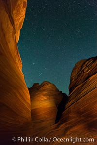
The Wave at Night, under a clear night sky full of stars. The Wave, an area of fantastic eroded sandstone featuring beautiful swirls, wild colors, countless striations, and bizarre shapes set amidst the dramatic surrounding North Coyote Buttes of Arizona and Utah. The sandstone formations of the North Coyote Buttes, including the Wave, date from the Jurassic period. Managed by the Bureau of Land Management, the Wave is located in the Paria Canyon-Vermilion Cliffs Wilderness and is accessible on foot by permit only.
Location: North Coyote Buttes, Paria Canyon-Vermilion Cliffs Wilderness, Arizona
Image ID: 28624
Location: North Coyote Buttes, Paria Canyon-Vermilion Cliffs Wilderness, Arizona
Image ID: 28624
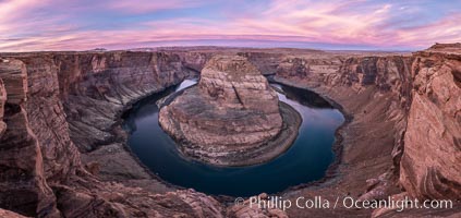
Spectacular Horseshoe Bend sunrise. The Colorado River makes a 180-degree turn at Horseshoe Bend. Here the river has eroded the Navajo sandstone for eons, digging a canyon 1100-feet deep.
Location: Horseshoe Bend, Page, Arizona
Image ID: 35940
Panorama dimensions: 4266 x 9024
Location: Horseshoe Bend, Page, Arizona
Image ID: 35940
Panorama dimensions: 4266 x 9024
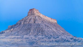
Factory Butte at sunrise. An exceptional example of solitary butte surrounded by dramatically eroded badlands, Factory Butte stands alone on the San Rafael Swell.
Location: Factory Butte, Hanksville, Utah
Image ID: 37018
Location: Factory Butte, Hanksville, Utah
Image ID: 37018
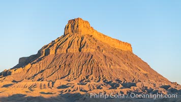
Factory Butte at sunrise. An exceptional example of solitary butte surrounded by dramatically eroded badlands, Factory Butte stands alone on the San Rafael Swell.
Location: Factory Butte, Hanksville, Utah
Image ID: 37019
Location: Factory Butte, Hanksville, Utah
Image ID: 37019
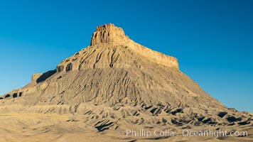
Factory Butte at sunrise. An exceptional example of solitary butte surrounded by dramatically eroded badlands, Factory Butte stands alone on the San Rafael Swell.
Location: Factory Butte, Hanksville, Utah
Image ID: 37020
Location: Factory Butte, Hanksville, Utah
Image ID: 37020
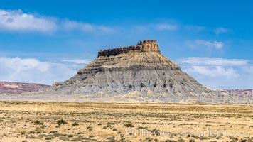
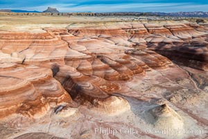
Factory Butte. An exceptional example of a solitary butte surrounded by dramatically eroded badlands, Factory Butte stands alone on the San Rafael Swell.
Location: Factory Butte, Hanksville, Utah
Image ID: 37872
Location: Factory Butte, Hanksville, Utah
Image ID: 37872
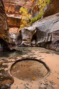
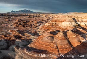
The Subway, a iconic eroded sandstone formation in Zion National Park.
Location: The Subway, Zion National Park, Utah
Image ID: 26136
Location: The Subway, Zion National Park, Utah
Image ID: 26136

Panorama of the Wave. The Wave is a sweeping, dramatic display of eroded sandstone, forged by eons of water and wind erosion, laying bare striations formed from compacted sand dunes over millenia. This panoramic picture is formed from thirteen individual photographs.
Location: North Coyote Buttes, Paria Canyon-Vermilion Cliffs Wilderness, Arizona
Image ID: 20702
Panorama dimensions: 4617 x 17432
Location: North Coyote Buttes, Paria Canyon-Vermilion Cliffs Wilderness, Arizona
Image ID: 20702
Panorama dimensions: 4617 x 17432
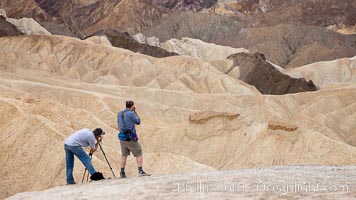
Eroded hillsides near Zabriskie Point and Gower Wash.
Location: Zabriskie Point, Death Valley National Park, California
Image ID: 25295
Location: Zabriskie Point, Death Valley National Park, California
Image ID: 25295
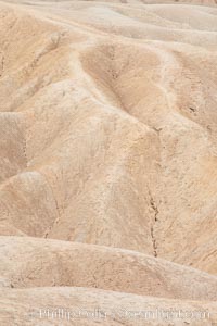
Eroded hillsides near Zabriskie Point and Gower Wash.
Location: Zabriskie Point, Death Valley National Park, California
Image ID: 25296
Location: Zabriskie Point, Death Valley National Park, California
Image ID: 25296
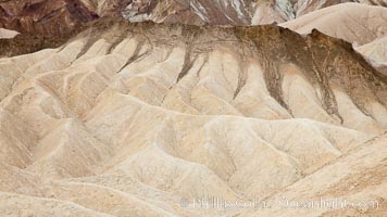
Eroded hillsides near Zabriskie Point and Gower Wash.
Location: Zabriskie Point, Death Valley National Park, California
Image ID: 25297
Location: Zabriskie Point, Death Valley National Park, California
Image ID: 25297
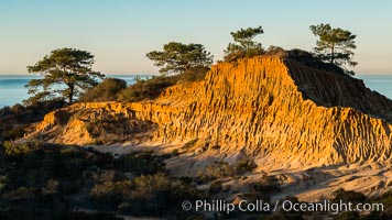
Broken Hill and view to La Jolla, from Torrey Pines State Reserve, sunrise.
Location: Torrey Pines State Reserve, San Diego, California
Image ID: 28374
Location: Torrey Pines State Reserve, San Diego, California
Image ID: 28374
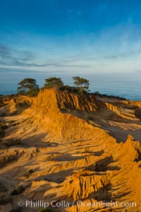
Broken Hill and view to La Jolla, from Torrey Pines State Reserve, sunrise.
Location: Torrey Pines State Reserve, San Diego, California
Image ID: 28399
Location: Torrey Pines State Reserve, San Diego, California
Image ID: 28399
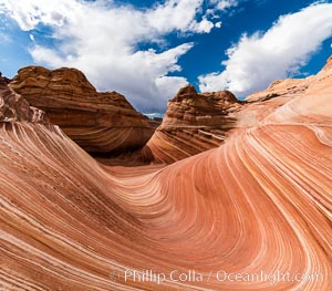
The Wave in the North Coyote Buttes, an area of fantastic eroded sandstone featuring beautiful swirls, wild colors, countless striations, and bizarre shapes set amidst the dramatic surrounding North Coyote Buttes of Arizona and Utah. The sandstone formations of the North Coyote Buttes, including the Wave, date from the Jurassic period. Managed by the Bureau of Land Management, the Wave is located in the Paria Canyon-Vermilion Cliffs Wilderness and is accessible on foot by permit only.
Location: North Coyote Buttes, Paria Canyon-Vermilion Cliffs Wilderness, Arizona
Image ID: 28600
Location: North Coyote Buttes, Paria Canyon-Vermilion Cliffs Wilderness, Arizona
Image ID: 28600
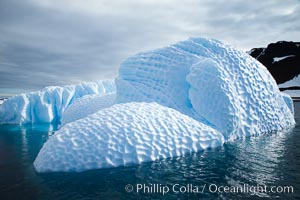
Iceberg with scalloped erosion. The eroded indentations on this iceberg were melted when this portion of the iceberg was underwater. As it melted, the iceberg grew topheavy, eventually flipping and exposing this interesting surface.
Location: Paulet Island, Antarctic Peninsula, Antarctica
Image ID: 24789
Location: Paulet Island, Antarctic Peninsula, Antarctica
Image ID: 24789
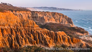
Torrey Pines Cliffs and Pacific Ocean, Razor Point view to La Jolla, San Diego, California.
Location: Torrey Pines State Reserve, San Diego, California
Image ID: 28495
Location: Torrey Pines State Reserve, San Diego, California
Image ID: 28495
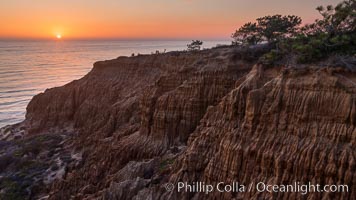
Torrey Pines Cliffs and Pacific Ocean, Razor Point view to La Jolla, San Diego, California.
Location: Torrey Pines State Reserve, San Diego, California
Image ID: 28496
Location: Torrey Pines State Reserve, San Diego, California
Image ID: 28496
