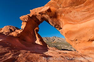
Arch Rock at sunrise, Valley of Fire State Park. Natural arch formed in sandstone. Sunrise with the full moon setting over mountains in the distance.
Location: Valley of Fire State Park, Nevada
Image ID: 26472
Location: Valley of Fire State Park, Nevada
Image ID: 26472
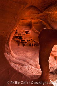
Fire Arch or Windstone Arch, also known as Fire Cave, is a tiny cave with a miniature arch and a group of natural pocket holes. Many people walk by this cave without realizing it is there!.
Location: Valley of Fire State Park, Nevada
Image ID: 26475
Location: Valley of Fire State Park, Nevada
Image ID: 26475
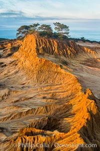
Broken Hill and view to La Jolla, from Torrey Pines State Reserve, sunrise.
Location: Torrey Pines State Reserve, San Diego, California
Image ID: 28395
Location: Torrey Pines State Reserve, San Diego, California
Image ID: 28395
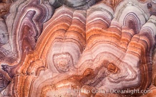
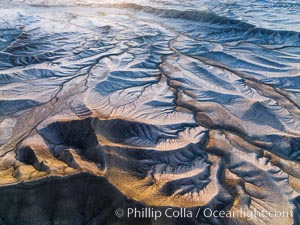
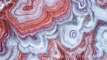
Fantastic colorful sedimentary patterns, Bentonite layers are seen as striations exposed in the Utah Badlands. The Bentonite Hills are composed of the Brushy Basin shale member of the Morrison Formation. This layer was formed during Jurassic times when mud, silt, fine sand, and volcanic ash were deposited in swamps and lakes. Aerial photograph.
Location: Utah
Image ID: 38029
Location: Utah
Image ID: 38029
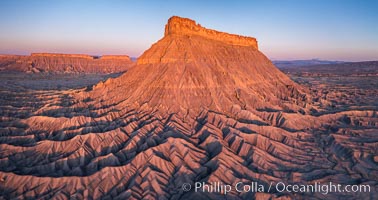
Factory Butte at sunrise. An exceptional example of a solitary butte surrounded by dramatically eroded badlands, Factory Butte stands alone on the San Rafael Swell.
Location: Factory Butte, Hanksville, Utah
Image ID: 38054
Location: Factory Butte, Hanksville, Utah
Image ID: 38054
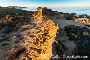
Broken Hill by the first light of dawn, overlooking the Pacific Ocean and Torrey Pines State Reserve, La Jolla and Mount Soledad in the distance.
Location: Torrey Pines State Reserve, San Diego, California
Image ID: 36568
Location: Torrey Pines State Reserve, San Diego, California
Image ID: 36568
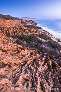
Torrey Pines Cliffs and Pacific Ocean, Razor Point view to La Jolla, San Diego, California.
Location: Torrey Pines State Reserve, San Diego, California
Image ID: 28485
Location: Torrey Pines State Reserve, San Diego, California
Image ID: 28485
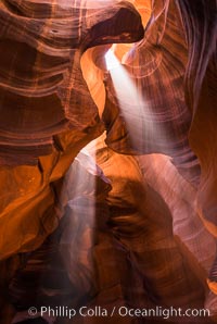
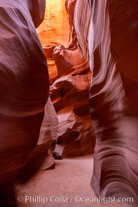
Light Beam in Upper Antelope Slot Canyon. Thin shafts of light briefly penetrate the convoluted narrows of Upper Antelope Slot Canyon, sending piercing beams through the sandstone maze to the sand floor below.
Location: Navajo Tribal Lands, Page, Arizona
Image ID: 28563
Location: Navajo Tribal Lands, Page, Arizona
Image ID: 28563
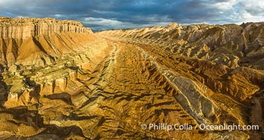
Aerial View of the San Rafael Reef, Utah. This is a canyon-like section of the San Rafael Reef, photographed at sunrise. The "reef proper" is on the right, with its characteristic triangular flatiron erosion. The canyon in the center is a fold in the Earth's crust affiliated with the boundary of the San Rafael Swell. The colors seen here arise primarily from Navajo and Wingate sandstone.
Location: Utah
Image ID: 39497
Panorama dimensions: 4490 x 8439
Location: Utah
Image ID: 39497
Panorama dimensions: 4490 x 8439
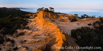
Broken Hill and view to La Jolla, panoramic photograph, from Torrey Pines State Reserve, sunrise.
Location: Torrey Pines State Reserve, San Diego, California
Image ID: 28464
Panorama dimensions: 3867 x 7787
Location: Torrey Pines State Reserve, San Diego, California
Image ID: 28464
Panorama dimensions: 3867 x 7787
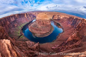
Horseshoe Bend. The Colorado River makes a 180-degree turn at Horseshoe Bend. Here the river has eroded the Navajo sandstone for eons, digging a canyon 1100-feet deep.
Location: Horseshoe Bend, Page, Arizona
Image ID: 26602
Location: Horseshoe Bend, Page, Arizona
Image ID: 26602
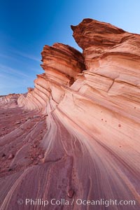
The Great Wall, Navajo Tribal Lands, Arizona. Sandstone "fins", eroded striations that depict how sandstone -- ancient compressed sand -- was laid down in layers over time. Now exposed, the layer erode at different rates, forming delicate "fins" that stretch for long distances.
Location: Navajo Tribal Lands, Page, Arizona
Image ID: 26643
Location: Navajo Tribal Lands, Page, Arizona
Image ID: 26643
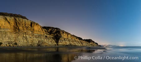
Torrey Pines Cliffs lit at night by a full moon, low tide reflections.
Location: Torrey Pines State Reserve, San Diego, California
Image ID: 28455
Panorama dimensions: 3623 x 8213
Location: Torrey Pines State Reserve, San Diego, California
Image ID: 28455
Panorama dimensions: 3623 x 8213
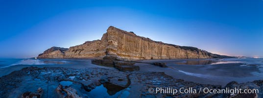
Torrey Pines Cliffs lit at night by a full moon, low tide reflections.
Location: Torrey Pines State Reserve, San Diego, California
Image ID: 28463
Panorama dimensions: 5072 x 13623
Location: Torrey Pines State Reserve, San Diego, California
Image ID: 28463
Panorama dimensions: 5072 x 13623
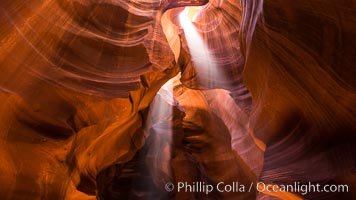
Light Beam in Upper Antelope Slot Canyon. Thin shafts of light briefly penetrate the convoluted narrows of Upper Antelope Slot Canyon, sending piercing beams through the sandstone maze to the sand floor below.
Location: Navajo Tribal Lands, Page, Arizona
Image ID: 28564
Location: Navajo Tribal Lands, Page, Arizona
Image ID: 28564
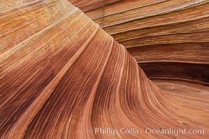
The Wave in the North Coyote Buttes, an area of fantastic eroded sandstone featuring beautiful swirls, wild colors, countless striations, and bizarre shapes set amidst the dramatic surrounding North Coyote Buttes of Arizona and Utah. The sandstone formations of the North Coyote Buttes, including the Wave, date from the Jurassic period. Managed by the Bureau of Land Management, the Wave is located in the Paria Canyon-Vermilion Cliffs Wilderness and is accessible on foot by permit only.
Location: North Coyote Buttes, Paria Canyon-Vermilion Cliffs Wilderness, Arizona
Image ID: 28602
Location: North Coyote Buttes, Paria Canyon-Vermilion Cliffs Wilderness, Arizona
Image ID: 28602

The Wave in the North Coyote Buttes, an area of fantastic eroded sandstone featuring beautiful swirls, wild colors, countless striations, and bizarre shapes set amidst the dramatic surrounding North Coyote Buttes of Arizona and Utah. The sandstone formations of the North Coyote Buttes, including the Wave, date from the Jurassic period. Managed by the Bureau of Land Management, the Wave is located in the Paria Canyon-Vermilion Cliffs Wilderness and is accessible on foot by permit only.
Location: North Coyote Buttes, Paria Canyon-Vermilion Cliffs Wilderness, Arizona
Image ID: 28603
Location: North Coyote Buttes, Paria Canyon-Vermilion Cliffs Wilderness, Arizona
Image ID: 28603
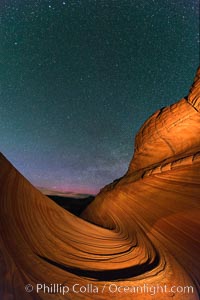
The Wave at Night, under a clear night sky full of stars. The Wave, an area of fantastic eroded sandstone featuring beautiful swirls, wild colors, countless striations, and bizarre shapes set amidst the dramatic surrounding North Coyote Buttes of Arizona and Utah. The sandstone formations of the North Coyote Buttes, including the Wave, date from the Jurassic period. Managed by the Bureau of Land Management, the Wave is located in the Paria Canyon-Vermilion Cliffs Wilderness and is accessible on foot by permit only.
Location: North Coyote Buttes, Paria Canyon-Vermilion Cliffs Wilderness, Arizona
Image ID: 28623
Location: North Coyote Buttes, Paria Canyon-Vermilion Cliffs Wilderness, Arizona
Image ID: 28623
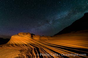
The Second Wave at Night. The Second Wave, a spectacular sandstone formation in the North Coyote Buttes, lies under a sky full of stars.
Location: North Coyote Buttes, Paria Canyon-Vermilion Cliffs Wilderness, Arizona
Image ID: 28628
Location: North Coyote Buttes, Paria Canyon-Vermilion Cliffs Wilderness, Arizona
Image ID: 28628
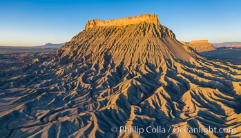
Factory Butte at sunrise, aerial photo, Utah. An exceptional example of solitary butte surrounded by dramatically eroded badlands, Factory Butte stands alone on the San Rafael Swell.
Location: Factory Butte, Hanksville, Utah
Image ID: 38076
Location: Factory Butte, Hanksville, Utah
Image ID: 38076
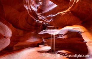
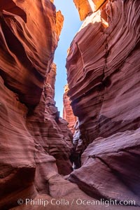
Upper Antelope Canyon, a deep, narrow and spectacular slot canyon lying on Navajo Tribal lands near Page, Arizona.
Location: Navajo Tribal Lands, Page, Arizona
Image ID: 35934
Location: Navajo Tribal Lands, Page, Arizona
Image ID: 35934
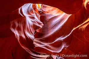
Upper Antelope Canyon, a deep, narrow and spectacular slot canyon lying on Navajo Tribal lands near Page, Arizona.
Location: Navajo Tribal Lands, Page, Arizona
Image ID: 35935
Location: Navajo Tribal Lands, Page, Arizona
Image ID: 35935
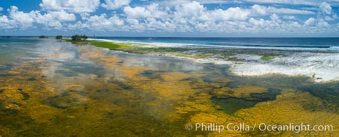
Aerial view of the lagoon inside Clipperton Island. The lagoon within the atoll was formerly open to the ocean but has been closed and stagnant for many decades. Some experts believe erosion will open the lagoon up to the ocean again soon. Clipperton Island, a minor territory of France also known as Ile de la Passion, is a spectacular coral atoll in the eastern Pacific. By permit HC / 1485 / CAB (France).
Location: Clipperton Island, France
Image ID: 32878
Location: Clipperton Island, France
Image ID: 32878
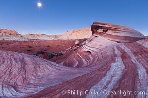
The moon sets over the Fire Wave, a beautiful sandstone formation exhibiting dramatic striations, striped layers in the geologic historical record.
Location: Valley of Fire State Park, Nevada
Image ID: 26511
Location: Valley of Fire State Park, Nevada
Image ID: 26511
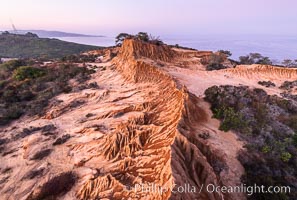
Sunrise over Broken Hill, overlooking La Jolla and the Pacific Ocean, Torrey Pines State Reserve.
Location: Torrey Pines State Reserve, San Diego, California
Image ID: 35849
Location: Torrey Pines State Reserve, San Diego, California
Image ID: 35849
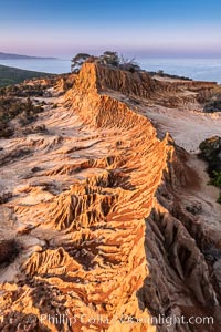
Sunrise over Broken Hill, overlooking La Jolla and the Pacific Ocean, Torrey Pines State Reserve.
Location: Torrey Pines State Reserve, San Diego, California
Image ID: 35850
Location: Torrey Pines State Reserve, San Diego, California
Image ID: 35850
