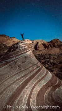
Exuberant hiker atop the Fire Wave, at night, stars and the evening sky.
Location: Valley of Fire State Park, Nevada
Image ID: 28450
Location: Valley of Fire State Park, Nevada
Image ID: 28450
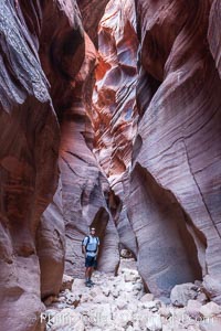
Hiker in Buckskin Gulch. A hiker considers the towering walls and narrow passageway of Buckskin Gulch, a dramatic slot canyon forged by centuries of erosion through sandstone. Buckskin Gulch is the worlds longest accessible slot canyon, running from the Paria River toward the Colorado River. Flash flooding is a serious danger in the narrows where there is no escape.
Location: Buckskin Gulch, Paria Canyon-Vermilion Cliffs Wilderness, Arizona
Image ID: 20716
Location: Buckskin Gulch, Paria Canyon-Vermilion Cliffs Wilderness, Arizona
Image ID: 20716
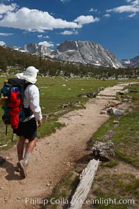
Hiker traversing the John Muir Trail to Fletcher Peak and Vogelsang Peak through alpine meadow in Yosemite's high country, trail on approach to Vogelsang High Sierra Camp.
Location: Yosemite National Park, California
Image ID: 23204
Location: Yosemite National Park, California
Image ID: 23204
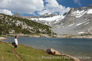
Hiker admires Townsley Lake (10396') and the Cathedral Range in Yosemite's High Sierra.
Location: Yosemite National Park, California
Image ID: 23227
Location: Yosemite National Park, California
Image ID: 23227

Buckskin Gulch hiker. A hiker moves through the deep narrow passages of Buckskin Gulch, a slot canyon cut deep into sandstone by years of river-induced erosion. In some places the Buckskin Gulch narrows are only about 15 feet wide but several hundred feet high, blocking sunlight. Flash floods are dangerous as there is no escape once into the Buckskin Gulch slot canyons. This is a panorama made of sixteen individual photos.
Location: Buckskin Gulch, Paria Canyon-Vermilion Cliffs Wilderness, Arizona
Image ID: 20699
Panorama dimensions: 4771 x 15311
Location: Buckskin Gulch, Paria Canyon-Vermilion Cliffs Wilderness, Arizona
Image ID: 20699
Panorama dimensions: 4771 x 15311
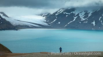
A hiker ascends the slopes of South Georgia Island above Fortuna Bay.
Location: Fortuna Bay, South Georgia Island
Image ID: 24591
Location: Fortuna Bay, South Georgia Island
Image ID: 24591
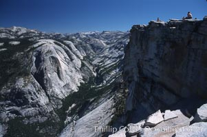
Hikers atop Summit of Half Dome, view of Tenaya Canyon.
Location: Half Dome, Yosemite National Park, California
Image ID: 05458
Location: Half Dome, Yosemite National Park, California
Image ID: 05458
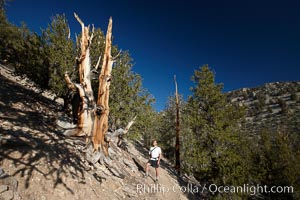
A hiker admires an ancient bristlecone pine tree, on the Methuselah Walk in the Schulman Grove in the White Mountains at an elevation of 9500 above sea level. The oldest bristlecone pines in the world are found in the Schulman Grove, some of them over 4700 years old. Ancient Bristlecone Pine Forest.
Species: Bristlecone pine, Pinus longaeva
Location: White Mountains, Inyo National Forest, California
Image ID: 23239
Species: Bristlecone pine, Pinus longaeva
Location: White Mountains, Inyo National Forest, California
Image ID: 23239
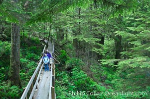
Hikers admire the temperate rainforest along the Rainforest Trail in Pacific Rim NP, one of the best places along the Pacific Coast to experience an old-growth rain forest, complete with western hemlock, red cedar and amabilis fir trees. Moss gardens hang from tree crevices, forming a base for many ferns and conifer seedlings.
Location: Rainforest Trail, Pacific Rim National Park, British Columbia, Canada
Image ID: 21056
Location: Rainforest Trail, Pacific Rim National Park, British Columbia, Canada
Image ID: 21056
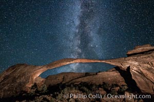
Landscape Arch and Milky Way galaxy. Stars rise over Landscape arch at night, filling the Utah sky, while the arch is gently lit by a hiker's light. (Note: this image was created before a ban on light-painting in Arches National Park was put into effect. Light-painting is no longer permitted in Arches National Park).
Location: Arches National Park, Utah
Image ID: 27869
Location: Arches National Park, Utah
Image ID: 27869
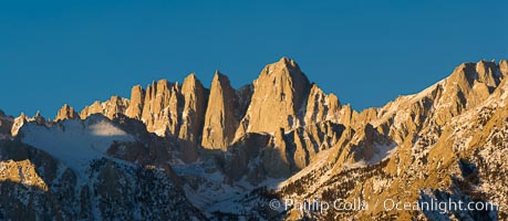
Mt. Whitney is the highest point in the contiguous United States with an elevation of 14,505 feet (4,421 m). It lies along the crest of the Sierra Nevada mountain range. Composed of the Sierra Nevada batholith granite formation, its eastern side (seen here) is quite steep. It is climbed by hundreds of hikers each year.
Location: Alabama Hills Recreational Area, California
Image ID: 27653
Panorama dimensions: 4959 x 11372
Location: Alabama Hills Recreational Area, California
Image ID: 27653
Panorama dimensions: 4959 x 11372
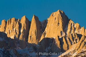
Mt. Whitney is the highest point in the contiguous United States with an elevation of 14,505 feet (4,421 m). It lies along the crest of the Sierra Nevada mountain range. Composed of the Sierra Nevada batholith granite formation, its eastern side (seen here) is quite steep. It is climbed by hundreds of hikers each year.
Location: Alabama Hills Recreational Area, California
Image ID: 27654
Location: Alabama Hills Recreational Area, California
Image ID: 27654
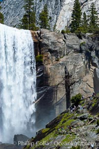
Hikers climb the Mist Trail (at right) through Little Yosemite Valley, approaching Vernal Falls. Spring.
Location: Vernal Falls, Yosemite National Park, California
Image ID: 09201
Location: Vernal Falls, Yosemite National Park, California
Image ID: 09201
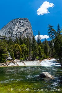
The Emerald Pool forms in the Merced River just above Vernal Falls. Unfortunately, a few careless hikers have tried swimming in Emerald Pool only to be swept downstream and plunge over Vernals Falls to their deaths. Yosemite National Park, Spring.
Location: Vernal Falls, Yosemite National Park, California
Image ID: 09205
Location: Vernal Falls, Yosemite National Park, California
Image ID: 09205
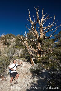
A hiker admires an ancient bristlecone pine tree, on the Methuselah Walk in the Schulman Grove in the White Mountains at an elevation of 9500 above sea level. The oldest bristlecone pines in the world are found in the Schulman Grove, some of them over 4700 years old. Ancient Bristlecone Pine Forest.
Species: Bristlecone pine, Pinus longaeva
Location: White Mountains, Inyo National Forest, California
Image ID: 23238
Species: Bristlecone pine, Pinus longaeva
Location: White Mountains, Inyo National Forest, California
Image ID: 23238
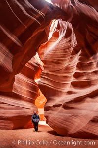
A hiker admiring the striated walls and dramatic light within Antelope Canyon, a deep narrow slot canyon formed by water and wind erosion.
Location: Navajo Tribal Lands, Page, Arizona
Image ID: 17996
Location: Navajo Tribal Lands, Page, Arizona
Image ID: 17996
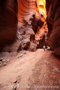
Hiker in Buckskin Gulch. A hiker considers the towering walls and narrow passageway of Buckskin Gulch, a dramatic slot canyon forged by centuries of erosion through sandstone. Buckskin Gulch is the worlds longest accessible slot canyon, running from the Paria River toward the Colorado River. Flash flooding is a serious danger in the narrows where there is no escape.
Location: Buckskin Gulch, Paria Canyon-Vermilion Cliffs Wilderness, Arizona
Image ID: 20710
Location: Buckskin Gulch, Paria Canyon-Vermilion Cliffs Wilderness, Arizona
Image ID: 20710
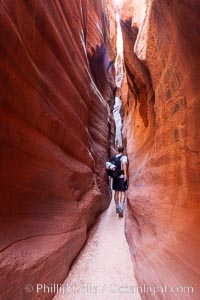
A hiker walking through the Wire Pass narrows. This exceedingly narrow slot canyon, in some places only two feet wide, is formed by water erosion which cuts slots deep into the surrounding sandstone plateau.
Location: Wire Pass, Paria Canyon-Vermilion Cliffs Wilderness, Arizona
Image ID: 20715
Location: Wire Pass, Paria Canyon-Vermilion Cliffs Wilderness, Arizona
Image ID: 20715
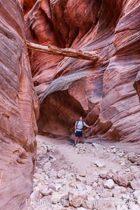
Suspended log in Buckskin Gulch. A hiker considers a heavy log stuck between the narrow walls of Buckskin Gulch, placed there by a flash flood some time in the past. Buckskin Gulch is the world's longest accessible slot canyon, forged by centuries of erosion through sandstone. Flash flooding is a serious danger in the narrows where there is no escape.
Location: Buckskin Gulch, Paria Canyon-Vermilion Cliffs Wilderness, Arizona
Image ID: 20717
Location: Buckskin Gulch, Paria Canyon-Vermilion Cliffs Wilderness, Arizona
Image ID: 20717
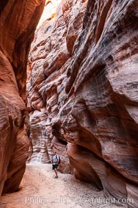
Hiker in Buckskin Gulch. A hiker considers the towering walls and narrow passageway of Buckskin Gulch, a dramatic slot canyon forged by centuries of erosion through sandstone. Buckskin Gulch is the worlds longest accessible slot canyon, running from the Paria River toward the Colorado River. Flash flooding is a serious danger in the narrows where there is no escape.
Location: Buckskin Gulch, Paria Canyon-Vermilion Cliffs Wilderness, Arizona
Image ID: 20772
Location: Buckskin Gulch, Paria Canyon-Vermilion Cliffs Wilderness, Arizona
Image ID: 20772
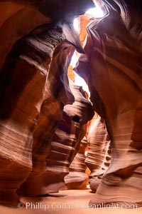
Upper Antelope Canyon, a spectacular slot canyon near Page, Arizona.
Location: Navajo Tribal Lands, Page, Arizona
Image ID: 36041
Location: Navajo Tribal Lands, Page, Arizona
Image ID: 36041
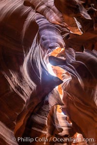
Upper Antelope Canyon, a spectacular slot canyon near Page, Arizona.
Location: Navajo Tribal Lands, Page, Arizona
Image ID: 36042
Location: Navajo Tribal Lands, Page, Arizona
Image ID: 36042
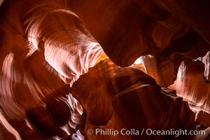
Upper Antelope Canyon, a spectacular slot canyon near Page, Arizona.
Location: Navajo Tribal Lands, Page, Arizona
Image ID: 36043
Location: Navajo Tribal Lands, Page, Arizona
Image ID: 36043
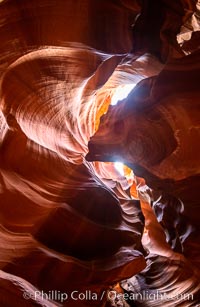
Upper Antelope Canyon, a spectacular slot canyon near Page, Arizona.
Location: Navajo Tribal Lands, Page, Arizona
Image ID: 36044
Location: Navajo Tribal Lands, Page, Arizona
Image ID: 36044
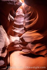
Upper Antelope Canyon, a spectacular slot canyon near Page, Arizona.
Location: Navajo Tribal Lands, Page, Arizona
Image ID: 36045
Location: Navajo Tribal Lands, Page, Arizona
Image ID: 36045
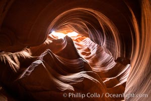
Upper Antelope Canyon, a spectacular slot canyon near Page, Arizona.
Location: Navajo Tribal Lands, Page, Arizona
Image ID: 36046
Location: Navajo Tribal Lands, Page, Arizona
Image ID: 36046
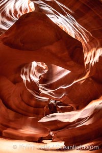
Upper Antelope Canyon, a spectacular slot canyon near Page, Arizona.
Location: Navajo Tribal Lands, Page, Arizona
Image ID: 36047
Location: Navajo Tribal Lands, Page, Arizona
Image ID: 36047
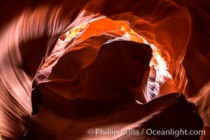
Upper Antelope Canyon, a spectacular slot canyon near Page, Arizona.
Location: Navajo Tribal Lands, Page, Arizona
Image ID: 36048
Location: Navajo Tribal Lands, Page, Arizona
Image ID: 36048
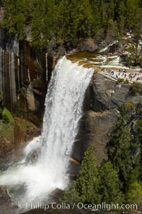
Vernal Falls at peak flow in late spring. Hikers are seen at the precipice to Vernal Falls, having hiked up the Mist Trail to get there.
Location: Vernal Falls, Yosemite National Park, California
Image ID: 12635
Location: Vernal Falls, Yosemite National Park, California
Image ID: 12635
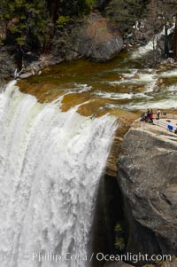
Vernal Falls at peak flow in late spring. Hikers are seen at the precipice to Vernal Falls, having hiked up the Mist Trail to get there.
Location: Vernal Falls, Yosemite National Park, California
Image ID: 12637
Location: Vernal Falls, Yosemite National Park, California
Image ID: 12637