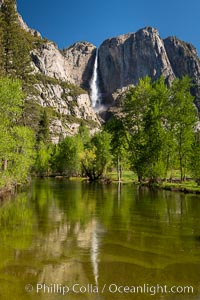
Yosemite Falls rises above the Merced River, viewed from the Swinging Bridge. The 2425' falls is the tallest in North America.
Location: Yosemite Falls, Yosemite National Park, California
Image ID: 34547
Panorama dimensions: 7921 x 5281
Location: Yosemite Falls, Yosemite National Park, California
Image ID: 34547
Panorama dimensions: 7921 x 5281
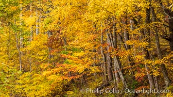
Blue Ridge Parkway Fall Colors, Asheville, North Carolina.
Location: Asheville, North Carolina
Image ID: 34639
Location: Asheville, North Carolina
Image ID: 34639
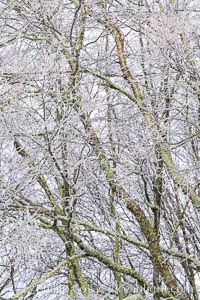
Early Snow and Late Blue Ridge Parkway Fall Colors, Asheville, North Carolina.
Location: Asheville, North Carolina
Image ID: 34645
Location: Asheville, North Carolina
Image ID: 34645
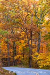
Blue Ridge Parkway Fall Colors, Asheville, North Carolina.
Location: Asheville, North Carolina
Image ID: 34646
Location: Asheville, North Carolina
Image ID: 34646

Early Snow and Late Blue Ridge Parkway Fall Colors, Asheville, North Carolina.
Location: Asheville, North Carolina
Image ID: 34653
Location: Asheville, North Carolina
Image ID: 34653
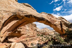
Hickman Bridge, Capitol Reef National Park.
Location: Capitol Reef National Park, Utah
Image ID: 37013
Location: Capitol Reef National Park, Utah
Image ID: 37013
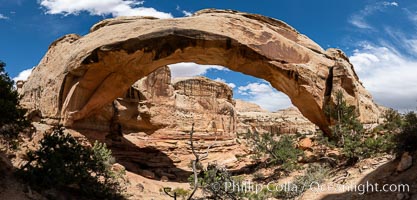
Hickman Bridge, Capitol Reef National Park.
Location: Capitol Reef National Park, Utah
Image ID: 37014
Panorama dimensions: 6222 x 12749
Location: Capitol Reef National Park, Utah
Image ID: 37014
Panorama dimensions: 6222 x 12749
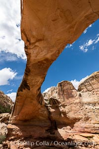
Hickman Bridge, Capitol Reef National Park.
Location: Capitol Reef National Park, Utah
Image ID: 37015
Location: Capitol Reef National Park, Utah
Image ID: 37015
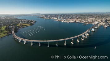
Aerial Photo of San Diego Coronado Bridge, known locally as the Coronado Bridge, links San Diego with Coronado, California. The bridge was completed in 1969 and was a toll bridge until 2002. It is 2.1 miles long and reaches a height of 200 feet above San Diego Bay. Coronado Island is to the left, and downtown San Diego is to the right in this view looking north.
Image ID: 30761
Image ID: 30761
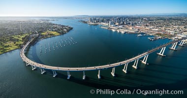
Aerial Photo of San Diego Coronado Bridge, known locally as the Coronado Bridge, links San Diego with Coronado, California. The bridge was completed in 1969 and was a toll bridge until 2002. It is 2.1 miles long and reaches a height of 200 feet above San Diego Bay. Coronado Island is to the left, and downtown San Diego is to the right in this view looking north.
Image ID: 30762
Image ID: 30762
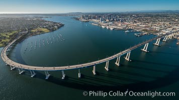
Aerial Photo of San Diego Coronado Bridge, known locally as the Coronado Bridge, links San Diego with Coronado, California. The bridge was completed in 1969 and was a toll bridge until 2002. It is 2.1 miles long and reaches a height of 200 feet above San Diego Bay. Coronado Island is to the left, and downtown San Diego is to the right in this view looking north.
Image ID: 30763
Image ID: 30763
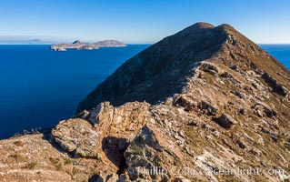
Summit Ridge of North Coronado Island, Baja California, Mexico.
Image ID: 36516
Image ID: 36516
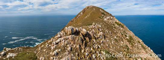
Summit Ridge of North Coronado Island, Baja California, Mexico.
Image ID: 36528
Panorama dimensions: 3536 x 9592
Image ID: 36528
Panorama dimensions: 3536 x 9592
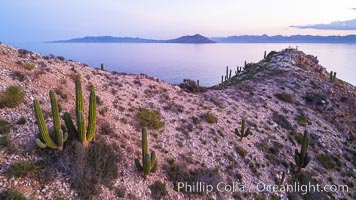
Summit Ridge of Isla San Diego, Aerial View, Sea of Cortez.
Location: Isla San Diego, Baja California, Mexico
Image ID: 33515
Location: Isla San Diego, Baja California, Mexico
Image ID: 33515
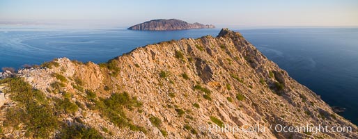
Summit Ridge of Isla San Diego, Aerial View, Sea of Cortez.
Location: Isla San Diego, Baja California, Mexico
Image ID: 33520
Panorama dimensions: 2827 x 7271
Location: Isla San Diego, Baja California, Mexico
Image ID: 33520
Panorama dimensions: 2827 x 7271
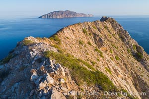
Summit Ridge of Isla San Diego, Aerial View, Sea of Cortez.
Location: Isla San Diego, Baja California, Mexico
Image ID: 33521
Location: Isla San Diego, Baja California, Mexico
Image ID: 33521
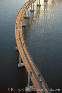
San Diego Coronado Bridge, known locally as the Coronado Bridge, links San Diego with Coronado, California. The bridge was completed in 1969 and was a toll bridge until 2002. It is 2.1 miles long and reaches a height of 200 feet above San Diego Bay.
Location: San Diego, California
Image ID: 22327
Location: San Diego, California
Image ID: 22327
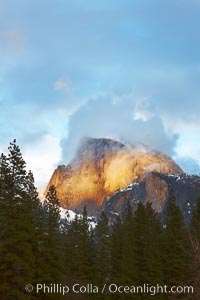
Half Dome and storm clouds at sunset, viewed from Sentinel Bridge.
Location: Half Dome, Yosemite National Park, California
Image ID: 22760
Location: Half Dome, Yosemite National Park, California
Image ID: 22760
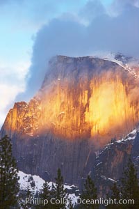
Half Dome and storm clouds at sunset, viewed from Sentinel Bridge.
Location: Half Dome, Yosemite National Park, California
Image ID: 22761
Location: Half Dome, Yosemite National Park, California
Image ID: 22761
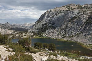
Spectacular Vogelsang Lake in Yosemite's High Sierra, with Fletcher Peak (11407') to the right and Choo-choo Ridge in the distance, near Vogelsang High Sierra Camp.
Location: Yosemite National Park, California
Image ID: 23214
Location: Yosemite National Park, California
Image ID: 23214
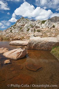
Alpine pond and ridge near Vogelsang Peak, near Vogelsang Pass (10685') in Yosemite's high country.
Location: Yosemite National Park, California
Image ID: 23215
Location: Yosemite National Park, California
Image ID: 23215
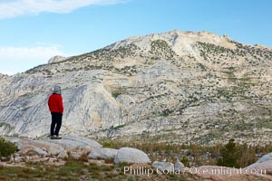
Choo-choo Ridge and Rafferty Peak, in Yosemite's high country, viewed from Vogelsang Lake.
Location: Yosemite National Park, California
Image ID: 23224
Location: Yosemite National Park, California
Image ID: 23224
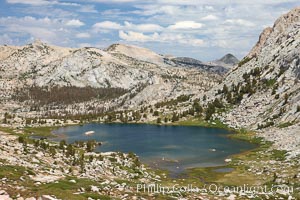
Spectacular Vogelsang Lake in Yosemite's High Sierra, with Fletcher Peak (11407') to the right and Choo-choo Ridge in the distance, near Vogelsang High Sierra Camp.
Location: Yosemite National Park, California
Image ID: 23226
Location: Yosemite National Park, California
Image ID: 23226

Panorama of Vogelsang basin, surrounding Vogelsang Lake in Yosemite's High Sierra, viewed from near Vogelsang Pass. Left is Vogelsang Peak (11516'), Choo-choo Ridge is in the distant middle, and the western flank of Fletcher Peak is to the right.
Location: Yosemite National Park, California
Image ID: 23231
Panorama dimensions: 5075 x 16023
Location: Yosemite National Park, California
Image ID: 23231
Panorama dimensions: 5075 x 16023
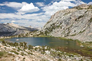
Spectacular Vogelsang Lake in Yosemite's High Sierra, with Fletcher Peak (10319') to the right and Choo-choo ridge in the distance, near Vogelsang High Sierra Camp.
Location: Yosemite National Park, California
Image ID: 23253
Location: Yosemite National Park, California
Image ID: 23253
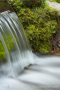
Fern Springs, a small natural spring in Yosemite Valley near the Pohono Bridge, trickles quietly over rocks as it flows into the Merced River. Yosemite Valley.
Location: Fern Springs, Yosemite National Park, California
Image ID: 16086
Location: Fern Springs, Yosemite National Park, California
Image ID: 16086
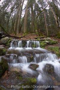
Fern Springs, a small natural spring in Yosemite Valley near the Pohono Bridge, trickles quietly over rocks as it flows into the Merced River.
Location: Fern Springs, Yosemite National Park, California
Image ID: 22754
Location: Fern Springs, Yosemite National Park, California
Image ID: 22754
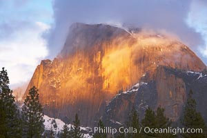
Half Dome and storm clouds at sunset, viewed from Sentinel Bridge.
Location: Half Dome, Yosemite National Park, California
Image ID: 22762
Location: Half Dome, Yosemite National Park, California
Image ID: 22762
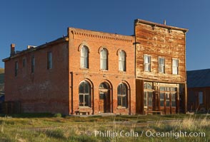
Main Street buildings, Dechambeau Hotel (left) and I.O.O.F. Hall (right).
Location: Bodie State Historical Park, California
Image ID: 23104
Location: Bodie State Historical Park, California
Image ID: 23104
