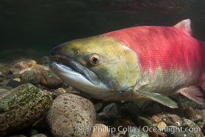
Adams River sockeye salmon. A female sockeye salmon swims upstream in the Adams River to spawn, having traveled hundreds of miles upstream from the ocean.
Species: Sockeye salmon, Oncorhynchus nerka
Location: Adams River, Roderick Haig-Brown Provincial Park, British Columbia, Canada
Image ID: 26157
Species: Sockeye salmon, Oncorhynchus nerka
Location: Adams River, Roderick Haig-Brown Provincial Park, British Columbia, Canada
Image ID: 26157
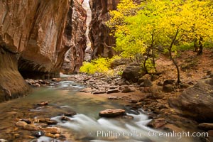
The Virgin River flows by autumn cottonwood trees, part of the Virgin River Narrows. This is a fantastic hike in fall with the comfortable temperatures, beautiful fall colors and light crowds.
Location: Virgin River Narrows, Zion National Park, Utah
Image ID: 26098
Location: Virgin River Narrows, Zion National Park, Utah
Image ID: 26098
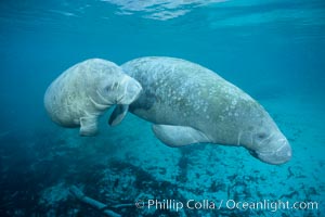
Two Florida manatees, or West Indian Manatees, swim together in the clear waters of Crystal River. Florida manatees are endangered.
Species: West indian manatee, Trichechus manatus
Location: Three Sisters Springs, Crystal River, Florida
Image ID: 02628
Species: West indian manatee, Trichechus manatus
Location: Three Sisters Springs, Crystal River, Florida
Image ID: 02628
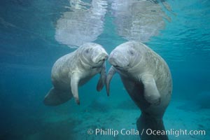
Two Florida manatees, or West Indian Manatees, swim together in the clear waters of Crystal River. Florida manatees are endangered.
Species: West indian manatee, Trichechus manatus
Location: Three Sisters Springs, Crystal River, Florida
Image ID: 02629
Species: West indian manatee, Trichechus manatus
Location: Three Sisters Springs, Crystal River, Florida
Image ID: 02629
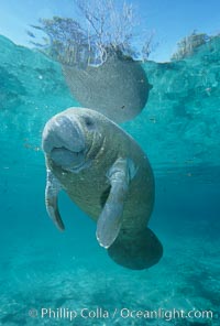
A Florida manatee, or West Indian Manatee, hovers in the clear waters of Crystal River.
Species: West indian manatee, Trichechus manatus
Location: Three Sisters Springs, Crystal River, Florida
Image ID: 02653
Species: West indian manatee, Trichechus manatus
Location: Three Sisters Springs, Crystal River, Florida
Image ID: 02653
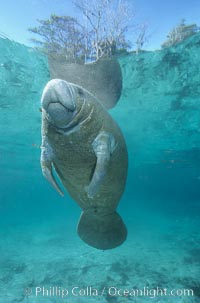
A Florida manatee, or West Indian Manatee, hovers in the clear waters of Crystal River.
Species: West indian manatee, Trichechus manatus
Location: Three Sisters Springs, Crystal River, Florida
Image ID: 02654
Species: West indian manatee, Trichechus manatus
Location: Three Sisters Springs, Crystal River, Florida
Image ID: 02654
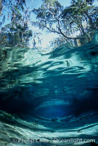
Three Sisters Springs depicted in an underwater landscape with sand, clear water and trees.
Location: Three Sisters Springs, Crystal River, Florida
Image ID: 02673
Location: Three Sisters Springs, Crystal River, Florida
Image ID: 02673
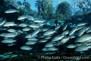
Mangrove snapper schooling in the clear waters of Crystal River, with trees in the background.
Species: Mangrove snapper, Lutjanus griseus
Location: Three Sisters Springs, Crystal River, Florida
Image ID: 02688
Species: Mangrove snapper, Lutjanus griseus
Location: Three Sisters Springs, Crystal River, Florida
Image ID: 02688
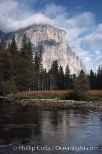
El Capitan and Merced River, Yosemite Valley.
Location: El Capitan, Yosemite National Park, California
Image ID: 05413
Location: El Capitan, Yosemite National Park, California
Image ID: 05413
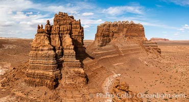
Molly's Castle, aerial view, Goblin Valley State Park. Curtis Formation whiteish caprock is on top, with reddish Entrada Sandstone below, both of Jurassic era. Molly's castle lies in the San Rafael desert near Goblin Valley, and drains into the Colorado River watershed. Aerial panoramic photograph.
Location: Goblin Valley State Park, Utah
Image ID: 37950
Location: Goblin Valley State Park, Utah
Image ID: 37950
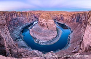
Belt of Venus over Horseshoe Bend on the Colorado River. The Colorado River makes a 180-degree turn at Horseshoe Bend. Here the river has eroded the Navajo sandstone for eons, digging a canyon 1100-feet deep. The Belt of Venus, or anti-twilight arch, is the shadow of the earth cast upon the atmosphere just above the horizon, and occurs a few minutes before sunrise or after sunset.
Location: Page, Arizona
Image ID: 37781
Panorama dimensions: 5719 x 8788
Location: Page, Arizona
Image ID: 37781
Panorama dimensions: 5719 x 8788
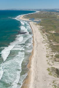
Aerial Photo of Tijuana River Mouth SMCA. Tijuana River Mouth State Marine Conservation Area borders Imperial Beach and the Mexican Border.
Location: Imperial Beach, California
Image ID: 30649
Location: Imperial Beach, California
Image ID: 30649
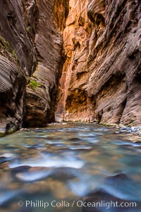
The Virgin River Narrows, where the Virgin River has carved deep, narrow canyons through the Zion National Park sandstone, creating one of the finest hikes in the world.
Location: Virgin River Narrows, Zion National Park, Utah
Image ID: 28578
Location: Virgin River Narrows, Zion National Park, Utah
Image ID: 28578
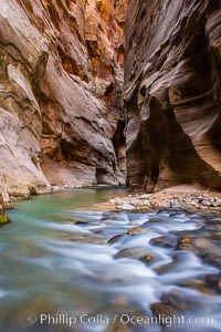
The Virgin River Narrows, where the Virgin River has carved deep, narrow canyons through the Zion National Park sandstone, creating one of the finest hikes in the world.
Location: Virgin River Narrows, Zion National Park, Utah
Image ID: 28579
Location: Virgin River Narrows, Zion National Park, Utah
Image ID: 28579
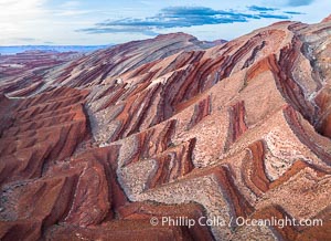
Aerial Photo of Raplee Ridge near Mexican Hat, Utah. Raplee Ridge is a spectacular series of multicolored triangular flatirons near the San Juan River. Often called "the Raplee Anticline" the geologic structure is in fact better described as a monocline, according to the Utah Geological Survey.
Location: Mexican Hat, Utah
Image ID: 39490
Location: Mexican Hat, Utah
Image ID: 39490
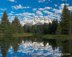
The Grand Tetons, reflected in the glassy waters of the Snake River at Schwabacher Landing, on a beautiful summer morning.
Location: Grand Teton National Park, Wyoming
Image ID: 26923
Panorama dimensions: 5318 x 6689
Location: Grand Teton National Park, Wyoming
Image ID: 26923
Panorama dimensions: 5318 x 6689

Saint Peter's Basilica over the Tiber River, Vatican City.
Location: Vatican City, Rome, Italy
Image ID: 35547
Location: Vatican City, Rome, Italy
Image ID: 35547
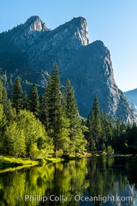
Three Brothers and Merced River in spring, Yosemite National Park.
Location: Yosemite National Park, California
Image ID: 36354
Location: Yosemite National Park, California
Image ID: 36354
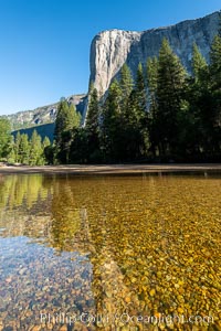
El Capitan and the Merced River, early morning, Yosemite National Park.
Location: Yosemite National Park, California
Image ID: 36355
Location: Yosemite National Park, California
Image ID: 36355
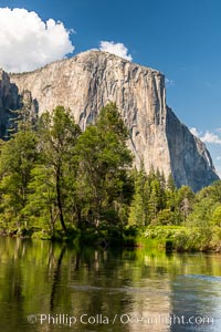
El Capitan and the Merced River in spring, Yosemite National Park.
Location: Yosemite National Park, California
Image ID: 36377
Location: Yosemite National Park, California
Image ID: 36377
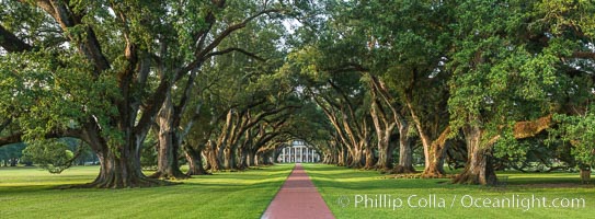
Oak Alley Plantation and its famous shaded tunnel of 300-year-old southern live oak trees (Quercus virginiana). The plantation is now designated as a National Historic Landmark.
Species: Southern live oak, Quercus virginiana
Location: Oak Alley Plantation, Vacherie, Louisiana
Image ID: 31018
Panorama dimensions: 6564 x 17803
Species: Southern live oak, Quercus virginiana
Location: Oak Alley Plantation, Vacherie, Louisiana
Image ID: 31018
Panorama dimensions: 6564 x 17803
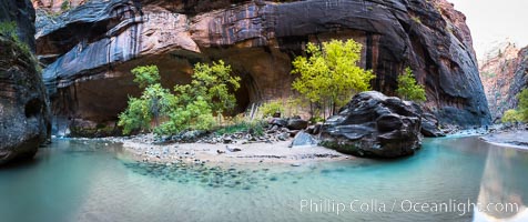
Fall Colors in the Virgin River Narrows, Zion National Park, Utah.
Location: Virgin River Narrows, Zion National Park, Utah
Image ID: 32635
Panorama dimensions: 4795 x 11405
Location: Virgin River Narrows, Zion National Park, Utah
Image ID: 32635
Panorama dimensions: 4795 x 11405
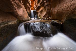
Kanarra Creek Falls in Kanarra Canyon, Utah.
Location: Kanarra Creek, Kanarraville, Utah
Image ID: 32644
Location: Kanarra Creek, Kanarraville, Utah
Image ID: 32644
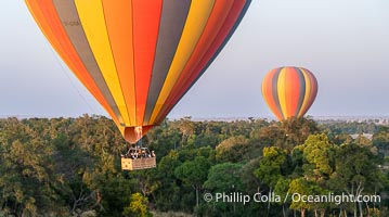
Ballooning over the Maasai Mara National Reserve and Mara River, Kenya.
Location: Maasai Mara National Reserve, Kenya
Image ID: 39614
Location: Maasai Mara National Reserve, Kenya
Image ID: 39614
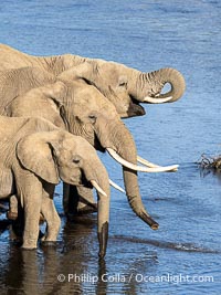
African Elephants Drinking from the Mara River, Mara Triangle, Kenya.
Species: African elephant, Loxodonta africana
Location: Maasai Mara National Reserve, Kenya
Image ID: 39648
Species: African elephant, Loxodonta africana
Location: Maasai Mara National Reserve, Kenya
Image ID: 39648
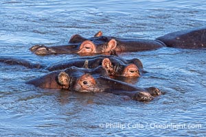
Hippos, Mara River.
Species: Hippopotamus, Hippopotamus amphibius
Location: Maasai Mara National Reserve, Kenya
Image ID: 39649
Species: Hippopotamus, Hippopotamus amphibius
Location: Maasai Mara National Reserve, Kenya
Image ID: 39649
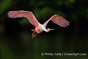
Roseate Spoonbill in Flight, Platalea ajaja, Alafia Banks, Florida.
Species: Roseate Spoonbill, Platalea ajaja
Location: Alafia Banks Critical Wildlife Area, Tampa, Florida
Image ID: 40542
Species: Roseate Spoonbill, Platalea ajaja
Location: Alafia Banks Critical Wildlife Area, Tampa, Florida
Image ID: 40542
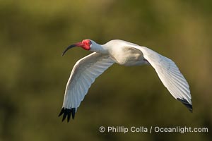
White Ibis in flight, Eudocimus albus, Alafia Banks, Florida.
Species: White Ibis, Eudocimus albus
Location: Alafia Banks Critical Wildlife Area, Tampa, Florida
Image ID: 40546
Species: White Ibis, Eudocimus albus
Location: Alafia Banks Critical Wildlife Area, Tampa, Florida
Image ID: 40546
