
San Diego Marriott Hotel and Marina, and Manchester Grand Hyatt Hotel (left) viewed from the San Diego Embarcadero Marine Park, sunrise.
Location: San Diego, California
Image ID: 28820
Panorama dimensions: 5720 x 18590
Location: San Diego, California
Image ID: 28820
Panorama dimensions: 5720 x 18590

San Diego City Skyline viewed from Harbor Island, storm clouds at sunrise.
Location: San Diego, California
Image ID: 28844
Panorama dimensions: 5693 x 16813
Location: San Diego, California
Image ID: 28844
Panorama dimensions: 5693 x 16813
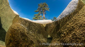
Split view of Trees and Underwater Boulders, Lake Tahoe, Nevada.
Location: Lake Tahoe, Nevada
Image ID: 32331
Location: Lake Tahoe, Nevada
Image ID: 32331
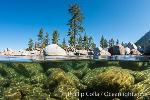
Split view of Trees and Underwater Boulders, Lake Tahoe, Nevada.
Location: Lake Tahoe, Nevada
Image ID: 32339
Location: Lake Tahoe, Nevada
Image ID: 32339
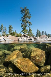
Split view of Trees and Underwater Boulders, Lake Tahoe, Nevada.
Location: Lake Tahoe, Nevada
Image ID: 32341
Location: Lake Tahoe, Nevada
Image ID: 32341
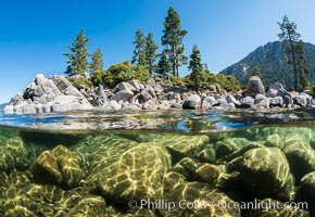
Split view of Trees and Underwater Boulders, Lake Tahoe, Nevada.
Location: Lake Tahoe, Nevada
Image ID: 32353
Location: Lake Tahoe, Nevada
Image ID: 32353
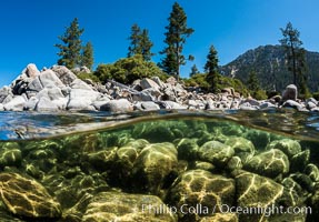
Split view of Trees and Underwater Boulders, Lake Tahoe, Nevada.
Location: Lake Tahoe, Nevada
Image ID: 32355
Location: Lake Tahoe, Nevada
Image ID: 32355
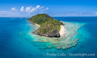
Aerial View of Namena Island, Fiji.
Location: Namena Marine Reserve, Namena Island, Fiji
Image ID: 34685
Location: Namena Marine Reserve, Namena Island, Fiji
Image ID: 34685
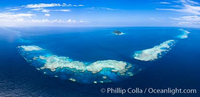
Aerial View of Namena Marine Reserve and Coral Reefs, Namena Island, Fiji.
Location: Namena Marine Reserve, Namena Island, Fiji
Image ID: 34686
Panorama dimensions: 5617 x 11605
Location: Namena Marine Reserve, Namena Island, Fiji
Image ID: 34686
Panorama dimensions: 5617 x 11605
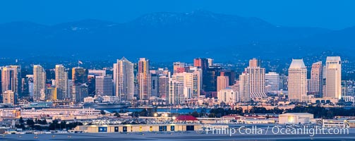
San Diego City Skyline at Sunset, viewed from Point Loma, panoramic photograph.
Location: San Diego, California
Image ID: 36762
Panorama dimensions: 5455 x 13702
Location: San Diego, California
Image ID: 36762
Panorama dimensions: 5455 x 13702

Carlsbad Coast at Sunset, Terramar and the Oceanside Pier, with Camp Pendleton and the San Onofre power plant in the distance on this incredibly clean and crisp evening view. Rising in the distance is San Onofre Mountain (1722') topped by a tall signal tower, one of the southern peaks in the Santa Ana Mountains.
Location: Carlsbad, California
Image ID: 37482
Panorama dimensions: 1106 x 3500
Location: Carlsbad, California
Image ID: 37482
Panorama dimensions: 1106 x 3500
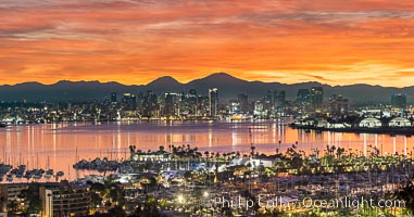
Spectacular Sunrise over San Diego Bay and Downtown San Diego. Mount San Miguel and Mount Lyons in the distance. Shelter Island in the foreground. Viewed from Point Loma.
Image ID: 38892
Panorama dimensions: 8187 x 15600
Image ID: 38892
Panorama dimensions: 8187 x 15600

UCSD University of California San Diego, viewed from Mount Soledad, Panoramic Photo.
Location: La Jolla, California
Image ID: 36667
Panorama dimensions: 5734 x 24048
Location: La Jolla, California
Image ID: 36667
Panorama dimensions: 5734 x 24048
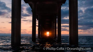
Scripps Pier solstice, surfer's view from among the waves, sunset aligned perfectly with the pier. Research pier at Scripps Institution of Oceanography SIO, sunset.
Location: Scripps Institution of Oceanography, La Jolla, California
Image ID: 30150
Location: Scripps Institution of Oceanography, La Jolla, California
Image ID: 30150

Hotel Del Coronado and Coronado Island City Skyline, viewed from Point Loma, panoramic photograph.
Location: San Diego, California
Image ID: 30202
Panorama dimensions: 5494 x 21430
Location: San Diego, California
Image ID: 30202
Panorama dimensions: 5494 x 21430
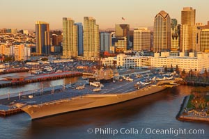
Downtown San Diego and USS Midway. The USS Midway was a US Navy aircraft carrier, launched in 1945 and active through the Vietnam War and Operation Desert Storm, as of 2008 a museum along the downtown waterfront in San Diego.
Location: San Diego, California
Image ID: 22289
Location: San Diego, California
Image ID: 22289
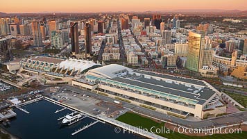
San Diego Convention Center, located in the Marina District of downtown San Diego. Built in 1989, the San Diego Convention Center offers 525,700 square feet of exhibit space. It is noted for its distinctive "sails" made of Teflon-coated fiberglass suspended over the central exhibition hall, aptly named Sails Pavilion.
Location: San Diego, California
Image ID: 22290
Location: San Diego, California
Image ID: 22290
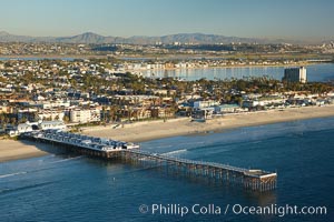
Crystal Pier, 872 feet long and built in 1925, extends out into the Pacific Ocean from the town of Pacific Beach. Mission Bay and downtown San Diego are seen in the distance.
Location: San Diego, California
Image ID: 22294
Location: San Diego, California
Image ID: 22294
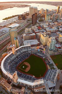
Downtown San Diego and Petco Park, viewed from the southeast.
Location: San Diego, California
Image ID: 22300
Location: San Diego, California
Image ID: 22300
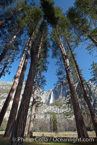
Yosemite Falls and tall pine trees, viewed from Cook's Meadow.
Location: Yosemite Falls, Yosemite National Park, California
Image ID: 22746
Location: Yosemite Falls, Yosemite National Park, California
Image ID: 22746
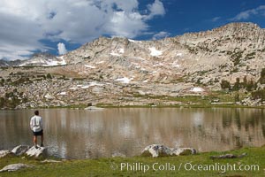
Hiker views Vogelsang Lake, and Vogelsang Peak (11516') at sunrise in Yosemite's High Sierra.
Location: Yosemite National Park, California
Image ID: 23201
Location: Yosemite National Park, California
Image ID: 23201
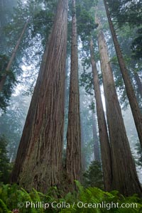
Giant redwood, Lady Bird Johnson Grove, Redwood National Park. The coastal redwood, or simply 'redwood', is the tallest tree on Earth, reaching a height of 379' and living 3500 years or more. It is native to coastal California and the southwestern corner of Oregon within the United States, but most concentrated in Redwood National and State Parks in Northern California, found close to the coast where moisture and soil conditions can support its unique size and growth requirements.
Species: California redwood, Coast redwood, Giant redwood, Sequoia sempervirens
Location: Redwood National Park, California
Image ID: 25795
Species: California redwood, Coast redwood, Giant redwood, Sequoia sempervirens
Location: Redwood National Park, California
Image ID: 25795
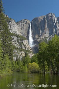
Yosemite Falls rises above the Merced River, viewed from the Swinging Bridge. The 2425 falls is the tallest in North America. Yosemite Valley.
Location: Yosemite Falls, Yosemite National Park, California
Image ID: 16143
Location: Yosemite Falls, Yosemite National Park, California
Image ID: 16143
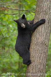
Black bear in a tree. Black bears are expert tree climbers and will ascend trees if they sense danger or the approach of larger bears, to seek a place to rest, or to get a view of their surroundings.
Species: American black bear, Ursus americanus
Location: Orr, Minnesota
Image ID: 18745
Species: American black bear, Ursus americanus
Location: Orr, Minnesota
Image ID: 18745
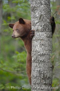
Black bear in a tree. Black bears are expert tree climbers and will ascend trees if they sense danger or the approach of larger bears, to seek a place to rest, or to get a view of their surroundings.
Species: American black bear, Ursus americanus
Location: Orr, Minnesota
Image ID: 18747
Species: American black bear, Ursus americanus
Location: Orr, Minnesota
Image ID: 18747

Young brown bear stands in tall sedge grass to get a better view of other approaching bears.
Species: Brown bear, Ursus arctos
Location: Lake Clark National Park, Alaska
Image ID: 19143
Species: Brown bear, Ursus arctos
Location: Lake Clark National Park, Alaska
Image ID: 19143
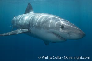
A great white shark swims toward the photographer. Perhaps the shark is considering him as possible prey? The photographer, a "shark diver" is safely situated in a sturdy metal cage. The best location in the world to "shark dive" to view great white sharks is Mexico's Guadalupe Island.
Species: Great white shark, Carcharodon carcharias
Location: Guadalupe Island (Isla Guadalupe), Baja California, Mexico
Image ID: 19457
Species: Great white shark, Carcharodon carcharias
Location: Guadalupe Island (Isla Guadalupe), Baja California, Mexico
Image ID: 19457
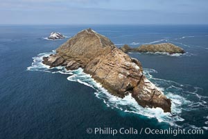
Middle Coronado Island, viewed from the south.
Location: Coronado Islands (Islas Coronado), Baja California, Mexico
Image ID: 21322
Location: Coronado Islands (Islas Coronado), Baja California, Mexico
Image ID: 21322
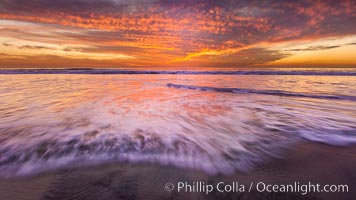
Sunset and incoming surf, gorgeous colors in the sky and on the ocean at dusk, the incoming waves are blurred in this long exposure.
Location: Carlsbad, California
Image ID: 27156
Location: Carlsbad, California
Image ID: 27156
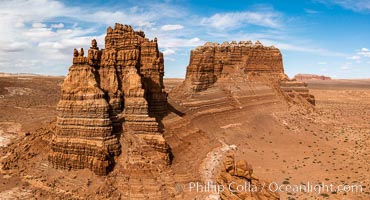
Molly's Castle, aerial view, Goblin Valley State Park. Curtis Formation whiteish caprock is on top, with reddish Entrada Sandstone below, both of Jurassic era. Molly's castle lies in the San Rafael desert near Goblin Valley, and drains into the Colorado River watershed. Aerial panoramic photograph.
Location: Goblin Valley State Park, Utah
Image ID: 37950
Location: Goblin Valley State Park, Utah
Image ID: 37950