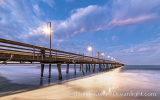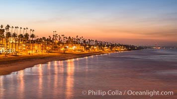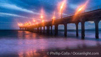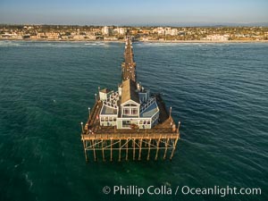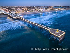
Aerial photo of Crystal Pier with Holiday Christmas Lights at night. The Crystal Pier, Holiday Lights and Pacific Ocean at sunset, waves blur as they crash upon the sand. Crystal Pier, 872 feet long and built in 1925, extends out into the Pacific Ocean from the town of Pacific Beach.
Location: Pacific Beach, California
Image ID: 39999
Location: Pacific Beach, California
Image ID: 39999
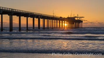
Scripps Pier at sunset.
Location: Scripps Institution of Oceanography, La Jolla, California
Image ID: 29171
Location: Scripps Institution of Oceanography, La Jolla, California
Image ID: 29171
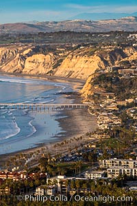
La Jolla Shores Coastline and Scripps Pier, Blacks Beach and Torrey Pines, aerial photo, sunset.
Location: La Jolla, California
Image ID: 36671
Location: La Jolla, California
Image ID: 36671
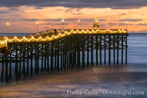
The Crystal Pier, Holiday Lights and Pacific Ocean at sunset, waves blur as they crash upon the sand. Crystal Pier, 872 feet long and built in 1925, extends out into the Pacific Ocean from the town of Pacific Beach.
Image ID: 37562
Image ID: 37562
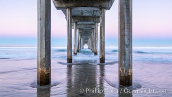
Scripps Institution of Oceanography Pier and Belt of Venus in pre-dawn light. The Earth's shadow appears as the blue just above the horizon.
Location: Scripps Institution of Oceanography, La Jolla, California
Image ID: 37697
Location: Scripps Institution of Oceanography, La Jolla, California
Image ID: 37697
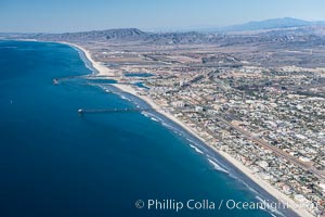
Coastal Oceanside, including Oceanside Pier and Oceanside Harbor, view toward the north showing Camp Pendleton in the distance, aerial photo.
Location: Oceanside, California
Image ID: 29073
Location: Oceanside, California
Image ID: 29073
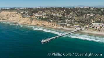
Aerial Photo of San Diego Scripps Coastal SMCA. Scripps Institution of Oceanography Research Pier.
Location: Scripps Institution of Oceanography, La Jolla, California
Image ID: 30627
Location: Scripps Institution of Oceanography, La Jolla, California
Image ID: 30627
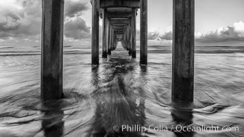
Scripps Pier and moving water, pre-dawn light, La Jolla.
Location: La Jolla, California
Image ID: 30181
Location: La Jolla, California
Image ID: 30181
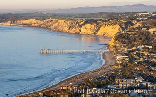
La Jolla Shores Coastline and Scripps Pier, Blacks Beach and Torrey Pines, aerial photo, sunset.
Location: La Jolla, California
Image ID: 37485
Location: La Jolla, California
Image ID: 37485
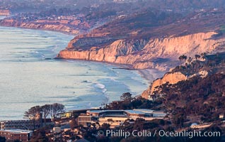
La Jolla Shores Coastline and Scripps Pier, Blacks Beach and Torrey Pines, from Mount Soledad, sunset.
Location: La Jolla, California
Image ID: 37494
Location: La Jolla, California
Image ID: 37494
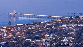
Scripps Pier and Christmas Lights from Mount Soledad.
Location: La Jolla, California
Image ID: 37495
Location: La Jolla, California
Image ID: 37495

Mission Bay, Ocean Beach, Point Loma, OB Pier, Mission Bay Channel and Coronado islands, at night.
Location: San Diego, California
Image ID: 37497
Panorama dimensions: 1070 x 3500
Location: San Diego, California
Image ID: 37497
Panorama dimensions: 1070 x 3500
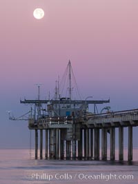
Full Moon Setting Over SIO Pier in the moments just before sunrise, Scripps Institution of Oceanography.
Location: Scripps Institution of Oceanography, La Jolla, California
Image ID: 37507
Location: Scripps Institution of Oceanography, La Jolla, California
Image ID: 37507
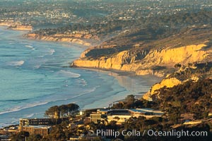
La Jolla Shores Coastline and Scripps Pier, aerial photo, sunset.
Location: La Jolla, California
Image ID: 36655
Panorama dimensions: 5672 x 8508
Location: La Jolla, California
Image ID: 36655
Panorama dimensions: 5672 x 8508
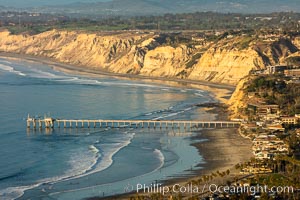
La Jolla Shores Coastline and Scripps Pier, Blacks Beach and Torrey Pines, aerial photo, sunset.
Location: La Jolla, California
Image ID: 36668
Panorama dimensions: 5698 x 8547
Location: La Jolla, California
Image ID: 36668
Panorama dimensions: 5698 x 8547

Scripps Pier and Blacks Beach, Sunset, Panorama. The Gold Coast of La Jolla basks in warm serene light as the sun sets over the Pacific Ocean.
Location: La Jolla, California
Image ID: 36674
Panorama dimensions: 8699 x 28127
Location: La Jolla, California
Image ID: 36674
Panorama dimensions: 8699 x 28127
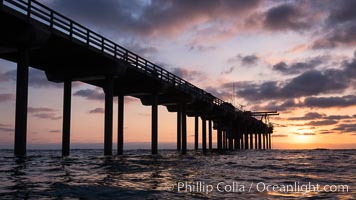
Scripps Pier, Surfer's view from among the waves. Research pier at Scripps Institution of Oceanography SIO, sunset.
Location: Scripps Institution of Oceanography, La Jolla, California
Image ID: 30148
Location: Scripps Institution of Oceanography, La Jolla, California
Image ID: 30148
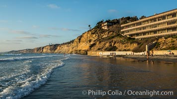
Black's Beach sea cliffs, sunset, looking north from Scripps Pier with Torrey Pines State Reserve in the distance.
Location: Scripps Institution of Oceanography, La Jolla, California
Image ID: 30153
Location: Scripps Institution of Oceanography, La Jolla, California
Image ID: 30153
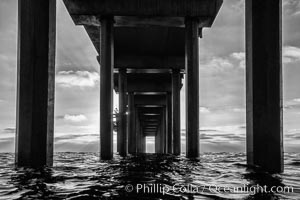
Scripps Pier, Surfer's view from among the waves. Research pier at Scripps Institution of Oceanography SIO, sunset.
Location: Scripps Institution of Oceanography, La Jolla, California
Image ID: 30156
Location: Scripps Institution of Oceanography, La Jolla, California
Image ID: 30156
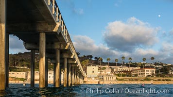
Scripps Pier, Surfer's view from among the waves. Research pier at Scripps Institution of Oceanography SIO, sunset.
Location: Scripps Institution of Oceanography, La Jolla, California
Image ID: 30159
Location: Scripps Institution of Oceanography, La Jolla, California
Image ID: 30159
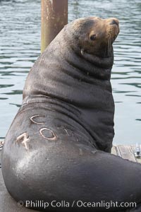
A bull sea lion shows a brand burned into its hide by the Oregon Department of Fish and Wildlife, to monitor it from season to season as it travels between California, Oregon and Washington. Some California sea lions, such as this one C-704, prey upon migrating salmon that gather in the downstream waters and fish ladders of Bonneville Dam on the Columbia River. The "C" in its brand denotes Columbia River. These sea lions also form bachelor colonies that haul out on public docks in Astoria's East Mooring Basin and elsewhere, where they can damage or even sink docks.
Species: California sea lion, Zalophus californianus
Location: Columbia River, Astoria, Oregon
Image ID: 19419
Species: California sea lion, Zalophus californianus
Location: Columbia River, Astoria, Oregon
Image ID: 19419
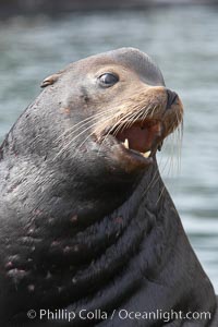
Sea lion head profile, showing small external ear, prominant forehead typical of adult males, whiskers. This sea lion is hauled out on public docks in Astoria's East Mooring Basin. This bachelor colony of adult males takes up residence for several weeks in late summer on public docks in Astoria after having fed upon migrating salmon in the Columbia River. The sea lions can damage or even sink docks and some critics feel that they cost the city money in the form of lost dock fees.
Species: California sea lion, Zalophus californianus
Location: Columbia River, Astoria, Oregon
Image ID: 19420
Species: California sea lion, Zalophus californianus
Location: Columbia River, Astoria, Oregon
Image ID: 19420
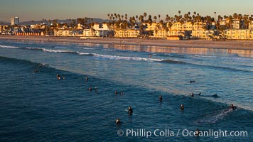
The coast of Oceanside California, waves and surfers, beach houses, just before sunset, winter, looking north.
Location: Oceanside Pier, California
Image ID: 27605
Location: Oceanside Pier, California
Image ID: 27605
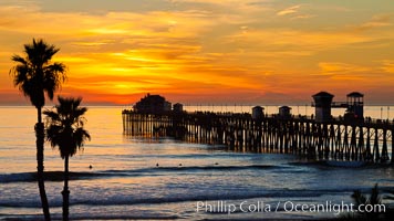
Oceanside Pier at sunset, clouds and palm trees with a brilliant sky at dusk.
Location: Oceanside Pier, California
Image ID: 27612
Location: Oceanside Pier, California
Image ID: 27612
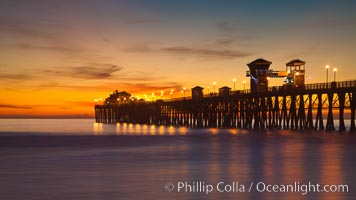
Oceanside Pier at sunset, clouds with a brilliant sky at dusk, the lights on the pier are lit.
Location: Oceanside Pier, California
Image ID: 27617
Location: Oceanside Pier, California
Image ID: 27617
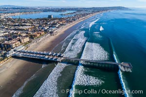
Crystal Pier and Pacific Beach coastline, Mission Bay, Point Loma and San Diego visible in the distance, aerial photo.
Location: Pacific Beach, California
Image ID: 37975
Location: Pacific Beach, California
Image ID: 37975
