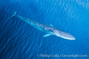
Fin whale showing distinctive white right jaw, aerial photo.
Image ID: 38078
Image ID: 38078
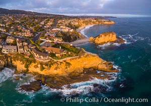
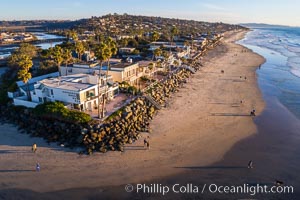
Laguna Beach Coastline including Views South to Three Arch Bay, Aerial Photo.
Location: Laguna Beach, California
Image ID: 38082
Location: Laguna Beach, California
Image ID: 38082
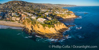
Laguna Beach Coastline, north of Crescent Point, Aerial Photo.
Location: Laguna Beach, California
Image ID: 38150
Location: Laguna Beach, California
Image ID: 38150
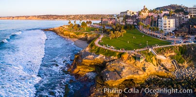
Aerial Photo of Point La Jolla and Scripps Park, La Jolla Coastline.
Location: La Jolla, California
Image ID: 38152
Location: La Jolla, California
Image ID: 38152
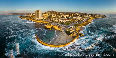
Childrens Pool Aerial Panoramic Photo at Sunset, people enjoying the sunset on the sea wall and the protected beach, Coast Boulevard in the foreground, Mount Soledad in the distance.
Location: La Jolla, California
Image ID: 38208
Panorama dimensions: 5582 x 11191
Location: La Jolla, California
Image ID: 38208
Panorama dimensions: 5582 x 11191
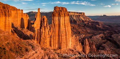
Fisher Towers at sunset, near Moab, Utah. Fisher Towers are a series of towers made of Cutler sandstone capped with Moenkopi sandstone and caked with a stucco of red mud located near Moab, Utah.
Location: Fisher Towers, Moab, Utah
Image ID: 38225
Location: Fisher Towers, Moab, Utah
Image ID: 38225
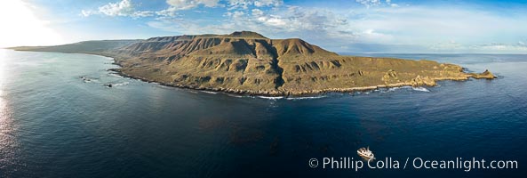
San Clemente Island aerial photo, Pyramid Head and Balanced Rock at the southern end of the island. San Clemente Island Pyramid Head, the distinctive pyramid shaped southern end of the island, exhibits distinctive geologic terracing, underwater reefs and giant kelp forests.
Location: San Clemente Island, California
Image ID: 38485
Panorama dimensions: 4232 x 12542
Location: San Clemente Island, California
Image ID: 38485
Panorama dimensions: 4232 x 12542
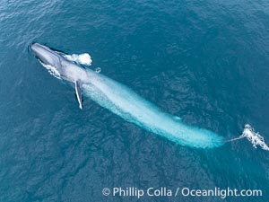
Aerial photo of blue whale near San Diego as it swims on its side turning and blows a bubble of air out of its blowhole. This enormous blue whale glides at the surface of the ocean, resting and breathing before it dives to feed on subsurface krill.
Species: Blue whale, Balaenoptera musculus
Location: San Diego, California
Image ID: 39427
Species: Blue whale, Balaenoptera musculus
Location: San Diego, California
Image ID: 39427
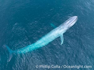
Aerial photo of blue whale near San Diego. This enormous blue whale glides at the surface of the ocean, resting and breathing before it dives to feed on subsurface krill.
Species: Blue whale, Balaenoptera musculus
Location: San Diego, California
Image ID: 39428
Species: Blue whale, Balaenoptera musculus
Location: San Diego, California
Image ID: 39428
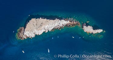
Los Islotes, famous for its friendly colony of California sea lions, part of Archipelago Espiritu Santo, Sea of Cortez, Aerial Photo.
Location: Los Islotes, Baja California, Mexico
Image ID: 32409
Location: Los Islotes, Baja California, Mexico
Image ID: 32409
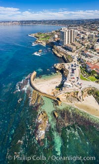
Childrens Pool Reef Exposed at Extreme Low Tide, Aerial View, La Jolla, California. Aerial panoramic photograph.
Location: La Jolla, California
Image ID: 37942
Location: La Jolla, California
Image ID: 37942
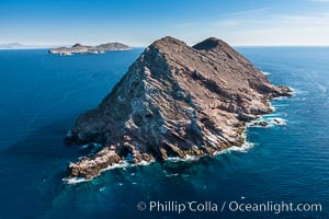
North Coronado Island, Mexico, northern point looking south with Middle and South Islands in the distance, aerial photograph.
Location: Coronado Islands (Islas Coronado), Baja California, Mexico
Image ID: 29052
Location: Coronado Islands (Islas Coronado), Baja California, Mexico
Image ID: 29052
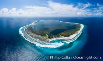
Aerial panorama of Clipperton Island, showing the entire atoll. Clipperton Island, a minor territory of France also known as Ile de la Passion, is a small (2.3 sq mi) but spectacular coral atoll in the eastern Pacific. By permit HC / 1485 / CAB (France).
Location: Clipperton Island, France
Image ID: 32835
Panorama dimensions: 5523 x 9328
Location: Clipperton Island, France
Image ID: 32835
Panorama dimensions: 5523 x 9328
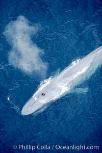
Blue whale, exhaling in a huge blow as it swims at the surface between deep dives. The blue whale's blow is a combination of water spray from around its blowhole and condensation from its warm breath.
Species: Blue whale, Balaenoptera musculus
Location: La Jolla, California
Image ID: 21253
Species: Blue whale, Balaenoptera musculus
Location: La Jolla, California
Image ID: 21253
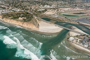
Aerial photo of San Dieguito Lagoon and Dog Beach. San Dieguito Lagoon State Marine Conservation Area (SMCA) is a marine protected area near Del Mar in San Diego County.
Location: Del Mar, California
Image ID: 30604
Location: Del Mar, California
Image ID: 30604
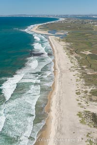
Aerial Photo of Tijuana River Mouth SMCA. Tijuana River Mouth State Marine Conservation Area borders Imperial Beach and the Mexican Border.
Location: Imperial Beach, California
Image ID: 30649
Location: Imperial Beach, California
Image ID: 30649
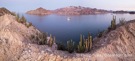
Cardon Cactus grow on Isla Angel de la Guarda at Sunset, Aerial Photo, Sea of Cortez, Mexico. Guardian Angel island is part of the Midriff Islands in Mexico's Sea of Cortez.
Species: Cardon cactus, Elephant cactus, Pachycereus pringlei
Location: Isla Angel de la Guarda, Baja California, Mexico
Image ID: 40340
Species: Cardon cactus, Elephant cactus, Pachycereus pringlei
Location: Isla Angel de la Guarda, Baja California, Mexico
Image ID: 40340
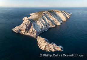
Isla San Pedro Martir at sunset with extensive forest of Cardon Cactus seen on the summit ridge of the island, aerial photo, Sea of Cortez, Mexico. San Pedro Martir Island and its marine life are, since 2002, part of the San Pedro Martir Biosphere Reserve, and is regarded as a natural laboratory of adaptive evolution, similar to that of the Galapagos Islands. It is home to 292 species of fauna and flora (both land-based and aquatic), with 42 species protected by Mexican law, and 30 listed on the Red List of Threatened Species. San Pedro Martir is also unique in the area for its year-round quantity of birds. The island is the only island in the area with a perpetually swirling cloud of sea birds. This is because the water around the island, has some of the most successful marine productivity in the world.
Location: Isla San Pedro Martir, Sonora, Mexico
Image ID: 40397
Location: Isla San Pedro Martir, Sonora, Mexico
Image ID: 40397
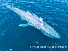
Aerial photo of blue whale near San Diego. This enormous blue whale glides at the surface of the ocean, resting and breathing before it dives to feed on subsurface krill.
Species: Blue whale, Balaenoptera musculus
Location: San Diego, California
Image ID: 40611
Species: Blue whale, Balaenoptera musculus
Location: San Diego, California
Image ID: 40611
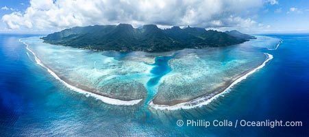
Barrier Reef around Moorea Island, French Polynesia. Nu'urua and Iumaru communities along the coast. The outer reef slope is seen adjacent to deep blue oceanic water with white waves breaking against the reef edge. Next, a wide shallow reef flat occurs dotted with coral bommies. Inside of that, a shallow protected lagoon is formed against the island. Tall, rugged, eroded mountains are seen hinting at the age of the ancient volcano that originally formed the island and that is now sinking back down, leaving the encircling reef behind.
Location: Moorea, French Polynesia, France
Image ID: 40666
Panorama dimensions: 5505 x 12416
Location: Moorea, French Polynesia, France
Image ID: 40666
Panorama dimensions: 5505 x 12416
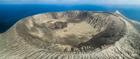
Barcena volcano crater, highest point on San Benedicto Island, Revillagigedos, Mexico.
Location: San Benedicto Island (Islas Revillagigedos), Baja California, Mexico
Image ID: 32922
Panorama dimensions: 3742 x 8857
Location: San Benedicto Island (Islas Revillagigedos), Baja California, Mexico
Image ID: 32922
Panorama dimensions: 3742 x 8857
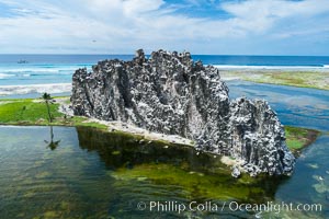
Clipperton Rock, a 95' high volcanic remnant, is the highest point on Clipperton Island, a spectacular coral atoll in the eastern Pacific. By permit HC / 1485 / CAB (France).
Location: Clipperton Island, France
Image ID: 32940
Location: Clipperton Island, France
Image ID: 32940
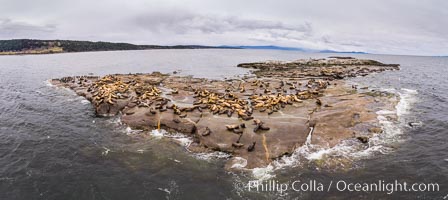
Steller Sea Lions atop Norris Rocks, Hornby Island and Vancouver Island, panoramic photo.
Species: Steller sea lion, Eumetopias jubatus
Location: British Columbia, Canada
Image ID: 34468
Panorama dimensions: 4590 x 10283
Species: Steller sea lion, Eumetopias jubatus
Location: British Columbia, Canada
Image ID: 34468
Panorama dimensions: 4590 x 10283
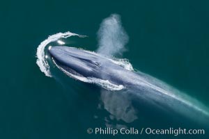
Blue whale, exhaling as it surfaces from a dive, aerial photo. The blue whale is the largest animal ever to have lived on Earth, exceeding 100' in length and 200 tons in weight.
Species: Blue whale, Balaenoptera musculus
Location: Redondo Beach, California
Image ID: 25953
Species: Blue whale, Balaenoptera musculus
Location: Redondo Beach, California
Image ID: 25953
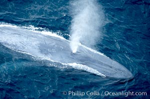
Blue whale, exhaling in a huge blow as it swims at the surface between deep dives. The blue whale's blow is a combination of water spray from around its blowhole and condensation from its warm breath.
Species: Blue whale, Balaenoptera musculus
Location: La Jolla, California
Image ID: 21249
Species: Blue whale, Balaenoptera musculus
Location: La Jolla, California
Image ID: 21249
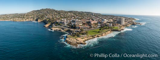
Aerial Panoramic Photo of Point La Jolla and La Jolla Cove, Boomer Beach, Scripps Park. Panoramic aerial photograph of La Jolla Cove and Scripps Parks (center), with La Jolla’s Mount Soledad rising above, La Jolla Shores and La Jolla Caves to the left and the La Jolla Coast with Children’s Pool (Casa Cove) to the right. The undersea reefs of Boomer Beach are seen through the clear, calm ocean waters. This extremely high resolution panorama will print 50″ high by 130″ long with no interpolation.
Location: La Jolla, California
Image ID: 30773
Panorama dimensions: 7744 x 20541
Location: La Jolla, California
Image ID: 30773
Panorama dimensions: 7744 x 20541
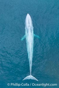
Aerial photo of blue whale near San Diego. This enormous blue whale glides at the surface of the ocean, resting and breathing before it dives to feed on subsurface krill.
Species: Blue whale, Balaenoptera musculus
Location: San Diego, California
Image ID: 39421
Species: Blue whale, Balaenoptera musculus
Location: San Diego, California
Image ID: 39421
