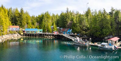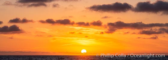
Sunset over the Pacific Ocean.
Location: San Clemente Island, California
Image ID: 38511
Panorama dimensions: 4540 x 12694
Location: San Clemente Island, California
Image ID: 38511
Panorama dimensions: 4540 x 12694
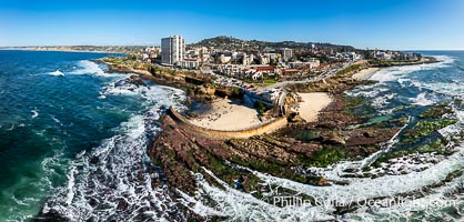
Childrens Pool Reef Exposed at Extreme Low Tide, Casa Cove, La Jolla, California. Aerial panoramic photograph.
Location: La Jolla, California
Image ID: 40234
Panorama dimensions: 5612 x 11740
Location: La Jolla, California
Image ID: 40234
Panorama dimensions: 5612 x 11740
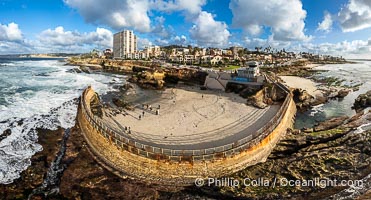
Children's Pool Reef Exposed at Extreme Low King Tide, La Jolla, California. Aerial panoramic photograph.
Location: La Jolla, California
Image ID: 40718
Panorama dimensions: 6238 x 11571
Location: La Jolla, California
Image ID: 40718
Panorama dimensions: 6238 x 11571
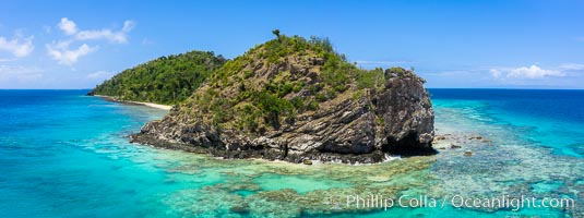
Aerial View of Namena Island, Fiji.
Location: Namena Marine Reserve, Namena Island, Fiji
Image ID: 34684
Panorama dimensions: 2870 x 7676
Location: Namena Marine Reserve, Namena Island, Fiji
Image ID: 34684
Panorama dimensions: 2870 x 7676
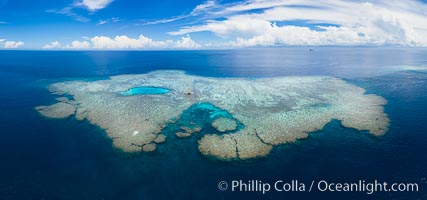
Aerial View of Vatu-i-Ra Coral Seascape, Fiji.
Location: Vatu I Ra Passage, Bligh Waters, Viti Levu Island, Fiji
Image ID: 34690
Panorama dimensions: 5841 x 12480
Location: Vatu I Ra Passage, Bligh Waters, Viti Levu Island, Fiji
Image ID: 34690
Panorama dimensions: 5841 x 12480
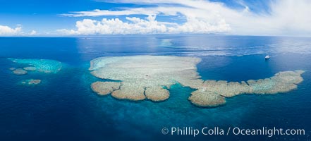
Aerial View of Vatu-i-Ra Coral Seascape, Fiji.
Location: Vatu I Ra Passage, Bligh Waters, Viti Levu Island, Fiji
Image ID: 34691
Panorama dimensions: 5420 x 11951
Location: Vatu I Ra Passage, Bligh Waters, Viti Levu Island, Fiji
Image ID: 34691
Panorama dimensions: 5420 x 11951
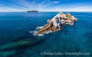
Middle Coronado Island, aerial photo.
Location: Coronado Islands (Islas Coronado), Baja California, Mexico
Image ID: 35084
Panorama dimensions: 5371 x 8722
Location: Coronado Islands (Islas Coronado), Baja California, Mexico
Image ID: 35084
Panorama dimensions: 5371 x 8722
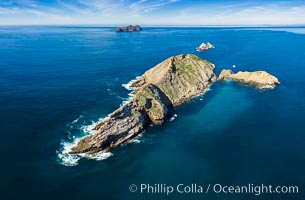
Middle Coronado Island, aerial photo.
Location: Coronado Islands (Islas Coronado), Baja California, Mexico
Image ID: 35086
Location: Coronado Islands (Islas Coronado), Baja California, Mexico
Image ID: 35086
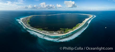
Aerial panorama of Clipperton Island, showing the entire atoll. Clipperton Island, a minor territory of France also known as Ile de la Passion, is a small (2.3 sq mi) but spectacular coral atoll in the eastern Pacific. By permit HC / 1485 / CAB (France).
Location: Clipperton Island, France
Image ID: 32843
Panorama dimensions: 5161 x 11384
Location: Clipperton Island, France
Image ID: 32843
Panorama dimensions: 5161 x 11384
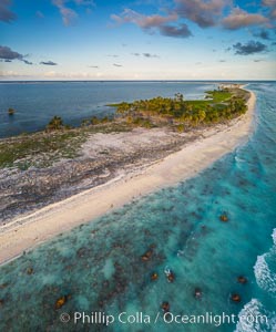
Coconut palm trees on Clipperton Island, aerial photo. Clipperton Island is a spectacular coral atoll in the eastern Pacific. By permit HC / 1485 / CAB (France).
Location: Clipperton Island, France
Image ID: 32846
Location: Clipperton Island, France
Image ID: 32846
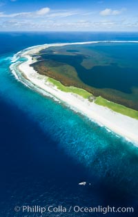
Aerial photo of M/V Nautilus Undersea at Clipperton Island. Clipperton Island, a minor territory of France also known as Ile de la Passion, is a small (2.3 sq mi) but spectacular coral atoll in the eastern Pacific. By permit HC / 1485 / CAB (France).
Location: Clipperton Island, France
Image ID: 32848
Panorama dimensions: 7944 x 5064
Location: Clipperton Island, France
Image ID: 32848
Panorama dimensions: 7944 x 5064
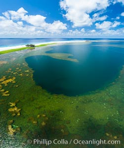
Aerial view of the lagoon inside Clipperton Island. The lagoon within the atoll was formerly open to the ocean but has been closed and stagnant for many decades. Some experts believe erosion will open the lagoon up to the ocean again soon. Clipperton Island, a minor territory of France also known as Ile de la Passion, is a spectacular coral atoll in the eastern Pacific. By permit HC / 1485 / CAB (France).
Location: Clipperton Island, France
Image ID: 32866
Location: Clipperton Island, France
Image ID: 32866
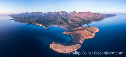
San Evaristo at dawn, panoramic view, a small fishing town, aerial photo, Sea of Cortez, Baja California.
Location: San Evaristo, Baja California, Mexico
Image ID: 33487
Panorama dimensions: 5360 x 11790
Location: San Evaristo, Baja California, Mexico
Image ID: 33487
Panorama dimensions: 5360 x 11790
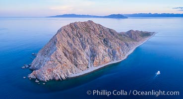
Boat Ambar at Isla San Diego, Aerial View, Sea of Cortez.
Location: Isla San Diego, Baja California, Mexico
Image ID: 33513
Location: Isla San Diego, Baja California, Mexico
Image ID: 33513
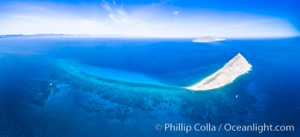
Isla San Diego and Coral Reef, reef extends from Isla San Diego to Isla San Jose, aerial photo, Sea of Cortez, Baja California.
Location: Isla San Diego, Baja California, Mexico
Image ID: 33601
Panorama dimensions: 5596 x 12223
Location: Isla San Diego, Baja California, Mexico
Image ID: 33601
Panorama dimensions: 5596 x 12223
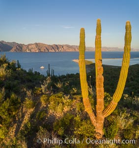
Cardon Cactus on Isla San Jose, Aerial View, Baja California.
Species: Cardon cactus, Elephant cactus, Pachycereus pringlei
Location: Isla San Jose, Baja California, Mexico
Image ID: 33624
Species: Cardon cactus, Elephant cactus, Pachycereus pringlei
Location: Isla San Jose, Baja California, Mexico
Image ID: 33624
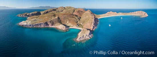
Isla San Francisquito, Aerial View, Sea of Cortez.
Location: Isla San Francisquito, Baja California, Mexico
Image ID: 33640
Panorama dimensions: 3983 x 10956
Location: Isla San Francisquito, Baja California, Mexico
Image ID: 33640
Panorama dimensions: 3983 x 10956
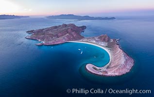
Sunset over Isla San Francisquito, Aerial View, Sea of Cortez.
Location: Isla San Francisquito, Baja California, Mexico
Image ID: 33660
Location: Isla San Francisquito, Baja California, Mexico
Image ID: 33660
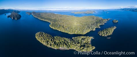
Browning Pass and Balaklava Island, location of the best cold water diving in the world, aerial panoramic photo.
Location: British Columbia, Canada
Image ID: 34471
Panorama dimensions: 5157 x 12273
Location: British Columbia, Canada
Image ID: 34471
Panorama dimensions: 5157 x 12273
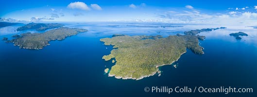
Hurst Island, Balaklava Island (left) and Gods Pocket Provincial Park, aerial photo.
Location: Gods Pocket Provincial Park, Vancouver Island, British Columbia, Canada
Image ID: 34473
Panorama dimensions: 5112 x 13528
Location: Gods Pocket Provincial Park, Vancouver Island, British Columbia, Canada
Image ID: 34473
Panorama dimensions: 5112 x 13528
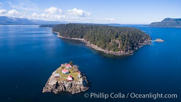
Chrome Island (foreground) and Denman Island, Hornby Island in the distance.
Location: British Columbia, Canada
Image ID: 34475
Location: British Columbia, Canada
Image ID: 34475
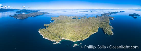
Hurst Island, Balaklava Island (left) and Gods Pocket Provincial Park, aerial photo.
Location: Gods Pocket Provincial Park, Vancouver Island, British Columbia, Canada
Image ID: 34479
Panorama dimensions: 5202 x 14357
Location: Gods Pocket Provincial Park, Vancouver Island, British Columbia, Canada
Image ID: 34479
Panorama dimensions: 5202 x 14357

Aerial Panoramic Photo of Sunset Cliffs San Diego, Pappy's Point, Claiborne Cove.
Location: San Diego, California
Image ID: 30790
Panorama dimensions: 8011 x 28354
Location: San Diego, California
Image ID: 30790
Panorama dimensions: 8011 x 28354
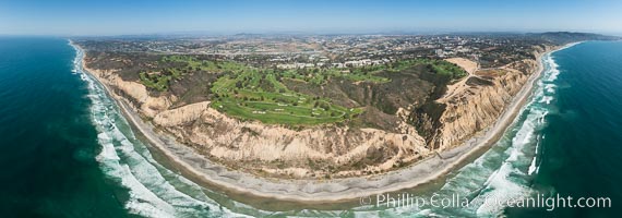
Aerial panorama of Blacks Beach, Torrey Pines Golf Course (south course), and views to La Jolla (south) and Carlsbad (north).
Location: La Jolla, California
Image ID: 30851
Panorama dimensions: 6962 x 19824
Location: La Jolla, California
Image ID: 30851
Panorama dimensions: 6962 x 19824
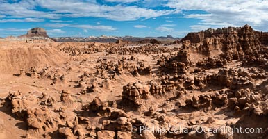
Hoodoos in Goblin Valley State Park, aerial panorama. The "goblins" are technically known as hoodoos, formed through the gradual erosion of Entrada sandstone deposited 170 millions years ago. Aerial panoramic photograph.
Location: Goblin Valley State Park, Utah
Image ID: 37957
Location: Goblin Valley State Park, Utah
Image ID: 37957
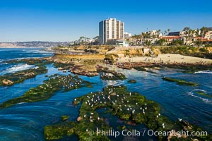
Childrens Pool Reef Exposed at Extreme Low King Tide, La Jolla, California. Aerial panoramic photograph.
Location: Children's Pool, La Jolla, California
Image ID: 37990
Location: Children's Pool, La Jolla, California
Image ID: 37990
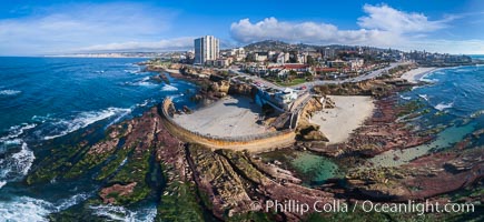
Childrens Pool Reef Exposed at Extreme Low King Tide, La Jolla, California. Aerial panoramic photograph.
Location: Children's Pool, La Jolla, California
Image ID: 37995
Panorama dimensions: 5787 x 12589
Location: Children's Pool, La Jolla, California
Image ID: 37995
Panorama dimensions: 5787 x 12589
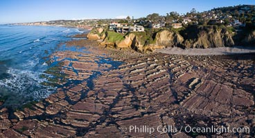
La Jolla Bay submarine reef system on extreme low King Tide, south of La Jolla Shores, aerial panoramic photo.
Location: La Jolla, California
Image ID: 37999
Panorama dimensions: 5103 x 9390
Location: La Jolla, California
Image ID: 37999
Panorama dimensions: 5103 x 9390
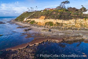
Swamis Reef exposed at extreme low King Tide, Encinitas, aerial panoramic photo.
Location: Swamis, Encinitas, California
Image ID: 38002
Location: Swamis, Encinitas, California
Image ID: 38002
