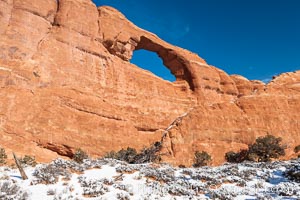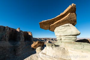
Pedestal rock, or hoodoo, at Stud Horse Point. These hoodoos form when erosion occurs around but not underneath a more resistant caprock that sits atop of the hoodoo spire. Stud Horse Point is a spectacular viewpoint on a mesa overlooking the Arizona / Utah border.
Location: Page, Arizona
Image ID: 37778
Location: Page, Arizona
Image ID: 37778
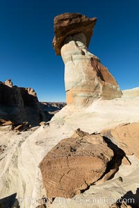
Pedestal rock, or hoodoo, at Stud Horse Point. These hoodoos form when erosion occurs around but not underneath a more resistant caprock that sits atop of the hoodoo spire. Stud Horse Point is a spectacular viewpoint on a mesa overlooking the Arizona / Utah border.
Location: Page, Arizona
Image ID: 37780
Location: Page, Arizona
Image ID: 37780
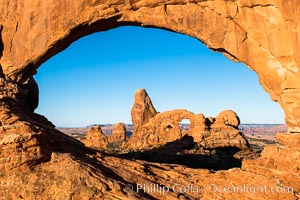
Turret Arch viewed through North Window at Sunrise.
Location: North Window, Arches National Park, Utah
Image ID: 37863
Location: North Window, Arches National Park, Utah
Image ID: 37863
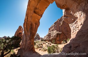
Pine Tree Arch, Arches National Park.
Location: Pine Tree Arch, Arches National Park, Utah
Image ID: 37865
Location: Pine Tree Arch, Arches National Park, Utah
Image ID: 37865
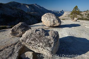
Glacial erratic boulders atop Olmsted Point, with the massive granite monoliths Half Dome and Clouds Rest in the background. Erratics are huge boulders left behind by the passing of glaciers which carved the granite surroundings into their present-day form. When the glaciers melt, any boulders and other geologic material that it was carrying are left in place, sometimes many miles from their original location.
Location: Yosemite National Park, California
Image ID: 23264
Location: Yosemite National Park, California
Image ID: 23264
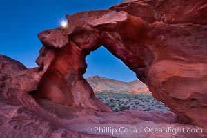
Natural arch formed in sandstone frames the setting moon.
Location: Valley of Fire State Park, Nevada
Image ID: 26486
Location: Valley of Fire State Park, Nevada
Image ID: 26486
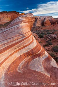
The Fire Wave, a beautiful sandstone formation exhibiting dramatic striations, striped layers in the geologic historical record.
Location: Valley of Fire State Park, Nevada
Image ID: 26487
Location: Valley of Fire State Park, Nevada
Image ID: 26487
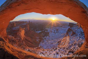
Mesa Arch spans 90 feet and stands at the edge of a mesa precipice thousands of feet above the Colorado River gorge. For a few moments at sunrise the underside of the arch glows dramatically red and orange.
Location: Island in the Sky, Canyonlands National Park, Utah
Image ID: 18085
Location: Island in the Sky, Canyonlands National Park, Utah
Image ID: 18085
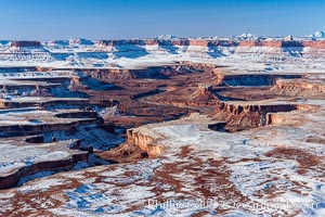
Soda Springs Basin in Canyonlands National Park, snow covered mesas and canyons, with the Green River far below, not far from its confluence with the Colorado River. Island in the Sky.
Location: Canyonlands National Park, Utah
Image ID: 18093
Location: Canyonlands National Park, Utah
Image ID: 18093
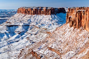
Canyonlands National Park, winter, viewed from Grandview Point. Island in the Sky.
Location: Canyonlands National Park, Utah
Image ID: 18097
Location: Canyonlands National Park, Utah
Image ID: 18097
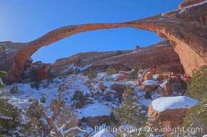
Landscape Arch in winter. Landscape Arch has an amazing 306-foot span.
Location: Landscape Arch, Arches National Park, Utah
Image ID: 18115
Location: Landscape Arch, Arches National Park, Utah
Image ID: 18115
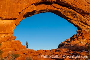
Hiker in North Window, sunset, western face. North Window is a natural sandstone arch 90 feet wide and 48 feet high.
Location: North Window, Arches National Park, Utah
Image ID: 18160
Location: North Window, Arches National Park, Utah
Image ID: 18160
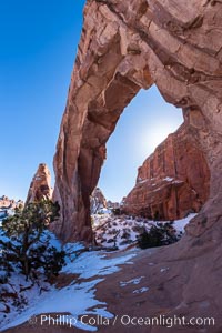
Pine Tree Arch on the Devil's Garden Trail in Arches National Park.
Location: Pine Tree Arch, Arches National Park, Utah
Image ID: 18186
Location: Pine Tree Arch, Arches National Park, Utah
Image ID: 18186
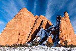
Fins. The vertical slabs of Entrada sandstone may become natural sandstone arches.
Location: Arches National Park, Utah
Image ID: 18187
Location: Arches National Park, Utah
Image ID: 18187
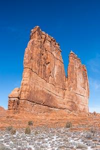
The Organ at Courthouse Towers, narrow sandstone fins towering above the surrounding flatlands.
Location: Courthouse Towers, Arches National Park, Utah
Image ID: 18195
Location: Courthouse Towers, Arches National Park, Utah
Image ID: 18195
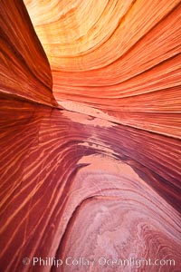
The Wave, an area of fantastic eroded sandstone featuring beautiful swirls, wild colors, countless striations, and bizarre shapes set amidst the dramatic surrounding North Coyote Buttes of Arizona and Utah. The sandstone formations of the North Coyote Buttes, including the Wave, date from the Jurassic period. Managed by the Bureau of Land Management, the Wave is located in the Paria Canyon-Vermilion Cliffs Wilderness and is accessible on foot by permit only.
Location: North Coyote Buttes, Paria Canyon-Vermilion Cliffs Wilderness, Arizona
Image ID: 20609
Location: North Coyote Buttes, Paria Canyon-Vermilion Cliffs Wilderness, Arizona
Image ID: 20609
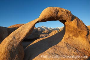
Mobius Arch in golden early morning light. The natural stone arch is found in the scenic Alabama Hlls near Lone Pine, California.
Location: Alabama Hills Recreational Area, California
Image ID: 21731
Location: Alabama Hills Recreational Area, California
Image ID: 21731
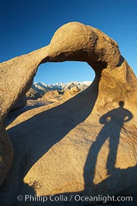
The long shadow of a hiker lies on Mobius Arch, a natural stone arch in the Alabama Hills.
Location: Alabama Hills Recreational Area, California
Image ID: 21733
Location: Alabama Hills Recreational Area, California
Image ID: 21733
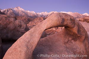
Mobius Arch, the Alabama Hills and the Sierra Nevada Range at sunrise, pink early morning light.
Location: Alabama Hills Recreational Area, California
Image ID: 21734
Location: Alabama Hills Recreational Area, California
Image ID: 21734
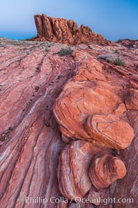
Sunrise lights sandstone rocks, Valley of Fire.
Location: Valley of Fire State Park, Nevada
Image ID: 28444
Location: Valley of Fire State Park, Nevada
Image ID: 28444
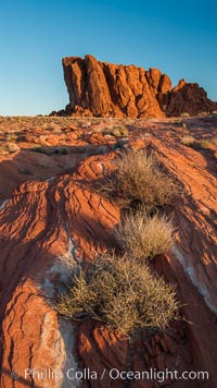
Sunrise lights sandstone rocks, Valley of Fire.
Location: Valley of Fire State Park, Nevada
Image ID: 28445
Location: Valley of Fire State Park, Nevada
Image ID: 28445
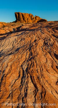
Sunrise lights sandstone rocks, Valley of Fire.
Location: Valley of Fire State Park, Nevada
Image ID: 28446
Location: Valley of Fire State Park, Nevada
Image ID: 28446
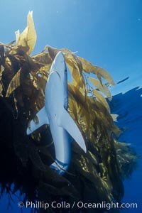
Blue shark and offshore drift kelp paddy, open ocean.
Species: Blue shark, Prionace glauca
Location: San Diego, California
Image ID: 02287
Species: Blue shark, Prionace glauca
Location: San Diego, California
Image ID: 02287
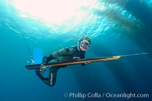
A freediving spearfisherman glides quietly through the kelp forest in search of game fish to hunt. The most skilled spearfishermen forego the use of SCUBA, which is noisy underwater and scares away fish. Instead, they practice breathhold techniques to move silently through the water. San Clemente Island.
Location: San Clemente Island, California
Image ID: 10235
Location: San Clemente Island, California
Image ID: 10235
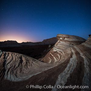
The Fire Wave at night, lit by the light of the moon.
Location: Valley of Fire State Park, Nevada
Image ID: 28430
Panorama dimensions: 7280 x 7255
Location: Valley of Fire State Park, Nevada
Image ID: 28430
Panorama dimensions: 7280 x 7255
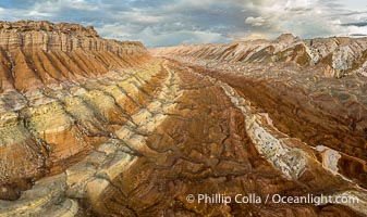
Aerial View of the San Rafael Reef, Utah. This is a canyon-like section of the San Rafael Reef, photographed at sunrise. The "reef proper" is on the right, with its characteristic triangular flatiron erosion. The canyon in the center is a fold in the Earth's crust affiliated with the boundary of the San Rafael Swell. The colors seen here arise primarily from Navajo and Wingate sandstone.
Location: Utah
Image ID: 39496
Location: Utah
Image ID: 39496
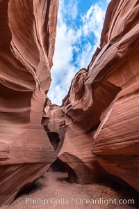
Owl Canyon, a beautiful slot canyon that is part of the larger Antelope Canyon system. Page, Arizona.
Location: Navajo Tribal Lands, Page, Arizona
Image ID: 36032
Location: Navajo Tribal Lands, Page, Arizona
Image ID: 36032
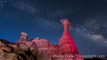
The Milky Way rises in the sky above the Toadstool Hoodoos near the Paria Rimrocks. Rimrock Hoodoos.
Location: Grand Staircase - Escalante National Monument, Utah
Image ID: 26616
Location: Grand Staircase - Escalante National Monument, Utah
Image ID: 26616
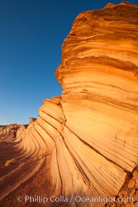
The Great Wall, Navajo Tribal Lands, Arizona. Sandstone "fins", eroded striations that depict how sandstone -- ancient compressed sand -- was laid down in layers over time. Now exposed, the layer erode at different rates, forming delicate "fins" that stretch for long distances.
Location: Navajo Tribal Lands, Page, Arizona
Image ID: 26644
Location: Navajo Tribal Lands, Page, Arizona
Image ID: 26644
