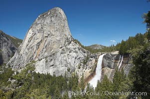
Nevada Falls, with Liberty Cap rising above it. Nevada Falls marks where the Merced River plummets almost 600 through a joint in the Little Yosemite Valley, shooting out from a sheer granite cliff and then down to a boulder pile far below.
Location: Nevada Falls, Yosemite National Park, California
Image ID: 16127
Location: Nevada Falls, Yosemite National Park, California
Image ID: 16127
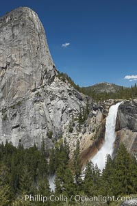
Nevada Falls, with Liberty Cap rising above it. Nevada Falls marks where the Merced River plummets almost 600 through a joint in the Little Yosemite Valley, shooting out from a sheer granite cliff and then down to a boulder pile far below.
Location: Nevada Falls, Yosemite National Park, California
Image ID: 16128
Location: Nevada Falls, Yosemite National Park, California
Image ID: 16128
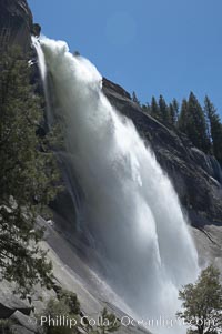
Nevada Falls marks where the Merced River plummets almost 600 through a joint in the Little Yosemite Valley, shooting out from a sheer granite cliff and then down to a boulder pile far below.
Location: Nevada Falls, Yosemite National Park, California
Image ID: 16129
Location: Nevada Falls, Yosemite National Park, California
Image ID: 16129
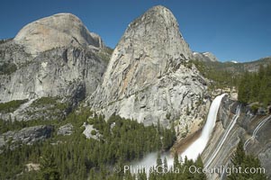
Nevada Falls, with Liberty Cap (center) and Half Dome (left). Nevada Falls marks where the Merced River plummets almost 600 through a joint in the Little Yosemite Valley, shooting out from a sheer granite cliff and then down to a boulder pile far below.
Location: Nevada Falls, Yosemite National Park, California
Image ID: 16130
Location: Nevada Falls, Yosemite National Park, California
Image ID: 16130
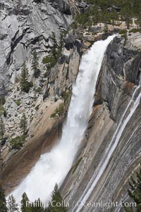
Nevada Falls marks where the Merced River plummets almost 600 through a joint in the Little Yosemite Valley, shooting out from a sheer granite cliff and then down to a boulder pile far below.
Location: Nevada Falls, Yosemite National Park, California
Image ID: 16131
Location: Nevada Falls, Yosemite National Park, California
Image ID: 16131
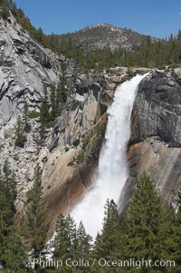
Nevada Falls marks where the Merced River plummets almost 600 through a joint in the Little Yosemite Valley, shooting out from a sheer granite cliff and then down to a boulder pile far below.
Location: Nevada Falls, Yosemite National Park, California
Image ID: 16132
Location: Nevada Falls, Yosemite National Park, California
Image ID: 16132
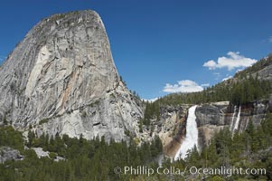
Nevada Falls, with Liberty Cap rising above it. Nevada Falls marks where the Merced River plummets almost 600 through a joint in the Little Yosemite Valley, shooting out from a sheer granite cliff and then down to a boulder pile far below.
Location: Nevada Falls, Yosemite National Park, California
Image ID: 16133
Location: Nevada Falls, Yosemite National Park, California
Image ID: 16133
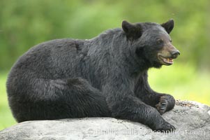
Black bear on granite rock. This bear still has its thick, full winter coat, which will be shed soon with the approach of summer.
Species: American black bear, Ursus americanus
Location: Orr, Minnesota
Image ID: 18826
Species: American black bear, Ursus americanus
Location: Orr, Minnesota
Image ID: 18826
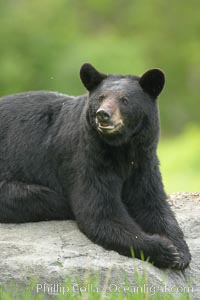
Black bear on granite rock. This bear still has its thick, full winter coat, which will be shed soon with the approach of summer.
Species: American black bear, Ursus americanus
Location: Orr, Minnesota
Image ID: 18872
Species: American black bear, Ursus americanus
Location: Orr, Minnesota
Image ID: 18872
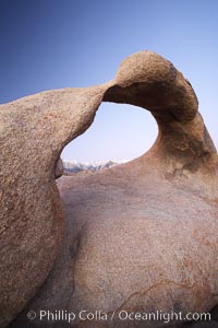
Moebius Arch, a natural rock arch found amid the spectacular granite and metamorphose stone formations of the Alabama Hills, near the eastern Sierra town of Lone Pine.
Location: Alabama Hills Recreational Area, California
Image ID: 21745
Location: Alabama Hills Recreational Area, California
Image ID: 21745
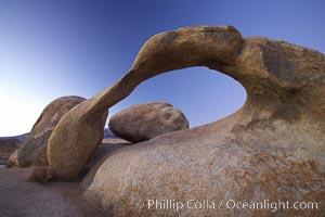
Moebius Arch, a natural rock arch found amid the spectacular granite and metamorphose stone formations of the Alabama Hills, near the eastern Sierra town of Lone Pine.
Location: Alabama Hills Recreational Area, California
Image ID: 21746
Location: Alabama Hills Recreational Area, California
Image ID: 21746
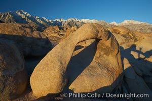
Moebius Arch, a 17-foot-wide natural rock arch found amid the spectacular granite and metamorphose stone formations of the Alabama Hills, near the eastern Sierra town of Lone Pine.
Location: Alabama Hills Recreational Area, California
Image ID: 21747
Location: Alabama Hills Recreational Area, California
Image ID: 21747
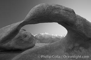
Moebius Arch, a natural rock arch found amid the spectacular granite and metamorphose stone formations of the Alabama Hills, near the eastern Sierra town of Lone Pine.
Location: Alabama Hills Recreational Area, California
Image ID: 21755
Location: Alabama Hills Recreational Area, California
Image ID: 21755
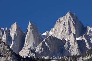
Mt. Whitney is the highest point in the contiguous United States with an elevation of 14,505 feet (4,421 m). It lies along the crest of the Sierra Nevada mountain range. Composed of the Sierra Nevada batholith granite formation, its eastern side (seen here) is quite steep. It is climbed by hundreds of hikers each year.
Image ID: 21760
Image ID: 21760
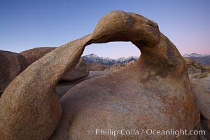
Moebius Arch, a natural rock arch found amid the spectacular granite and metamorphose stone formations of the Alabama Hills, near the eastern Sierra town of Lone Pine.
Location: Alabama Hills Recreational Area, California
Image ID: 21768
Location: Alabama Hills Recreational Area, California
Image ID: 21768
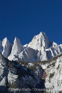
Mt. Whitney is the highest point in the contiguous United States with an elevation of 14,505 feet (4,421 m). It lies along the crest of the Sierra Nevada mountain range. Composed of the Sierra Nevada batholith granite formation, its eastern side (seen here) is quite steep. It is climbed by hundreds of hikers each year.
Image ID: 21770
Image ID: 21770
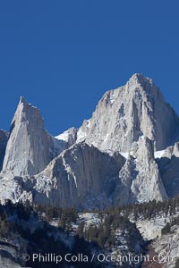
Mt. Whitney is the highest point in the contiguous United States with an elevation of 14,505 feet (4,421 m). It lies along the crest of the Sierra Nevada mountain range. Composed of the Sierra Nevada batholith granite formation, its eastern side (seen here) is quite steep. It is climbed by hundreds of hikers each year.
Image ID: 21771
Image ID: 21771
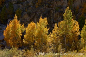
A golden grove of turning aspen trees, is backlit by the late afternoon sun, with dark granite cliffs behind.
Species: Aspen, Populus tremuloides
Location: Bishop Creek Canyon, Sierra Nevada Mountains, California
Image ID: 23368
Species: Aspen, Populus tremuloides
Location: Bishop Creek Canyon, Sierra Nevada Mountains, California
Image ID: 23368
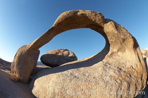
Moebius Arch, a 17-foot-wide natural rock arch found amid the spectacular granite and metamorphose stone formations of the Alabama Hills, near the eastern Sierra town of Lone Pine.
Location: Alabama Hills Recreational Area, California
Image ID: 21749
Location: Alabama Hills Recreational Area, California
Image ID: 21749
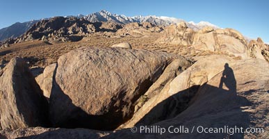
The Alabama Hills, with characteristic curious eroded rock formations formed of ancient granite and metamorphosed rock, next to the Sierra Nevada mountains and the town of Lone Pine.
Location: Alabama Hills Recreational Area, California
Image ID: 21757
Panorama dimensions: 2255 x 4366
Location: Alabama Hills Recreational Area, California
Image ID: 21757
Panorama dimensions: 2255 x 4366
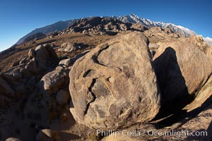
The Alabama Hills, with characteristic curious eroded rock formations formed of ancient granite and metamorphosed rock, next to the Sierra Nevada mountains and the town of Lone Pine.
Location: Alabama Hills Recreational Area, California
Image ID: 21758
Location: Alabama Hills Recreational Area, California
Image ID: 21758
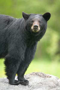
Black bear on granite rock. This bear still has its thick, full winter coat, which will be shed soon with the approach of summer.
Species: American black bear, Ursus americanus
Location: Orr, Minnesota
Image ID: 18777
Species: American black bear, Ursus americanus
Location: Orr, Minnesota
Image ID: 18777
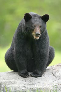
Black bear on granite rock. This bear still has its thick, full winter coat, which will be shed soon with the approach of summer.
Species: American black bear, Ursus americanus
Location: Orr, Minnesota
Image ID: 18811
Species: American black bear, Ursus americanus
Location: Orr, Minnesota
Image ID: 18811
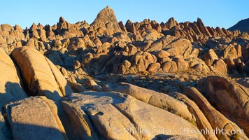
The Alabama Hills, with characteristic curious eroded rock formations formed of ancient granite and metamorphosed rock, next to the Sierra Nevada mountains and the town of Lone Pine.
Location: Alabama Hills Recreational Area, California
Image ID: 21753
Location: Alabama Hills Recreational Area, California
Image ID: 21753
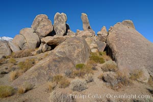
The Alabama Hills, with characteristic curious eroded rock formations formed of ancient granite and metamorphosed rock, next to the Sierra Nevada mountains and the town of Lone Pine.
Location: Alabama Hills Recreational Area, California
Image ID: 21754
Location: Alabama Hills Recreational Area, California
Image ID: 21754
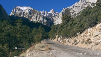
Mount Whitney rises above the Whitney Portal Road which leads to the trailhead from which Mt. Whitney is usually approached by climbers. Mt. Whitney is the highest point in the contiguous United States with an elevation of 14,505 feet (4,421 m). It lies along the crest of the Sierra Nevada mountain range. Composed of the Sierra Nevada batholith granite formation, its eastern side (seen here) is quite steep. It is climbed by hundreds of hikers each year.
Location: California
Image ID: 21762
Location: California
Image ID: 21762
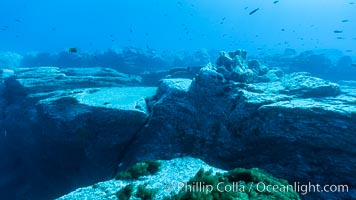
Granite structures form the underwater reef at Abalone Point.
Location: Guadalupe Island (Isla Guadalupe), Baja California, Mexico
Image ID: 09541
Location: Guadalupe Island (Isla Guadalupe), Baja California, Mexico
Image ID: 09541
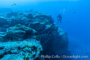
Granite structures form the underwater reef at Abalone Point.
Location: Guadalupe Island (Isla Guadalupe), Baja California, Mexico
Image ID: 09542
Location: Guadalupe Island (Isla Guadalupe), Baja California, Mexico
Image ID: 09542
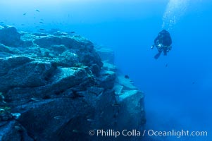
Granite structures form the underwater reef at Abalone Point.
Location: Guadalupe Island (Isla Guadalupe), Baja California, Mexico
Image ID: 09543
Location: Guadalupe Island (Isla Guadalupe), Baja California, Mexico
Image ID: 09543
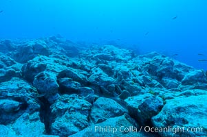
Granite structures form the underwater reef at Abalone Point.
Location: Guadalupe Island (Isla Guadalupe), Baja California, Mexico
Image ID: 09544
Location: Guadalupe Island (Isla Guadalupe), Baja California, Mexico
Image ID: 09544