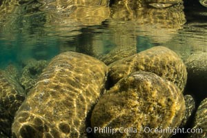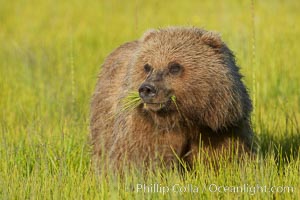
Young brown bear grazes in tall sedge grass. Brown bears can consume 30 lbs of sedge grass daily, waiting weeks until spawning salmon fill the rivers.
Species: Brown bear, Ursus arctos
Location: Lake Clark National Park, Alaska
Image ID: 19244
Species: Brown bear, Ursus arctos
Location: Lake Clark National Park, Alaska
Image ID: 19244
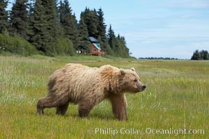
Coastal brown bear (grizzly bear) walks sedge grass meadow near Silver Salmon Creek.
Species: Brown bear, Ursus arctos
Location: Lake Clark National Park, Alaska
Image ID: 19145
Species: Brown bear, Ursus arctos
Location: Lake Clark National Park, Alaska
Image ID: 19145
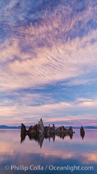
Mono Lake sunset, tufa and clouds reflected in the still waters of Mono Lake.
Location: Mono Lake, California
Image ID: 26977
Location: Mono Lake, California
Image ID: 26977
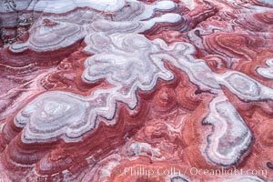
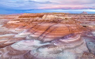
Fantastic colorful sedimentary patterns of Bentonite layers, seen as striations exposed in the Utah Badlands. The Bentonite Hills are composed of the Brushy Basin shale member of the Morrison Formation formed during Jurassic times when mud, silt, fine sand, and volcanic ash were deposited in swamps and lakes into layers, now revealed through erosion. Aerial photograph.
Location: Utah
Image ID: 37947
Location: Utah
Image ID: 37947
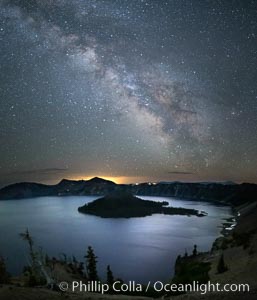
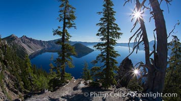
Milky Way and stars over Crater Lake at night. Panorama of Crater Lake and Wizard Island at night, Crater Lake National Park.
Location: Crater Lake National Park, Oregon
Image ID: 28643
Location: Crater Lake National Park, Oregon
Image ID: 28643
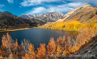
Sierra Nevada Fall Colors, North Lake, Bishop Creek Canyon.
Species: Quaking aspen, Populus tremuloides
Location: Bishop Creek Canyon, Sierra Nevada Mountains, California
Image ID: 36437
Panorama dimensions: 6440 x 10545
Species: Quaking aspen, Populus tremuloides
Location: Bishop Creek Canyon, Sierra Nevada Mountains, California
Image ID: 36437
Panorama dimensions: 6440 x 10545
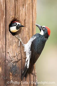
Two Adult Acorn Woodpeckers in their Nest Hole, Lake Hodges.
Location: Lake Hodges, San Diego, California
Image ID: 39397
Location: Lake Hodges, San Diego, California
Image ID: 39397
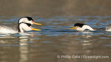
Clark's Grebes Ratchet Pointing, a courtship behavior in which the grebes assume a low facing position in the water, point beaks at one another and emit a ratchet-like sound. Coupled with dip-shaking, several rounds of ratchet pointing is often an immediate precursor to rushing.
Species: Clark's Grebe, Aechmophorus clarkii
Location: Lake Wohlford, Escondido, California
Image ID: 40891
Species: Clark's Grebe, Aechmophorus clarkii
Location: Lake Wohlford, Escondido, California
Image ID: 40891
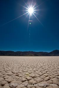
Racetrack Playa, an ancient lake now dried and covered with dessicated mud.
Location: Racetrack Playa, Death Valley National Park, California
Image ID: 25263
Location: Racetrack Playa, Death Valley National Park, California
Image ID: 25263
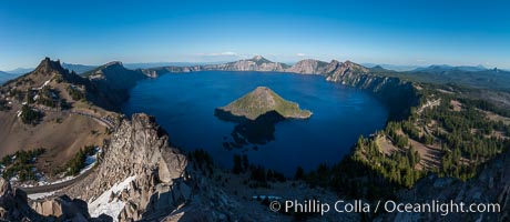
Panorama of Crater Lake from Watchman Lookout Station, panoramic picture. The Watchman Lookout Station No. 168 is one of two fire lookout towers in Crater Lake National Park in southern Oregon. For many years, National Park Service personnel used the lookout to watch for wildfires during the summer months. It is also a popular hiking destination because it offers an excellent view of Crater Lake and the surrounding area.
Location: Crater Lake National Park, Oregon
Image ID: 28633
Panorama dimensions: 4885 x 11229
Location: Crater Lake National Park, Oregon
Image ID: 28633
Panorama dimensions: 4885 x 11229
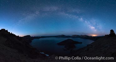
Milky Way and stars over Crater Lake at night. Panorama of Crater Lake and Wizard Island at night, Crater Lake National Park.
Location: Crater Lake National Park, Oregon
Image ID: 28635
Panorama dimensions: 6635 x 12270
Location: Crater Lake National Park, Oregon
Image ID: 28635
Panorama dimensions: 6635 x 12270
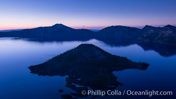
Crater Lake and Wizard Island at sunrise.
Location: Crater Lake National Park, Oregon
Image ID: 28668
Location: Crater Lake National Park, Oregon
Image ID: 28668
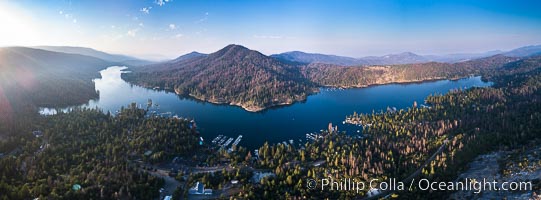
Bass Lake, Aerial Panoramic Photo.
Location: Bass Lake, California
Image ID: 38216
Panorama dimensions: 4947 x 13389
Location: Bass Lake, California
Image ID: 38216
Panorama dimensions: 4947 x 13389
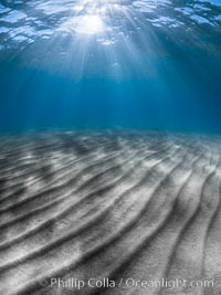
Sunlight and sand ripples, Sand Harbor, Lake Tahoe.
Location: Sand Harbor State Park, Lake Tahoe, Nevada
Image ID: 36410
Location: Sand Harbor State Park, Lake Tahoe, Nevada
Image ID: 36410
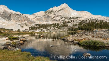
Greenstone Lake and North Peak, Hoover Wilderness.
Location: 20 Lakes Basin, Hoover Wilderness, California
Image ID: 36420
Location: 20 Lakes Basin, Hoover Wilderness, California
Image ID: 36420
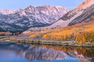
Sierra Nevada fall colors in soft predawn light, North Lake, Bishop Creek Canyon.
Species: Quaking aspen, Populus tremuloides
Location: Bishop Creek Canyon, Sierra Nevada Mountains, California
Image ID: 36431
Species: Quaking aspen, Populus tremuloides
Location: Bishop Creek Canyon, Sierra Nevada Mountains, California
Image ID: 36431
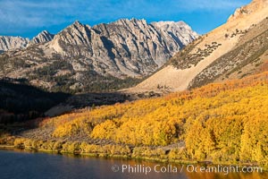
Paiute Peak, Aspen Trees and North Lake, fal colors, Bishop Creek Canyon.
Species: Quaking aspen, Populus tremuloides
Location: Bishop Creek Canyon, Sierra Nevada Mountains, California
Image ID: 36435
Species: Quaking aspen, Populus tremuloides
Location: Bishop Creek Canyon, Sierra Nevada Mountains, California
Image ID: 36435
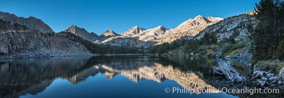
Panorama of Bear Creek Spire over Long Lake at Sunrise, Little Lakes Valley, John Muir Wilderness, Inyo National Forest.
Location: Little Lakes Valley, Inyo National Forest, California
Image ID: 31173
Panorama dimensions: 5473 x 15812
Location: Little Lakes Valley, Inyo National Forest, California
Image ID: 31173
Panorama dimensions: 5473 x 15812
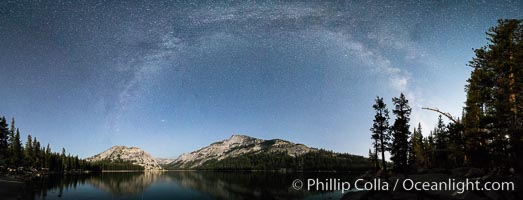
Milky Way over Tenaya Lake, Polly Dome (left), Tenaya Peak (center), Yosemite National Park.
Location: Yosemite National Park, California
Image ID: 31185
Panorama dimensions: 5342 x 13966
Location: Yosemite National Park, California
Image ID: 31185
Panorama dimensions: 5342 x 13966
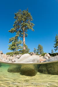
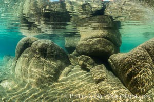
Split view of Trees and Underwater Boulders, Lake Tahoe, Nevada.
Location: Lake Tahoe, Nevada
Image ID: 32330
Location: Lake Tahoe, Nevada
Image ID: 32330
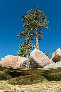
Split view of Trees and Underwater Boulders, Lake Tahoe, Nevada.
Location: Lake Tahoe, Nevada
Image ID: 32332
Location: Lake Tahoe, Nevada
Image ID: 32332
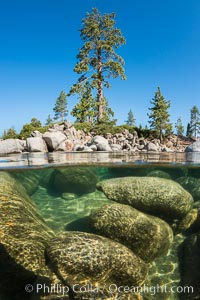
Split view of Trees and Underwater Boulders, Lake Tahoe, Nevada.
Location: Lake Tahoe, Nevada
Image ID: 32334
Location: Lake Tahoe, Nevada
Image ID: 32334
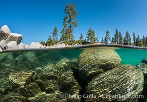
Split view of Trees and Underwater Boulders, Lake Tahoe, Nevada.
Location: Lake Tahoe, Nevada
Image ID: 32335
Location: Lake Tahoe, Nevada
Image ID: 32335
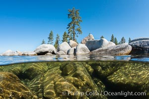
Split view of Trees and Underwater Boulders, Lake Tahoe, Nevada.
Location: Lake Tahoe, Nevada
Image ID: 32336
Location: Lake Tahoe, Nevada
Image ID: 32336
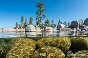
Split view of Trees and Underwater Boulders, Lake Tahoe, Nevada.
Location: Lake Tahoe, Nevada
Image ID: 32337
Location: Lake Tahoe, Nevada
Image ID: 32337
