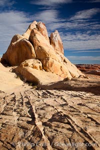
Sandstone ridges and fins, in the White Domes section of Valley of Fire State Park.
Location: Valley of Fire State Park, Nevada
Image ID: 26482
Location: Valley of Fire State Park, Nevada
Image ID: 26482
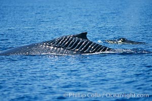
Blade Runner, the injured North Pacific humpback whale, is seen with her calf swimming alongside. This humpback whale showing extensive scarring, almost certainly from a boat propeller, on dorsal ridge. This female North Pacific humpback whale was first seen with the depicted lacerations near the island of Maui in the Hawaiian Islands in the mid-90s, and is the original humpback to bear the name 'Blade Runner'. This female has apparently recovered, as evidenced by her calf in the background. A South Pacific humpback whale endured a similar injury in Sydney Australia in 2001, and bears a remarkably similar scar pattern to the above-pictured whale.
Species: Humpback whale, Megaptera novaeangliae
Location: Maui, Hawaii
Image ID: 05907
Species: Humpback whale, Megaptera novaeangliae
Location: Maui, Hawaii
Image ID: 05907
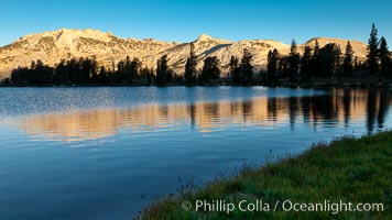
Choo-choo Ridge (11357') is reflected in Townsley Lake (10,353') at sunrise.
Location: Yosemite National Park, California
Image ID: 25767
Location: Yosemite National Park, California
Image ID: 25767

Ile Saint-Louis, is one of two natural islands in the Seine river, in Paris, France. The island is named after King Louis IX of France (Saint Louis). The island is connected to the rest of Paris by bridges to both banks of the river and by the Pont Saint Louis to the Ile de la Cite.
Location: Ile Saint-Louis, Paris, France
Image ID: 28189
Panorama dimensions: 3437 x 12063
Location: Ile Saint-Louis, Paris, France
Image ID: 28189
Panorama dimensions: 3437 x 12063
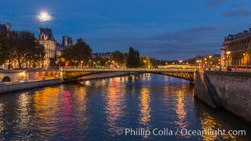
Ile Saint-Louis, is one of two natural islands in the Seine river, in Paris, France. The island is named after King Louis IX of France (Saint Louis). The island is connected to the rest of Paris by bridges to both banks of the river and by the Pont Saint Louis to the Ile de la Cite.
Location: Ile Saint-Louis, Paris, France
Image ID: 28190
Location: Ile Saint-Louis, Paris, France
Image ID: 28190
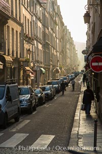
Rue de Ile Saint-Louis, early morning, Paris. Ile Saint-Louis is one of two natural islands in the Seine river, in Paris, France. The island is named after King Louis IX of France (Saint Louis). The island is connected to the rest of Paris by bridges to both banks of the river and by the Pont Saint Louis to the Ile de la Cite.
Location: Ile Saint-Louis, Paris, France
Image ID: 28216
Location: Ile Saint-Louis, Paris, France
Image ID: 28216
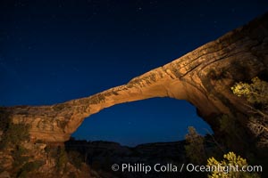
Owachomo Bridge at sunset, stars and blue sky. Owachomo Bridge, a natural stone bridge standing 106' high and spanning 130' wide,stretches across a canyon with the Milky Way crossing the night sky.
Location: Owachomo Bridge, Natural Bridges National Monument, Utah
Image ID: 28546
Location: Owachomo Bridge, Natural Bridges National Monument, Utah
Image ID: 28546
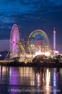
Del Mar Fair and San Dieguito Lagoon at Night. Lights from the San Diego Fair reflect in San Dieguito Lagooon, with the train track trestles to the left.
Location: Del Mar, California
Image ID: 31022
Location: Del Mar, California
Image ID: 31022
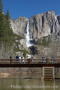
Visitors admire Yosemite Falls from the Swinging Bridge, Leidig Meadow.
Location: Yosemite Falls, Yosemite National Park, California
Image ID: 22758
Location: Yosemite Falls, Yosemite National Park, California
Image ID: 22758
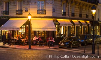
Ile Saint-Louis, is one of two natural islands in the Seine river, in Paris, France. The island is named after King Louis IX of France (Saint Louis). The island is connected to the rest of Paris by bridges to both banks of the river and by the Pont Saint Louis to the Ile de la Cite.
Location: Ile Saint-Louis, Paris, France
Image ID: 28201
Location: Ile Saint-Louis, Paris, France
Image ID: 28201
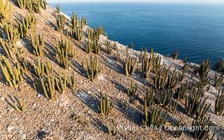
Extensive Forest of Cardon Cactus on the Summit Ridge of San Pedro Martir Island, Sea of Cortez, Mexico. The island and its marine life are, since 2002, part of the San Pedro Martir Biosphere Reserve, and is regarded as a natural laboratory of adaptive evolution, similar to that of the Galapagos Islands. It is home to 292 species of fauna and flora (both land-based and aquatic), with 42 species protected by Mexican law, and 30 listed on the Red List of Threatened Species. San Pedro Martir is also unique in the area for its year-round quantity of birds. The island is the only island in the area with a perpetually swirling cloud of sea birds. This is because the water around the island, has some of the most successful marine productivity in the world.
Location: Isla San Pedro Martir, Sonora, Mexico
Image ID: 40399
Location: Isla San Pedro Martir, Sonora, Mexico
Image ID: 40399
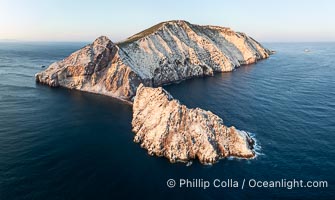
Isla San Pedro Martir at sunset with extensive forest of Cardon Cactus seen on the summit ridge of the island, aerial photo, Sea of Cortez, Mexico. San Pedro Martir Island and its marine life are, since 2002, part of the San Pedro Martir Biosphere Reserve, and is regarded as a natural laboratory of adaptive evolution, similar to that of the Galapagos Islands. It is home to 292 species of fauna and flora (both land-based and aquatic), with 42 species protected by Mexican law, and 30 listed on the Red List of Threatened Species. San Pedro Martir is also unique in the area for its year-round quantity of birds. The island is the only island in the area with a perpetually swirling cloud of sea birds. This is because the water around the island, has some of the most successful marine productivity in the world.
Location: Isla San Pedro Martir, Sonora, Mexico
Image ID: 40403
Location: Isla San Pedro Martir, Sonora, Mexico
Image ID: 40403
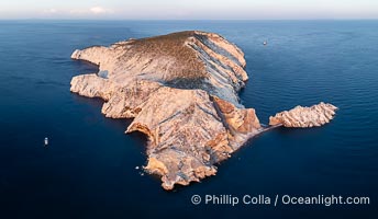
Isla San Pedro Martir at sunset with extensive forest of Cardon Cactus seen on the summit ridge of the island, aerial photo, Sea of Cortez, Mexico. San Pedro Martir Island and its marine life are, since 2002, part of the San Pedro Martir Biosphere Reserve, and is regarded as a natural laboratory of adaptive evolution, similar to that of the Galapagos Islands. It is home to 292 species of fauna and flora (both land-based and aquatic), with 42 species protected by Mexican law, and 30 listed on the Red List of Threatened Species. San Pedro Martir is also unique in the area for its year-round quantity of birds. The island is the only island in the area with a perpetually swirling cloud of sea birds. This is because the water around the island, has some of the most successful marine productivity in the world.
Location: Isla San Pedro Martir, Sonora, Mexico
Image ID: 40404
Location: Isla San Pedro Martir, Sonora, Mexico
Image ID: 40404
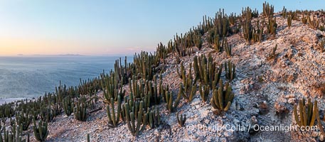
Extensive Forest of Cardon Cactus on the Summit Ridge of San Pedro Martir Island, Sea of Cortez, Mexico. The island and its marine life are, since 2002, part of the San Pedro Martir Biosphere Reserve, and is regarded as a natural laboratory of adaptive evolution, similar to that of the Galapagos Islands. It is home to 292 species of fauna and flora (both land-based and aquatic), with 42 species protected by Mexican law, and 30 listed on the Red List of Threatened Species. San Pedro Martir is also unique in the area for its year-round quantity of birds. The island is the only island in the area with a perpetually swirling cloud of sea birds. This is because the water around the island, has some of the most successful marine productivity in the world.
Location: Isla San Pedro Martir, Sonora, Mexico
Image ID: 40405
Location: Isla San Pedro Martir, Sonora, Mexico
Image ID: 40405
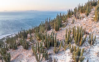
Extensive Forest of Cardon Cactus on the Summit Ridge of San Pedro Martir Island, Sea of Cortez, Mexico. The island and its marine life are, since 2002, part of the San Pedro Martir Biosphere Reserve, and is regarded as a natural laboratory of adaptive evolution, similar to that of the Galapagos Islands. It is home to 292 species of fauna and flora (both land-based and aquatic), with 42 species protected by Mexican law, and 30 listed on the Red List of Threatened Species. San Pedro Martir is also unique in the area for its year-round quantity of birds. The island is the only island in the area with a perpetually swirling cloud of sea birds. This is because the water around the island, has some of the most successful marine productivity in the world.
Location: Isla San Pedro Martir, Sonora, Mexico
Image ID: 40406
Location: Isla San Pedro Martir, Sonora, Mexico
Image ID: 40406
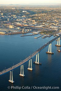
San Diego Coronado Bridge, known locally as the Coronado Bridge, links San Diego with Coronado, California. The bridge was completed in 1969 and was a toll bridge until 2002. It is 2.1 miles long and reaches a height of 200 feet above San Diego Bay. Coronado Island is to the left, and downtown San Diego is to the right in this view looking north.
Location: San Diego, California
Image ID: 22467
Location: San Diego, California
Image ID: 22467
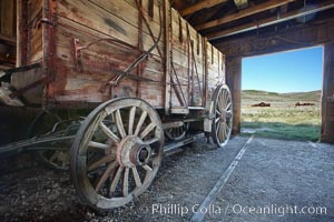
Wagon and interior of County Barn, Brown House and Moyle House in distance.
Location: Bodie State Historical Park, California
Image ID: 23106
Location: Bodie State Historical Park, California
Image ID: 23106
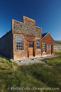
Barber shop, front porch and facade, Main Street.
Location: Bodie State Historical Park, California
Image ID: 23107
Location: Bodie State Historical Park, California
Image ID: 23107
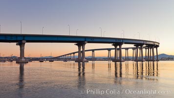
Coronado Bridge, linking San Diego to Coronado, sunrise, viewed from Coronado Island. San Diego Coronado Bridge, known locally as the Coronado Bridge, links San Diego with Coronado, California. The bridge was completed in 1969 and was a toll bridge until 2002. It is 2.1 miles long and reaches a height of 200 feet above San Diego Bay.
Location: San Diego, California
Image ID: 27094
Location: San Diego, California
Image ID: 27094
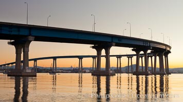
Coronado Bridge, linking San Diego to Coronado, sunrise, viewed from Coronado Island. San Diego Coronado Bridge, known locally as the Coronado Bridge, links San Diego with Coronado, California. The bridge was completed in 1969 and was a toll bridge until 2002. It is 2.1 miles long and reaches a height of 200 feet above San Diego Bay.
Location: San Diego, California
Image ID: 27095
Location: San Diego, California
Image ID: 27095
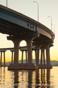
Coronado Bridge, linking San Diego to Coronado, sunrise, viewed from Coronado Island. San Diego Coronado Bridge, known locally as the Coronado Bridge, links San Diego with Coronado, California. The bridge was completed in 1969 and was a toll bridge until 2002. It is 2.1 miles long and reaches a height of 200 feet above San Diego Bay.
Location: San Diego, California
Image ID: 27096
Location: San Diego, California
Image ID: 27096
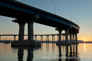
Coronado Bridge, linking San Diego to Coronado, sunrise, viewed from Coronado Island. San Diego Coronado Bridge, known locally as the Coronado Bridge, links San Diego with Coronado, California. The bridge was completed in 1969 and was a toll bridge until 2002. It is 2.1 miles long and reaches a height of 200 feet above San Diego Bay.
Location: San Diego, California
Image ID: 27097
Location: San Diego, California
Image ID: 27097
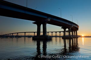
Coronado Bridge, linking San Diego to Coronado, sunrise, viewed from Coronado Island. San Diego Coronado Bridge, known locally as the Coronado Bridge, links San Diego with Coronado, California. The bridge was completed in 1969 and was a toll bridge until 2002. It is 2.1 miles long and reaches a height of 200 feet above San Diego Bay.
Location: San Diego, California
Image ID: 27098
Location: San Diego, California
Image ID: 27098
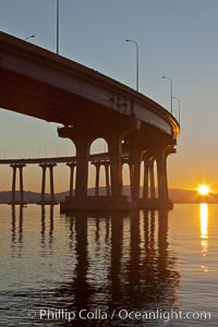
Coronado Bridge, linking San Diego to Coronado, sunrise, viewed from Coronado Island. San Diego Coronado Bridge, known locally as the Coronado Bridge, links San Diego with Coronado, California. The bridge was completed in 1969 and was a toll bridge until 2002. It is 2.1 miles long and reaches a height of 200 feet above San Diego Bay.
Location: San Diego, California
Image ID: 27099
Location: San Diego, California
Image ID: 27099
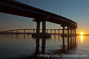
Coronado Bridge, linking San Diego to Coronado, sunrise, viewed from Coronado Island. San Diego Coronado Bridge, known locally as the Coronado Bridge, links San Diego with Coronado, California. The bridge was completed in 1969 and was a toll bridge until 2002. It is 2.1 miles long and reaches a height of 200 feet above San Diego Bay.
Location: San Diego, California
Image ID: 27100
Location: San Diego, California
Image ID: 27100
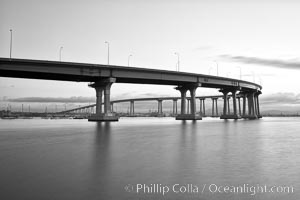
San Diego Coronado Bridge, known locally as the Coronado Bridge, links San Diego with Coronado, California. The bridge was completed in 1969 and was a toll bridge until 2002. It is 2.1 miles long and reaches a height of 200 feet above San Diego Bay.
Location: San Diego, California
Image ID: 27174
Location: San Diego, California
Image ID: 27174
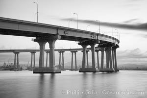
San Diego Coronado Bridge, known locally as the Coronado Bridge, links San Diego with Coronado, California. The bridge was completed in 1969 and was a toll bridge until 2002. It is 2.1 miles long and reaches a height of 200 feet above San Diego Bay.
Location: San Diego, California
Image ID: 27175
Location: San Diego, California
Image ID: 27175
