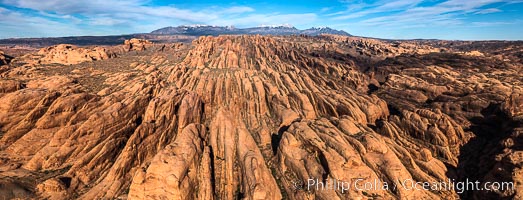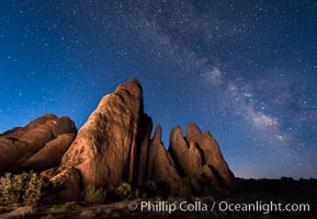
Milky Way over Sandstone Fins. Sandstone fins stand on edge. Vertical fractures separate standing plates of sandstone that are eroded into freestanding fins, that may one day further erode into arches.
Location: Arches National Park, Utah
Image ID: 29254
Location: Arches National Park, Utah
Image ID: 29254
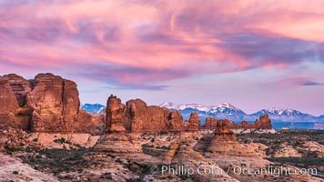
Sunset over Garden of the Gods, Arches National Park.
Location: Garden of the Gods, Arches National Park, Utah
Image ID: 29264
Location: Garden of the Gods, Arches National Park, Utah
Image ID: 29264
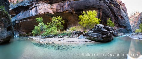
Fall Colors in the Virgin River Narrows, Zion National Park, Utah.
Location: Virgin River Narrows, Zion National Park, Utah
Image ID: 32635
Panorama dimensions: 4795 x 11405
Location: Virgin River Narrows, Zion National Park, Utah
Image ID: 32635
Panorama dimensions: 4795 x 11405
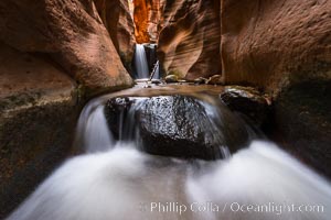
Kanarra Creek Falls in Kanarra Canyon, Utah.
Location: Kanarra Creek, Kanarraville, Utah
Image ID: 32644
Location: Kanarra Creek, Kanarraville, Utah
Image ID: 32644
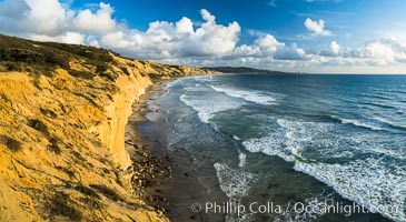
Torrey Pines cliffs.
Location: Torrey Pines State Reserve, San Diego, California
Image ID: 29133
Panorama dimensions: 4995 x 9126
Location: Torrey Pines State Reserve, San Diego, California
Image ID: 29133
Panorama dimensions: 4995 x 9126

Peregrine Falcon in flight along Torrey Pines sandstone cliffs, Torrey Pines State Natural Reserve.
Species: Peregrine Falcon, Falco peregrinus
Location: Torrey Pines State Reserve, San Diego, California
Image ID: 39304
Species: Peregrine Falcon, Falco peregrinus
Location: Torrey Pines State Reserve, San Diego, California
Image ID: 39304
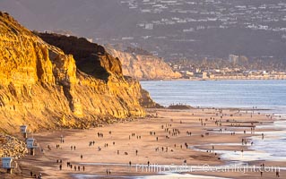
Torrey Pines State Beach on the extreme low King Tide, people walking on the beach, sunset light and La Jolla in the distance.
Location: Torrey Pines State Reserve, San Diego, California
Image ID: 37601
Location: Torrey Pines State Reserve, San Diego, California
Image ID: 37601

The Windows at sunset, Arches National Park.
Location: North Window, Arches National Park, Utah
Image ID: 37868
Panorama dimensions: 5203 x 16982
Location: North Window, Arches National Park, Utah
Image ID: 37868
Panorama dimensions: 5203 x 16982
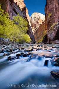
Yellow cottonwood trees in autumn, fall colors in the Virgin River Narrows in Zion National Park.
Location: Virgin River Narrows, Zion National Park, Utah
Image ID: 26090
Location: Virgin River Narrows, Zion National Park, Utah
Image ID: 26090
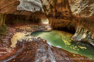
The Subway, a iconic eroded sandstone formation in Zion National Park.
Location: The Subway, Zion National Park, Utah
Image ID: 26092
Location: The Subway, Zion National Park, Utah
Image ID: 26092
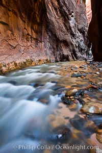
The Virgin River flows through the Zion Narrows, with tall sandstone walls towering hundreds of feet above.
Location: Virgin River Narrows, Zion National Park, Utah
Image ID: 26103
Location: Virgin River Narrows, Zion National Park, Utah
Image ID: 26103
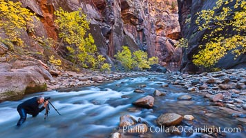
Photographer in the Virgin River Narrows, with flowing water, autumn cottonwood trees and towering red sandstone cliffs.
Location: Virgin River Narrows, Zion National Park, Utah
Image ID: 26106
Location: Virgin River Narrows, Zion National Park, Utah
Image ID: 26106
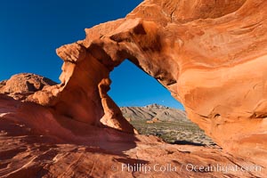
Arch Rock at sunrise, Valley of Fire State Park. Natural arch formed in sandstone. Sunrise with the full moon setting over mountains in the distance.
Location: Valley of Fire State Park, Nevada
Image ID: 26472
Location: Valley of Fire State Park, Nevada
Image ID: 26472
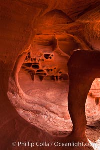
Fire Arch or Windstone Arch, also known as Fire Cave, is a tiny cave with a miniature arch and a group of natural pocket holes. Many people walk by this cave without realizing it is there!.
Location: Valley of Fire State Park, Nevada
Image ID: 26475
Location: Valley of Fire State Park, Nevada
Image ID: 26475
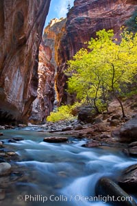
Yellow cottonwood trees in autumn, fall colors in the Virgin River Narrows in Zion National Park.
Location: Virgin River Narrows, Zion National Park, Utah
Image ID: 26091
Location: Virgin River Narrows, Zion National Park, Utah
Image ID: 26091

Torrey Pines State Beach, sandstone cliffs rise above the beach at Torrey Pines State Reserve.
Location: Torrey Pines State Reserve, San Diego, California
Image ID: 27247
Panorama dimensions: 3192 x 9738
Location: Torrey Pines State Reserve, San Diego, California
Image ID: 27247
Panorama dimensions: 3192 x 9738
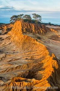
Broken Hill and view to La Jolla, from Torrey Pines State Reserve, sunrise.
Location: Torrey Pines State Reserve, San Diego, California
Image ID: 28395
Location: Torrey Pines State Reserve, San Diego, California
Image ID: 28395
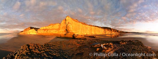
Torrey Pines State Beach, sandstone cliffs rise above the beach at Torrey Pines State Reserve.
Location: Torrey Pines State Reserve, San Diego, California
Image ID: 27194
Panorama dimensions: 3810 x 10199
Location: Torrey Pines State Reserve, San Diego, California
Image ID: 27194
Panorama dimensions: 3810 x 10199
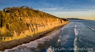
Torrey Pines State Beach at Sunset, La Jolla, Mount Soledad and Blacks Beach in the distance.
Location: Torrey Pines State Reserve, San Diego, California
Image ID: 38220
Location: Torrey Pines State Reserve, San Diego, California
Image ID: 38220
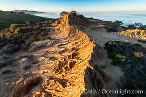
Broken Hill by the first light of dawn, overlooking the Pacific Ocean and Torrey Pines State Reserve, La Jolla and Mount Soledad in the distance.
Location: Torrey Pines State Reserve, San Diego, California
Image ID: 36568
Location: Torrey Pines State Reserve, San Diego, California
Image ID: 36568
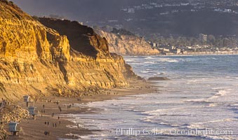
Torrey Pines State Beach at Sunset, La Jolla, Mount Soledad and Blacks Beach in the distance.
Location: Torrey Pines State Reserve, San Diego, California
Image ID: 36741
Location: Torrey Pines State Reserve, San Diego, California
Image ID: 36741
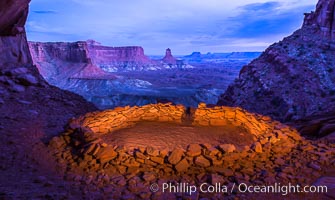
False Kiva at Sunset, Canyonlands National Park, Utah.
Location: False Kiva, Canyonlands National Park, Utah
Image ID: 28017
Location: False Kiva, Canyonlands National Park, Utah
Image ID: 28017
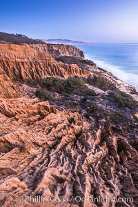
Torrey Pines Cliffs and Pacific Ocean, Razor Point view to La Jolla, San Diego, California.
Location: Torrey Pines State Reserve, San Diego, California
Image ID: 28485
Location: Torrey Pines State Reserve, San Diego, California
Image ID: 28485
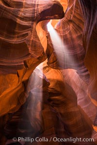
Light Beam in Upper Antelope Slot Canyon. Thin shafts of light briefly penetrate the convoluted narrows of Upper Antelope Slot Canyon, sending piercing beams through the sandstone maze to the sand floor below.
Location: Navajo Tribal Lands, Page, Arizona
Image ID: 28563
Location: Navajo Tribal Lands, Page, Arizona
Image ID: 28563
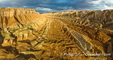
Aerial View of the San Rafael Reef, Utah. This is a canyon-like section of the San Rafael Reef, photographed at sunrise. The "reef proper" is on the right, with its characteristic triangular flatiron erosion. The canyon in the center is a fold in the Earth's crust affiliated with the boundary of the San Rafael Swell. The colors seen here arise primarily from Navajo and Wingate sandstone.
Location: Utah
Image ID: 39497
Panorama dimensions: 4490 x 8439
Location: Utah
Image ID: 39497
Panorama dimensions: 4490 x 8439
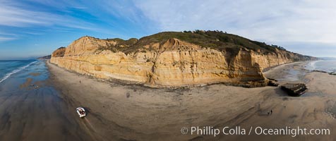
Torrey Pines balloon aerial survey photo. Torrey Pines seacliffs, rising up to 300 feet above the ocean, stretch from Del Mar to La Jolla. On the mesa atop the bluffs are found Torrey pine trees, one of the rare species of pines in the world. Peregrine falcons nest at the edge of the cliffs. This photo was made as part of an experimental balloon aerial photographic survey flight over Torrey Pines State Reserve, by permission of Torrey Pines State Reserve.
Location: Torrey Pines State Reserve, San Diego, California
Image ID: 27271
Panorama dimensions: 5001 x 11896
Location: Torrey Pines State Reserve, San Diego, California
Image ID: 27271
Panorama dimensions: 5001 x 11896
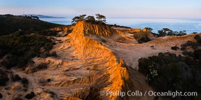
Broken Hill and view to La Jolla, panoramic photograph, from Torrey Pines State Reserve, sunrise.
Location: Torrey Pines State Reserve, San Diego, California
Image ID: 28464
Panorama dimensions: 3867 x 7787
Location: Torrey Pines State Reserve, San Diego, California
Image ID: 28464
Panorama dimensions: 3867 x 7787
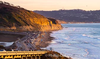
Torrey Pines State Beach at Sunset, La Jolla, Mount Soledad and Blacks Beach in the distance.
Location: Torrey Pines State Reserve, San Diego, California
Image ID: 35057
Location: Torrey Pines State Reserve, San Diego, California
Image ID: 35057
