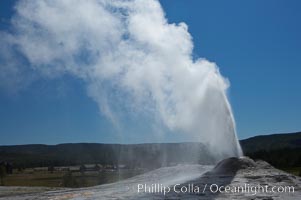
Lion Geyser, whose eruption is preceded by a release of steam that sounds like a lion roaring, erupts just once or a few times each day, reaching heights of up to 90 feet. Upper Geyser Basin.
Location: Upper Geyser Basin, Yellowstone National Park, Wyoming
Image ID: 13374
Location: Upper Geyser Basin, Yellowstone National Park, Wyoming
Image ID: 13374
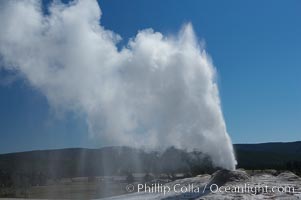
Lion Geyser, whose eruption is preceded by a release of steam that sounds like a lion roaring, erupts just once or a few times each day, reaching heights of up to 90 feet. Upper Geyser Basin.
Location: Upper Geyser Basin, Yellowstone National Park, Wyoming
Image ID: 13375
Location: Upper Geyser Basin, Yellowstone National Park, Wyoming
Image ID: 13375
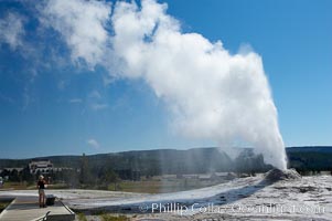
A visitor videotapes the eruption of Lion Geyser, with Old Faithful Inn visible in the distance. Lion Geyser, whose eruption is preceded by a release of steam that sounds like a lion roaring, erupts just once or a few times each day, reaching heights of up to 90 feet. Upper Geyser Basin.
Location: Upper Geyser Basin, Yellowstone National Park, Wyoming
Image ID: 13376
Location: Upper Geyser Basin, Yellowstone National Park, Wyoming
Image ID: 13376
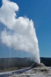
Lion Geyser, whose eruption is preceded by a release of steam that sounds like a lion roaring, erupts just once or a few times each day, reaching heights of up to 90 feet. Upper Geyser Basin.
Location: Upper Geyser Basin, Yellowstone National Park, Wyoming
Image ID: 13377
Location: Upper Geyser Basin, Yellowstone National Park, Wyoming
Image ID: 13377
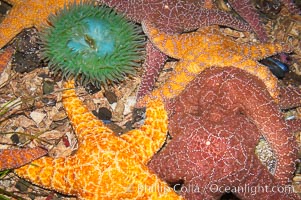
Starfish, seastars and anemones cover the rocks in a intertidal tidepool, Puget Sound, Washington.
Image ID: 13721
Image ID: 13721
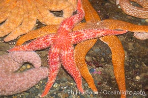
Starfish, seastars and anemones cover the rocks in a intertidal tidepool, Puget Sound, Washington.
Image ID: 13722
Image ID: 13722
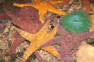
Starfish, seastars and anemones cover the rocks in a intertidal tidepool, Puget Sound, Washington.
Image ID: 13723
Image ID: 13723
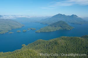
Flores Island (foreground) and Clayoquot Sound, aerial photo, near Tofino on the west coast of Vancouver Island.
Location: Tofino, British Columbia, Canada
Image ID: 21070
Location: Tofino, British Columbia, Canada
Image ID: 21070
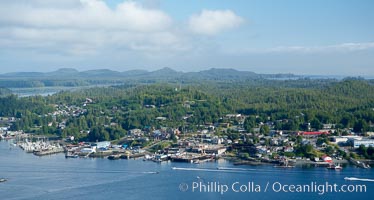
Tofino, a small beautiful town on the edge of Clayoquot Sound and the Pacific Ocean on the west coast of Vancouver Island, aerial photo.
Location: Tofino, British Columbia, Canada
Image ID: 21073
Location: Tofino, British Columbia, Canada
Image ID: 21073
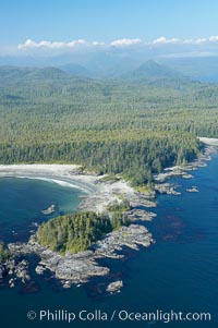
Cow Bay (left) and Flores Island, aerial photo, part of Clayoquot Sound, near Tofino on the west coast of Vancouver Island.
Location: Tofino, British Columbia, Canada
Image ID: 21075
Location: Tofino, British Columbia, Canada
Image ID: 21075
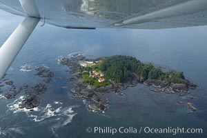
Lennard Island Lighthouse, aerial photo, surrounded by the waters of Clayoquot Sound near Tofino on the west coast of Vancouver Island, British Columbia, Canada.
Location: Tofino, British Columbia, Canada
Image ID: 21077
Location: Tofino, British Columbia, Canada
Image ID: 21077
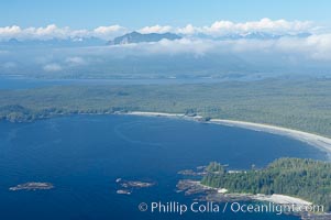
Ahouse Bay and Vargas Island, aerial photo, Clayoquot Sound in the foreground, near Tofino on the west coast of Vancouver Island.
Location: Tofino, British Columbia, Canada
Image ID: 21078
Location: Tofino, British Columbia, Canada
Image ID: 21078
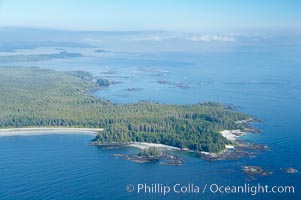
Ahouse Bay and Vargas Island, aerial photo, Clayoquot Sound in the foreground, near Tofino on the west coast of Vancouver Island.
Location: Tofino, British Columbia, Canada
Image ID: 21079
Location: Tofino, British Columbia, Canada
Image ID: 21079
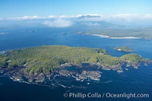
Blunden Island (foreground) and Vargas Island (distance), surrounded by the waters of Clayoquot Sound, west coast of Vancouver Island.
Location: Tofino, British Columbia, Canada
Image ID: 21080
Location: Tofino, British Columbia, Canada
Image ID: 21080
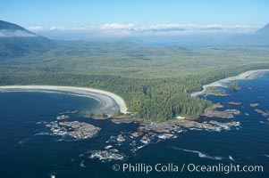
Cow Bay (left) and Flores Island, aerial photo, part of Clayoquot Sound, near Tofino on the west coast of Vancouver Island.
Location: Tofino, British Columbia, Canada
Image ID: 21081
Location: Tofino, British Columbia, Canada
Image ID: 21081
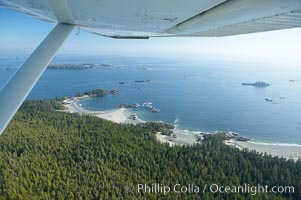
Cow Bay and Flores Island, aerial photo, part of Clayoquot Sound, near Tofino on the west coast of Vancouver Island.
Location: Tofino, British Columbia, Canada
Image ID: 21082
Location: Tofino, British Columbia, Canada
Image ID: 21082
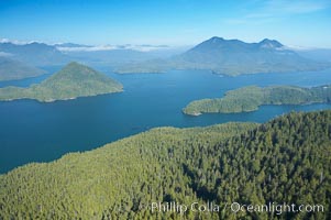
Flores Island (foreground) and Clayoquot Sound, aerial photo, near Tofino on the west coast of Vancouver Island.
Location: Tofino, British Columbia, Canada
Image ID: 21083
Location: Tofino, British Columbia, Canada
Image ID: 21083
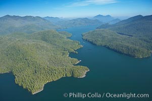
Obstruction Island (left) and Flores Island (right), Shelter Inlet section of Clayoquot Sound, aerial photo, near Tofino on the west coast of Vancouver Island.
Location: Tofino, British Columbia, Canada
Image ID: 21084
Location: Tofino, British Columbia, Canada
Image ID: 21084
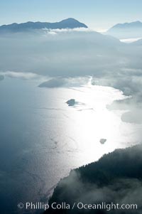
Clayoquot Sound, on the west coast of Vancouver Island, aerial photo.
Location: Tofino, British Columbia, Canada
Image ID: 21094
Location: Tofino, British Columbia, Canada
Image ID: 21094
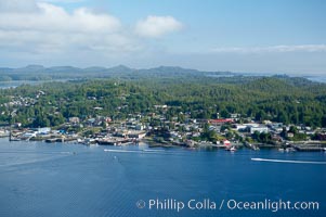
Tofino, a small beautiful town on the edge of Clayoquot Sound and the Pacific Ocean on the west coast of Vancouver Island, aerial photo.
Location: Tofino, British Columbia, Canada
Image ID: 21095
Location: Tofino, British Columbia, Canada
Image ID: 21095
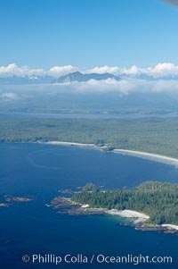
Ahouse Bay and Vargas Island, aerial photo, Clayoquot Sound in the foreground, near Tofino on the west coast of Vancouver Island.
Location: Tofino, British Columbia, Canada
Image ID: 21097
Location: Tofino, British Columbia, Canada
Image ID: 21097
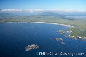
Ahouse Bay and Vargas Island, aerial photo, Clayoquot Sound in the foreground, near Tofino on the west coast of Vancouver Island.
Location: Tofino, British Columbia, Canada
Image ID: 21098
Location: Tofino, British Columbia, Canada
Image ID: 21098
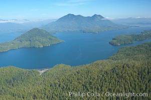
Flores Island (foreground) and Clayoquot Sound, aerial photo, near Tofino on the west coast of Vancouver Island.
Location: Tofino, British Columbia, Canada
Image ID: 21099
Location: Tofino, British Columbia, Canada
Image ID: 21099
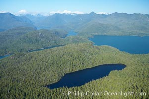
Flores Island (foreground) and Clayoquot Sound, aerial photo, near Tofino on the west coast of Vancouver Island.
Location: Tofino, British Columbia, Canada
Image ID: 21100
Location: Tofino, British Columbia, Canada
Image ID: 21100
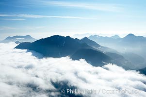
Coastal mountains and clouds, rising above Bedwell Sound (hidden by clouds) and Clayoquot Sound, near Tofino on the west coast of Vancouver Island.
Location: Tofino, British Columbia, Canada
Image ID: 21109
Location: Tofino, British Columbia, Canada
Image ID: 21109
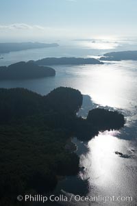
Clayoquot Sound, on the west coast of Vancouver Island, aerial photo.
Location: Tofino, British Columbia, Canada
Image ID: 21110
Location: Tofino, British Columbia, Canada
Image ID: 21110
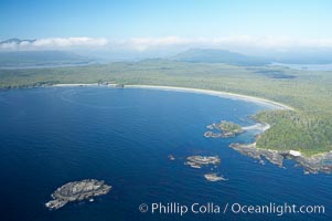
Ahouse Bay and Vargas Island, aerial photo, Clayoquot Sound in the foreground, near Tofino on the west coast of Vancouver Island.
Location: Tofino, British Columbia, Canada
Image ID: 21112
Location: Tofino, British Columbia, Canada
Image ID: 21112
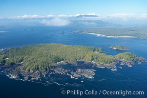
Blunden Island (foreground) and Vargas Island (distance), surrounded by the waters of Clayoquot Sound, west coast of Vancouver Island.
Location: Tofino, British Columbia, Canada
Image ID: 21113
Location: Tofino, British Columbia, Canada
Image ID: 21113
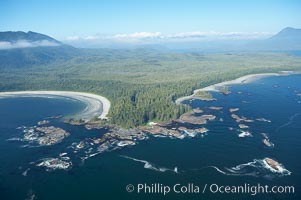
Cow Bay (left) and Flores Island, aerial photo, part of Clayoquot Sound, near Tofino on the west coast of Vancouver Island.
Location: Tofino, British Columbia, Canada
Image ID: 21114
Location: Tofino, British Columbia, Canada
Image ID: 21114
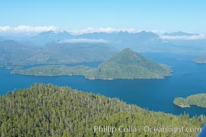
Flores Island (foreground) and Clayoquot Sound, aerial photo, near Tofino on the west coast of Vancouver Island.
Location: Tofino, British Columbia, Canada
Image ID: 21115
Location: Tofino, British Columbia, Canada
Image ID: 21115