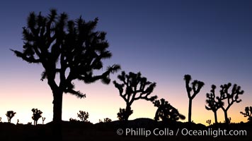
Joshua Trees silhouetted against predawn sunrise light.
Species: Joshua tree, Yucca brevifolia
Location: Joshua Tree National Park, California
Image ID: 22115
Species: Joshua tree, Yucca brevifolia
Location: Joshua Tree National Park, California
Image ID: 22115
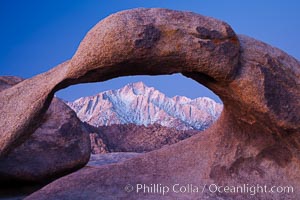
Mobius Arch at sunrise, framing snow dusted Lone Pine Peak and the Sierra Nevada Range in the background. Also known as Galen's Arch, Mobius Arch is found in the Alabama Hills Recreational Area near Lone Pine.
Location: Alabama Hills Recreational Area, California
Image ID: 27627
Location: Alabama Hills Recreational Area, California
Image ID: 27627

Coronado Bridge, linking San Diego to Coronado, sunrise, viewed from Coronado Island. San Diego Coronado Bridge, known locally as the Coronado Bridge, links San Diego with Coronado, California. The bridge was completed in 1969 and was a toll bridge until 2002. It is 2.1 miles long and reaches a height of 200 feet above San Diego Bay.
Location: San Diego, California
Image ID: 27101
Location: San Diego, California
Image ID: 27101
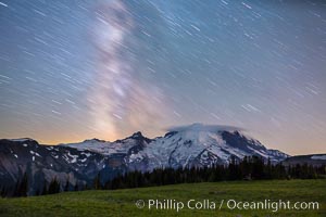
Milky Way and stars at night above Mount Rainier.
Location: Sunrise, Mount Rainier National Park, Washington
Image ID: 28728
Location: Sunrise, Mount Rainier National Park, Washington
Image ID: 28728
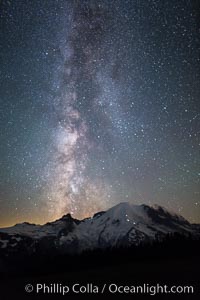
Milky Way and stars at night above Mount Rainier.
Location: Sunrise, Mount Rainier National Park, Washington
Image ID: 28731
Location: Sunrise, Mount Rainier National Park, Washington
Image ID: 28731
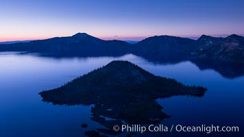
Crater Lake and Wizard Island at sunrise.
Location: Crater Lake National Park, Oregon
Image ID: 28668
Location: Crater Lake National Park, Oregon
Image ID: 28668

Mesquite Dunes sunrise, dawn, clouds and morning sky, sand dunes.
Location: Stovepipe Wells, Death Valley National Park, California
Image ID: 28688
Location: Stovepipe Wells, Death Valley National Park, California
Image ID: 28688
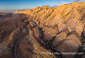
Aerial photo of the San Rafael Reef at dawn. A fold in the Earth's crust leads to this inclined section of the San Rafael Reef, at the eastern edge of the San Rafael Swell. Clearly seen are the characteristic triangular flatiron erosion patterns that typical this formation. The colors seen here arise primarily from Navajo and Wingate sandstone.
Location: Utah
Image ID: 39784
Location: Utah
Image ID: 39784
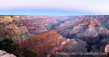
Belt of Venus over Grand Canyon at sunrise, viewed from Hopi Point on the south rim of Grand Canyon National Park. The Belt of Venus, or anti-twilight arch, is the shadow of the earth cast upon the atmosphere just above the horizon, and occurs a few minutes before sunrise or after sunset.
Location: Grand Canyon National Park, Arizona
Image ID: 37765
Panorama dimensions: 5409 x 10272
Location: Grand Canyon National Park, Arizona
Image ID: 37765
Panorama dimensions: 5409 x 10272

Brown pelican head throw in soft pre-sunrise light, adult winter non-breeding plumage.
Species: Brown Pelican, Pelecanus occidentalis, Pelecanus occidentalis californicus
Location: La Jolla, California
Image ID: 38585
Species: Brown Pelican, Pelecanus occidentalis, Pelecanus occidentalis californicus
Location: La Jolla, California
Image ID: 38585

Brown pelican head throw in soft pre-sunrise light, adult winter non-breeding plumage.
Species: Brown Pelican, Pelecanus occidentalis, Pelecanus occidentalis californicus
Location: La Jolla, California
Image ID: 38586
Species: Brown Pelican, Pelecanus occidentalis, Pelecanus occidentalis californicus
Location: La Jolla, California
Image ID: 38586

Juvenile California Brown Pelican Flying over the Ocean, early morning light just after sunrise.
Species: Brown Pelican, Pelecanus occidentalis, Pelecanus occidentalis californicus
Location: La Jolla, California
Image ID: 38808
Species: Brown Pelican, Pelecanus occidentalis, Pelecanus occidentalis californicus
Location: La Jolla, California
Image ID: 38808
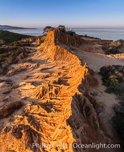
Sunrise over Broken Hill, overlooking La Jolla and the Pacific Ocean, Torrey Pines State Reserve.
Location: Torrey Pines State Reserve, San Diego, California
Image ID: 35844
Location: Torrey Pines State Reserve, San Diego, California
Image ID: 35844
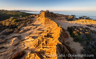
Sunrise over Broken Hill, overlooking La Jolla and the Pacific Ocean, Torrey Pines State Reserve.
Location: Torrey Pines State Reserve, San Diego, California
Image ID: 35845
Location: Torrey Pines State Reserve, San Diego, California
Image ID: 35845
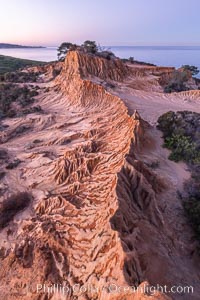
Broken Hill in soft pre-dawn light, overlooking the Pacific Ocean and Torrey Pines State Reserve.
Location: Torrey Pines State Reserve, San Diego, California
Image ID: 36565
Location: Torrey Pines State Reserve, San Diego, California
Image ID: 36565
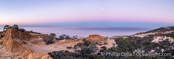
Earth Shadow over the Pacific, Torrey Pines, California.
Location: Torrey Pines State Reserve, San Diego, California
Image ID: 36566
Panorama dimensions: 4487 x 13160
Location: Torrey Pines State Reserve, San Diego, California
Image ID: 36566
Panorama dimensions: 4487 x 13160

Scripps Pier with Christmas Lights and Full Moon at Sunrise.
Location: La Jolla, California
Image ID: 36629
Location: La Jolla, California
Image ID: 36629
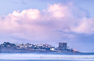
Point La Jolla viewed from Scripps Institution of Oceanography, big waves at sunrise.
Location: La Jolla, California
Image ID: 36630
Location: La Jolla, California
Image ID: 36630

Belt of Venus and Earth Shadow at Dawn. The Belt of Venus is actually alpenglow visible near the horizon during twilight, above the antisolar point. Like alpenglow, the backscatter of reddened sunlight also creates the Belt of Venus. Unlike alpenglow, the sunlight scattered by fine particulates that cause the rosy arch of the Belt shines high in the atmosphere and lasts for a while after sunset or before sunrise.
Location: La Jolla, California
Image ID: 37476
Location: La Jolla, California
Image ID: 37476
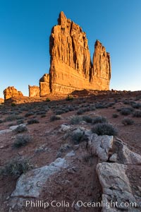
The Organ at sunrise, Courthouse Towers, Arches National Park.
Location: Courthouse Towers, Arches National Park, Utah
Image ID: 37859
Location: Courthouse Towers, Arches National Park, Utah
Image ID: 37859

Snow geese fly in huge numbers at sunrise. Thousands of wintering snow geese take to the sky in predawn light in Bosque del Apache's famous "blast off". The flock can be as large as 20,000 geese or more.
Species: Snow goose, Chen caerulescens
Location: Bosque del Apache National Wildlife Refuge, Socorro, New Mexico
Image ID: 38738
Species: Snow goose, Chen caerulescens
Location: Bosque del Apache National Wildlife Refuge, Socorro, New Mexico
Image ID: 38738

La Jolla Cove and Point La Jolla at Dawn, waves blur into abstract white, pre-sunrise soft light.
Location: La Jolla, California
Image ID: 38916
Panorama dimensions: 5384 x 10917
Location: La Jolla, California
Image ID: 38916
Panorama dimensions: 5384 x 10917

Spectacular Red and Magenta Sunrise Cloud Colors, San Diego.
Location: San Diego, California
Image ID: 38918
Location: San Diego, California
Image ID: 38918
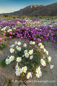
Spring Wildflowers Bloom in an Colorful Bouquet in Anza Borrego Desert State Park. Dune evening primrose (white) is mixed with sand verbena (purple) near Henderson Canyon Road, Spring 2024. Sunrise light barely illuminating the flowers.
Species: Dune evening primrose, Sand verbena, Oenothera deltoides, Abronia villosa
Location: Anza-Borrego Desert State Park, Borrego Springs, California
Image ID: 40271
Species: Dune evening primrose, Sand verbena, Oenothera deltoides, Abronia villosa
Location: Anza-Borrego Desert State Park, Borrego Springs, California
Image ID: 40271
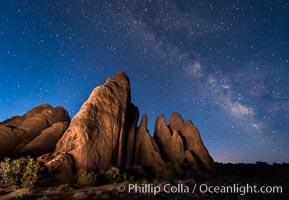
Milky Way over Sandstone Fins. Sandstone fins stand on edge. Vertical fractures separate standing plates of sandstone that are eroded into freestanding fins, that may one day further erode into arches.
Location: Arches National Park, Utah
Image ID: 29254
Location: Arches National Park, Utah
Image ID: 29254
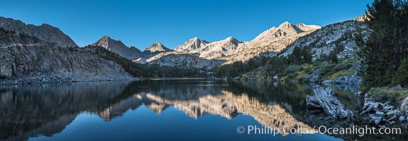
Panorama of Bear Creek Spire over Long Lake at Sunrise, Little Lakes Valley, John Muir Wilderness, Inyo National Forest.
Location: Little Lakes Valley, Inyo National Forest, California
Image ID: 31173
Panorama dimensions: 5473 x 15812
Location: Little Lakes Valley, Inyo National Forest, California
Image ID: 31173
Panorama dimensions: 5473 x 15812
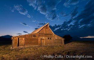
T.A. Moulton Barn and Teton Range at dusk, Grand Teton National Park.
Image ID: 32314
Image ID: 32314
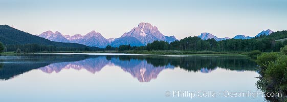
Mount Moran at sunrise from Oxbow Bend, Grand Teton National Park.
Image ID: 32317
Panorama dimensions: 4556 x 12787
Image ID: 32317
Panorama dimensions: 4556 x 12787

Mount Moran and Teton Range at sunrise from Willow Flats, Grand Teton National Park.
Image ID: 32318
Panorama dimensions: 4484 x 16888
Image ID: 32318
Panorama dimensions: 4484 x 16888
