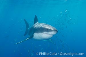
A great white shark underwater. A large great white shark cruises the clear oceanic waters of Guadalupe Island (Isla Guadalupe).
Species: Great white shark, Carcharodon carcharias
Location: Guadalupe Island (Isla Guadalupe), Baja California, Mexico
Image ID: 10110
Species: Great white shark, Carcharodon carcharias
Location: Guadalupe Island (Isla Guadalupe), Baja California, Mexico
Image ID: 10110
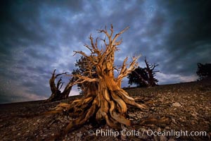
Ancient Bristlecone Pine Tree at night, stars and the Milky Way galaxy visible in the evening sky, near Patriarch Grove.
Species: Ancient bristlecone pine, Pinus longaeva
Location: Ancient Bristlecone Pine Forest, White Mountains, Inyo National Forest, California
Image ID: 28786
Species: Ancient bristlecone pine, Pinus longaeva
Location: Ancient Bristlecone Pine Forest, White Mountains, Inyo National Forest, California
Image ID: 28786
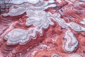
Fantastic colorful sedimentary patterns of Bentonite layers, seen as striations exposed in the Utah Badlands. The Bentonite Hills are composed of the Brushy Basin shale member of the Morrison Formation formed during Jurassic times when mud, silt, fine sand, and volcanic ash were deposited in swamps and lakes into layers, now revealed through erosion. Aerial photograph.
Location: Utah
Image ID: 37947
Location: Utah
Image ID: 37947
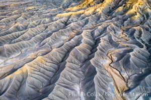
Erosion patterns in the Utah Badlands, aerial abstract photo.
Location: Hanksville, Utah
Image ID: 37948
Location: Hanksville, Utah
Image ID: 37948
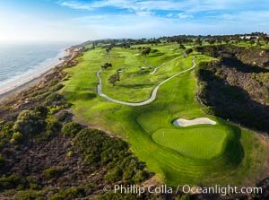
Torrey Pines Golf Course over looking Blacks Beach and the Pacific Ocean, south course, summer, afternoon.
Location: Torrey Pines Golf Course, San Diego, California
Image ID: 38050
Location: Torrey Pines Golf Course, San Diego, California
Image ID: 38050
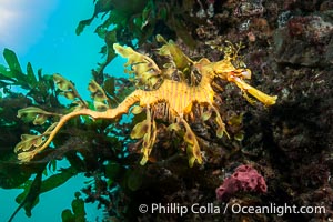
The leafy seadragon (Phycodurus eques) is found on the southern and western coasts of Australia. Its extravagent appendages serve only for camoflage, since it has a nearly-invisible dorsal fin that propels it slowly through the water. The leafy sea dragon is the marine emblem of South Australia.
Species: Leafy seadragon, Phycodurus eques
Location: Rapid Bay Jetty, South Australia
Image ID: 39134
Species: Leafy seadragon, Phycodurus eques
Location: Rapid Bay Jetty, South Australia
Image ID: 39134
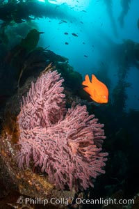
Garibaldi and Brown Gorgonian Muricea fruticosa, Catalina Island, with giant kelp stands reaching from the reef to the surface of the ocean in the distance. The clown prince of the kelp forest, the Garibaldi, alternately poses for me and chirps at me to move away from his gorgonian.
Location: Catalina Island, California
Image ID: 37157
Location: Catalina Island, California
Image ID: 37157
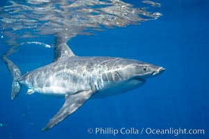
A great white shark swims through the clear waters of Isla Guadalupe, far offshore of the Pacific Coast of Mexico's Baja California. Guadalupe Island is host to a concentration of large great white sharks, which visit the island to feed on pinnipeds and use it as a staging area before journeying farther into the Pacific ocean.
Species: Great white shark, Carcharodon carcharias
Location: Guadalupe Island (Isla Guadalupe), Baja California, Mexico
Image ID: 19454
Species: Great white shark, Carcharodon carcharias
Location: Guadalupe Island (Isla Guadalupe), Baja California, Mexico
Image ID: 19454
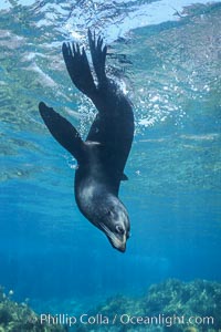
Female Guadalupe fur seal resting underwater.
Species: Guadalupe fur seal, Arctocephalus townsendi
Location: Guadalupe Island (Isla Guadalupe), Baja California, Mexico
Image ID: 10359
Species: Guadalupe fur seal, Arctocephalus townsendi
Location: Guadalupe Island (Isla Guadalupe), Baja California, Mexico
Image ID: 10359
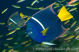
King angelfish in the Sea of Cortez, Mexico.
Species: King angelfish, Holacanthus passer
Location: Sea of Cortez, Baja California, Mexico
Image ID: 27470
Species: King angelfish, Holacanthus passer
Location: Sea of Cortez, Baja California, Mexico
Image ID: 27470
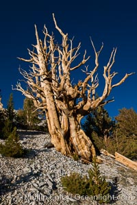
Ancient bristlecone pine trees in Patriarch Grove, display characteristic gnarled, twisted form as it rises above the arid, dolomite-rich slopes of the White Mountains at 11000-foot elevation. Patriarch Grove, Ancient Bristlecone Pine Forest.
Species: Ancient bristlecone pine, Pinus longaeva
Location: White Mountains, Inyo National Forest, California
Image ID: 28526
Species: Ancient bristlecone pine, Pinus longaeva
Location: White Mountains, Inyo National Forest, California
Image ID: 28526
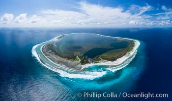
Aerial panorama of Clipperton Island, showing the entire atoll. Clipperton Island, a minor territory of France also known as Ile de la Passion, is a small (2.3 sq mi) but spectacular coral atoll in the eastern Pacific. By permit HC / 1485 / CAB (France).
Location: Clipperton Island, France
Image ID: 32835
Panorama dimensions: 5523 x 9328
Location: Clipperton Island, France
Image ID: 32835
Panorama dimensions: 5523 x 9328
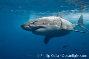
Great white shark, underwater.
Species: Great white shark, Carcharodon carcharias
Location: Guadalupe Island (Isla Guadalupe), Baja California, Mexico
Image ID: 21361
Species: Great white shark, Carcharodon carcharias
Location: Guadalupe Island (Isla Guadalupe), Baja California, Mexico
Image ID: 21361
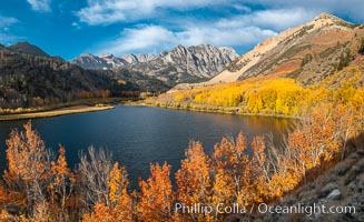
Sierra Nevada Fall Colors, North Lake, Bishop Creek Canyon.
Species: Quaking aspen, Populus tremuloides
Location: Bishop Creek Canyon, Sierra Nevada Mountains, California
Image ID: 36437
Panorama dimensions: 6440 x 10545
Species: Quaking aspen, Populus tremuloides
Location: Bishop Creek Canyon, Sierra Nevada Mountains, California
Image ID: 36437
Panorama dimensions: 6440 x 10545
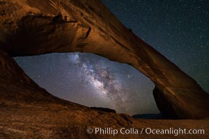
Milky Way and Stars through Wilson Arch. Wilson Arch rises high above route 191 in eastern Utah, with a span of 91 feet and a height of 46 feet.
Location: Wilson Arch, Moab, Utah
Image ID: 29275
Location: Wilson Arch, Moab, Utah
Image ID: 29275
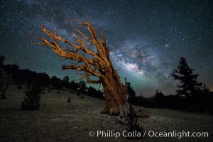
Milky Way over Ancient Bristlecone Pine Trees, Inyo National Forest.
Species: Bristlecone pine, Pinus longaeva
Location: Ancient Bristlecone Pine Forest, White Mountains, Inyo National Forest, California
Image ID: 29318
Species: Bristlecone pine, Pinus longaeva
Location: Ancient Bristlecone Pine Forest, White Mountains, Inyo National Forest, California
Image ID: 29318
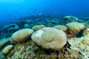
Coral reef expanse composed primarily of porites lobata, Clipperton Island, near eastern Pacific.
Species: Porites lobata
Location: Clipperton Island, France
Image ID: 32998
Species: Porites lobata
Location: Clipperton Island, France
Image ID: 32998

Royal tern in flight, Thalasseus maximus, adult nonbreeding plumage, ocean water in the background, La Jolla.
Species: Royal tern, Sterna maxima, Thalasseus maximus
Location: La Jolla, California
Image ID: 40687
Species: Royal tern, Sterna maxima, Thalasseus maximus
Location: La Jolla, California
Image ID: 40687
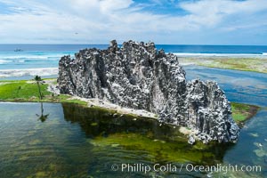
Clipperton Rock, a 95' high volcanic remnant, is the highest point on Clipperton Island, a spectacular coral atoll in the eastern Pacific. By permit HC / 1485 / CAB (France).
Location: Clipperton Island, France
Image ID: 32940
Location: Clipperton Island, France
Image ID: 32940

Royal tern, winter adult phase.
Species: Royal Tern, Sterna maxima, Thalasseus maximus
Location: La Jolla, California
Image ID: 37723
Species: Royal Tern, Sterna maxima, Thalasseus maximus
Location: La Jolla, California
Image ID: 37723
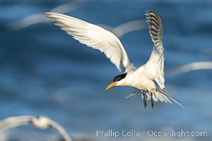
Royal Tern in flight, adult breeding plumage with black head cap, La Jolla.
Species: Royal tern, Sterna maxima, Thalasseus maximus
Location: La Jolla, California
Image ID: 38954
Species: Royal tern, Sterna maxima, Thalasseus maximus
Location: La Jolla, California
Image ID: 38954
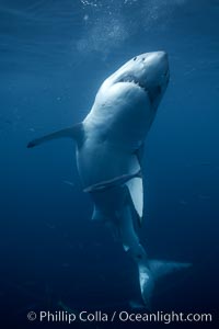
Great white shark, underwater.
Species: Great white shark, Carcharodon carcharias
Location: Guadalupe Island (Isla Guadalupe), Baja California, Mexico
Image ID: 21362
Species: Great white shark, Carcharodon carcharias
Location: Guadalupe Island (Isla Guadalupe), Baja California, Mexico
Image ID: 21362
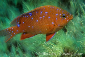
Juvenile garibaldi in motion.
Species: Garibaldi, Hypsypops rubicundus
Location: Catalina Island, California
Image ID: 02343
Species: Garibaldi, Hypsypops rubicundus
Location: Catalina Island, California
Image ID: 02343
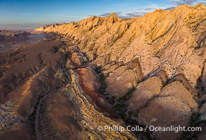
Aerial photo of the San Rafael Reef at dawn. A fold in the Earth's crust leads to this inclined section of the San Rafael Reef, at the eastern edge of the San Rafael Swell. Clearly seen are the characteristic triangular flatiron erosion patterns that typical this formation. The colors seen here arise primarily from Navajo and Wingate sandstone.
Location: Utah
Image ID: 39784
Location: Utah
Image ID: 39784
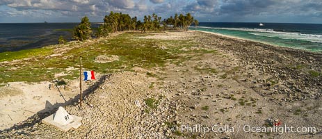
The French tricolor flag flies over Clipperton Island at sunset. Clipperton Island, a minor territory of France also known as Ile de la Passion, is a spectacular coral atoll in the eastern Pacific. By permit HC / 1485 / CAB (France).
Location: Clipperton Island, France
Image ID: 32902
Location: Clipperton Island, France
Image ID: 32902

Royal Tern in flight, breaking waves and surf in the background, adult non-breeding plumage, La Jolla.
Species: Royal tern, Sterna maxima, Thalasseus maximus
Location: La Jolla, California
Image ID: 38953
Species: Royal tern, Sterna maxima, Thalasseus maximus
Location: La Jolla, California
Image ID: 38953

Great white shark, underwater.
Species: Great white shark, Carcharodon carcharias
Location: Guadalupe Island (Isla Guadalupe), Baja California, Mexico
Image ID: 21360
Species: Great white shark, Carcharodon carcharias
Location: Guadalupe Island (Isla Guadalupe), Baja California, Mexico
Image ID: 21360
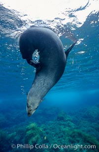
Guadalupe fur seal.
Species: Guadalupe fur seal, Arctocephalus townsendi
Location: Guadalupe Island (Isla Guadalupe), Baja California, Mexico
Image ID: 03741
Species: Guadalupe fur seal, Arctocephalus townsendi
Location: Guadalupe Island (Isla Guadalupe), Baja California, Mexico
Image ID: 03741
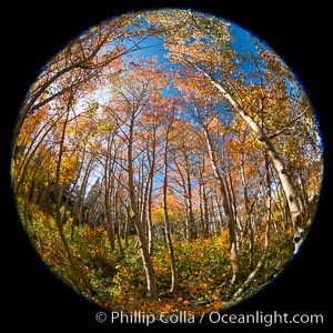
Aspen grove, Dunderberg Meadows, eastern Sierra Nevada.
Location: Sierra Nevada Mountains, California
Image ID: 35835
Location: Sierra Nevada Mountains, California
Image ID: 35835
