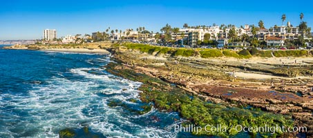
South Casa Reef Exposed at Extreme Low Tide, La Jolla, California.
Location: La Jolla, California
Image ID: 38011
Location: La Jolla, California
Image ID: 38011
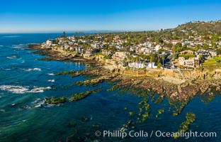
Sun Gold Point Reef Exposed at Extreme Low Tide, La Jolla, California.
Location: La Jolla, California
Image ID: 38012
Location: La Jolla, California
Image ID: 38012
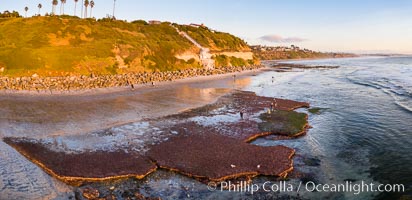
Swamis Beach Reefs Exposed by King Tides, people explore ocean reefs normally underwater but exposed on the extreme low tides known as King Tides. Aerial photo.
Location: Encinitas, California
Image ID: 38014
Panorama dimensions: 4226 x 8716
Location: Encinitas, California
Image ID: 38014
Panorama dimensions: 4226 x 8716
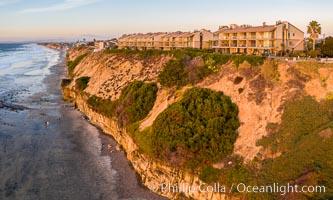
Aerial photo of Coastal Seacliffs in Encinitas California.
Location: Encinitas, California
Image ID: 38015
Location: Encinitas, California
Image ID: 38015
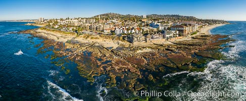
Aerial Panorama of Nicholson Point and Hospitals Beach, aerial photo, extreme low tide, La Jolla, California.
Location: La Jolla, California
Image ID: 38041
Panorama dimensions: 5143 x 12532
Location: La Jolla, California
Image ID: 38041
Panorama dimensions: 5143 x 12532
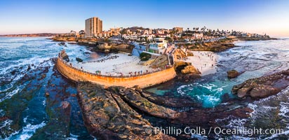
Childrens Pool Reef Exposed at Extreme Low Tide, La Jolla, California. Aerial panoramic photograph.
Location: La Jolla, California
Image ID: 38157
Panorama dimensions: 5499 x 11325
Location: La Jolla, California
Image ID: 38157
Panorama dimensions: 5499 x 11325
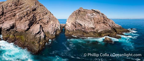
The Famed Keyhole at North Coronado Island, Mexico. The Keyhole is an underwater channel that passes below a natural stone arch which is exposed or underwater depending on the tides and waves.
Location: Coronado Islands (Islas Coronado), Baja California, Mexico
Image ID: 39991
Location: Coronado Islands (Islas Coronado), Baja California, Mexico
Image ID: 39991
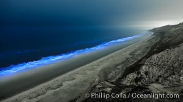
Lingulodinium polyedrum red tide dinoflagellate plankton, glows blue when it is agitated in wave and is visible at night.
Species: Lingulodinium polyedrum
Location: La Jolla, California
Image ID: 27062
Species: Lingulodinium polyedrum
Location: La Jolla, California
Image ID: 27062
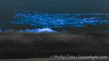
Bottlenose dolphins swim through red tide, hunt a school of fish, lit by glowing bioluminescence caused by microscopic Lingulodinium polyedrum dinoflagellate organisms which glow blue when agitated at night.
Species: Lingulodinium polyedrum
Location: La Jolla, California
Image ID: 27065
Species: Lingulodinium polyedrum
Location: La Jolla, California
Image ID: 27065
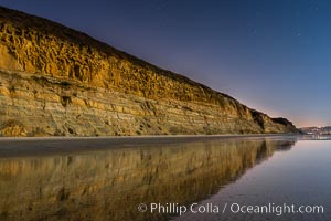
Torrey Pines Cliffs lit at night by a full moon, low tide reflections.
Location: Torrey Pines State Reserve, San Diego, California
Image ID: 28454
Location: Torrey Pines State Reserve, San Diego, California
Image ID: 28454
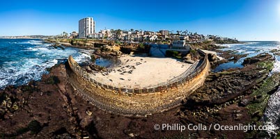
Childrens Pool Reef Exposed at Extreme Low Tide, Casa Cove, La Jolla, California. Aerial panoramic photograph.
Location: La Jolla, California
Image ID: 40235
Panorama dimensions: 6081 x 12216
Location: La Jolla, California
Image ID: 40235
Panorama dimensions: 6081 x 12216
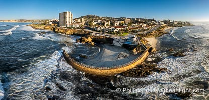
Children's Pool Reef Exposed at Extreme Low King Tide, La Jolla, California. Aerial panoramic photograph.
Location: La Jolla, California
Image ID: 40707
Panorama dimensions: 5387 x 11171
Location: La Jolla, California
Image ID: 40707
Panorama dimensions: 5387 x 11171
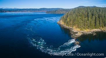
Seymour Narrows with strong tidal currents. Between Vancouver Island and Quadra Island, Seymour Narrows is about 750 meters wide and has currents reaching 15 knots. Aerial photo.
Location: British Columbia, Canada
Image ID: 34490
Location: British Columbia, Canada
Image ID: 34490
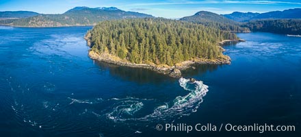
Seymour Narrows with strong tidal currents. Between Vancouver Island and Quadra Island, Seymour Narrows is about 750 meters wide and has currents reaching 15 knots. Aerial photo.
Location: British Columbia, Canada
Image ID: 34491
Location: British Columbia, Canada
Image ID: 34491
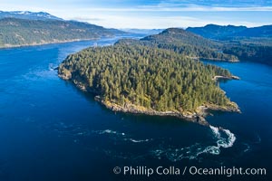
Seymour Narrows with strong tidal currents. Between Vancouver Island and Quadra Island, Seymour Narrows is about 750 meters wide and has currents reaching 15 knots. Aerial photo.
Location: British Columbia, Canada
Image ID: 34492
Location: British Columbia, Canada
Image ID: 34492
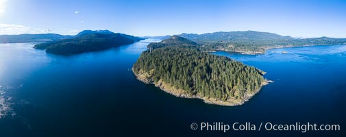
Seymour Narrows, between Vancouver Island and Quadra Island, Seymour Narrows is about 750 meters wide and has currents reaching 15 knots. Aerial photo.
Location: British Columbia, Canada
Image ID: 34493
Panorama dimensions: 5121 x 12921
Location: British Columbia, Canada
Image ID: 34493
Panorama dimensions: 5121 x 12921
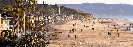
Del Mar Beach on the extreme low King Tide, people and dogs walking on the beach, late afternoon.
Location: Del Mar, California
Image ID: 37600
Panorama dimensions: 5278 x 14832
Location: Del Mar, California
Image ID: 37600
Panorama dimensions: 5278 x 14832

Sunset and King Tide on Del Mar Beach, Dog Beach, Solana Beach, looking north into North County San Diego.
Location: Del Mar, California
Image ID: 37614
Panorama dimensions: 4908 x 17283
Location: Del Mar, California
Image ID: 37614
Panorama dimensions: 4908 x 17283
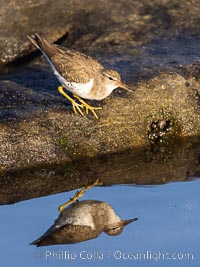
Least Sandpiper reflected in tide pool, foraging for food, La Jolla.
Location: La Jolla, California
Image ID: 38638
Location: La Jolla, California
Image ID: 38638
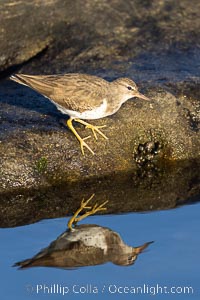
Least Sandpiper reflected in tide pool, foraging for food, La Jolla.
Location: La Jolla, California
Image ID: 38639
Location: La Jolla, California
Image ID: 38639
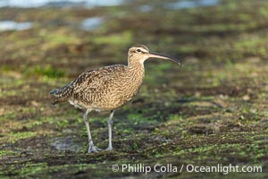
Hudsonian Whimbrel foraging in tide pools, La Jolla.
Species: Whimbrel, Numenius phaeopus
Location: La Jolla, California
Image ID: 39352
Species: Whimbrel, Numenius phaeopus
Location: La Jolla, California
Image ID: 39352
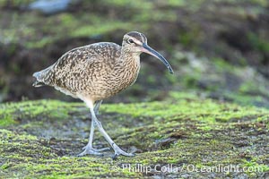
Hudsonian Whimbrel foraging in tide pools, La Jolla.
Species: Whimbrel, Numenius phaeopus
Location: La Jolla, California
Image ID: 39353
Species: Whimbrel, Numenius phaeopus
Location: La Jolla, California
Image ID: 39353
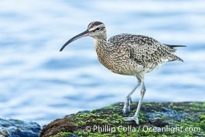
Hudsonian Whimbrel foraging in tide pools, La Jolla.
Species: Whimbrel, Numenius phaeopus
Location: La Jolla, California
Image ID: 39355
Species: Whimbrel, Numenius phaeopus
Location: La Jolla, California
Image ID: 39355

Hudsonian Whimbrel foraging in tide pools, La Jolla.
Species: Whimbrel, Numenius phaeopus
Location: La Jolla, California
Image ID: 39356
Species: Whimbrel, Numenius phaeopus
Location: La Jolla, California
Image ID: 39356
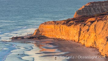
Torrey Pines sea cliffs at sunset, Flat Rock at low tide, looking north.
Location: Blacks Beach, La Jolla, California
Image ID: 36557
Panorama dimensions: 4876 x 8668
Location: Blacks Beach, La Jolla, California
Image ID: 36557
Panorama dimensions: 4876 x 8668
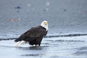
Bald eagle forages in tide waters on sand beach, snow falling.
Species: Bald eagle, Haliaeetus leucocephalus, Haliaeetus leucocephalus washingtoniensis
Location: Kachemak Bay, Homer, Alaska
Image ID: 22683
Species: Bald eagle, Haliaeetus leucocephalus, Haliaeetus leucocephalus washingtoniensis
Location: Kachemak Bay, Homer, Alaska
Image ID: 22683
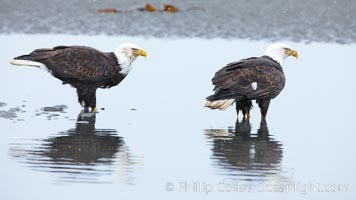
Bald eagle forages in tide waters on sand beach, snow falling.
Species: Bald eagle, Haliaeetus leucocephalus, Haliaeetus leucocephalus washingtoniensis
Location: Kachemak Bay, Homer, Alaska
Image ID: 22696
Species: Bald eagle, Haliaeetus leucocephalus, Haliaeetus leucocephalus washingtoniensis
Location: Kachemak Bay, Homer, Alaska
Image ID: 22696
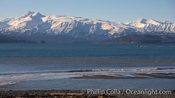
Kachemak Bay, Kenai Mountains, tide flats and rocky beach.
Location: Kachemak Bay, Homer, Alaska
Image ID: 22736
Location: Kachemak Bay, Homer, Alaska
Image ID: 22736
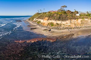
Swamis Reef exposed at extreme low King Tide, Encinitas, aerial panoramic photo.
Location: Swamis, Encinitas, California
Image ID: 37996
Location: Swamis, Encinitas, California
Image ID: 37996
