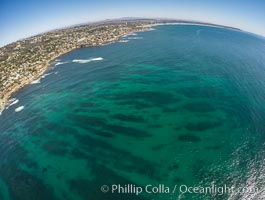
Aerial Panorama of La Jolla, University City, showing (from left) University of California at San Diego, University City, Scripps Institution of Oceanography, La Jolla Shores, Point La Jolla, Mount Soledad, in the background some of the mountains to the east of San Diego. The highest peak in the center of the panoram is Cuyamaca Peak (6512') while the rocky peak directly in front of it is El Cajon Mountain (3675').
Image ID: 29098
Panorama dimensions: 3881 x 20864
Image ID: 29098
Panorama dimensions: 3881 x 20864
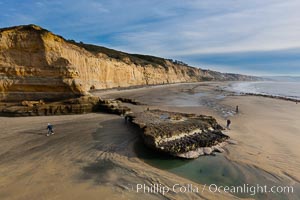
Torrey Pines balloon aerial survey photo. Torrey Pines seacliffs, rising up to 300 feet above the ocean, stretch from Del Mar to La Jolla. On the mesa atop the bluffs are found Torrey pine trees, one of the rare species of pines in the world. Peregrine falcons nest at the edge of the cliffs. This photo was made as part of an experimental balloon aerial photographic survey flight over Torrey Pines State Reserve, by permission of Torrey Pines State Reserve.
Location: Torrey Pines State Reserve, San Diego, California
Image ID: 27288
Location: Torrey Pines State Reserve, San Diego, California
Image ID: 27288
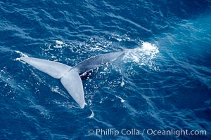
Blue whale fluking. An enormous blue whale raises its powerful fluke (tail) high out of the water as it makes a steep dive into the open ocean.
Species: Blue whale, Balaenoptera musculus
Location: La Jolla, California
Image ID: 21261
Species: Blue whale, Balaenoptera musculus
Location: La Jolla, California
Image ID: 21261
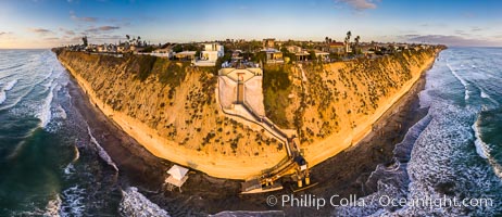
Stone Steps Beach at Sunset, Aerial Panorama, Encinitas, California.
Location: Encinitas, California
Image ID: 38093
Panorama dimensions: 7281 x 16824
Location: Encinitas, California
Image ID: 38093
Panorama dimensions: 7281 x 16824
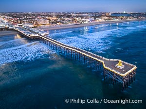
Aerial photo of Crystal Pier with Holiday Christmas Lights at night. The Crystal Pier, Holiday Lights and Pacific Ocean at sunset, waves blur as they crash upon the sand. Crystal Pier, 872 feet long and built in 1925, extends out into the Pacific Ocean from the town of Pacific Beach.
Location: Pacific Beach, California
Image ID: 39999
Location: Pacific Beach, California
Image ID: 39999
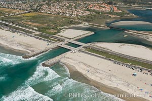
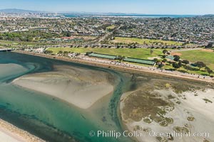
Aerial photo of Batiquitos Lagoon, Carlsbad. The Batiquitos Lagoon is a coastal wetland in southern Carlsbad, California. Part of the lagoon is designated as the Batiquitos Lagoon State Marine Conservation Area, run by the California Department of Fish and Game as a nature reserve.
Location: Carlsbad, Callifornia
Image ID: 30556
Location: Carlsbad, Callifornia
Image ID: 30556
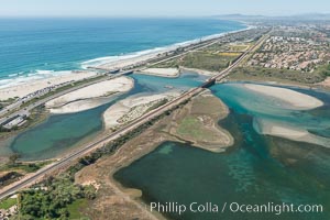
Aerial photo of Batiquitos Lagoon, Carlsbad. The Batiquitos Lagoon is a coastal wetland in southern Carlsbad, California. Part of the lagoon is designated as the Batiquitos Lagoon State Marine Conservation Area, run by the California Department of Fish and Game as a nature reserve.
Location: Carlsbad, Callifornia
Image ID: 30558
Location: Carlsbad, Callifornia
Image ID: 30558
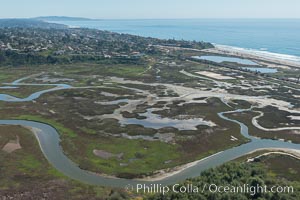
Aerial Photo of San Elijo Lagoon. San Elijo Lagoon Ecological Reserve is one of the largest remaining coastal wetlands in San Diego County, California, on the border of Encinitas, Solana Beach and Rancho Santa Fe.
Location: Encinitas, California
Image ID: 30592
Location: Encinitas, California
Image ID: 30592
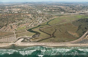
Aerial photo of Los Penasquitos Lagoon. Los Peñasquitos Marsh Natural Preserve and Lagoon is a coastal marsh in San Diego County, California, USA situated at the northern edge of the City of San Diego, forming the natural border with Del Mar, California.
Location: Del Mar, California
Image ID: 30602
Location: Del Mar, California
Image ID: 30602
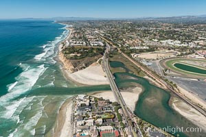
Aerial photo of San Dieguito Lagoon and Dog Beach. San Dieguito Lagoon State Marine Conservation Area (SMCA) is a marine protected area near Del Mar in San Diego County.
Location: Del Mar, California
Image ID: 30605
Location: Del Mar, California
Image ID: 30605
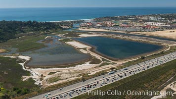
Aerial photo of San Dieguito Lagoon State Marine Conservation Area. San Dieguito Lagoon State Marine Conservation Area (SMCA) is a marine protected area near Del Mar in San Diego County.
Location: Del Mar, California
Image ID: 30609
Location: Del Mar, California
Image ID: 30609
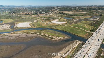
Aerial photo of San Dieguito Lagoon State Marine Conservation Area. San Dieguito Lagoon State Marine Conservation Area (SMCA) is a marine protected area near Del Mar in San Diego County.
Location: Del Mar, California
Image ID: 30614
Location: Del Mar, California
Image ID: 30614
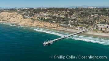
Aerial Photo of San Diego Scripps Coastal SMCA. Scripps Institution of Oceanography Research Pier.
Location: Scripps Institution of Oceanography, La Jolla, California
Image ID: 30627
Location: Scripps Institution of Oceanography, La Jolla, California
Image ID: 30627
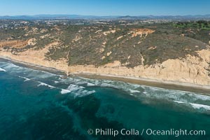
Torrey Pines seacliffs, rising up to 300 feet above the ocean, stretch from Del Mar to La Jolla. On the mesa atop the bluffs are found Torrey pine trees, one of the rare species of pines in the world.
Location: Torrey Pines State Reserve, San Diego, California
Image ID: 30673
Location: Torrey Pines State Reserve, San Diego, California
Image ID: 30673
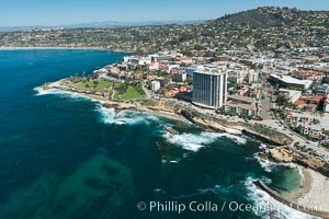
Aerial Photo of La Jolla coastline, showing underwater reefs and Mount Soledad.
Location: La Jolla, California
Image ID: 30676
Location: La Jolla, California
Image ID: 30676
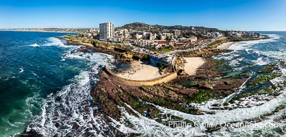
Childrens Pool Reef Exposed at Extreme Low Tide, Casa Cove, La Jolla, California. Aerial panoramic photograph.
Location: La Jolla, California
Image ID: 40234
Panorama dimensions: 5612 x 11740
Location: La Jolla, California
Image ID: 40234
Panorama dimensions: 5612 x 11740
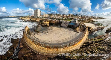
Children's Pool Reef Exposed at Extreme Low King Tide, La Jolla, California. Aerial panoramic photograph.
Location: La Jolla, California
Image ID: 40718
Panorama dimensions: 6238 x 11571
Location: La Jolla, California
Image ID: 40718
Panorama dimensions: 6238 x 11571
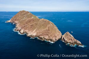
Aerial Photo of North Coronado Island, Baja California, Mexico, viewed from the southwest. The Keyhole, a spectacular narrow cut and underwater tunnel through the island, is seen at the narrow neck of the island. The San Diego and Tijuana coastline is visible in the distance.
Location: Coronado Islands (Islas Coronado), Baja California, Mexico
Image ID: 35896
Location: Coronado Islands (Islas Coronado), Baja California, Mexico
Image ID: 35896
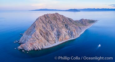
Boat Ambar at Isla San Diego, Aerial View, Sea of Cortez.
Location: Isla San Diego, Baja California, Mexico
Image ID: 33513
Location: Isla San Diego, Baja California, Mexico
Image ID: 33513
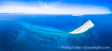
Isla San Diego and Coral Reef, reef extends from Isla San Diego to Isla San Jose, aerial photo, Sea of Cortez, Baja California.
Location: Isla San Diego, Baja California, Mexico
Image ID: 33601
Panorama dimensions: 5596 x 12223
Location: Isla San Diego, Baja California, Mexico
Image ID: 33601
Panorama dimensions: 5596 x 12223
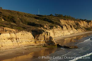
Torrey Pines seacliffs, rising up to 300 feet above the ocean, stretch from Del Mar to La Jolla. On the mesa atop the bluffs are found Torrey pine trees, one of the rare species of pines in the world.
Location: Torrey Pines State Reserve, San Diego, California
Image ID: 22311
Location: Torrey Pines State Reserve, San Diego, California
Image ID: 22311
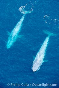
Blue whales, two blue whales swimming alongside one another.
Species: Blue whale, Balaenoptera musculus
Location: La Jolla, California
Image ID: 21259
Species: Blue whale, Balaenoptera musculus
Location: La Jolla, California
Image ID: 21259
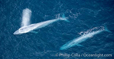
Blue whale, exhaling in a huge blow as it swims at the surface between deep dives. The blue whale's blow is a combination of water spray from around its blowhole and condensation from its warm breath.
Species: Blue whale, Balaenoptera musculus
Location: La Jolla, California
Image ID: 21260
Species: Blue whale, Balaenoptera musculus
Location: La Jolla, California
Image ID: 21260
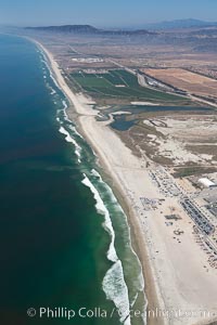
Camp Pendleton, Pacific coastline, north of San Diego county and the city of Oceanside. Marine Corps Base Camp Pendleton.
Location: Marine Corps Base Camp Pendleton, California
Image ID: 25980
Location: Marine Corps Base Camp Pendleton, California
Image ID: 25980
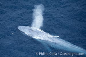
Blue whale, exhaling in a huge blow as it swims at the surface between deep dives. The blue whale's blow is a combination of water spray from around its blowhole and condensation from its warm breath.
Species: Blue whale, Balaenoptera musculus
Location: La Jolla, California
Image ID: 21257
Species: Blue whale, Balaenoptera musculus
Location: La Jolla, California
Image ID: 21257

Aerial Panoramic Photo of Sunset Cliffs San Diego, Pappy's Point, Claiborne Cove.
Location: San Diego, California
Image ID: 30790
Panorama dimensions: 8011 x 28354
Location: San Diego, California
Image ID: 30790
Panorama dimensions: 8011 x 28354
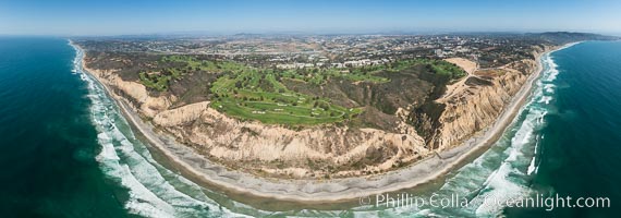
Aerial panorama of Blacks Beach, Torrey Pines Golf Course (south course), and views to La Jolla (south) and Carlsbad (north).
Location: La Jolla, California
Image ID: 30851
Panorama dimensions: 6962 x 19824
Location: La Jolla, California
Image ID: 30851
Panorama dimensions: 6962 x 19824
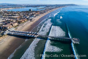
Crystal Pier and Pacific Beach coastline, Mission Bay, Point Loma and San Diego visible in the distance, aerial photo.
Location: Pacific Beach, California
Image ID: 37975
Location: Pacific Beach, California
Image ID: 37975
