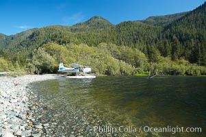
Float plane on the shore of Megin Lake, near Tofino on the west coast of Vancouver Island.
Location: Megin Lake, British Columbia, Canada
Image ID: 21102
Location: Megin Lake, British Columbia, Canada
Image ID: 21102
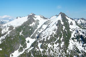
Mariner Mountain, viewed from the northwest, on the west coast of Vancouver Island, British Columbia, Canada, part of Strathcona Provincial Park, located 36 km (22 mi) north of Tofino. It is 1,771 m (5,810 ft) high, snow covered year-round and home to several glaciers.
Location: Mariner Mountain, Strathcona Provincial Park, British Columbia, Canada
Image ID: 21103
Location: Mariner Mountain, Strathcona Provincial Park, British Columbia, Canada
Image ID: 21103
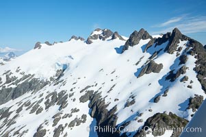
Mariner Mountain, viewed from the northwest, on the west coast of Vancouver Island, British Columbia, Canada, part of Strathcona Provincial Park, located 36 km (22 mi) north of Tofino. It is 1,771 m (5,810 ft) high, snow covered year-round and home to several glaciers.
Location: Mariner Mountain, Strathcona Provincial Park, British Columbia, Canada
Image ID: 21104
Location: Mariner Mountain, Strathcona Provincial Park, British Columbia, Canada
Image ID: 21104
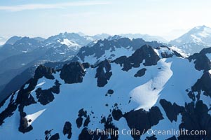
Mariner Mountain, on the west coast of Vancouver Island, British Columbia, Canada, part of Strathcona Provincial Park, located 36 km (22 mi) north of Tofino. It is 1,771 m (5,810 ft) high, snow covered year-round and home to several glaciers.
Location: Mariner Mountain, Strathcona Provincial Park, British Columbia, Canada
Image ID: 21105
Location: Mariner Mountain, Strathcona Provincial Park, British Columbia, Canada
Image ID: 21105
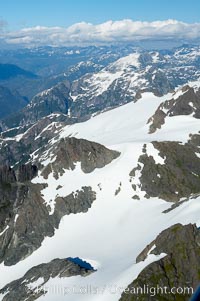
Mariner Mountain, on the west coast of Vancouver Island, British Columbia, Canada, part of Strathcona Provincial Park, located 36 km (22 mi) north of Tofino. It is 1,771 m (5,810 ft) high, snow covered year-round and home to several glaciers.
Location: Mariner Mountain, Strathcona Provincial Park, British Columbia, Canada
Image ID: 21106
Location: Mariner Mountain, Strathcona Provincial Park, British Columbia, Canada
Image ID: 21106
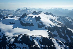
Mariner Mountain, on the west coast of Vancouver Island, British Columbia, Canada, part of Strathcona Provincial Park, located 36 km (22 mi) north of Tofino. It is 1,771 m (5,810 ft) high, snow covered year-round and home to several glaciers.
Location: Mariner Mountain, Strathcona Provincial Park, British Columbia, Canada
Image ID: 21107
Location: Mariner Mountain, Strathcona Provincial Park, British Columbia, Canada
Image ID: 21107
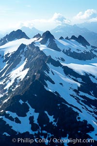
Mariner Mountain, on the west coast of Vancouver Island, British Columbia, Canada, part of Strathcona Provincial Park, located 36 km (22 mi) north of Tofino. It is 1,771 m (5,810 ft) high, snow covered year-round and home to several glaciers.
Location: Mariner Mountain, Strathcona Provincial Park, British Columbia, Canada
Image ID: 21108
Location: Mariner Mountain, Strathcona Provincial Park, British Columbia, Canada
Image ID: 21108
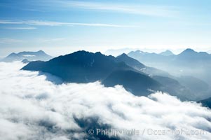
Coastal mountains and clouds, rising above Bedwell Sound (hidden by clouds) and Clayoquot Sound, near Tofino on the west coast of Vancouver Island.
Location: Tofino, British Columbia, Canada
Image ID: 21109
Location: Tofino, British Columbia, Canada
Image ID: 21109
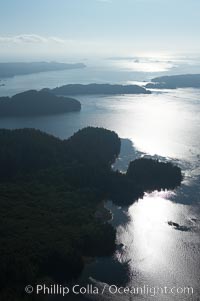
Clayoquot Sound, on the west coast of Vancouver Island, aerial photo.
Location: Tofino, British Columbia, Canada
Image ID: 21110
Location: Tofino, British Columbia, Canada
Image ID: 21110
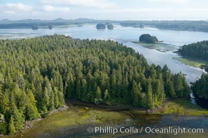
Lemmens Inlet viewed from Meares Island, with Tofino in the distance, aerial photo, on the west coast of Vancouver Island.
Location: Tofino, British Columbia, Canada
Image ID: 21111
Location: Tofino, British Columbia, Canada
Image ID: 21111
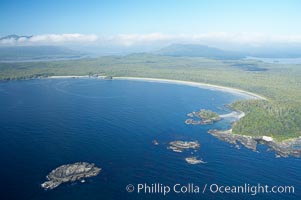
Ahouse Bay and Vargas Island, aerial photo, Clayoquot Sound in the foreground, near Tofino on the west coast of Vancouver Island.
Location: Tofino, British Columbia, Canada
Image ID: 21112
Location: Tofino, British Columbia, Canada
Image ID: 21112
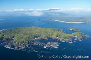
Blunden Island (foreground) and Vargas Island (distance), surrounded by the waters of Clayoquot Sound, west coast of Vancouver Island.
Location: Tofino, British Columbia, Canada
Image ID: 21113
Location: Tofino, British Columbia, Canada
Image ID: 21113
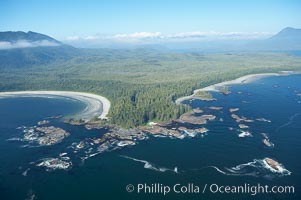
Cow Bay (left) and Flores Island, aerial photo, part of Clayoquot Sound, near Tofino on the west coast of Vancouver Island.
Location: Tofino, British Columbia, Canada
Image ID: 21114
Location: Tofino, British Columbia, Canada
Image ID: 21114
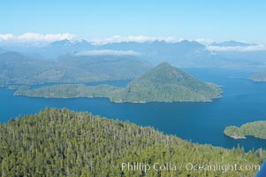
Flores Island (foreground) and Clayoquot Sound, aerial photo, near Tofino on the west coast of Vancouver Island.
Location: Tofino, British Columbia, Canada
Image ID: 21115
Location: Tofino, British Columbia, Canada
Image ID: 21115
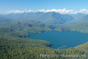
Flores Island (foreground) and Clayoquot Sound, aerial photo, near Tofino on the west coast of Vancouver Island.
Location: Tofino, British Columbia, Canada
Image ID: 21116
Location: Tofino, British Columbia, Canada
Image ID: 21116
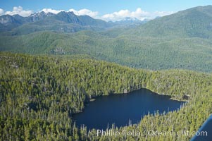
Densely forested Vancouver Island, aerial photo, near Tofino on the west coast of Vancouver Island.
Location: Tofino, British Columbia, Canada
Image ID: 21117
Location: Tofino, British Columbia, Canada
Image ID: 21117
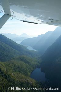
Shelter Inlet of Clayoquot Sound (distance) and small lake (foreground), amid the coastal mountains of western Vancouver Island, aerial photo.
Location: Megin Lake, British Columbia, Canada
Image ID: 21118
Location: Megin Lake, British Columbia, Canada
Image ID: 21118
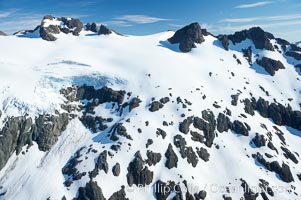
Glaciers on the summit of Mariner Mountain, on the west coast of Vancouver Island, British Columbia, Canada, part of Strathcona Provincial Park, located 36 km (22 mi) north of Tofino. It is 1,771 m (5,810 ft) high and is snow covered year-round.
Location: Mariner Mountain, Strathcona Provincial Park, British Columbia, Canada
Image ID: 21119
Location: Mariner Mountain, Strathcona Provincial Park, British Columbia, Canada
Image ID: 21119
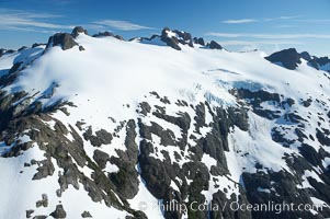
Glaciers on the summit of Mariner Mountain, on the west coast of Vancouver Island, British Columbia, Canada, part of Strathcona Provincial Park, located 36 km (22 mi) north of Tofino. It is 1,771 m (5,810 ft) high and is snow covered year-round.
Location: Mariner Mountain, Strathcona Provincial Park, British Columbia, Canada
Image ID: 21120
Location: Mariner Mountain, Strathcona Provincial Park, British Columbia, Canada
Image ID: 21120
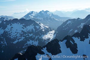
Mariner Mountain, on the west coast of Vancouver Island, British Columbia, Canada, part of Strathcona Provincial Park, located 36 km (22 mi) north of Tofino. It is 1,771 m (5,810 ft) high, snow covered year-round and home to several glaciers.
Location: Mariner Mountain, Strathcona Provincial Park, British Columbia, Canada
Image ID: 21121
Location: Mariner Mountain, Strathcona Provincial Park, British Columbia, Canada
Image ID: 21121
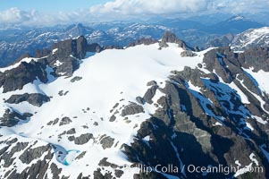
Glaciers on the summit of Mariner Mountain, on the west coast of Vancouver Island, British Columbia, Canada, part of Strathcona Provincial Park, located 36 km (22 mi) north of Tofino. It is 1,771 m (5,810 ft) high and is snow covered year-round.
Location: Mariner Mountain, Strathcona Provincial Park, British Columbia, Canada
Image ID: 21122
Location: Mariner Mountain, Strathcona Provincial Park, British Columbia, Canada
Image ID: 21122
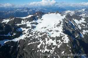
Mariner Mountain, on the west coast of Vancouver Island, British Columbia, Canada, part of Strathcona Provincial Park, located 36 km (22 mi) north of Tofino. It is 1,771 m (5,810 ft) high, snow covered year-round and home to several glaciers.
Location: Mariner Mountain, Strathcona Provincial Park, British Columbia, Canada
Image ID: 21123
Location: Mariner Mountain, Strathcona Provincial Park, British Columbia, Canada
Image ID: 21123
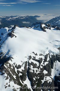
Glaciers on the summit of Mariner Mountain, on the west coast of Vancouver Island, British Columbia, Canada, part of Strathcona Provincial Park, located 36 km (22 mi) north of Tofino. It is 1,771 m (5,810 ft) high and is snow covered year-round.
Location: Mariner Mountain, Strathcona Provincial Park, British Columbia, Canada
Image ID: 21124
Location: Mariner Mountain, Strathcona Provincial Park, British Columbia, Canada
Image ID: 21124
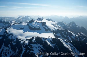
Mariner Mountain, on the west coast of Vancouver Island, British Columbia, Canada, part of Strathcona Provincial Park, located 36 km (22 mi) north of Tofino. It is 1,771 m (5,810 ft) high, snow covered year-round and home to several glaciers.
Location: Mariner Mountain, Strathcona Provincial Park, British Columbia, Canada
Image ID: 21125
Location: Mariner Mountain, Strathcona Provincial Park, British Columbia, Canada
Image ID: 21125
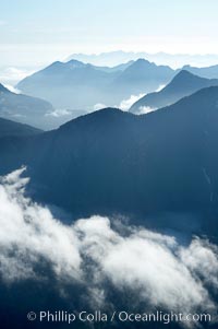
Coastal mountains and clouds, rising above Bedwell Sound (hidden by clouds) and Clayoquot Sound, near Tofino on the west coast of Vancouver Island.
Location: Tofino, British Columbia, Canada
Image ID: 21126
Location: Tofino, British Columbia, Canada
Image ID: 21126
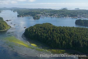
Lemmens Inlet viewed from Meares Island, with Tofino in the distance, aerial photo, on the west coast of Vancouver Island.
Location: Tofino, British Columbia, Canada
Image ID: 21127
Location: Tofino, British Columbia, Canada
Image ID: 21127