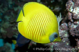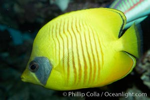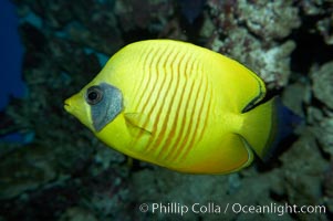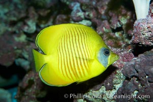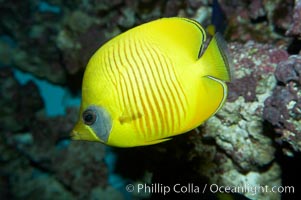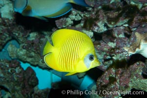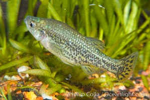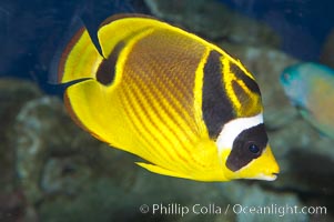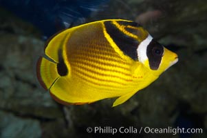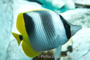
Pacific double-saddle butterflyfish.
Species: Pacific double-saddle butterflyfish, Chaetodon ulietensis
Image ID: 11815
Species: Pacific double-saddle butterflyfish, Chaetodon ulietensis
Image ID: 11815
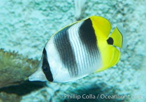
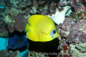
Pacific double-saddle butterflyfish.
Species: Pacific double-saddle butterflyfish, Chaetodon ulietensis
Image ID: 11816
Species: Pacific double-saddle butterflyfish, Chaetodon ulietensis
Image ID: 11816
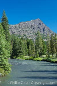
Barronette Peak rises above Soda Butte Creek.
Location: Yellowstone National Park, Wyoming
Image ID: 13635
Location: Yellowstone National Park, Wyoming
Image ID: 13635
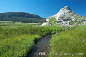
Soda Butte. This travertine (calcium carbonate) mound was formed more than a century ago by a hot spring. Only small amounts of hydrothermal water and hydrogen sulfide gas currently flow from this once more prolific spring.
Location: Yellowstone National Park, Wyoming
Image ID: 13642
Location: Yellowstone National Park, Wyoming
Image ID: 13642
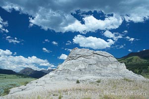
Soda Butte. This travertine (calcium carbonate) mound was formed more than a century ago by a hot spring. Only small amounts of hydrothermal water and hydrogen sulfide gas currently flow from this once more prolific spring.
Location: Yellowstone National Park, Wyoming
Image ID: 13643
Location: Yellowstone National Park, Wyoming
Image ID: 13643
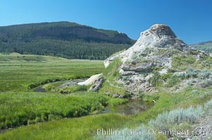
Soda Butte. This travertine (calcium carbonate) mound was formed more than a century ago by a hot spring. Only small amounts of hydrothermal water and hydrogen sulfide gas currently flow from this once more prolific spring.
Location: Yellowstone National Park, Wyoming
Image ID: 13644
Location: Yellowstone National Park, Wyoming
Image ID: 13644
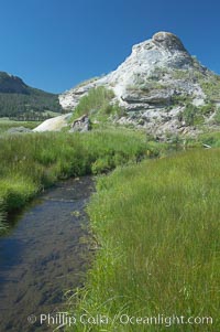
Soda Butte. This travertine (calcium carbonate) mound was formed more than a century ago by a hot spring. Only small amounts of hydrothermal water and hydrogen sulfide gas currently flow from this once more prolific spring.
Location: Yellowstone National Park, Wyoming
Image ID: 13645
Location: Yellowstone National Park, Wyoming
Image ID: 13645
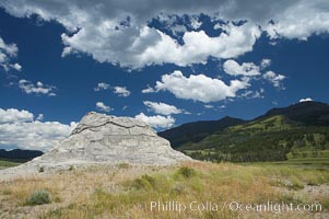
Soda Butte. This travertine (calcium carbonate) mound was formed more than a century ago by a hot spring. Only small amounts of hydrothermal water and hydrogen sulfide gas currently flow from this once more prolific spring.
Location: Yellowstone National Park, Wyoming
Image ID: 13646
Location: Yellowstone National Park, Wyoming
Image ID: 13646
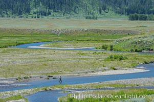
Fly fishermen fish along Soda Butte Creek near the Lamar Valley.
Location: Lamar Valley, Yellowstone National Park, Wyoming
Image ID: 13651
Location: Lamar Valley, Yellowstone National Park, Wyoming
Image ID: 13651
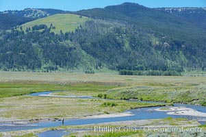
Flyfishermen fish along Soda Butte Creek near the Lamar Valley.
Location: Lamar Valley, Yellowstone National Park, Wyoming
Image ID: 13659
Location: Lamar Valley, Yellowstone National Park, Wyoming
Image ID: 13659
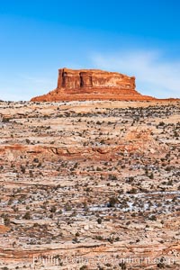
Monitor Butte (right), formed of Entrada sandstone with Carmel and Dewey Bridge formations comprising the basal slope and whiter Navajo sandstone below.
Location: Island in the Sky, Canyonlands National Park, Utah
Image ID: 18095
Location: Island in the Sky, Canyonlands National Park, Utah
Image ID: 18095
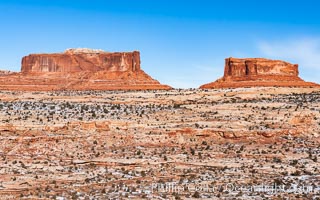
Merrimac Butte (left) and Monitor Butte (right), formed of Entrada sandstone with Carmel and Dewey Bridge formations comprising the basal slope and whiter Navajo sandstone below.
Location: Island in the Sky, Canyonlands National Park, Utah
Image ID: 18096
Location: Island in the Sky, Canyonlands National Park, Utah
Image ID: 18096
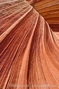
The Wave, an area of fantastic eroded sandstone featuring beautiful swirls, wild colors, countless striations, and bizarre shapes set amidst the dramatic surrounding North Coyote Buttes of Arizona and Utah. The sandstone formations of the North Coyote Buttes, including the Wave, date from the Jurassic period. Managed by the Bureau of Land Management, the Wave is located in the Paria Canyon-Vermilion Cliffs Wilderness and is accessible on foot by permit only.
Location: North Coyote Buttes, Paria Canyon-Vermilion Cliffs Wilderness, Arizona
Image ID: 20615
Location: North Coyote Buttes, Paria Canyon-Vermilion Cliffs Wilderness, Arizona
Image ID: 20615
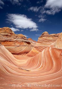
The Wave, an area of fantastic eroded sandstone featuring beautiful swirls, wild colors, countless striations, and bizarre shapes set amidst the dramatic surrounding North Coyote Buttes of Arizona and Utah. The sandstone formations of the North Coyote Buttes, including the Wave, date from the Jurassic period. Managed by the Bureau of Land Management, the Wave is located in the Paria Canyon-Vermilion Cliffs Wilderness and is accessible on foot by permit only.
Location: North Coyote Buttes, Paria Canyon-Vermilion Cliffs Wilderness, Arizona
Image ID: 20616
Location: North Coyote Buttes, Paria Canyon-Vermilion Cliffs Wilderness, Arizona
Image ID: 20616
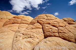
Brain rocks, curious sandstone formations in the North Coyote Buttes.
Location: North Coyote Buttes, Paria Canyon-Vermilion Cliffs Wilderness, Arizona
Image ID: 20617
Location: North Coyote Buttes, Paria Canyon-Vermilion Cliffs Wilderness, Arizona
Image ID: 20617
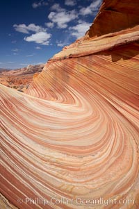
The Wave, an area of fantastic eroded sandstone featuring beautiful swirls, wild colors, countless striations, and bizarre shapes set amidst the dramatic surrounding North Coyote Buttes of Arizona and Utah. The sandstone formations of the North Coyote Buttes, including the Wave, date from the Jurassic period. Managed by the Bureau of Land Management, the Wave is located in the Paria Canyon-Vermilion Cliffs Wilderness and is accessible on foot by permit only.
Location: North Coyote Buttes, Paria Canyon-Vermilion Cliffs Wilderness, Arizona
Image ID: 20618
Location: North Coyote Buttes, Paria Canyon-Vermilion Cliffs Wilderness, Arizona
Image ID: 20618
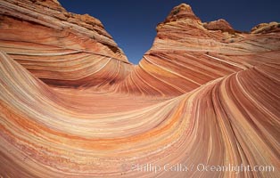
The Wave, an area of fantastic eroded sandstone featuring beautiful swirls, wild colors, countless striations, and bizarre shapes set amidst the dramatic surrounding North Coyote Buttes of Arizona and Utah. The sandstone formations of the North Coyote Buttes, including the Wave, date from the Jurassic period. Managed by the Bureau of Land Management, the Wave is located in the Paria Canyon-Vermilion Cliffs Wilderness and is accessible on foot by permit only.
Location: North Coyote Buttes, Paria Canyon-Vermilion Cliffs Wilderness, Arizona
Image ID: 20619
Location: North Coyote Buttes, Paria Canyon-Vermilion Cliffs Wilderness, Arizona
Image ID: 20619
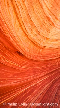
The Wave, an area of fantastic eroded sandstone featuring beautiful swirls, wild colors, countless striations, and bizarre shapes set amidst the dramatic surrounding North Coyote Buttes of Arizona and Utah. The sandstone formations of the North Coyote Buttes, including the Wave, date from the Jurassic period. Managed by the Bureau of Land Management, the Wave is located in the Paria Canyon-Vermilion Cliffs Wilderness and is accessible on foot by permit only.
Location: North Coyote Buttes, Paria Canyon-Vermilion Cliffs Wilderness, Arizona
Image ID: 20620
Location: North Coyote Buttes, Paria Canyon-Vermilion Cliffs Wilderness, Arizona
Image ID: 20620
