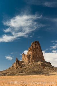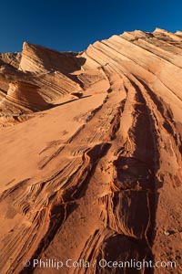
Sandstone "fins", eroded striations that depict how sandstone -- ancient compressed sand -- was laid down in layers over time. Now exposed, the layer erode at different rates, forming delicate "fins" that stretch for long distances.
Location: Navajo Tribal Lands, Page, Arizona
Image ID: 26683
Location: Navajo Tribal Lands, Page, Arizona
Image ID: 26683
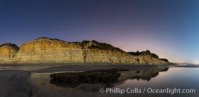
Torrey Pines Cliffs lit at night by a full moon, low tide reflections.
Location: Torrey Pines State Reserve, San Diego, California
Image ID: 28456
Panorama dimensions: 3567 x 7285
Location: Torrey Pines State Reserve, San Diego, California
Image ID: 28456
Panorama dimensions: 3567 x 7285
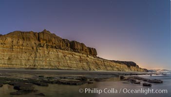
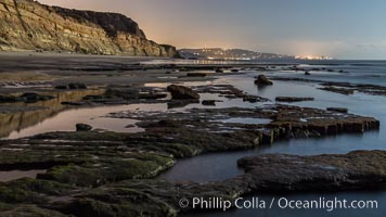
Torrey Pines Cliffs lit at night by a full moon, low tide reflections.
Location: Torrey Pines State Reserve, San Diego, California
Image ID: 28457
Location: Torrey Pines State Reserve, San Diego, California
Image ID: 28457
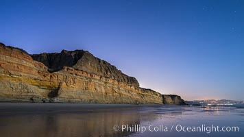
Torrey Pines Cliffs lit at night by a full moon, low tide reflections.
Location: Torrey Pines State Reserve, San Diego, California
Image ID: 28458
Location: Torrey Pines State Reserve, San Diego, California
Image ID: 28458
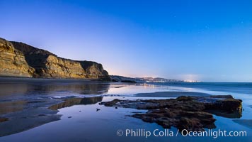
Torrey Pines Cliffs lit at night by a full moon, low tide reflections.
Location: Torrey Pines State Reserve, San Diego, California
Image ID: 28459
Location: Torrey Pines State Reserve, San Diego, California
Image ID: 28459
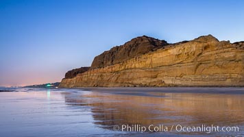
Torrey Pines Cliffs lit at night by a full moon, low tide reflections.
Location: Torrey Pines State Reserve, San Diego, California
Image ID: 28460
Location: Torrey Pines State Reserve, San Diego, California
Image ID: 28460
Torrey Pines Cliffs lit at night by a full moon, low tide reflections.
Location: Torrey Pines State Reserve, San Diego, California
Image ID: 28462
Location: Torrey Pines State Reserve, San Diego, California
Image ID: 28462
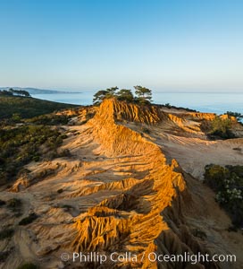
Broken Hill and view to La Jolla, panoramic photographic, from Torrey Pines State Reserve, sunrise.
Location: Torrey Pines State Reserve, San Diego, California
Image ID: 28465
Location: Torrey Pines State Reserve, San Diego, California
Image ID: 28465
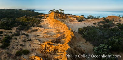
Broken Hill and view to La Jolla, panoramic photographic, from Torrey Pines State Reserve, sunrise.
Location: Torrey Pines State Reserve, San Diego, California
Image ID: 28466
Panorama dimensions: 5290 x 10726
Location: Torrey Pines State Reserve, San Diego, California
Image ID: 28466
Panorama dimensions: 5290 x 10726
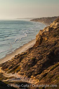
Torrey Pines Cliffs and Pacific Ocean, Razor Point view to La Jolla, San Diego, California.
Location: Torrey Pines State Reserve, San Diego, California
Image ID: 28486
Location: Torrey Pines State Reserve, San Diego, California
Image ID: 28486
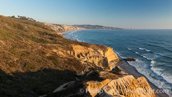
Torrey Pines Cliffs and Pacific Ocean, Razor Point view to La Jolla, San Diego, California.
Location: Torrey Pines State Reserve, San Diego, California
Image ID: 28488
Location: Torrey Pines State Reserve, San Diego, California
Image ID: 28488
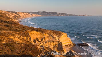
Torrey Pines Cliffs and Pacific Ocean, Razor Point view to La Jolla, San Diego, California.
Location: Torrey Pines State Reserve, San Diego, California
Image ID: 28489
Location: Torrey Pines State Reserve, San Diego, California
Image ID: 28489
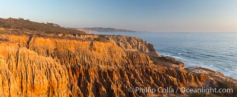
Torrey Pines Cliffs and Pacific Ocean, Razor Point view to La Jolla, San Diego, California.
Location: Torrey Pines State Reserve, San Diego, California
Image ID: 28491
Panorama dimensions: 5283 x 12828
Location: Torrey Pines State Reserve, San Diego, California
Image ID: 28491
Panorama dimensions: 5283 x 12828
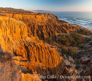
Torrey Pines Cliffs and Pacific Ocean, Razor Point view to La Jolla, San Diego, California.
Location: Torrey Pines State Reserve, San Diego, California
Image ID: 28492
Location: Torrey Pines State Reserve, San Diego, California
Image ID: 28492
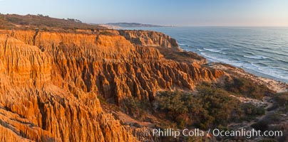
Torrey Pines Cliffs and Pacific Ocean, Razor Point view to La Jolla, San Diego, California.
Location: Torrey Pines State Reserve, San Diego, California
Image ID: 28493
Panorama dimensions: 3161 x 6384
Location: Torrey Pines State Reserve, San Diego, California
Image ID: 28493
Panorama dimensions: 3161 x 6384
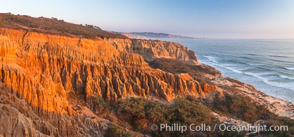
Torrey Pines Cliffs and Pacific Ocean, Razor Point view to La Jolla, San Diego, California.
Location: Torrey Pines State Reserve, San Diego, California
Image ID: 28494
Panorama dimensions: 3227 x 6916
Location: Torrey Pines State Reserve, San Diego, California
Image ID: 28494
Panorama dimensions: 3227 x 6916
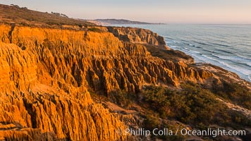
Torrey Pines Cliffs and Pacific Ocean, Razor Point view to La Jolla, San Diego, California.
Location: Torrey Pines State Reserve, San Diego, California
Image ID: 28483
Location: Torrey Pines State Reserve, San Diego, California
Image ID: 28483
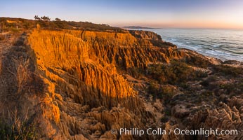
Torrey Pines Cliffs and Pacific Ocean, Razor Point view to La Jolla, San Diego, California.
Location: Torrey Pines State Reserve, San Diego, California
Image ID: 28484
Location: Torrey Pines State Reserve, San Diego, California
Image ID: 28484
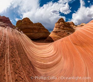
The Wave in the North Coyote Buttes, an area of fantastic eroded sandstone featuring beautiful swirls, wild colors, countless striations, and bizarre shapes set amidst the dramatic surrounding North Coyote Buttes of Arizona and Utah. The sandstone formations of the North Coyote Buttes, including the Wave, date from the Jurassic period. Managed by the Bureau of Land Management, the Wave is located in the Paria Canyon-Vermilion Cliffs Wilderness and is accessible on foot by permit only.
Location: North Coyote Buttes, Paria Canyon-Vermilion Cliffs Wilderness, Arizona
Image ID: 28604
Location: North Coyote Buttes, Paria Canyon-Vermilion Cliffs Wilderness, Arizona
Image ID: 28604
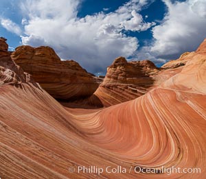
The Wave in the North Coyote Buttes, an area of fantastic eroded sandstone featuring beautiful swirls, wild colors, countless striations, and bizarre shapes set amidst the dramatic surrounding North Coyote Buttes of Arizona and Utah. The sandstone formations of the North Coyote Buttes, including the Wave, date from the Jurassic period. Managed by the Bureau of Land Management, the Wave is located in the Paria Canyon-Vermilion Cliffs Wilderness and is accessible on foot by permit only.
Location: North Coyote Buttes, Paria Canyon-Vermilion Cliffs Wilderness, Arizona
Image ID: 28605
Location: North Coyote Buttes, Paria Canyon-Vermilion Cliffs Wilderness, Arizona
Image ID: 28605
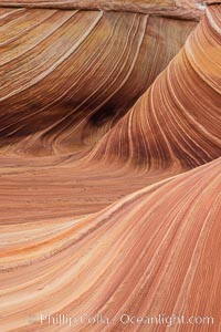
The Wave in the North Coyote Buttes, an area of fantastic eroded sandstone featuring beautiful swirls, wild colors, countless striations, and bizarre shapes set amidst the dramatic surrounding North Coyote Buttes of Arizona and Utah. The sandstone formations of the North Coyote Buttes, including the Wave, date from the Jurassic period. Managed by the Bureau of Land Management, the Wave is located in the Paria Canyon-Vermilion Cliffs Wilderness and is accessible on foot by permit only.
Location: North Coyote Buttes, Paria Canyon-Vermilion Cliffs Wilderness, Arizona
Image ID: 28606
Location: North Coyote Buttes, Paria Canyon-Vermilion Cliffs Wilderness, Arizona
Image ID: 28606
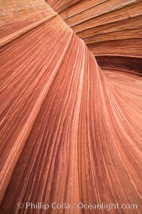
The Wave in the North Coyote Buttes, an area of fantastic eroded sandstone featuring beautiful swirls, wild colors, countless striations, and bizarre shapes set amidst the dramatic surrounding North Coyote Buttes of Arizona and Utah. The sandstone formations of the North Coyote Buttes, including the Wave, date from the Jurassic period. Managed by the Bureau of Land Management, the Wave is located in the Paria Canyon-Vermilion Cliffs Wilderness and is accessible on foot by permit only.
Location: North Coyote Buttes, Paria Canyon-Vermilion Cliffs Wilderness, Arizona
Image ID: 28607
Location: North Coyote Buttes, Paria Canyon-Vermilion Cliffs Wilderness, Arizona
Image ID: 28607

The Wave in the North Coyote Buttes, an area of fantastic eroded sandstone featuring beautiful swirls, wild colors, countless striations, and bizarre shapes set amidst the dramatic surrounding North Coyote Buttes of Arizona and Utah. The sandstone formations of the North Coyote Buttes, including the Wave, date from the Jurassic period. Managed by the Bureau of Land Management, the Wave is located in the Paria Canyon-Vermilion Cliffs Wilderness and is accessible on foot by permit only.
Location: North Coyote Buttes, Paria Canyon-Vermilion Cliffs Wilderness, Arizona
Image ID: 28608
Location: North Coyote Buttes, Paria Canyon-Vermilion Cliffs Wilderness, Arizona
Image ID: 28608
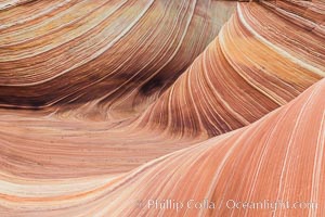
The Wave in the North Coyote Buttes, an area of fantastic eroded sandstone featuring beautiful swirls, wild colors, countless striations, and bizarre shapes set amidst the dramatic surrounding North Coyote Buttes of Arizona and Utah. The sandstone formations of the North Coyote Buttes, including the Wave, date from the Jurassic period. Managed by the Bureau of Land Management, the Wave is located in the Paria Canyon-Vermilion Cliffs Wilderness and is accessible on foot by permit only.
Location: North Coyote Buttes, Paria Canyon-Vermilion Cliffs Wilderness, Arizona
Image ID: 28610
Location: North Coyote Buttes, Paria Canyon-Vermilion Cliffs Wilderness, Arizona
Image ID: 28610
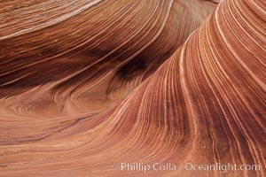
The Wave in the North Coyote Buttes, an area of fantastic eroded sandstone featuring beautiful swirls, wild colors, countless striations, and bizarre shapes set amidst the dramatic surrounding North Coyote Buttes of Arizona and Utah. The sandstone formations of the North Coyote Buttes, including the Wave, date from the Jurassic period. Managed by the Bureau of Land Management, the Wave is located in the Paria Canyon-Vermilion Cliffs Wilderness and is accessible on foot by permit only.
Location: North Coyote Buttes, Paria Canyon-Vermilion Cliffs Wilderness, Arizona
Image ID: 28611
Location: North Coyote Buttes, Paria Canyon-Vermilion Cliffs Wilderness, Arizona
Image ID: 28611
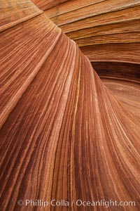
The Wave in the North Coyote Buttes, an area of fantastic eroded sandstone featuring beautiful swirls, wild colors, countless striations, and bizarre shapes set amidst the dramatic surrounding North Coyote Buttes of Arizona and Utah. The sandstone formations of the North Coyote Buttes, including the Wave, date from the Jurassic period. Managed by the Bureau of Land Management, the Wave is located in the Paria Canyon-Vermilion Cliffs Wilderness and is accessible on foot by permit only.
Location: North Coyote Buttes, Paria Canyon-Vermilion Cliffs Wilderness, Arizona
Image ID: 28612
Location: North Coyote Buttes, Paria Canyon-Vermilion Cliffs Wilderness, Arizona
Image ID: 28612
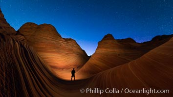
The Wave at Night, under a clear night sky full of stars. The Wave, an area of fantastic eroded sandstone featuring beautiful swirls, wild colors, countless striations, and bizarre shapes set amidst the dramatic surrounding North Coyote Buttes of Arizona and Utah. The sandstone formations of the North Coyote Buttes, including the Wave, date from the Jurassic period. Managed by the Bureau of Land Management, the Wave is located in the Paria Canyon-Vermilion Cliffs Wilderness and is accessible on foot by permit only.
Location: North Coyote Buttes, Paria Canyon-Vermilion Cliffs Wilderness, Arizona
Image ID: 28622
Location: North Coyote Buttes, Paria Canyon-Vermilion Cliffs Wilderness, Arizona
Image ID: 28622
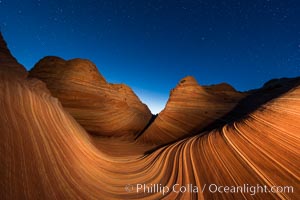
The Wave at Night, under a clear night sky full of stars. The Wave, an area of fantastic eroded sandstone featuring beautiful swirls, wild colors, countless striations, and bizarre shapes set amidst the dramatic surrounding North Coyote Buttes of Arizona and Utah. The sandstone formations of the North Coyote Buttes, including the Wave, date from the Jurassic period. Managed by the Bureau of Land Management, the Wave is located in the Paria Canyon-Vermilion Cliffs Wilderness and is accessible on foot by permit only.
Location: North Coyote Buttes, Paria Canyon-Vermilion Cliffs Wilderness, Arizona
Image ID: 28625
Location: North Coyote Buttes, Paria Canyon-Vermilion Cliffs Wilderness, Arizona
Image ID: 28625
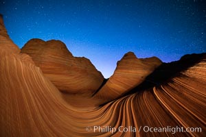
The Wave at Night, under a clear night sky full of stars. The Wave, an area of fantastic eroded sandstone featuring beautiful swirls, wild colors, countless striations, and bizarre shapes set amidst the dramatic surrounding North Coyote Buttes of Arizona and Utah. The sandstone formations of the North Coyote Buttes, including the Wave, date from the Jurassic period. Managed by the Bureau of Land Management, the Wave is located in the Paria Canyon-Vermilion Cliffs Wilderness and is accessible on foot by permit only.
Location: North Coyote Buttes, Paria Canyon-Vermilion Cliffs Wilderness, Arizona
Image ID: 28626
Location: North Coyote Buttes, Paria Canyon-Vermilion Cliffs Wilderness, Arizona
Image ID: 28626
