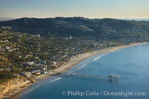
Scripps Pier, with Mount Soledad and La Jolla in the distance.
Location: La Jolla, California
Image ID: 22358
Location: La Jolla, California
Image ID: 22358
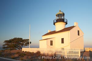
The old Point Loma lighthouse operated from 1855 to 1891 above the entrance to San Diego Bay. It is now a maintained by the National Park Service and is part of Cabrillo National Monument.
Location: Cabrillo National Monument, San Diego, California
Image ID: 14522
Location: Cabrillo National Monument, San Diego, California
Image ID: 14522
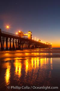
Oceanside Pier at dusk, sunset, night. Oceanside.
Location: Oceanside Pier, California
Image ID: 14642
Location: Oceanside Pier, California
Image ID: 14642

Panorama of the Wave. The Wave is a sweeping, dramatic display of eroded sandstone, forged by eons of water and wind erosion, laying bare striations formed from compacted sand dunes over millenia. This panoramic picture is formed from thirteen individual photographs.
Location: North Coyote Buttes, Paria Canyon-Vermilion Cliffs Wilderness, Arizona
Image ID: 20702
Panorama dimensions: 4617 x 17432
Location: North Coyote Buttes, Paria Canyon-Vermilion Cliffs Wilderness, Arizona
Image ID: 20702
Panorama dimensions: 4617 x 17432
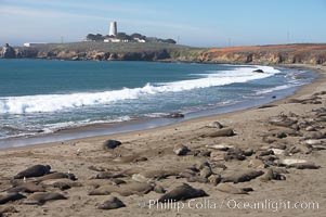
Elephant seals crowd a sand beach at the Piedras Blancas rookery near San Simeon. The Piedras Blancas lighthouse is visible in upper left.
Location: Piedras Blancas, San Simeon, California
Image ID: 20355
Location: Piedras Blancas, San Simeon, California
Image ID: 20355
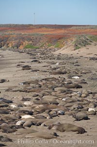
Elephant seals crowd a sand beach at the Piedras Blancas rookery near San Simeon.
Location: Piedras Blancas, San Simeon, California
Image ID: 20358
Location: Piedras Blancas, San Simeon, California
Image ID: 20358
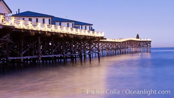
The Crystal Pier and Pacific Ocean at sunrise, dawn, waves blur as they crash upon the sand. Crystal Pier, 872 feet long and built in 1925, extends out into the Pacific Ocean from the town of Pacific Beach.
Location: Pacific Beach, California
Image ID: 27240
Location: Pacific Beach, California
Image ID: 27240
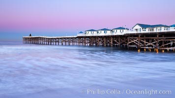
The Crystal Pier and Pacific Ocean at sunrise, dawn, waves blur as they crash upon the sand. Crystal Pier, 872 feet long and built in 1925, extends out into the Pacific Ocean from the town of Pacific Beach.
Location: Pacific Beach, California
Image ID: 27243
Location: Pacific Beach, California
Image ID: 27243
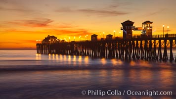
Oceanside Pier at sunset, clouds with a brilliant sky at dusk, the lights on the pier are lit.
Location: Oceanside Pier, California
Image ID: 27616
Location: Oceanside Pier, California
Image ID: 27616
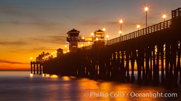
Oceanside Pier at sunset, clouds with a brilliant sky at dusk, the lights on the pier are lit.
Location: Oceanside Pier, California
Image ID: 27618
Location: Oceanside Pier, California
Image ID: 27618
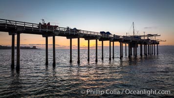
SIO Pier. The Scripps Institution of Oceanography research pier is 1090 feet long and was built of reinforced concrete in 1988, replacing the original wooden pier built in 1915. The Scripps Pier is home to a variety of sensing equipment above and below water that collects various oceanographic data. The Scripps research diving facility is located at the foot of the pier. Fresh seawater is pumped from the pier to the many tanks and facilities of SIO, including the Birch Aquarium. The Scripps Pier is named in honor of Ellen Browning Scripps, the most significant donor and benefactor of the Institution.
Location: Scripps Institution of Oceanography, La Jolla, California
Image ID: 38023
Location: Scripps Institution of Oceanography, La Jolla, California
Image ID: 38023
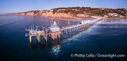
Holiday Christmas Lights on Scripps Pier, Blacks Beach and Scripps Institution of Oceanography, sunset, aerial.
Location: La Jolla, California
Image ID: 39881
Location: La Jolla, California
Image ID: 39881
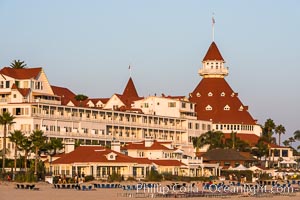
Hotel del Coronado, known affectionately as the Hotel Del. It was once the largest hotel in the world, and is one of the few remaining wooden Victorian beach resorts. It sits on the beach on Coronado Island, seen here with downtown San Diego in the distance. It is widely considered to be one of Americas most beautiful and classic hotels. Built in 1888, it was designated a National Historic Landmark in 1977.
Location: San Diego, California
Image ID: 29419
Location: San Diego, California
Image ID: 29419

Guadalupe Island at sunrise, panorama. Volcanic coastline south of Pilot Rock and Spanish Cove, near El Faro lighthouse.
Location: Guadalupe Island (Isla Guadalupe), Baja California, Mexico
Image ID: 19497
Panorama dimensions: 2797 x 16157
Location: Guadalupe Island (Isla Guadalupe), Baja California, Mexico
Image ID: 19497
Panorama dimensions: 2797 x 16157
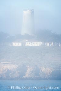
Piedras Blancas lighthouse. Completed in 1875, the 115-foot-tall Piedras Blancas lighthouse is one of the few tall-style lighthouses on the West Coast of the United States. Piedras Blancas, named for a group of three white rocks just offshore, is north of San Simeon, California very close to Hearst Castle.
Location: Piedras Blancas, San Simeon, California
Image ID: 20348
Location: Piedras Blancas, San Simeon, California
Image ID: 20348
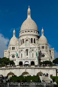
Sacre-Coeur Basilica. The Basilica of the Sacred Heart of Paris, commonly known as Sacre-Coeur Basilica, is a Roman Catholic church and minor basilica, dedicated to the Sacred Heart of Jesus, in Paris, France. A popular landmark, the basilica is located at the summit of the butte Montmartre, the highest point in the city.
Location: Basilique du Sacre-Coeur, Paris, France
Image ID: 28153
Location: Basilique du Sacre-Coeur, Paris, France
Image ID: 28153
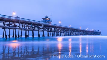
San Clemente Pier at dawn, San Clemente, California.
Location: San Clemente, California
Image ID: 28469
Location: San Clemente, California
Image ID: 28469
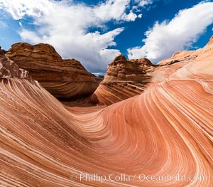
The Wave in the North Coyote Buttes, an area of fantastic eroded sandstone featuring beautiful swirls, wild colors, countless striations, and bizarre shapes set amidst the dramatic surrounding North Coyote Buttes of Arizona and Utah. The sandstone formations of the North Coyote Buttes, including the Wave, date from the Jurassic period. Managed by the Bureau of Land Management, the Wave is located in the Paria Canyon-Vermilion Cliffs Wilderness and is accessible on foot by permit only.
Location: North Coyote Buttes, Paria Canyon-Vermilion Cliffs Wilderness, Arizona
Image ID: 28600
Location: North Coyote Buttes, Paria Canyon-Vermilion Cliffs Wilderness, Arizona
Image ID: 28600
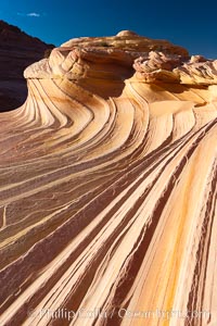
The Second Wave at sunset. The Second Wave, a curiously-shaped sandstone swirl, takes on rich warm tones and dramatic shadowed textures at sunset. Set in the North Coyote Buttes of Arizona and Utah, the Second Wave is characterized by striations revealing layers of sedimentary deposits, a visible historical record depicting eons of submarine geology.
Location: North Coyote Buttes, Paria Canyon-Vermilion Cliffs Wilderness, Arizona
Image ID: 20613
Location: North Coyote Buttes, Paria Canyon-Vermilion Cliffs Wilderness, Arizona
Image ID: 20613
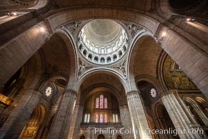
Sacre-Coeur Basilica. The Basilica of the Sacred Heart of Paris, commonly known as Sacre-Coeur Basilica, is a Roman Catholic church and minor basilica, dedicated to the Sacred Heart of Jesus, in Paris, France. A popular landmark, the basilica is located at the summit of the butte Montmartre, the highest point in the city.
Location: Sacre-Coeur, Paris, France
Image ID: 35713
Location: Sacre-Coeur, Paris, France
Image ID: 35713
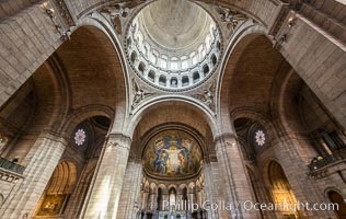
Sacre-Coeur Basilica. The Basilica of the Sacred Heart of Paris, commonly known as Sacre-Coeur Basilica, is a Roman Catholic church and minor basilica, dedicated to the Sacred Heart of Jesus, in Paris, France. A popular landmark, the basilica is located at the summit of the butte Montmartre, the highest point in the city.
Location: Sacre-Coeur, Paris, France
Image ID: 35714
Location: Sacre-Coeur, Paris, France
Image ID: 35714
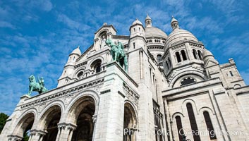
Sacre-Coeur Basilica. The Basilica of the Sacred Heart of Paris, commonly known as Sacre-Coeur Basilica, is a Roman Catholic church and minor basilica, dedicated to the Sacred Heart of Jesus, in Paris, France. A popular landmark, the basilica is located at the summit of the butte Montmartre, the highest point in the city.
Location: Sacre-Coeur, Paris, France
Image ID: 35715
Location: Sacre-Coeur, Paris, France
Image ID: 35715
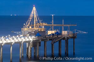
Scripps Institution of Oceanography Research Pier at dawn, with Christmas Lights and Christmas Tree.
Location: Scripps Institution of Oceanography, La Jolla, California
Image ID: 37552
Location: Scripps Institution of Oceanography, La Jolla, California
Image ID: 37552
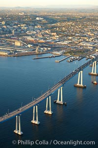
San Diego Coronado Bridge, known locally as the Coronado Bridge, links San Diego with Coronado, California. The bridge was completed in 1969 and was a toll bridge until 2002. It is 2.1 miles long and reaches a height of 200 feet above San Diego Bay. Coronado Island is to the left, and downtown San Diego is to the right in this view looking north.
Location: San Diego, California
Image ID: 22467
Location: San Diego, California
Image ID: 22467
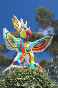
Sun God is a strange artwork, the first in the Stuart Collection at University of California San Diego (UCSD). Commissioned in 1983 and produced by Niki de Sainte Phalle, Sun God has become a landmark on the UCSD campus.
Location: University of California, San Diego, La Jolla
Image ID: 12836
Location: University of California, San Diego, La Jolla
Image ID: 12836
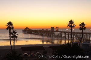
Oceanside Pier at dusk, sunset, night. Oceanside.
Location: Oceanside Pier, California
Image ID: 14629
Location: Oceanside Pier, California
Image ID: 14629
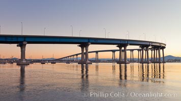
Coronado Bridge, linking San Diego to Coronado, sunrise, viewed from Coronado Island. San Diego Coronado Bridge, known locally as the Coronado Bridge, links San Diego with Coronado, California. The bridge was completed in 1969 and was a toll bridge until 2002. It is 2.1 miles long and reaches a height of 200 feet above San Diego Bay.
Location: San Diego, California
Image ID: 27094
Location: San Diego, California
Image ID: 27094
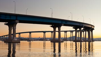
Coronado Bridge, linking San Diego to Coronado, sunrise, viewed from Coronado Island. San Diego Coronado Bridge, known locally as the Coronado Bridge, links San Diego with Coronado, California. The bridge was completed in 1969 and was a toll bridge until 2002. It is 2.1 miles long and reaches a height of 200 feet above San Diego Bay.
Location: San Diego, California
Image ID: 27095
Location: San Diego, California
Image ID: 27095
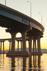
Coronado Bridge, linking San Diego to Coronado, sunrise, viewed from Coronado Island. San Diego Coronado Bridge, known locally as the Coronado Bridge, links San Diego with Coronado, California. The bridge was completed in 1969 and was a toll bridge until 2002. It is 2.1 miles long and reaches a height of 200 feet above San Diego Bay.
Location: San Diego, California
Image ID: 27096
Location: San Diego, California
Image ID: 27096
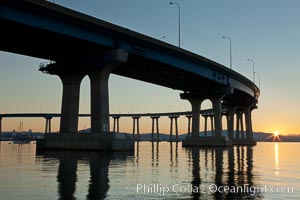
Coronado Bridge, linking San Diego to Coronado, sunrise, viewed from Coronado Island. San Diego Coronado Bridge, known locally as the Coronado Bridge, links San Diego with Coronado, California. The bridge was completed in 1969 and was a toll bridge until 2002. It is 2.1 miles long and reaches a height of 200 feet above San Diego Bay.
Location: San Diego, California
Image ID: 27097
Location: San Diego, California
Image ID: 27097