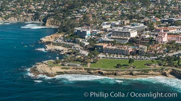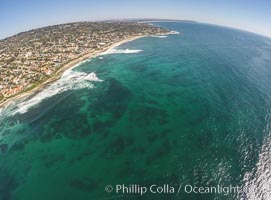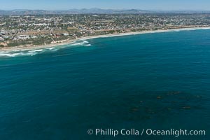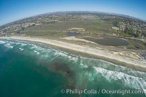
Aerial Photo of San Elijo Lagoon and Cardiff Reef beach. San Elijo Lagoon Ecological Reserve is one of the largest remaining coastal wetlands in San Diego County, California, on the border of Encinitas, Solana Beach and Rancho Santa Fe.
Location: Encinitas, California
Image ID: 30582
Location: Encinitas, California
Image ID: 30582
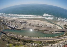
Aerial Photo of San Elijo Lagoon and Cardiff Reef beach. San Elijo Lagoon Ecological Reserve is one of the largest remaining coastal wetlands in San Diego County, California, on the border of Encinitas, Solana Beach and Rancho Santa Fe.
Location: Encinitas, California
Image ID: 30594
Location: Encinitas, California
Image ID: 30594
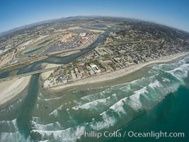
Aerial photo of San Dieguito Lagoon State Marine Conservation Area. San Dieguito Lagoon State Marine Conservation Area (SMCA) is a marine protected area near Del Mar in San Diego County.
Location: Del Mar, California
Image ID: 30603
Location: Del Mar, California
Image ID: 30603
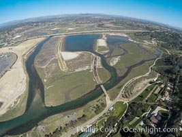
Aerial photo of San Dieguito Lagoon State Marine Conservation Area. San Dieguito Lagoon State Marine Conservation Area (SMCA) is a marine protected area near Del Mar in San Diego County.
Location: Del Mar, California
Image ID: 30606
Location: Del Mar, California
Image ID: 30606
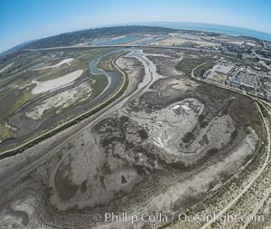
Aerial photo of San Dieguito Lagoon State Marine Conservation Area. San Dieguito Lagoon State Marine Conservation Area (SMCA) is a marine protected area near Del Mar in San Diego County.
Location: Del Mar, California
Image ID: 30612
Location: Del Mar, California
Image ID: 30612
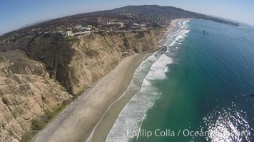
Aerial Photo of San Diego Scripps Coastal SMCA. Blacks Beach and Scripps Pier.
Location: La Jolla, California
Image ID: 30624
Location: La Jolla, California
Image ID: 30624
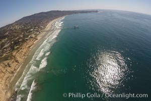
Aerial Photo of San Diego Scripps Coastal SMCA. Blacks Beach and Scripps Pier.
Location: La Jolla, California
Image ID: 30625
Location: La Jolla, California
Image ID: 30625
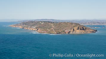
Aerial Photo of Cabrillo State Marine Reserve, Point Loma, San Diego.
Location: San Diego, California
Image ID: 30640
Location: San Diego, California
Image ID: 30640
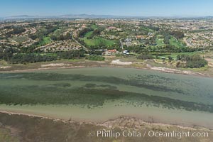
Aerial photo of Batiquitos Lagoon, Carlsbad. The Batiquitos Lagoon is a coastal wetland in southern Carlsbad, California. Part of the lagoon is designated as the Batiquitos Lagoon State Marine Conservation Area, run by the California Department of Fish and Game as a nature reserve.
Location: Carlsbad, Callifornia
Image ID: 30562
Location: Carlsbad, Callifornia
Image ID: 30562
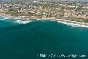
Aerial Photo of Swamis Marine Conservation Area. Swami's State Marine Conservation Area (SMCA) is a marine protected area that extends offshore of Encinitas in San Diego County.
Location: Encinitas, California
Image ID: 30575
Location: Encinitas, California
Image ID: 30575
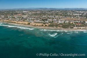
Aerial Photo of Swamis Marine Conservation Area. Swami's State Marine Conservation Area (SMCA) is a marine protected area that extends offshore of Encinitas in San Diego County.
Location: Encinitas, California
Image ID: 30576
Location: Encinitas, California
Image ID: 30576
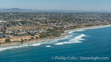
Aerial Photo of Swamis Marine Conservation Area. Swami's State Marine Conservation Area (SMCA) is a marine protected area that extends offshore of Encinitas in San Diego County.
Location: Encinitas, California
Image ID: 30577
Location: Encinitas, California
Image ID: 30577
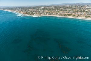
Aerial Photo of Swamis Marine Conservation Area. Swami's State Marine Conservation Area (SMCA) is a marine protected area that extends offshore of Encinitas in San Diego County.
Location: Encinitas, California
Image ID: 30578
Location: Encinitas, California
Image ID: 30578
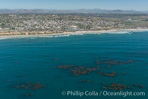
Aerial Photo of Swamis Marine Conservation Area. Swami’s State Marine Conservation Area (SMCA) is a marine protected area that extends offshore of Encinitas in San Diego County.
Location: Encinitas, California
Image ID: 30579
Location: Encinitas, California
Image ID: 30579
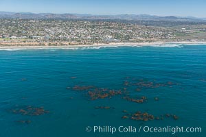
Aerial Photo of Swamis Marine Conservation Area. Swami's State Marine Conservation Area (SMCA) is a marine protected area that extends offshore of Encinitas in San Diego County.
Location: Encinitas, California
Image ID: 30580
Location: Encinitas, California
Image ID: 30580
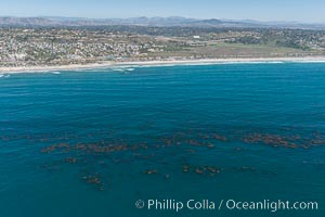
Aerial Photo of Swamis Marine Conservation Area. Swami's State Marine Conservation Area (SMCA) is a marine protected area that extends offshore of Encinitas in San Diego County.
Location: Encinitas, California
Image ID: 30581
Location: Encinitas, California
Image ID: 30581
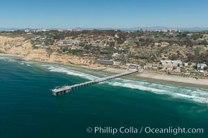
Aerial Photo of San Diego Scripps Coastal SMCA. Scripps Institution of Oceanography Research Pier.
Location: Scripps Institution of Oceanography, La Jolla, California
Image ID: 30628
Location: Scripps Institution of Oceanography, La Jolla, California
Image ID: 30628
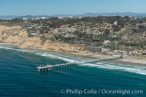
Aerial Photo of San Diego Scripps Coastal SMCA. Scripps Institution of Oceanography Research Pier.
Location: Scripps Institution of Oceanography, La Jolla, California
Image ID: 30630
Location: Scripps Institution of Oceanography, La Jolla, California
Image ID: 30630
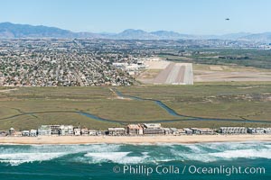
Aerial Photo of Tijuana River Mouth SMCA. Tijuana River Mouth State Marine Conservation Area borders Imperial Beach and the Mexican Border.
Location: Imperial Beach, California
Image ID: 30644
Location: Imperial Beach, California
Image ID: 30644
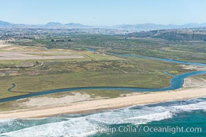
Aerial Photo of Tijuana River Mouth SMCA. Tijuana River Mouth State Marine Conservation Area borders Imperial Beach and the Mexican Border.
Location: Imperial Beach, California
Image ID: 30645
Location: Imperial Beach, California
Image ID: 30645
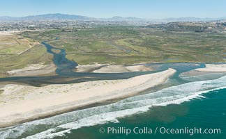
Aerial Photo of Tijuana River Mouth SMCA. Tijuana River Mouth State Marine Conservation Area borders Imperial Beach and the Mexican Border.
Location: Imperial Beach, California
Image ID: 30646
Location: Imperial Beach, California
Image ID: 30646
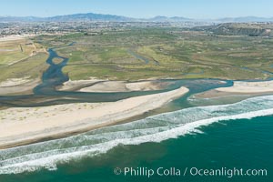
Aerial Photo of Tijuana River Mouth SMCA. Tijuana River Mouth State Marine Conservation Area borders Imperial Beach and the Mexican Border.
Location: Imperial Beach, California
Image ID: 30647
Location: Imperial Beach, California
Image ID: 30647
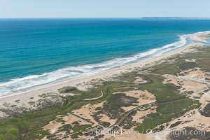
Aerial Photo of Tijuana River Mouth SMCA. Tijuana River Mouth State Marine Conservation Area borders Imperial Beach and the Mexican Border.
Location: Imperial Beach, California
Image ID: 30650
Location: Imperial Beach, California
Image ID: 30650
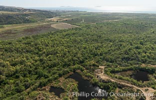
Aerial Photo of Tijuana River Mouth SMCA. Tijuana River Mouth State Marine Conservation Area borders Imperial Beach and the Mexican Border.
Location: Imperial Beach, California
Image ID: 30651
Location: Imperial Beach, California
Image ID: 30651
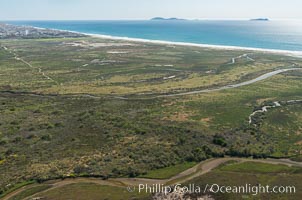
Aerial Photo of Tijuana River Mouth SMCA. Tijuana River Mouth State Marine Conservation Area borders Imperial Beach and the Mexican Border.
Location: Imperial Beach, California
Image ID: 30652
Location: Imperial Beach, California
Image ID: 30652
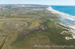
Aerial Photo of Tijuana River Mouth SMCA. Tijuana River Mouth State Marine Conservation Area borders Imperial Beach and the Mexican Border.
Location: Imperial Beach, California
Image ID: 30653
Location: Imperial Beach, California
Image ID: 30653
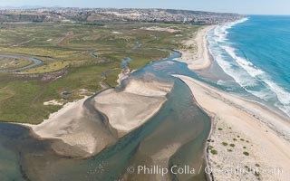
Aerial Photo of Tijuana River Mouth SMCA. Tijuana River Mouth State Marine Conservation Area borders Imperial Beach and the Mexican Border.
Location: Imperial Beach, California
Image ID: 30654
Location: Imperial Beach, California
Image ID: 30654
