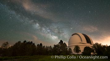
Palomar Observatory at Night under the Milky Way, Panoramic photograph.
Location: Palomar Observatory, Palomar Mountain, California
Image ID: 29346
Location: Palomar Observatory, Palomar Mountain, California
Image ID: 29346
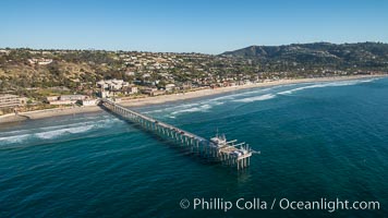
Aerial Photo of Scripps Pier. SIO Pier. The Scripps Institution of Oceanography research pier is 1090 feet long and was built of reinforced concrete in 1988, replacing the original wooden pier built in 1915. The Scripps Pier is home to a variety of sensing equipment above and below water that collects various oceanographic data. The Scripps research diving facility is located at the foot of the pier. Fresh seawater is pumped from the pier to the many tanks and facilities of SIO, including the Birch Aquarium. The Scripps Pier is named in honor of Ellen Browning Scripps, the most significant donor and benefactor of the Institution.
Image ID: 30737
Image ID: 30737
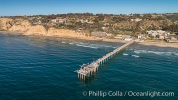
Aerial Photo of Scripps Pier. SIO Pier. The Scripps Institution of Oceanography research pier is 1090 feet long and was built of reinforced concrete in 1988, replacing the original wooden pier built in 1915. The Scripps Pier is home to a variety of sensing equipment above and below water that collects various oceanographic data. The Scripps research diving facility is located at the foot of the pier. Fresh seawater is pumped from the pier to the many tanks and facilities of SIO, including the Birch Aquarium. The Scripps Pier is named in honor of Ellen Browning Scripps, the most significant donor and benefactor of the Institution.
Image ID: 30738
Image ID: 30738
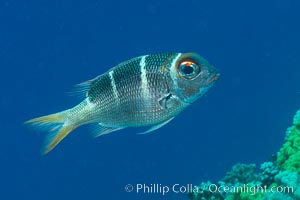
Humpnose Bigeye Bream, Monotaxis grandoculis, Fiji.
Location: Makogai Island, Lomaiviti Archipelago, Fiji
Image ID: 31799
Location: Makogai Island, Lomaiviti Archipelago, Fiji
Image ID: 31799
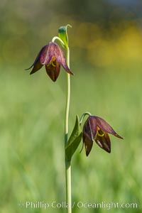
Chocolate lily growing among grasses on oak-covered hillsides. The chocolate lily is a herbaceous perennial monocot that is increasingly difficult to find in the wild due to habitat loss. The flower is a striking brown color akin to the color of chocolate.
Location: Santa Rosa Plateau Ecological Reserve, Murrieta, California
Image ID: 33150
Location: Santa Rosa Plateau Ecological Reserve, Murrieta, California
Image ID: 33150
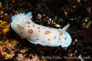
Spotted Leopard Dorid, Diaulula odonoghuei, Vancouver Island.
Species: Spotted leopard dorid, Diaulula odonoghuei
Location: British Columbia, Canada
Image ID: 34415
Species: Spotted leopard dorid, Diaulula odonoghuei
Location: British Columbia, Canada
Image ID: 34415
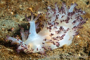
Red Nudibranch, Dendronotus rufus, Browning Pass, Vancouver Island.
Species: Red nudibranch, Dendronotus rufus
Location: British Columbia, Canada
Image ID: 35453
Species: Red nudibranch, Dendronotus rufus
Location: British Columbia, Canada
Image ID: 35453
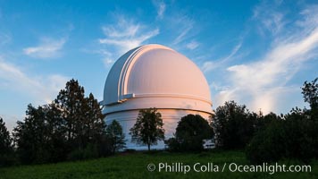
Palomar Observatory at sunset.
Location: Palomar Observatory, Palomar Mountain, California
Image ID: 29326
Location: Palomar Observatory, Palomar Mountain, California
Image ID: 29326
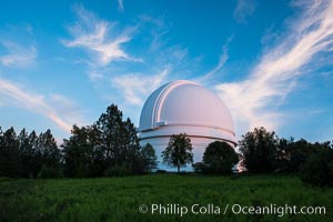
Palomar Observatory at sunset.
Location: Palomar Observatory, Palomar Mountain, California
Image ID: 29327
Location: Palomar Observatory, Palomar Mountain, California
Image ID: 29327
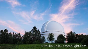
Palomar Observatory at sunset.
Location: Palomar Observatory, Palomar Mountain, California
Image ID: 29328
Location: Palomar Observatory, Palomar Mountain, California
Image ID: 29328
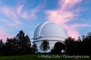
Palomar Observatory at sunset.
Location: Palomar Observatory, Palomar Mountain, California
Image ID: 29329
Location: Palomar Observatory, Palomar Mountain, California
Image ID: 29329
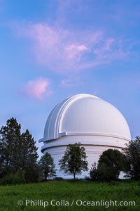
Palomar Observatory at sunset.
Location: Palomar Observatory, Palomar Mountain, California
Image ID: 29330
Location: Palomar Observatory, Palomar Mountain, California
Image ID: 29330
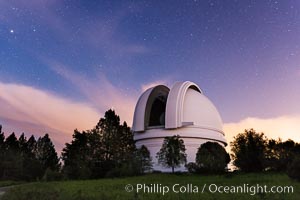
Palomar Observatory at sunset.
Location: Palomar Observatory, Palomar Mountain, California
Image ID: 29333
Location: Palomar Observatory, Palomar Mountain, California
Image ID: 29333
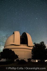
Palomar Observatory at night, under a sky of stars.
Location: Palomar Observatory, Palomar Mountain, California
Image ID: 29338
Location: Palomar Observatory, Palomar Mountain, California
Image ID: 29338
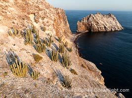
Rugged Terrain of Isla San Pedro Martir, Sea of Cortez. Aerial photo. The large bird population deposits enormous quantities of guano on the island, resulting in the white appearance of the island contrasted with sparse vegetation. In the late 19th and early 20th century guano was heavily mined off the island and shipped as far as Europe for use as fertilizer. San Pedro Martir is seldom visited, having near vertical sides leaving only questionable fair weather anchorages in two locations. Landing access was possible near a small isthmus in the southeast of the island, but is now forbidden. In 2005, the island was classified along with 244 others as a World Heritage Site by UNESCO, and included in the Islands and Protected Areas of the Gulf of California.
Location: Isla San Pedro Martir, Sonora, Mexico
Image ID: 40400
Location: Isla San Pedro Martir, Sonora, Mexico
Image ID: 40400
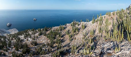
Rugged Terrain of Isla San Pedro Martir, Sea of Cortez. Aerial photo. The large bird population deposits enormous quantities of guano on the island, resulting in the white appearance of the island contrasted with sparse vegetation. In the late 19th and early 20th century guano was heavily mined off the island and shipped as far as Europe for use as fertilizer. San Pedro Martir is seldom visited, having near vertical sides leaving only questionable fair weather anchorages in two locations. Landing access was possible near a small isthmus in the southeast of the island, but is now forbidden. In 2005, the island was classified along with 244 others as a World Heritage Site by UNESCO, and included in the Islands and Protected Areas of the Gulf of California.
Location: Isla San Pedro Martir, Sonora, Mexico
Image ID: 40421
Panorama dimensions: 4451 x 10130
Location: Isla San Pedro Martir, Sonora, Mexico
Image ID: 40421
Panorama dimensions: 4451 x 10130
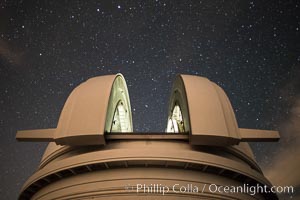
Palomar Observatory at night, under a sky of stars.
Location: Palomar Observatory, Palomar Mountain, California
Image ID: 29334
Location: Palomar Observatory, Palomar Mountain, California
Image ID: 29334
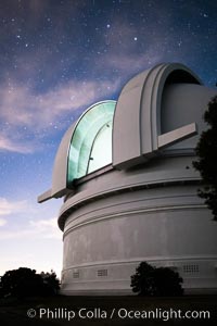
Palomar Observatory at sunset.
Location: Palomar Observatory, Palomar Mountain, California
Image ID: 29335
Location: Palomar Observatory, Palomar Mountain, California
Image ID: 29335
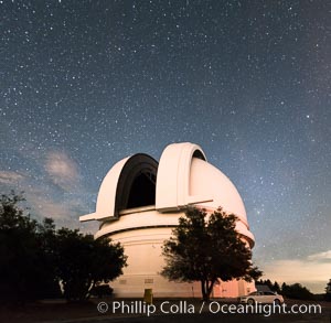
Palomar Observatory at night, under a sky of stars.
Location: Palomar Observatory, Palomar Mountain, California
Image ID: 29337
Panorama dimensions: 8630 x 8835
Location: Palomar Observatory, Palomar Mountain, California
Image ID: 29337
Panorama dimensions: 8630 x 8835
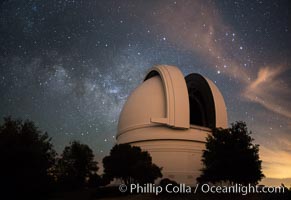
Palomar Observatory at Night under the Milky Way, Panoramic photograph.
Location: Palomar Observatory, Palomar Mountain, California
Image ID: 29339
Location: Palomar Observatory, Palomar Mountain, California
Image ID: 29339
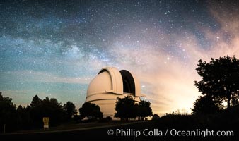
Palomar Observatory at Night under the Milky Way, Panoramic photograph.
Location: Palomar Observatory, Palomar Mountain, California
Image ID: 29343
Panorama dimensions: 6521 x 11132
Location: Palomar Observatory, Palomar Mountain, California
Image ID: 29343
Panorama dimensions: 6521 x 11132
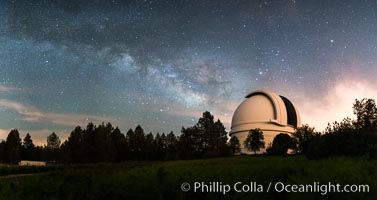
Palomar Observatory at Night under the Milky Way, Panoramic photograph.
Location: Palomar Observatory, Palomar Mountain, California
Image ID: 29344
Panorama dimensions: 6270 x 11632
Location: Palomar Observatory, Palomar Mountain, California
Image ID: 29344
Panorama dimensions: 6270 x 11632
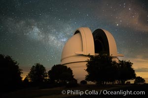
Palomar Observatory at Night under the Milky Way.
Location: Palomar Observatory, Palomar Mountain, California
Image ID: 29347
Location: Palomar Observatory, Palomar Mountain, California
Image ID: 29347
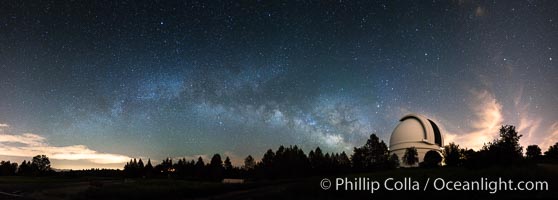
Palomar Observatory at Night under the Milky Way, Panoramic photograph.
Location: Palomar Observatory, Palomar Mountain, California
Image ID: 29348
Panorama dimensions: 7782 x 21708
Location: Palomar Observatory, Palomar Mountain, California
Image ID: 29348
Panorama dimensions: 7782 x 21708
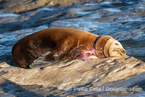
California sea lion entangled in fishing line, deep laceration around neck, Point La Jolla.
Species: California sea lion, Zalophus californianus
Location: La Jolla, California
Image ID: 40489
Species: California sea lion, Zalophus californianus
Location: La Jolla, California
Image ID: 40489
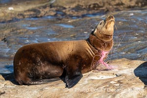
California sea lion entangled in fishing line, deep laceration around neck, Point La Jolla.
Species: California sea lion, Zalophus californianus
Location: La Jolla, California
Image ID: 40494
Species: California sea lion, Zalophus californianus
Location: La Jolla, California
Image ID: 40494
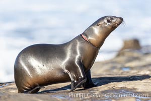
California sea lion entangled in fishing line, deep laceration around neck, Point La Jolla.
Species: California, Zalophus californianus
Location: La Jolla, California
Image ID: 37830
Species: California, Zalophus californianus
Location: La Jolla, California
Image ID: 37830
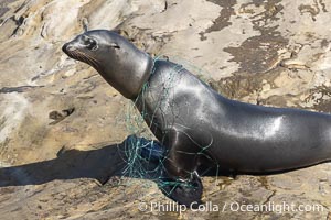
California sea lion entangled in fishing line, deep laceration around neck, Point La Jolla.
Species: California Sea Lion, Zalophus californianus
Location: La Jolla, California
Image ID: 39054
Species: California Sea Lion, Zalophus californianus
Location: La Jolla, California
Image ID: 39054
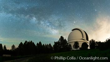
Palomar Observatory at Night under the Milky Way, Panoramic photograph.
Location: Palomar Observatory, Palomar Mountain, California
Image ID: 29342
Location: Palomar Observatory, Palomar Mountain, California
Image ID: 29342
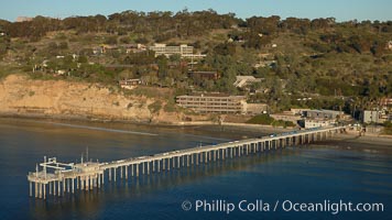
SIO Pier. The Scripps Institution of Oceanography research pier is 1090 feet long and was built of reinforced concrete in 1988, replacing the original wooden pier built in 1915. The Scripps Pier is home to a variety of sensing equipment above and below water that collects various oceanographic data. The Scripps research diving facility is located at the foot of the pier. Fresh seawater is pumped from the pier to the many tanks and facilities of SIO, including the Birch Aquarium. The Scripps Pier is named in honor of Ellen Browning Scripps, the most significant donor and benefactor of the Institution.
Location: Scripps Institution of Oceanography, La Jolla, California
Image ID: 22293
Location: Scripps Institution of Oceanography, La Jolla, California
Image ID: 22293