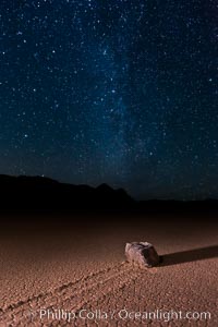
Racetrack sailing stone and Milky Way, at night. A sliding rock of the Racetrack Playa. The sliding rocks, or sailing stones, move across the mud flats of the Racetrack Playa, leaving trails behind in the mud. The explanation for their movement is not known with certainty, but many believe wind pushes the rocks over wet and perhaps icy mud in winter.
Location: Racetrack Playa, Death Valley National Park, California
Image ID: 27638
Location: Racetrack Playa, Death Valley National Park, California
Image ID: 27638
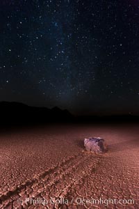
Racetrack sailing stone and Milky Way, at night. A sliding rock of the Racetrack Playa. The sliding rocks, or sailing stones, move across the mud flats of the Racetrack Playa, leaving trails behind in the mud. The explanation for their movement is not known with certainty, but many believe wind pushes the rocks over wet and perhaps icy mud in winter.
Location: Racetrack Playa, Death Valley National Park, California
Image ID: 27639
Location: Racetrack Playa, Death Valley National Park, California
Image ID: 27639
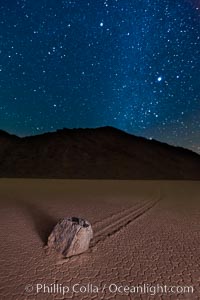
Racetrack sailing stone and Milky Way, at night. A sliding rock of the Racetrack Playa. The sliding rocks, or sailing stones, move across the mud flats of the Racetrack Playa, leaving trails behind in the mud. The explanation for their movement is not known with certainty, but many believe wind pushes the rocks over wet and perhaps icy mud in winter.
Location: Racetrack Playa, Death Valley National Park, California
Image ID: 27641
Location: Racetrack Playa, Death Valley National Park, California
Image ID: 27641
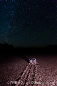
Racetrack sailing stone and stars at night. A sliding rock of the Racetrack Playa. The sliding rocks, or sailing stones, move across the mud flats of the Racetrack Playa, leaving trails behind in the mud. The explanation for their movement is not known with certainty, but many believe wind pushes the rocks over wet and perhaps icy mud in winter.
Location: Racetrack Playa, Death Valley National Park, California
Image ID: 27669
Location: Racetrack Playa, Death Valley National Park, California
Image ID: 27669
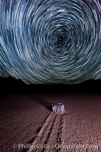
Racetrack sailing stone and star trails. A sliding rock of the Racetrack Playa. The sliding rocks, or sailing stones, move across the mud flats of the Racetrack Playa, leaving trails behind in the mud. The explanation for their movement is not known with certainty, but many believe wind pushes the rocks over wet and perhaps icy mud in winter.
Location: Racetrack Playa, Death Valley National Park, California
Image ID: 27670
Location: Racetrack Playa, Death Valley National Park, California
Image ID: 27670
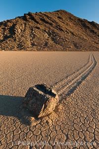
Sailing stone on the Racetrack Playa. The sliding rocks, or sailing stones, move across the mud flats of the Racetrack Playa, leaving trails behind in the mud. The explanation for their movement is not known with certainty, but many believe wind pushes the rocks over wet and perhaps icy mud in winter.
Location: Racetrack Playa, Death Valley National Park, California
Image ID: 27690
Location: Racetrack Playa, Death Valley National Park, California
Image ID: 27690
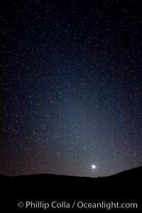
Zodiacal light over Death Valley. Zodiacal light is a faint diffuse light seen along the plane of the ecliptic in the vicinity of the setting or rising sun, caused by sunlight scattered off space dust in the zodiacal cloud.
Location: Racetrack Playa, Death Valley National Park, California
Image ID: 27692
Location: Racetrack Playa, Death Valley National Park, California
Image ID: 27692
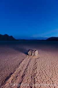
Sunrise on the Racetrack Playa. The sliding rocks, or sailing stones, move across the mud flats of the Racetrack Playa, leaving trails behind in the mud. The explanation for their movement is not known with certainty, but many believe wind pushes the rocks over wet and perhaps icy mud in winter.
Location: Racetrack Playa, Death Valley National Park, California
Image ID: 27694
Location: Racetrack Playa, Death Valley National Park, California
Image ID: 27694
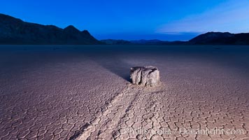
Sunrise on the Racetrack Playa. The sliding rocks, or sailing stones, move across the mud flats of the Racetrack Playa, leaving trails behind in the mud. The explanation for their movement is not known with certainty, but many believe wind pushes the rocks over wet and perhaps icy mud in winter.
Location: Racetrack Playa, Death Valley National Park, California
Image ID: 27695
Location: Racetrack Playa, Death Valley National Park, California
Image ID: 27695
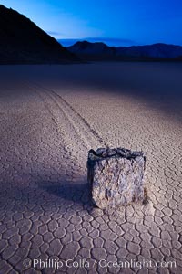
Sailing stone at dawn, Racetrack Playa, Death Valley National Park, California.
Location: Racetrack Playa, Death Valley National Park, California
Image ID: 27697
Location: Racetrack Playa, Death Valley National Park, California
Image ID: 27697
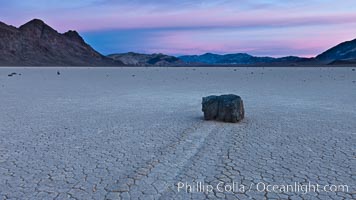
Sunrise on the Racetrack Playa. The sliding rocks, or sailing stones, move across the mud flats of the Racetrack Playa, leaving trails behind in the mud. The explanation for their movement is not known with certainty, but many believe wind pushes the rocks over wet and perhaps icy mud in winter.
Location: Racetrack Playa, Death Valley National Park, California
Image ID: 27698
Location: Racetrack Playa, Death Valley National Park, California
Image ID: 27698
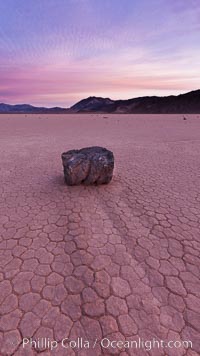
Sunrise on the Racetrack Playa. The sliding rocks, or sailing stones, move across the mud flats of the Racetrack Playa, leaving trails behind in the mud. The explanation for their movement is not known with certainty, but many believe wind pushes the rocks over wet and perhaps icy mud in winter.
Location: Racetrack Playa, Death Valley National Park, California
Image ID: 27700
Location: Racetrack Playa, Death Valley National Park, California
Image ID: 27700
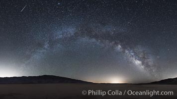
Milky Way and Shooting Star over Clark Dry Lake playa, Anza Borrego Desert State Park.
Image ID: 31033
Panorama dimensions: 8499 x 15109
Image ID: 31033
Panorama dimensions: 8499 x 15109
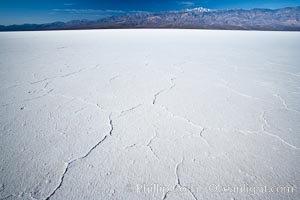
Badwater, California. Badwater, at 282 feet below sea level, is the lowest point in North America. 9000 square miles of watershed drain into the Badwater basin, to dry and form huge white salt flats.
Location: Badwater, Death Valley National Park, California
Image ID: 15579
Location: Badwater, Death Valley National Park, California
Image ID: 15579
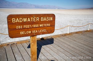
Badwater, California. Badwater, at 282 feet below sea level, is the lowest point in North America. 9000 square miles of watershed drain into the Badwater basin, to dry and form huge white salt flats.
Location: Badwater, Death Valley National Park, California
Image ID: 15580
Location: Badwater, Death Valley National Park, California
Image ID: 15580
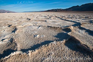
Devils Golf Course, California. Evaporated salt has formed into gnarled, complex crystalline shapes in on the salt pan of Death Valley National Park, one of the largest salt pans in the world. The shapes are constantly evolving as occasional floods submerge the salt concretions before receding and depositing more salt.
Location: Devils Golf Course, Death Valley National Park, California
Image ID: 15583
Location: Devils Golf Course, Death Valley National Park, California
Image ID: 15583
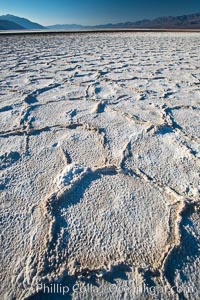
Devils Golf Course, California. Evaporated salt has formed into gnarled, complex crystalline shapes in on the salt pan of Death Valley National Park, one of the largest salt pans in the world. The shapes are constantly evolving as occasional floods submerge the salt concretions before receding and depositing more salt.
Location: Devils Golf Course, Death Valley National Park, California
Image ID: 15597
Location: Devils Golf Course, Death Valley National Park, California
Image ID: 15597
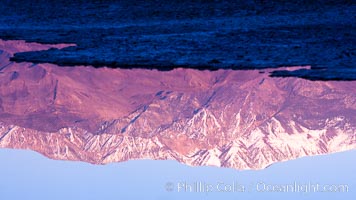
Sunrise lights Telescope Peak as it rises over the salt flats of Badwater, Death Valley. At 11,049 feet, Telescope Peak is the highest peak in the Panamint Range as well as the highest point in Death Valley National Park. At 282 feet below sea level, Badwater is the lowest point in North America.
Location: Badwater, Death Valley National Park, California
Image ID: 20550
Location: Badwater, Death Valley National Park, California
Image ID: 20550
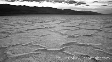
Salt polygons. After winter flooding, the salt on the Badwater Basin playa dries into geometric polygonal shapes.
Location: Badwater, Death Valley National Park, California
Image ID: 25299
Location: Badwater, Death Valley National Park, California
Image ID: 25299
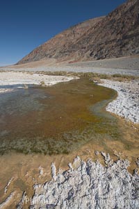
Badwater, California. Badwater, at 282 feet below sea level, is the lowest point in North America. 9000 square miles of watershed drain into the Badwater basin, to dry and form huge white salt flats.
Location: Badwater, Death Valley National Park, California
Image ID: 15581
Location: Badwater, Death Valley National Park, California
Image ID: 15581
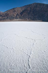
Badwater, California. Badwater, at 282 feet below sea level, is the lowest point in North America. 9000 square miles of watershed drain into the Badwater basin, to dry and form huge white salt flats.
Location: Badwater, Death Valley National Park, California
Image ID: 15592
Location: Badwater, Death Valley National Park, California
Image ID: 15592
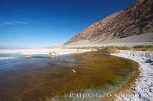
Badwater, California. Badwater, at 282 feet below sea level, is the lowest point in North America. 9000 square miles of watershed drain into the Badwater basin, to dry and form huge white salt flats.
Location: Badwater, Death Valley National Park, California
Image ID: 15593
Location: Badwater, Death Valley National Park, California
Image ID: 15593
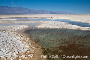
Badwater, California. Badwater, at 282 feet below sea level, is the lowest point in North America. 9000 square miles of watershed drain into the Badwater basin, to dry and form huge white salt flats.
Location: Badwater, Death Valley National Park, California
Image ID: 15594
Location: Badwater, Death Valley National Park, California
Image ID: 15594
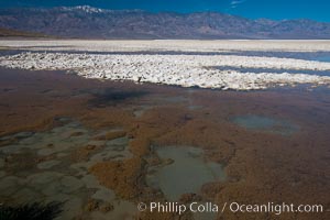
Badwater, California. Badwater, at 282 feet below sea level, is the lowest point in North America. 9000 square miles of watershed drain into the Badwater basin, to dry and form huge white salt flats.
Location: Badwater, Death Valley National Park, California
Image ID: 15595
Location: Badwater, Death Valley National Park, California
Image ID: 15595
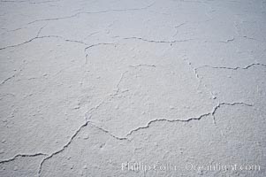
Badwater, California. Badwater, at 282 feet below sea level, is the lowest point in North America. 9000 square miles of watershed drain into the Badwater basin, to dry and form huge white salt flats.
Location: Badwater, Death Valley National Park, California
Image ID: 15611
Location: Badwater, Death Valley National Park, California
Image ID: 15611
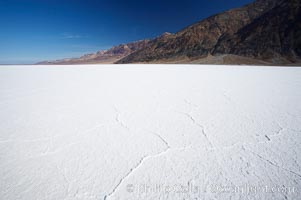
Badwater, California. Badwater, at 282 feet below sea level, is the lowest point in North America. 9000 square miles of watershed drain into the Badwater basin, to dry and form huge white salt flats.
Location: Badwater, Death Valley National Park, California
Image ID: 15612
Location: Badwater, Death Valley National Park, California
Image ID: 15612
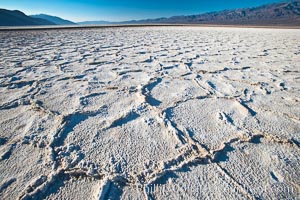
Devils Golf Course, California. Evaporated salt has formed into gnarled, complex crystalline shapes in on the salt pan of Death Valley National Park, one of the largest salt pans in the world. The shapes are constantly evolving as occasional floods submerge the salt concretions before receding and depositing more salt.
Location: Devils Golf Course, Death Valley National Park, California
Image ID: 15615
Location: Devils Golf Course, Death Valley National Park, California
Image ID: 15615
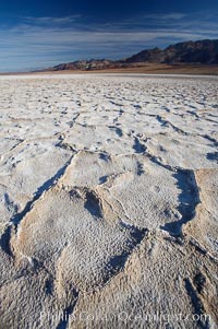
Devils Golf Course, California. Evaporated salt has formed into gnarled, complex crystalline shapes in on the salt pan of Death Valley National Park, one of the largest salt pans in the world. The shapes are constantly evolving as occasional floods submerge the salt concretions before receding and depositing more salt.
Location: Devils Golf Course, Death Valley National Park, California
Image ID: 15616
Location: Devils Golf Course, Death Valley National Park, California
Image ID: 15616
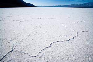
Badwater, California. Badwater, at 282 feet below sea level, is the lowest point in North America. 9000 square miles of watershed drain into the Badwater basin, to dry and form huge white salt flats.
Location: Badwater, Death Valley National Park, California
Image ID: 15622
Location: Badwater, Death Valley National Park, California
Image ID: 15622
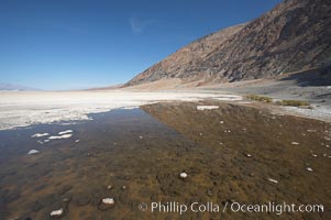
Badwater, California. Badwater, at 282 feet below sea level, is the lowest point in North America. 9000 square miles of watershed drain into the Badwater basin, to dry and form huge white salt flats.
Location: Badwater, Death Valley National Park, California
Image ID: 15623
Location: Badwater, Death Valley National Park, California
Image ID: 15623